Riverside, San Juan County, New Mexico
Riverside (Hendricks) is an unincorporated community in San Juan County, New Mexico, United States.[1] It is located on the right bank (west side) of the Animas River, approximately one mile south of the Colorado border on U.S. Route 550, at its intersection with county roads 2090 and 2093.[2] The nearest settlement is Cedar Hill, 3.5 miles (5.6 km) to the south.[3]
Riverside | |
|---|---|
 Riverside Location within the state of New Mexico  Riverside Riverside (the United States) | |
| Coordinates: 36°58′56″N 107°52′33″W | |
| Country | United States |
| State | New Mexico |
| County | San Juan |
| Elevation | 5,993 ft (1,827 m) |
| Time zone | UTC-7 (MST) |
| • Summer (DST) | UTC-6 (MDT) |
| ZIP codes | 87410 |
| Area code(s) | 505 |
History
Until circa 1876, the area was generally acknowledged to be the land of the Jicarilla Apache and their Ute allies; in 1887, it was officially excluded from the Jicarillas' new reservation.[4] Anglo settlement began shortly thereafter. Riverside had its own post office starting from 1905 until 1938.[1][5]
References
- Julyan, Robert (1998). "Riverside (San Juan County)". The Place Names of New Mexico (revised ed.). Albuquerque, New Mexico: University of New Mexico Press. p. 300. ISBN 0-8263-1689-1.
- Mount Nebo Quadrangle, New Mexico – Colorado (Map) (provisional 1985 ed.). 1:24,000. 7.5 minutes series (topographic). United States Geological Survey. 1985.
- "Riverside in San Juan County, NM". NM Hometown locator. Archived from the original on 22 October 2013.
- Pritzker, Barry M. (2000). A Native American Encyclopedia: History, Culture, and Peoples. Oxford, England: Oxford University Press. pp. 12–13. ISBN 978-0-19-513877-1.
- See United States Official Postal Guide. United States Post Office. 1908. p. 557. and others.
Municipalities and communities of San Juan County, New Mexico, United States | ||
|---|---|---|
| Cities | 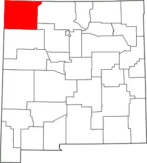 Map of New Mexico highlighting San Juan County | |
| CDPs |
| |
| Unincorporated communities | ||
| Indian reservations | ||
| Footnotes | ‡This populated place also has portions in an adjacent county or counties | |
| ||
This article is issued from Wikipedia. The text is licensed under Creative Commons - Attribution - Sharealike. Additional terms may apply for the media files.