Lake City, Iowa
Lake City is a city in Calhoun County, Iowa, United States, founded in 1856. The population was 1,727 at the 2010 census. The sign coming into town proudly proclaims that Lake City has "Everything but a Lake."
Lake City, Iowa | |
|---|---|
| Motto(s): Everything but a Lake | |
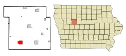 Location within Calhoun County and Iowa | |
| Coordinates: 42°16′7″N 94°44′9″W | |
| Country | United States |
| State | Iowa |
| County | Calhoun |
| Area | |
| • Total | 4.82 sq mi (12.47 km2) |
| • Land | 4.82 sq mi (12.47 km2) |
| • Water | 0.00 sq mi (0.00 km2) |
| Elevation | 1,240 ft (378 m) |
| Population | |
| • Total | 1,727 |
| • Estimate (2019)[3] | 1,642 |
| • Density | 340.95/sq mi (131.65/km2) |
| Time zone | UTC−6 (Central (CST)) |
| • Summer (DST) | UTC−5 (CDT) |
| ZIP Code | 51449 |
| Area code(s) | 712 |
| FIPS code | 19-42465 |
| GNIS feature ID | 0458181 |
| Website | www.lakecityiowa.com |
History
Lake City was founded in 1856.[4] Lake City took its name from Lake Creek.[5] The town experienced growth with the advent of the railroad in 1881.[4]
Geography
Lake City is located at 42°16′7″N 94°44′9″W (42.268646, −94.735699).[6]
According to the United States Census Bureau, the city has a total area of 4.81 square miles (12.46 km2), all land.[7]
Demographics
| Year | Pop. | ±% |
|---|---|---|
| 1870 | 103 | — |
| 1880 | 249 | +141.7% |
| 1890 | 1,160 | +365.9% |
| 1900 | 2,703 | +133.0% |
| 1910 | 2,043 | −24.4% |
| 1920 | 2,110 | +3.3% |
| 1930 | 2,012 | −4.6% |
| 1940 | 2,216 | +10.1% |
| 1950 | 2,308 | +4.2% |
| 1960 | 2,114 | −8.4% |
| 1970 | 1,910 | −9.6% |
| 1980 | 2,006 | +5.0% |
| 1990 | 1,841 | −8.2% |
| 2000 | 1,787 | −2.9% |
| 2010 | 1,727 | −3.4% |
| 2019 | 1,642 | −4.9% |
| Source:"U.S. Census website". United States Census Bureau. Retrieved 2011-03-19. and Iowa Data Center Source: | ||
2010 census
As of the census[2] of 2010, there were 1,727 people, 757 households, and 451 families residing in the city. The population density was 359.0 inhabitants per square mile (138.6/km2). There were 846 housing units at an average density of 175.9 per square mile (67.9/km2). The racial makeup of the city was 98.4% White, 0.2% African American, 0.1% Native American, 0.2% Asian, 0.3% from other races, and 0.7% from two or more races. Hispanic or Latino of any race were 1.2% of the population.
There were 757 households, of which 24.0% had children under the age of 18 living with them, 47.2% were married couples living together, 7.8% had a female householder with no husband present, 4.6% had a male householder with no wife present, and 40.4% were non-families. Of all households 37.1% were made up of individuals, and 20.3% had someone living alone who was 65 years of age or older. The average household size was 2.13 and the average family size was 2.74.
The median age in the city was 49.1 years. 20.2% of residents were under the age of 18; 7% were between the ages of 18 and 24; 17.8% were from 25 to 44; 28.7% were from 45 to 64; and 26.1% were 65 years of age or older. The gender makeup of the city was 47.0% male and 53.0% female.
2000 census
As of the census[9] of 2000, there were 1,787 people, 779 households, and 468 families residing in the city. The population density was 370.7 people per square mile (143.1/km2). There were 874 housing units at an average density of 181.3 per square mile (70.0/km2). The racial makeup of the city was 98.88% White, 0.06% African American, 0.06% Native American, 0.22% Asian, 0.11% from other races, and 0.67% from two or more races. Hispanic or Latino of any race were 1.06% of the population.
There were 779 households, out of which 24.8% had children under the age of 18 living with them, 50.6% were married couples living together, 7.8% had a female householder with no husband present, and 39.9% were non-families. Of all households 36.2% were made up of individuals, and 22.6% had someone living alone who was 65 years of age or older. The average household size was 2.18 and the average family size was 2.85.
22.6% were under the age of 18, 5.8% from 18 to 24, 19.8% from 25 to 44, 23.0% from 45 to 64, and 28.8% were 65 years of age or older. The median age was 46 years. For every 100 females, there were 81.4 males. For every 100 females age 18 and over, there were 79.0 males.
The median income for a household in the city was $31,000, and the median income for a family was $37,941. Males had a median income of $27,128 versus $18,477 for females. The per capita income for the city was $14,969. About 8.9% of families and 14.1% of the population were below the poverty line, including 20.5% of those under age 18 and 15.3% of those age 65 or over.
Economy
Dobson Pipe Organ Builders, which manufacturers and restores pipe organs, is located in Lake City.
Lake City also has many small businesses, including a hardware store, fitness center, restaurants, shopping and a theatre. Stewart Memorial Community Hospital, a 25-bed Critical Access Hospital, is the largest employer in Lake City with 291 employees.[10]
Education
Lake City is within the South Central Calhoun Community School District.[11]
It was a part of the Lake City Community School District until July 1, 1993, when it merged into the Southern Cal Community School District, which, in turn, merged into South Central Calhoun on July 1, 2014.[12]
In 2007, the Southern Cal district closed the Lincoln Elementary School building and later sold it for $22,000 to a private individual.[13]
References
- "2019 U.S. Gazetteer Files". United States Census Bureau. Retrieved July 17, 2020.
- "U.S. Census website". United States Census Bureau. Retrieved 2012-05-11.
- "Population and Housing Unit Estimates". United States Census Bureau. May 24, 2020. Retrieved May 27, 2020.
- Stonebraker, Beaumont E. (1915). Past and Present of Calhoun County, Iowa: A Record of Settlement, Organization, Progress, and Achievement, Volume 1. Pioneer Publishing Company. p. 130.
- Chicago and North Western Railway Company (1908). A History of the Origin of the Place Names Connected with the Chicago & North Western and Chicago, St. Paul, Minneapolis & Omaha Railways. p. 91.
- "US Gazetteer files: 2010, 2000, and 1990". United States Census Bureau. 2011-02-12. Retrieved 2011-04-23.
- "US Gazetteer files 2010". United States Census Bureau. Archived from the original on 2012-07-02. Retrieved 2012-05-11.
- "Census of Population and Housing". Census.gov. Retrieved June 4, 2015.
- "U.S. Census website". United States Census Bureau. Retrieved 2008-01-31.
- http://www.ihaonline.org/Portals/0/Files/Information/Econ%20Impact/Impact%20Table%20-%20Calhoun.pdf
- "South Central Calhoun." Iowa Department of Education. Retrieved on July 18, 2018.
- "REORGANIZATION & DISSOLUTION ACTIONS SINCE 1965-66." Iowa Department of Education. Retrieved on July 20, 2018.
- "When schools close". Daily Times Herald. 2014-03-28. Archived from the original on 2018-07-17. Retrieved 2018-07-17.
External links
Municipalities and communities of Calhoun County, Iowa, United States | ||
|---|---|---|
| Cities | Map of Iowa highlighting Calhoun County | |
| Townships | ||
| CDP | ||
| Other unincorporated communities | ||
| Footnotes | ‡This populated place also has portions in an adjacent county or counties | |
| ||
| Authority control |
|---|
