Somers, Iowa
Somers is a city in Calhoun County, Iowa, United States. The population was 113 at the 2010 census.
Somers, Iowa | |
|---|---|
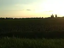 Field just outside of Somers | |
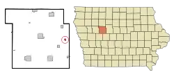 Location of Somers, Iowa | |
| Coordinates: 42°22′40″N 94°25′52″W | |
| Country | |
| State | |
| County | Calhoun |
| Area | |
| • Total | 0.35 sq mi (0.90 km2) |
| • Land | 0.35 sq mi (0.90 km2) |
| • Water | 0.00 sq mi (0.00 km2) |
| Elevation | 1,155 ft (352 m) |
| Population | |
| • Total | 113 |
| • Estimate (2019)[3] | 106 |
| • Density | 306.36/sq mi (118.25/km2) |
| Time zone | UTC-6 (Central (CST)) |
| • Summer (DST) | UTC-5 (CDT) |
| ZIP code | 50586 |
| Area code(s) | 515 |
| FIPS code | 19-73920 |
| GNIS feature ID | 0461750 |
Geography
Somers is located at 42°22′40″N 94°25′52″W (42.377902, -94.431013).[5]
According to the United States Census Bureau, the city has a total area of 0.35 square miles (0.91 km2), all land.[6]
Demographics
| Year | Pop. | ±% |
|---|---|---|
| 1910 | 169 | — |
| 1920 | 175 | +3.6% |
| 1930 | 199 | +13.7% |
| 1940 | 213 | +7.0% |
| 1950 | 217 | +1.9% |
| 1960 | 203 | −6.5% |
| 1970 | 197 | −3.0% |
| 1980 | 220 | +11.7% |
| 1990 | 161 | −26.8% |
| 2000 | 165 | +2.5% |
| 2010 | 113 | −31.5% |
| 2019 | 106 | −6.2% |
| Source:"U.S. Census website". United States Census Bureau. Retrieved 2020-03-29. and Iowa Data Center Source: | ||
2010 census
As of the census[2] of 2010, there were 113 people, 55 households, and 32 families living in the city. The population density was 322.9 inhabitants per square mile (124.7/km2). There were 68 housing units at an average density of 194.3 per square mile (75.0/km2). The racial makeup of the city was 95.6% White, 0.9% Asian, and 3.5% from two or more races.
There were 55 households, of which 27.3% had children under the age of 18 living with them, 41.8% were married couples living together, 14.5% had a female householder with no husband present, 1.8% had a male householder with no wife present, and 41.8% were non-families. 38.2% of all households were made up of individuals, and 16.4% had someone living alone who was 65 years of age or older. The average household size was 2.05 and the average family size was 2.63.
The median age in the city was 48.1 years. 21.2% of residents were under the age of 18; 5.3% were between the ages of 18 and 24; 20.4% were from 25 to 44; 32.6% were from 45 to 64; and 20.4% were 65 years of age or older. The gender makeup of the city was 53.1% male and 46.9% female.
2000 census
As of the census[8] of 2000, there were 165 people, 61 households, and 51 families living in the city. The population density was 473.1 people per square mile (182.0/km2). There were 66 housing units at an average density of 189.2 per square mile (72.8/km2). The racial makeup of the city was 97.58% White, 0.61% African American, 1.82% from other races. Hispanic or Latino of any race were 3.03% of the population.
There were 61 households, out of which 27.9% had children under the age of 18 living with them, 67.2% were married couples living together, 13.1% had a female householder with no husband present, and 14.8% were non-families. 9.8% of all households were made up of individuals, and 4.9% had someone living alone who was 65 years of age or older. The average household size was 2.70 and the average family size was 2.92.
In the city, the population was spread out, with 24.8% under the age of 18, 8.5% from 18 to 24, 24.8% from 25 to 44, 22.4% from 45 to 64, and 19.4% who were 65 years of age or older. The median age was 40 years. For every 100 females, there were 103.7 males. For every 100 females age 18 and over, there were 96.8 males.
The median income for a household in the city was $31,250, and the median income for a family was $43,750. Males had a median income of $32,083 versus $21,250 for females. The per capita income for the city was $15,777. About 11.5% of families and 15.9% of the population were below the poverty line, including 33.3% of those under the age of eighteen and 16.0% of those 65 or over.
Education
Somers is served by the Prairie Valley Community School District,[9] which formed on July 1, 1993 with the merger of the Cedar Valley Community School District and the Prairie Community School District.[10]
References
- "2019 U.S. Gazetteer Files". United States Census Bureau. Retrieved July 17, 2020.
- "U.S. Census website". United States Census Bureau. Retrieved 2012-05-11.
- "Population and Housing Unit Estimates". United States Census Bureau. May 24, 2020. Retrieved May 27, 2020.
- Stonebraker, Beaumont E. (1915). Past and Present of Calhoun County, Iowa: A Record of Settlement, Organization, Progress, and Achievement, Volume 1. Pioneer Publishing Company. p. 161.
- "US Gazetteer files: 2010, 2000, and 1990". United States Census Bureau. 2011-02-12. Retrieved 2011-04-23.
- "US Gazetteer files 2010". United States Census Bureau. Archived from the original on 2012-07-02. Retrieved 2012-05-11.
- "Census of Population and Housing". Census.gov. Retrieved June 4, 2015.
- "U.S. Census website". United States Census Bureau. Retrieved 2008-01-31.
- "Prairie Valley." Iowa Department of Education. Retrieved on February 25, 2019.
- "REORGANIZATION & DISSOLUTION ACTIONS SINCE 1965-66." Iowa Department of Education. Retrieved on February 23, 2019.
| Wikimedia Commons has media related to Somers, Iowa. |
Municipalities and communities of Calhoun County, Iowa, United States | ||
|---|---|---|
| Cities | Map of Iowa highlighting Calhoun County | |
| Townships | ||
| CDP | ||
| Other unincorporated communities | ||
| Footnotes | ‡This populated place also has portions in an adjacent county or counties | |
| ||