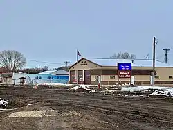
Lake Lillian, Minnesota
Lake Lillian is a city in Kandiyohi County, Minnesota, United States. The population was 238 at the 2010 census.[6]
Lake Lillian | |
|---|---|
 | |
| Motto(s): "A Friendly Town" | |
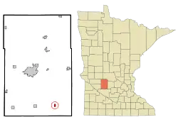 Location of Lake Lillian, Minnesota | |
| Coordinates: 44°56′40″N 94°52′51″W | |
| Country | United States |
| State | Minnesota |
| County | Kandiyohi |
| Area | |
| • Total | 0.45 sq mi (1.17 km2) |
| • Land | 0.45 sq mi (1.17 km2) |
| • Water | 0.00 sq mi (0.00 km2) |
| Elevation | 1,112 ft (339 m) |
| Population | |
| • Total | 238 |
| • Estimate (2019)[3] | 235 |
| • Density | 518.76/sq mi (200.46/km2) |
| Time zone | UTC-6 (Central (CST)) |
| • Summer (DST) | UTC-5 (CDT) |
| ZIP code | 56253 |
| Area code(s) | 320 |
| FIPS code | 27-34676[4] |
| GNIS feature ID | 0646640[5] |
| Website | lakelillian.govoffice.com |
Geography
According to the United States Census Bureau, the city has a total area of 0.46 square miles (1.19 km2), all land.[7]
Minnesota State Highway 7 serves as a main route in the community.
Demographics
| Historical population | |||
|---|---|---|---|
| Census | Pop. | %± | |
| 1930 | 206 | — | |
| 1940 | 271 | 31.6% | |
| 1950 | 358 | 32.1% | |
| 1960 | 335 | −6.4% | |
| 1970 | 316 | −5.7% | |
| 1980 | 329 | 4.1% | |
| 1990 | 229 | −30.4% | |
| 2000 | 257 | 12.2% | |
| 2010 | 238 | −7.4% | |
| 2019 (est.) | 235 | [3] | −1.3% |
| U.S. Decennial Census[8] | |||
2010 census
As of the census[2] of 2010, there were 238 people, 121 households, and 61 families living in the city. The population density was 517.4 inhabitants per square mile (199.8/km2). There were 136 housing units at an average density of 295.7 per square mile (114.2/km2). The racial makeup of the city was 98.3% White, 0.4% African American, 0.4% Asian, and 0.8% from two or more races. Hispanic or Latino of any race were 2.1% of the population.
There were 121 households, of which 19.0% had children under the age of 18 living with them, 38.8% were married couples living together, 8.3% had a female householder with no husband present, 3.3% had a male householder with no wife present, and 49.6% were non-families. 43.8% of all households were made up of individuals, and 23.1% had someone living alone who was 65 years of age or older. The average household size was 1.96 and the average family size was 2.72.
The median age in the city was 46.6 years. 18.9% of residents were under the age of 18; 10.1% were between the ages of 18 and 24; 17.5% were from 25 to 44; 28.2% were from 45 to 64; and 25.2% were 65 years of age or older. The gender makeup of the city was 52.1% male and 47.9% female.
2000 census
As of the census[4] of 2000, there were 257 people, 124 households, and 71 families living in the city. The population density was 559.0 people per square mile (215.7/km2). There were 135 housing units at an average density of 293.6 per square mile (113.3/km2). The racial makeup of the city was 99.22% White, 0.78% from other races. Hispanic or Latino of any race were 4.28% of the population.
There were 124 households, out of which 22.6% had children under the age of 18 living with them, 42.7% were married couples living together, 8.1% had a female householder with no husband present, and 42.7% were non-families. 38.7% of all households were made up of individuals, and 21.0% had someone living alone who was 65 years of age or older. The average household size was 2.07 and the average family size was 2.75.
In the city, the population was spread out, with 22.6% under the age of 18, 5.8% from 18 to 24, 24.9% from 25 to 44, 23.3% from 45 to 64, and 23.3% who were 65 years of age or older. The median age was 43 years. For every 100 females, there were 99.2 males. For every 100 females age 18 and over, there were 91.3 males.
The median income for a household in the city was $26,458, and the median income for a family was $31,875. Males had a median income of $29,205 versus $19,500 for females. The per capita income for the city was $16,881. About 9.7% of families and 14.6% of the population were below the poverty line, including 21.7% of those under the age of eighteen and 12.7% of those 65 or over.
References
- "2019 U.S. Gazetteer Files". United States Census Bureau. Retrieved July 26, 2020.
- "U.S. Census website". United States Census Bureau. Retrieved 2012-11-13.
- "Population and Housing Unit Estimates". United States Census Bureau. May 24, 2020. Retrieved May 27, 2020.
- "U.S. Census website". United States Census Bureau. Retrieved 2008-01-31.
- "US Board on Geographic Names". United States Geological Survey. 2007-10-25. Retrieved 2008-01-31.
- "2010 Census Redistricting Data (Public Law 94-171) Summary File". American FactFinder. U.S. Census Bureau, 2010 Census. Retrieved 27 April 2011.
- "US Gazetteer files 2010". United States Census Bureau. Archived from the original on 2012-07-02. Retrieved 2012-11-13.
- "Census of Population and Housing". Census.gov. Retrieved June 4, 2015.
External links
- City website
- The Straight Dope: Why are rebate checks drawn on obscure banks in the middle of nowhere? - A Cecil Adams column that discusses Lake Lillian
Municipalities and communities of Kandiyohi County, Minnesota, United States | ||
|---|---|---|
| Cities | 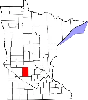 Map of Minnesota highlighting Kandiyohi County | |
| Townships | ||
| Unincorporated communities | ||
| ||
| Authority control |
|---|