Lamoille, Nevada
Lamoille is a rural census-designated place in Elko County in the northeastern section of the state of Nevada in the western United States. As of the 2010 census it had a population of 105.[1] It is located 19 miles (31 km) southeast of Elko at the base of the Ruby Mountains at an elevation of 5,889 feet (1,795 m) and is part of the Elko Micropolitan Statistical Area.[2][3]
Lamoille, Nevada | |
|---|---|
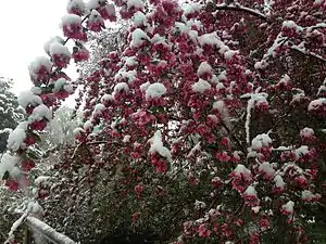 Snow on a crabapple tree, Lamoille, Nevada, May 2014 | |
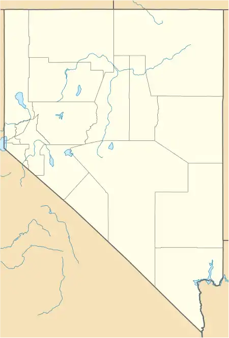 Lamoille Location within the state of Nevada | |
| Coordinates: 40°43′41″N 115°28′41″W | |
| Country | United States |
| State | Nevada |
| County | Elko |
| Area | |
| • Total | 1.85 sq mi (4.78 km2) |
| • Land | 1.85 sq mi (4.78 km2) |
| • Water | 0.0 sq mi (0.0 km2) |
| Elevation | 5,889 ft (1,795 m) |
| Population (2010) | |
| • Total | 105 |
| • Density | 57/sq mi (22.0/km2) |
| Time zone | UTC-8 (Pacific (PST)) |
| • Summer (DST) | UTC-7 (PDT) |
| ZIP code | 89828 |
| FIPS code | 32-39300 |
| GNIS feature ID | 860296 |
History
The early history of the community and surrounding area is summarized in a nearby highway marker:[4]
LAMOILLE VALLEY - Because heavy use denuded the grass from the main Fort Hall route of the California Emigrant Trail along the Humboldt River, many emigrants left the river near Starr Valley. They skirted the East Humboldt Range and the Ruby Mountains along a Shoshone Indian path, rested their livestock in Lamoille Valley, and returned to the Humboldt River.
John Walker and Thomas Waterman first settled the area in 1865. Waterman named the valley after his native Vermont. In 1868, Walker erected the Cottonwood Hotel, store and blacksmith shop in the valley, and the settlement became known as "The Crossroads." Here wagons were repaired and food and supplies could be obtained. The original buildings and the more recent 20-bedroom Lamoille hotel, creamery, flour mill and dance hall are gone.
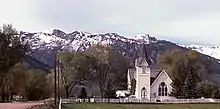
Lamoille is nestled off the western flanks of the Ruby Mountains at the end of Nevada State Route 227, and is the principal gateway to this range via the National Forest Scenic Byway up Lamoille Canyon. In 1907 a small church was constructed on the east side of the community, and is still in use today.
Former Disney president and good friend of Clint Eastwood, Frank Wells, died in a helicopter crash here in the Nevada Ruby Mountains. [5]
References
- "Geographic Identifiers: 2010 Demographic Profile Data (G001): Lamoille CDP, Nevada". U.S. Census Bureau, American Factfinder. Retrieved February 16, 2016.
- "The Complete Traveler Guide to Lamoille". Retrieved 2009-12-07.
- "Lamoille, NV Community Profile". HTL, Inc. Retrieved 2009-12-07.
- Sebesta, Paul. "HM 109 - Lamoille Valley." Nevada-Landmarks. 23 Sept. 2007. Web. 09 June 2012. <http://www.nevada-landmarks.com/el/shl109.htm Archived 2011-10-18 at the Wayback Machine>.
- McGilligan, Patrick (1999). Clint: The Life and Legend. Harper Collins. ISBN 0-00-638354-8.
External links
| Wikimedia Commons has media related to Lamoille, Nevada. |
Municipalities and communities of Elko County, Nevada, United States | ||
|---|---|---|
| Cities | 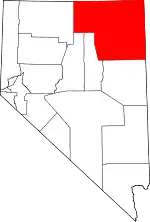 Elko County map | |
| CDPs | ||
| Other unincorporated communities | ||
| Indian reservations | ||
| Ghost towns |
| |
| Footnotes | ‡This populated place also has portions in an adjacent county or counties | |
| ||
