Oasis, Nevada
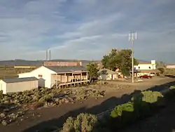
Oasis is a census-designated place (CDP) located in eastern Elko County, Nevada, United States,[1] at the junction of State Route 233 and Interstate 80, 31 miles (50 km) northwest of the Utah border and 77 miles (124 km) east of Elko. As of the 2008 American Community Survey it had a population of 34.[2]
Oasis, Nevada | |
|---|---|
 | |
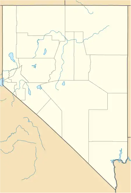 Oasis Location within the state of Nevada | |
| Coordinates: 41°01′43″N 114°29′13″W[1] | |
| Country | United States |
| State | Nevada |
| County | Elko |
| Area | |
| • Total | 0.89 sq mi (2.31 km2) |
| • Land | 0.89 sq mi (2.31 km2) |
| • Water | 0.0 sq mi (0.0 km2) |
| Elevation | 5,870 ft (1,790 m) |
| Population | |
| • Total | 34 |
| • Density | 38/sq mi (14.7/km2) |
| Time zone | UTC-8 (Pacific (PST)) |
| • Summer (DST) | UTC-7 (PDT) |
| ZIP code | 89835 |
| Area code(s) | 775 |
| FIPS code | 32-52200 |
| GNIS feature ID | 845590[1] |
Description
Oasis is a high desert community located in the Goshute Valley between the Pequop Mountains and the Toano Range at an elevation of approximately 5,870 feet (1,790 m).
Oasis is named for the Oasis Ranch, which in the late 1880s was owned by E. C. Hardy.[3]
The community is part of the Elko Micropolitan Statistical Area.
References
- U.S. Geological Survey Geographic Names Information System: Oasis
- "Census - Geography Profile". U.S. Census Bureau. Retrieved April 11, 2020.
- Carlson, Helen S. (1985). Nevada Place Names, A Geographical Dictionary. ISBN 9780874174038. Retrieved April 12, 2020.
External links
![]() Media related to Oasis, Nevada at Wikimedia Commons
Media related to Oasis, Nevada at Wikimedia Commons
Municipalities and communities of Elko County, Nevada, United States | ||
|---|---|---|
| Cities |  Elko County map | |
| CDPs | ||
| Other unincorporated communities | ||
| Indian reservations | ||
| Ghost towns |
| |
| Footnotes | ‡This populated place also has portions in an adjacent county or counties | |
| ||
This article is issued from Wikipedia. The text is licensed under Creative Commons - Attribution - Sharealike. Additional terms may apply for the media files.