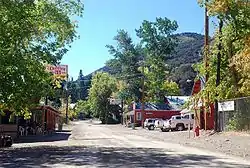
Jarbidge, Nevada
Jarbidge is an unincorporated community in Elko County, Nevada, United States.[1] Located at the bottom of the Jarbidge River's canyon near the north end of the Jarbidge Mountains, it lies within the Jarbidge Ranger District of the Humboldt-Toiyabe National Forest and is near the northwest edge of the Jarbidge Wilderness, approximately 10 miles (16 km) south of the Idaho–Nevada border. The ZIP code for Jarbidge is 89826.[2]
Jarbidge, Nevada | |
|---|---|
 | |
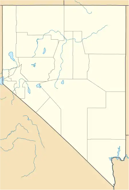 Jarbidge, Nevada Location within the state of Nevada  Jarbidge, Nevada Jarbidge, Nevada (the United States) | |
| Coordinates: 41°52′25″N 115°25′55″W | |
| Country | United States |
| State | Nevada |
| County | Elko |
| Elevation | 6,218 ft (1,895 m) |
| Reference no. | 69 |
Jarbidge, along with the rest of Nevada except for the city of West Wendover, is legally in the Pacific Time Zone,[3] but, along with other Idaho border towns such as Jackpot, Mountain City and Owyhee, unofficially observes the Mountain Time Zone due to closer proximity to and greater connections with towns in southern Idaho.[4]
Access

Noted locally for its remoteness, no paved roads exist within almost 20 miles of Jarbidge. The community is usually and most easily accessed using a motor vehicle by way of Three Creek Road, which originates along U.S. Route 93 in Rogerson, Twin Falls County, Idaho; the final 18 miles of this route are unimproved, but usually open all year. From Elko, the easiest access is by proceeding 55 miles north along Nevada State Route 225, then 27 miles east along Elko County Road 746, the North Fork-Charleston Road (signed for Charleston and Jarbidge), and finally 22 miles north along Elko County Road 748, the Charleston-Jarbidge Road. The latter two segments of this route are unimproved and receive no winter maintenance. They are therefore often closed from as early as October or November to as late as June or July due to heavy snowfall.[5]
History
"Jarbidge" is a name derived from the Shoshone language meaning "devil".[6] Natives believed the nearby hills were haunted.[7]
Gold was discovered near Jarbidge in 1909, making it the site of one of the last gold rushes in the Old West and, incidentally was the site of the last stagecoach robbery in 1916. Its population swelled to near 2000 in 1911, but afterwards began a slow decline when the mining facilities were largely cannibalized for the war effort during World War I. Mining operations ceased completely in 1932. However, in 2013 permits for the removal of the gold have been re-issued and the mine is reopening.[8]
Jazz musician Ralph Peña was born in Jarbidge in 1927.
References
- "Jarbidge, Nevada". Geographic Names Information System. United States Geological Survey.
- zip-info.com
- "CFR 2013 Title 49 Volume 1 Part 71 STANDARD TIME ZONE BOUNDARIES" (PDF). www.gpo.gov. Retrieved 2014-07-05.
- "Time Zone Exceptions and Oddities". Retrieved 2014-01-26.
- Sebesta, Paul. "GET ME TO JARBIDGE!". Nevada Landmarks. Retrieved 24 November 2013.
- Nestor, Sandy (29 November 2004). Indian Placenames in America. McFarland. p. 104. ISBN 978-0-7864-7167-6.
- Federal Writers' Project (1941). Origin of Place Names: Nevada (PDF). W.P.A. p. 25.
- "Jarbidge- Nevada Ghost Town". Retrieved 25 November 2013.
External links
| Wikimedia Commons has media related to Jarbidge, Nevada. |
Municipalities and communities of Elko County, Nevada, United States | ||
|---|---|---|
| Cities | 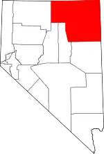 Elko County map | |
| CDPs | ||
| Other unincorporated communities | ||
| Indian reservations | ||
| Ghost towns |
| |
| Footnotes | ‡This populated place also has portions in an adjacent county or counties | |
| ||
