Lancha Plana, California
Lancha Plana ("flat boat" in Spanish; formerly, Sonora Bar)[2] was a small settlement in Amador County, California, formed as a result of a flatboat ferry crossing across the Mokelumne River. It was founded by Mexican settlers in 1848.[3] It lay on the north bank of the Mokelumne River, 9 miles (14 km) south-southeast of Ione,[2] at an elevation of 220 feet (67 m). The remnants of the town were submerged as a result of the damming of the river to form the Camanche Reservoir. Lancha Plana Bridge crosses the lake now about where the town once stood.
Lancha Plana | |
|---|---|
Former settlement | |
 Lancha Plana Location in California | |
| Coordinates: 38°13′29″N 120°54′07″W | |
| Country | United States |
| State | California |
| County | Amador County |
| Elevation | 220 ft (67 m) |
| GNIS feature ID | 253642[1] |
| Reference no. | 30 |
Lancha Plana is registered as a California Historical Landmark.[4]
A post office operated at Lancha Plana from 1859 to 1919, with a closure from 1912 to 1913.[2]
References
- "Lancha Plana (historical)". Geographic Names Information System. United States Geological Survey. Retrieved 2012-03-30.
- Durham, David L. (1998). California's Geographic Names: A Gazetteer of Historic and Modern Names of the State. Clovis, Calif.: Word Dancer Press. p. 511. ISBN 1-884995-14-4.
- Miller, Donald C. (1978). Ghost Towns of California. Boulder, Colorado: Pruett Publishing Company. p. 106. ISBN 0871085178.
- "Lancha Plana". Office of Historic Preservation, California State Parks. Retrieved 2012-03-30.
Municipalities and communities of Amador County, California, United States | ||
|---|---|---|
| Cities | 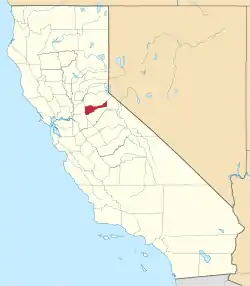 Amador County map | |
| CDPs | ||
| Unincorporated communities | ||
| Ghost towns |
| |
| Footnotes | ‡This CDP also has portions in an adjacent county or counties | |
| ||
This article is issued from Wikipedia. The text is licensed under Creative Commons - Attribution - Sharealike. Additional terms may apply for the media files.
