Amador County, California
Amador County, is a county in the U.S. state of California, in the Sierra Nevada. As of the 2010 census, the population was 38,091.[5] The county seat is Jackson.[6] Amador County, located within California's Gold Country, is known as "The Heart of the Mother Lode". There is a substantial viticultural industry in the county.
Amador County, California | |
|---|---|
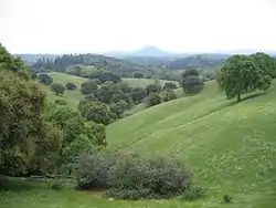 The Amador County foothills in April 2007 | |
 Flag  Seal | |
| Nickname(s): "The Heart of the Mother Lode" | |
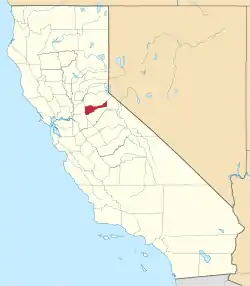 Location in the state of California | |
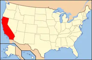 California's location in the United States | |
| Country | |
| State | |
| Region | Sierra Nevada |
| Incorporated | May 1, 1854[1] |
| Named for | José María Amador |
| County seat | Jackson |
| Largest city | Ione (population and area) |
| Area | |
| • Total | 606 sq mi (1,570 km2) |
| • Land | 595 sq mi (1,540 km2) |
| • Water | 11.4 sq mi (30 km2) |
| Highest elevation | 9,414 ft (2,869 m) |
| Population | |
| • Total | 38,091 |
| • Estimate (2019)[4] | 39,752 |
| • Density | 63/sq mi (24/km2) |
| Time zone | UTC-8 (Pacific Time Zone) |
| • Summer (DST) | UTC-7 (Pacific Daylight Time) |
| Area code | 209 |
| FIPS code | 06-005 |
| GNIS feature ID | 1675841 |
| Website | www |
History
.jpg.webp)
_(17161938811).jpg.webp)
Amador County was created by the California Legislature on May 11, 1854, from parts of Calaveras and El Dorado counties.[8] It was organized on July 3, 1854.[8] In 1864, part of the county's territory was given to Alpine County.
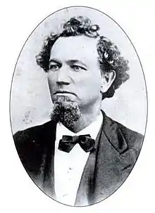
The county is named for José María Amador, a soldier, rancher, and miner, born in San Francisco in 1794,[9] the son of Sergeant Pedro Amador (a Spanish soldier who settled in California in 1771) and younger brother to Sinforosa Amador.
In 1848, Jose Maria Amador, with several Native Americans, established a successful gold mining camp near the present town of Amador City. In Spanish, the word amador means "one who loves". Some of the Mother Lode's most successful gold mines were located in Amador County, including the Kennedy, Argonaut, and Keystone.
There are numerous gold mines in Amador County including the Argonaut Mine, the Kennedy Mine, the Central Eureka, and the Lincoln. The Kennedy Mine in Jackson was the deepest gold mine of its time. The federal government closed all of the Mother Lode's mines in 1942 because they were considered non-essential to the war effort.
Geography
According to the U.S. Census Bureau, the county has a total area of 606 square miles (1,570 km2), of which 595 square miles (1,540 km2) is land and 11.4 square miles (30 km2) (1.9%) is water.[10] It is the fifth-smallest county in California by land area and second-smallest by total area. Water bodies in the county include Lake Amador, Lake Camanche, Pardee Reservoir, Bear River Reservoir, Silver Lake, Sutter Creek, Cosumnes River, Mokelumne River, and Lake Tabeaud. Thirty-seven miles of the North Fork and main Mokelumne River were added to the California Wild and Scenic Rivers System on June 27, 2018, when Governor Edmund G. "Jerry" Brown signed Senate Bill 854.
Amador County is located approximately 45 miles (72 km) southeast of Sacramento in the part of California known as the Mother Lode, or Gold Country in the Sierra Nevada.
Amador County ranges in elevation from approximately 250 feet (76 m) in the western portion of the county to over 9,000 feet (2,700 m) in the eastern portion of the county, the tallest point being Thunder Mountain. The county is bordered on the north by the Cosumnes River and El Dorado County and on the south by the Mokelumne River and Calaveras County, on the west by Sacramento and San Joaquin Counties, and the east by Alpine County.
Shenandoah Valley
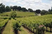

Though not as well known as the Napa Valley AVA or Sonoma Valley AVA viticultural regions of California, the Shenandoah Valley was once the principal viticultural region of California.[11] With the discovery of gold, the area quickly became a mecca for those trying to make their fortune. In the process numerous wineries sprouted up, many of whose vineyards are still in use by wineries today. The decline of the California Gold Rush coupled with the onset of Prohibition devastated the wine-making region of Amador County. Today this area has been resurrected and is now home to over 40 different wineries. Amador County is known for its Zinfandel, but many other varietals are produced as well. Amador County has a high percentage of old Zinfandel vines. Some of the Zinfandel vineyards in this county are more than 125 years old, including the original Grandpère vineyard, planted with Zinfandel before 1869 and believed to be the oldest Zinfandel vineyard in America.[12] This 10-acre (40,000 m2) vineyard is home to some of the oldest Zinfandel vines on Earth, with proof of their existence dating to 1869 when it was listed as a descriptor on a deed from the U.S. Geological Survey. A grant deed in Amador County records further proves their existence in 1869.
Adjacent counties
- El Dorado County - north
- Alpine County - east
- Calaveras County - south
- San Joaquin County - southwest
- Sacramento County - west
National protected area
- Eldorado National Forest (part)
- Mokelumne Wilderness (part)
Demographics
2011
| Population, race, and income | |||||
|---|---|---|---|---|---|
| Total population[13] | 38,244 | ||||
| White[13] | 33,454 | 87.5% | |||
| Black or African American[13] | 870 | 2.3% | |||
| American Indian or Alaska Native[13] | 889 | 2.3% | |||
| Asian[13] | 529 | 1.4% | |||
| Native Hawaiian or other Pacific Islander[13] | 82 | 0.2% | |||
| Some other race[13] | 1,432 | 3.7% | |||
| Two or more races[13] | 988 | 2.6% | |||
| Hispanic or Latino (of any race)[14] | 4,677 | 12.2% | |||
| Per capita income[15] | $28,030 | ||||
| Median household income[16] | $56,180 | ||||
| Median family income[17] | $69,521 | ||||
Places by population, race, and income
| Places by population and race | ||||||||
|---|---|---|---|---|---|---|---|---|
| Place | Type[18] | Population[13] | White[13] | Other[13] [note 1] |
Asian[13] | Black or African American[13] |
Native American[13] [note 2] |
Hispanic or Latino (of any race)[14] |
| Amador City | City | 158 | 100.0% | 0.0% | 0.0% | 0.0% | 0.0% | 0.0% |
| Buckhorn | CDP | 2,090 | 98.4% | 1.6% | 0.0% | 0.0% | 0.0% | 5.6% |
| Buena Vista | CDP | 435 | 68.5% | 25.1% | 0.0% | 0.0% | 6.4% | 0.0% |
| Camanche North Shore | CDP | 791 | 96.7% | 3.3% | 0.0% | 0.0% | 0.0% | 16.9% |
| Camanche Village | CDP | 704 | 100.0% | 0.0% | 0.0% | 0.0% | 0.0% | 0.0% |
| Drytown | CDP | 138 | 100.0% | 0.0% | 0.0% | 0.0% | 0.0% | 0.0% |
| Fiddletown | CDP | 121 | 100.0% | 0.0% | 0.0% | 0.0% | 0.0% | 0.0% |
| Ione | City | 7,873 | 70.7% | 14.6% | 2.6% | 9.7% | 2.4% | 25.3% |
| Jackson | City | 4,626 | 90.7% | 4.8% | 1.2% | 0.8% | 2.5% | 16.6% |
| Kirkwood ‡ | CDP | 158 | 96.8% | 0.0% | 0.6% | 2.5% | 0.0% | 0.0% |
| Martell | CDP | 140 | 100.0% | 0.0% | 0.0% | 0.0% | 0.0% | 0.0% |
| Pine Grove | CDP | 2,573 | 93.0% | 5.9% | 1.1% | 0.0% | 0.0% | 7.3% |
| Pioneer | CDP | 1,226 | 82.1% | 2.6% | 0.0% | 0.0% | 15.3% | 0.0% |
| Plymouth | City | 1,055 | 94.0% | 3.2% | 0.6% | 0.0% | 2.2% | 11.7% |
| Red Corral | CDP | 1,757 | 84.4% | 11.8% | 2.3% | 0.2% | 1.4% | 2.9% |
| River Pines | CDP | 578 | 97.1% | 0.0% | 2.9% | 0.0% | 0.0% | 6.9% |
| Sutter Creek | City | 2,497 | 93.4% | 1.5% | 4.8% | 0.0% | 0.3% | 5.3% |
| Volcano | CDP | 184 | 99.4% | 0.0% | 0.6% | 0.0% | 0.0% | 0.0% |
| ‡ Data for Amador County area of this CDP | ||||||||
| Places by population and income | |||||
|---|---|---|---|---|---|
| Place | Type[18] | Population[19] | Per capita income[15] | Median household income[16] | Median family income[17] |
| Amador City | City | 158 | $36,439 | $63,036 | $81,500 |
| Buckhorn | CDP | 2,090 | $31,611 | $50,365 | $54,833 |
| Buena Vista | CDP | 435 | $12,573 | $32,944 | $33,444 |
| Camanche North Shore | CDP | 791 | $31,857 | $58,309 | $79,125 |
| Camanche Village | CDP | 704 | $35,199 | $98,333 | $98,631 |
| Drytown | CDP | 138 | $20,676 | $21,172 | $70,595 |
| Fiddletown | CDP | 121 | $69,702 | $65,192 | $49,766 |
| Ione | City | 7,873 | $14,946 | $72,734 | $79,775 |
| Jackson | City | 4,626 | $24,945 | $48,631 | $63,028 |
| Kirkwood ‡ | CDP | 39 | $14,623 | $7,188 | [20] |
| Martell | CDP | 140 | $23,051 | $50,962 | $90,391 |
| Pine Grove | CDP | 2,573 | $29,918 | $52,917 | $74,048 |
| Pioneer | CDP | 1,226 | $32,153 | $42,917 | $92,600 |
| Plymouth | City | 1,055 | $21,626 | $38,333 | $56,667 |
| Red Corral | CDP | 1,757 | $20,145 | $58,450 | $57,803 |
| River Pines | CDP | 578 | $30,626 | $31,544 | $38,875 |
| Sutter Creek | City | 2,497 | $26,788 | $46,316 | $51,389 |
| Volcano | CDP | 183 | $47,178 | $89,688 | [20] |
| ‡ Data for Amador County area of this CDP | |||||
2010
| Historical population | |||
|---|---|---|---|
| Census | Pop. | %± | |
| 1860 | 10,930 | — | |
| 1870 | 9,582 | −12.3% | |
| 1880 | 11,384 | 18.8% | |
| 1890 | 10,320 | −9.3% | |
| 1900 | 11,116 | 7.7% | |
| 1910 | 9,086 | −18.3% | |
| 1920 | 7,793 | −14.2% | |
| 1930 | 8,494 | 9.0% | |
| 1940 | 8,973 | 5.6% | |
| 1950 | 9,151 | 2.0% | |
| 1960 | 9,990 | 9.2% | |
| 1970 | 11,821 | 18.3% | |
| 1980 | 19,314 | 63.4% | |
| 1990 | 30,039 | 55.5% | |
| 2000 | 35,100 | 16.8% | |
| 2010 | 38,091 | 8.5% | |
| 2019 (est.) | 39,752 | [4] | 4.4% |
| U.S. Decennial Census[21] 1790–1960[22] 1900–1990[23] 1990–2000[24] 2010–2015[5] | |||
The 2010 United States Census reported that Amador County had a population of 38,091. The racial makeup of Amador County was 33,149 (87.0%) White, 962 (2.5%) African American, 678 (1.8%) Native American, 419 (1.1%) Asian, 77 (0.2%) Pacific Islander, 1,450 (3.8%) from other races, and 1,356 (3.6%) from two or more races. Hispanic or Latino of any race were 4,756 persons (12.5%).[25]
| Population reported at 2010 United States Census | |||||||||
|---|---|---|---|---|---|---|---|---|---|
Population | American | American | Islander | races | more races | or Latino (of any race) | |||
| Amador County | 38,091 | 33,149 | 962 | 678 | 419 | 77 | 1,450 | 1,356 | 4,756 |
cities | Population | American | American | Islander | races | more races | or Latino (of any race) | ||
| Amador City | 185 | 171 | 0 | 4 | 2 | 0 | 2 | 6 | 11 |
| Ione | 7,918 | 5,826 | 824 | 173 | 110 | 21 | 678 | 286 | 1,991 |
| Jackson | 4,651 | 4,090 | 32 | 94 | 60 | 4 | 185 | 186 | 520 |
| Plymouth | 1,005 | 850 | 3 | 18 | 6 | 2 | 70 | 56 | 183 |
| Sutter Creek | 2,501 | 2,272 | 10 | 34 | 65 | 5 | 40 | 75 | 219 |
places | Population | American | American | Islander | races | more races | or Latino (of any race) | ||
| Buckhorn | 2,429 | 2,259 | 9 | 37 | 25 | 4 | 47 | 48 | 168 |
| Buena Vista | 429 | 365 | 1 | 23 | 0 | 0 | 12 | 28 | 35 |
| Camanche North Shore | 979 | 860 | 3 | 14 | 12 | 3 | 38 | 49 | 150 |
| Camanche Village | 847 | 762 | 0 | 9 | 8 | 4 | 31 | 33 | 121 |
| Drytown | 167 | 153 | 0 | 0 | 1 | 0 | 2 | 11 | 11 |
| Fiddletown | 235 | 215 | 0 | 5 | 1 | 0 | 8 | 6 | 22 |
| Kirkwood‡ | 61 | 59 | 0 | 1 | 1 | 0 | 0 | 0 | 2 |
| Martell | 282 | 234 | 0 | 14 | 0 | 5 | 14 | 15 | 36 |
| Pine Grove | 2,219 | 2,027 | 9 | 36 | 9 | 6 | 49 | 83 | 202 |
| Pioneer | 1,094 | 1,017 | 0 | 34 | 1 | 2 | 12 | 28 | 52 |
| Red Corral | 1,413 | 1,259 | 24 | 15 | 12 | 3 | 33 | 67 | 147 |
| River Pines | 379 | 324 | 0 | 5 | 4 | 0 | 8 | 38 | 31 |
| Volcano | 115 | 109 | 0 | 2 | 2 | 0 | 0 | 2 | 7 |
unincorporated areas | Population | American | American | Islander | races | more races | or Latino (of any race) | ||
| All others not CDPs (combined) | 11,182 | 10,297 | 47 | 160 | 100 | 18 | 221 | 339 | 848 |
| ‡ - census results for the portion of this CDP in Amador County | |||||||||
2000
As of the census[26] of 2000, there were 35,100 people, 12,759 households, and 9,071 families residing in the county. The population density was 59 people per square mile (23/km2). There were 15,035 housing units at an average density of 25 per square mile (10/km2). The racial makeup of the county was 85.8% White, 3.9% Black or African American, 1.8% Native American, 1.0% Asian, 0.1% Pacific Islander, 5.0% from other races, and 2.4% from two or more races. 8.9% of the population were Hispanic or Latino of any race. 14.9% were of German, 12.6% English, 11.7% Irish, 8.8% Italian and 7.3% American ancestry according to Census 2000. 93.1% spoke English and 5.1% Spanish as their first language.
There were 12,759 households, out of which 26.2% had children under the age of 18 living with them, 58.9% were married couples living together, 8.7% had a female householder with no husband present, and 28.9% were non-families. 23.9% of all households were made up of individuals, and 11.3% had someone living alone who was 65 years of age or older. The average household size was 2.39 and the average family size was 2.81.
In the county, the population was spread out, with 20.6% under the age of 18, 6.9% from 18 to 24, 26.2% from 25 to 44, 28.3% from 45 to 64, and 18.0% who were 65 years of age or older. The median age was 43 years. For every 100 females there were 122.5 males. For every 100 females age 18 and over, there were 123.4 males.
The median income for a household in the county was $42,280, and the median income for a family was $51,226. Males had a median income of $39,697 versus $28,850 for females. The per capita income for the county was $22,412. About 6.1% of families and 9.2% of the population were below the poverty line, including 13.1% of those under age 18 and 5.4% of those age 65 or over.
Politics, government, and policing
County Supervisors
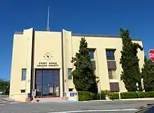
The county is governed by a five-person elected Board of Supervisors and a County Administrator. The county seat is Jackson.
Policing
The unincorporated areas of Amador County are patrolled by the county sheriff's department who also operates the county jail and protects the courts. Municipal police departments within the county are at Ione, Jackson, and Sutter Creek.
Voter registration statistics
| Population and registered voters | ||
|---|---|---|
| Total population[13] | 38,244 | |
| Registered voters[27][note 3] | 21,453 | 56.1% |
| Democratic[27] | 6,790 | 31.7% |
| Republican[27] | 9,663 | 45.0% |
| Democratic–Republican spread[27] | -2,873 | -13.3% |
| Independent[27] | 894 | 4.2% |
| Green[27] | 114 | 0.5% |
| Libertarian[27] | 185 | 0.9% |
| Peace and Freedom[27] | 46 | 0.2% |
| Americans Elect[27] | 0 | 0.0% |
| Other[27] | 78 | 0.4% |
| No party preference[27] | 3,683 | 17.2% |
Cities by population and voter registration
| Cities by population and voter registration | |||||||
|---|---|---|---|---|---|---|---|
| City | Population[13] | Registered voters[27] [note 3] |
Democratic[27] | Republican[27] | D–R spread[27] | Other[27] | No party preference[27] |
| Amador | 158 | 83.5% | 34.1% | 41.7% | -7.6% | 9.8% | 18.2% |
| Ione | 7,873 | 29.0% | 27.3% | 49.4% | -22.1% | 11.4% | 16.8% |
| Jackson | 4,626 | 55.7% | 32.3% | 42.6% | -10.3% | 11.2% | 18.4% |
| Plymouth | 1,055 | 49.4% | 30.9% | 38.8% | -7.9% | 13.2% | 22.5% |
| Sutter Creek | 2,497 | 68.4% | 35.9% | 41.9% | -6.0% | 9.6% | 16.7% |
Overview
Historically Amador was a Democratic-leaning county that voted Republican only in landslide victories. Between 1876 and 1976, Amador voted Republican only in 1900, 1904, 1908, 1920, 1952 and 1972[28] – and even in George McGovern’s landslide loss it voted more Democratic than the nation. Currently Amador is a strongly Republican county in Presidential and congressional elections. The last Democrat to win a majority in the county was Jimmy Carter in 1976.
| Year | GOP | DEM | Others |
|---|---|---|---|
| 2016 | 58.37% 10,485 | 33.42% 6,004 | 8.21% 1,474 |
| 2012 | 58.11% 10,281 | 38.60% 6,830 | 3.29% 582 |
| 2008 | 55.94% 10,561 | 41.38% 7,813 | 2.67% 505 |
| 2004 | 62.08% 11,107 | 36.56% 6,541 | 1.36% 243 |
| 2000 | 56.69% 8,766 | 38.19% 5,906 | 5.13% 792 |
| 1996 | 47.54% 6,870 | 40.60% 5,868 | 11.86% 1,714 |
| 1992 | 35.49% 5,477 | 34.25% 5,286 | 30.26% 4,671 |
| 1988 | 55.87% 6,893 | 42.12% 5,197 | 2.01% 248 |
| 1984 | 61.48% 6,986 | 36.86% 4,188 | 1.66% 189 |
| 1980 | 55.85% 5,401 | 33.00% 3,191 | 11.15% 1,078 |
| 1976 | 46.13% 3,699 | 50.35% 4,037 | 3.52% 282 |
| 1972 | 53.40% 3,533 | 40.89% 2,705 | 5.71% 378 |
| 1968 | 42.10% 2,269 | 45.27% 2,440 | 12.63% 681 |
| 1964 | 32.99% 1,682 | 66.89% 3,410 | 0.12% 6 |
| 1960 | 44.51% 2,175 | 55.04% 2,690 | 0.45% 22 |
| 1956 | 49.16% 2,126 | 50.43% 2,181 | 0.42% 18 |
| 1952 | 52.42% 2,440 | 46.60% 2,169 | 0.99% 46 |
| 1948 | 38.84% 1,578 | 57.45% 2,334 | 3.72% 151 |
| 1944 | 37.18% 1,191 | 61.69% 1,976 | 1.12% 36 |
| 1940 | 32.85% 1,372 | 66.14% 2,762 | 1.01% 42 |
| 1936 | 23.38% 777 | 75.41% 2,506 | 1.20% 40 |
| 1932 | 25.34% 822 | 72.97% 2,367 | 1.70% 55 |
| 1928 | 44.12% 990 | 55.53% 1,246 | 0.36% 8 |
| 1924 | 38.93% 719 | 17.11% 316 | 43.96% 812 |
| 1920 | 64.13% 1,350 | 30.36% 639 | 5.51% 116 |
| 1916 | 38.53% 1,209 | 56.28% 1,766 | 5.19% 163 |
| 1912 | 0.20% 5 | 64.80% 1,622 | 35.00% 876 |
| 1908 | 51.88% 1,035 | 43.81% 874 | 4.31% 86 |
| 1904 | 54.45% 1,279 | 38.95% 915 | 6.60% 155 |
| 1900 | 52.64% 1,384 | 45.99% 1,209 | 1.37% 36 |
| 1896 | 44.39% 1,144 | 54.25% 1,398 | 1.36% 35 |
| 1892 | 43.04% 1,125 | 48.01% 1,255 | 8.95% 234 |
Amador County is in California's 4th congressional district, represented by Republican Tom McClintock.[29] In the State Assembly, the county is in the 5th Assembly District, represented by Republican Frank Bigelow.[30] In the California State Senate, the county is in the 8th Senate District, represented by Republican Andreas Borgeas.[31]
| Election results from statewide races | ||
|---|---|---|
| Year | Office | Results |
| 2010 | Governor | Whitman 52.4 - 41.6% |
| Lieutenant Governor | Maldonado 52.1 - 33.4% | |
| Secretary of State | Dunn 50.5 - 38.5% | |
| Controller | Chiang 50.4 - 40.2% | |
| Treasurer | Walters 48.3 - 42.9% | |
| Attorney General | Cooley 59.1 - 27.8% | |
| Insurance Commissioner | Villines 50.6 - 35.1% | |
| 2006 | Governor | Schwarzenegger 72.1 - 22.5% |
| Lieutenant Governor | McClintock 56.8 - 38.3% | |
| Secretary of State | McPherson 62.0 - 31.2% | |
| Controller | Strickland 52.4 - 40.2% | |
| Treasurer | Parrish 49.0 - 42.5% | |
| Attorney General | Poochigian 52.7 - 42.0% | |
| Insurance Commissioner | Poizner 62.9 - 25.4% | |
Crime
The following table includes the number of incidents reported and the rate per 1,000 persons for each type of offense.
| Population and crime rates | ||
|---|---|---|
| Population[13] | 38,244 | |
| Violent crime[32] | 107 | 2.80 |
| Homicide[32] | 1 | 0.03 |
| Forcible rape[32] | 10 | 0.26 |
| Robbery[32] | 10 | 0.26 |
| Aggravated assault[32] | 86 | 2.25 |
| Property crime[32] | 537 | 14.04 |
| Burglary[32] | 337 | 8.81 |
| Larceny-theft[32][note 4] | 459 | 12.00 |
| Motor vehicle theft[32] | 60 | 1.57 |
| Arson[32] | 2 | 0.05 |
Education
Due to the low population of the area, there are few schools with small class sizes. In total for public schools, there are two high schools, two junior high schools, and six elementary schools.[34] These numbers are in addition to two independent study schools, one charter school and one continuing education school for adults. There are no colleges or universities within the county's borders.
In popular culture
"The Luck of Roaring Camp" is a short story by American author Bret Harte. It was first published in the August 1868 issue of the Overland Monthly and helped push Harte to international prominence. Harte lived in this area during his "Gold Rush" period, and possibly based the story in a mining camp on the Mokelumne River.
In the 1993 movie Homeward Bound: The Incredible Journey, a map of Amador County is shown, as well as many other California counties.
Transportation
Major highways
Public transportation
Amador Transit provides service in Jackson and nearby communities. Connections to Calaveras County and Sacramento are additionally provided.
Airport
Amador County Airport is a general aviation airport located near Jackson.
Attractions
Amador County is home of the California Gold Rush, and many century-old gold-mining sites in the county are now popular tourist destinations, as are other attractions such as:
- Amador County Model Railroad Museum - Representing our rich Railroad, Logging, and Mining history. Located in Pine Grove, CA.
- Hiking activities in the East
- Campgrounds areas with gold-panning activities
- Historic sites: Chew Kee Store in Fiddletown, Kennedy Mine in Jackson, Knight Foundry in Sutter Creek, Roaring Camp Mining Company, Preston School of Industry, or Preston Castle in Ione
- Amador City Main Street – antique shops, historical buildings, wine tasting
- Amador City Amador Whitney Museum – collections and displays about history and culture of the Mother Lode region[35]
- Jackson Main Street – antique shops
- Jackson Rancheria – casino and hotel built in 1986 by Larry Graham Construction
- Lakes for boating and fishing
- Mace Meadows Golf Course in Pioneer
- Mokelumne River – fishing, gold panning, whitewater kayaking, swimming, picnics, water play
- Old Mill Shopping Center in Martell
- Outdoor Activities – camping, fishing, picnicking, ATV riding, backpacking, hiking, lake kayaking, horseback riding, whitewater kayaking, birding, snowshoeing, cross-country skiing, rock climbing, etc.
- Sutter Creek Main Street – antique shops, Sutter Creek Theater
- Caves with tours (Black Chasm in Volcano)
- Volcano Theater Company and the Cobblestone Theater and the St. George Hotel in Volcano
- Wineries with wine-tasting activities
- Winter Ski Resorts – for skiers, snowboarders, etc.
- Amador County Summer Fair hosted annually every summer at the Fairgrounds in Plymouth, California.
Communities
Cities
- Amador City
- Ione
- Jackson (county seat)
- Plymouth
- Sutter Creek
Census-designated places
Unincorporated communities
Population ranking
The population ranking of the following table is based on the 2010 census of Amador County.[36]
† county seat
| Rank | City/Town/etc. | Municipal type | Population (2010 Census) |
|---|---|---|---|
| 1 | Ione | City | 7,918 |
| 2 | † Jackson | City | 4,651 |
| 3 | Sutter Creek | City | 2,501 |
| 4 | Buckhorn | CDP | 2,429 |
| 5 | Pine Grove | CDP | 2,219 |
| 6 | Red Corral | CDP | 1,413 |
| 7 | Pioneer | CDP | 1,094 |
| 8 | Plymouth | City | 1,005 |
| 9 | Camanche North Shore | CDP | 979 |
| 10 | Camanche Village | CDP | 847 |
| 11 | Buena Vista | CDP | 429 |
| 12 | River Pines | CDP | 379 |
| 13 | Martell | CDP | 282 |
| 14 | Fiddletown | CDP | 235 |
| 15 | Amador City | City | 185 |
| 16 | Drytown | CDP | 167 |
| 17 | Kirkwood (partially in Alpine County) | CDP | 158 |
| 18 | Volcano | CDP | 115 |
| 19 | Ione Band of MiwokTDSA[37] | AIAN | 5 |
See also
- California State Library - California Room Collection. Amador County Legal Records, 1853-1868.
- List of school districts in Amador County, California
- National Register of Historic Places listings in Amador County, California
- Amador High School
Notes
- Other = Some other race + Two or more races
- Native American = Native Hawaiian or other Pacific Islander + American Indian or Alaska Native
- Percentage of registered voters with respect to total population. Percentages of party members with respect to registered voters follow.
- Only larceny-theft cases involving property over $400 in value are reported as property crimes.
References
- "Amador County". Geographic Names Information System. United States Geological Survey. Retrieved February 10, 2015.
- "Thunder Mountain". Peakbagger.com. Retrieved February 10, 2015.
- "Annual Estimates of the Resident Population: April 1, 2010 to July 1, 2016 Estimates". Retrieved April 27, 2017.
- "Population and Housing Unit Estimates". Retrieved December 3, 2019.
- "State & County QuickFacts". United States Census Bureau. Archived from the original on July 6, 2011. Retrieved April 3, 2016.
- "Find a County". National Association of Counties. Archived from the original on May 31, 2011. Retrieved June 7, 2011.
- , Judicial Council of California. Retrieved August 2, 2009.
- Whittle, Syd (September 8, 2008). "1854 · Amador County · 1954". The Historical Marker Database. J. J. Prats. Retrieved May 14, 2012. (historical marker placed by Board of Supervisors and Amador County Historical Society, 1954)
- William Bright; Erwin Gustav Gudde (November 30, 1998). 1500 California place names: their origin and meaning. University of California Press. p. 15. ISBN 978-0-520-21271-8. Retrieved January 20, 2012.
- "2010 Census Gazetteer Files". United States Census Bureau. August 22, 2012. Retrieved September 24, 2015.
- Costa, Eric J (January 1, 1994). Old vines: A history of winegrowing in Amador County. Jackson, CA: Cenotto Publications. pp. v, 46. ISBN 0-938121-08-1.
- "Golden Oldies / There's more than just fruit in old-vine Zinfandel - its earthy flavors are history in a bottle - SFGate". SFgate.com. Hearst Communications Inc. July 28, 2005. Retrieved December 14, 2010.
- U.S. Census Bureau. American Community Survey, 2011 American Community Survey 5-Year Estimates, Table B02001. U.S. Census website . Retrieved October 26, 2013.
- U.S. Census Bureau. American Community Survey, 2011 American Community Survey 5-Year Estimates, Table B03003. U.S. Census website . Retrieved October 26, 2013.
- U.S. Census Bureau. American Community Survey, 2011 American Community Survey 5-Year Estimates, Table B19301. U.S. Census website . Retrieved October 21, 2013.
- U.S. Census Bureau. American Community Survey, 2011 American Community Survey 5-Year Estimates, Table B19013. U.S. Census website . Retrieved October 21, 2013.
- U.S. Census Bureau. American Community Survey, 2011 American Community Survey 5-Year Estimates, Table B19113. U.S. Census website . Retrieved October 21, 2013.
- U.S. Census Bureau. American Community Survey, 2011 American Community Survey 5-Year Estimates. U.S. Census website . Retrieved October 21, 2013.
- U.S. Census Bureau. American Community Survey, 2011 American Community Survey 5-Year Estimates, Table B01003. U.S. Census website . Retrieved October 21, 2013.
- Data unavailable
- "U.S. Decennial Census". United States Census Bureau. Retrieved September 24, 2015.
- "Historical Census Browser". University of Virginia Library. Retrieved September 24, 2015.
- Forstall, Richard L., ed. (March 27, 1995). "Population of Counties by Decennial Census: 1900 to 1990". United States Census Bureau. Retrieved September 24, 2015.
- "Census 2000 PHC-T-4. Ranking Tables for Counties: 1990 and 2000" (PDF). United States Census Bureau. April 2, 2001. Retrieved September 24, 2015.
- "2010 Census P.L. 94-171 Summary File Data". United States Census Bureau.
- "U.S. Census website". United States Census Bureau. Retrieved May 14, 2011.
- California Secretary of State. February 10, 2013 - Report of Registration Archived November 3, 2013, at the Wayback Machine. Retrieved October 31, 2013.
- Menendez, Albert J.; The Geography of Presidential Elections in the United States, 1868-2004, pp. 153-156 ISBN 0786422173
- "California's 4th Congressional District - Representatives & District Map". Civic Impulse, LLC. Retrieved March 1, 2013.
- "Members Assembly". State of California. Retrieved March 18, 2013.
- "Communities of Interest - Counties". California Citizens Redistricting Commission. Archived from the original on October 23, 2015. Retrieved September 24, 2014.
- Office of the Attorney General, Department of Justice, State of California. Table 11: Crimes – 2009 Archived December 2, 2013, at the Wayback Machine. Retrieved November 14, 2013.
- United States Department of Justice, Federal Bureau of Investigation. Crime in the United States, 2012, Table 8 (California). Retrieved November 14, 2013.
- "Amador County Public Schools". Amadorcoe. Retrieved November 26, 2018.
- "Amador City CA - Amador Whitney Museum - California Gold Country". www.amador-city.com. Retrieved March 16, 2018.
- "2010 U.S. Census website". United States Census Bureau. Retrieved 2015-12-06.
- Staff, Website Services & Coordination. "US Census Bureau 2010 Census Interactive Population Map". www.census.gov. Archived from the original on December 28, 2016. Retrieved March 16, 2018.
External links
| Wikivoyage has a travel guide for Amador County. |
| Wikimedia Commons has media related to Amador County, California. |
Places adjacent to Amador County, California | ||||||||||
|---|---|---|---|---|---|---|---|---|---|---|
| ||||||||||
Municipalities and communities of Amador County, California, United States | ||
|---|---|---|
| Cities | Amador County map | |
| CDPs | ||
| Unincorporated communities | ||
| Ghost towns |
| |
| Footnotes | ‡This CDP also has portions in an adjacent county or counties | |
| ||
| Authority control |
|---|