List of Sites of Special Scientific Interest in Avon

This is a list of the Sites of Special Scientific Interest (SSSIs) in the former county of Avon, England, United Kingdom. In England the body responsible for designating SSSIs is Natural England, which chooses a site because of its fauna, flora, geological or physiographical features.[1] Although the county of Avon no longer exists, Natural England still uses its former borders to mark one of its Areas of Search. As of 2006, there are 86 sites designated in this Area of Search, of which 38 have been designated due to their biological interest, 39 due to their geological interest, and 9 for both.[2]

A view of the Avon Gorge, designated as an SSSI for both its biological and its geological interest

Natural England took over the role of designating and managing SSSIs from English Nature in October 2006 when it was formed from the amalgamation of English Nature, parts of the Countryside Agency and the Rural Development Service. The English counties were revised under the 1974 reorganisation of local government. Until the 2010s, Natural England, which maintains the database of English SSSIs, kept the listing of counties as it was in 1974, but by 2015 they had updated their lists to reflect some later changes. However, even though Avon was abolished in 1996 it is still used as an area of search by Natural England, rather than being divided between the Gloucestershire and Somerset lists.[3]

The data in the table is taken from English Nature in the form of citation sheets for each SSSI.[4]

For other counties, see List of SSSIs by Area of Search.
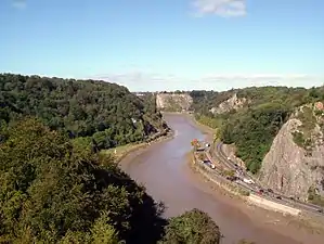
Sites

Site name Reason for designation Area[A] Grid reference[B] Year in which notified Map[C]
Biological interest Geological interest Hectares Acres
Ashton Court Y 210.3 519.7 ST553723 1998 Map
Aust Cliff Y 5.3 13.1 ST565894 1954 Map
Avon Gorge Y Y 155.4 384.0 ST560743 1952 Map
Banwell Caves Y Y 1.7 4.2 ST383588 1963 Map
Banwell Ochre Caves Y 12.5 30.8 ST407593 1983 Map
Barnhill Quarry Y 3.1 7.7 ST725827 1966 Map
Barns Batch Spinney Y 0.1 0.2 ST557659 1987 Map
Bickley Wood Y 9.5 23.5 ST644703 1988 Map
Biddle Street, Yatton Y 44.8 110.7 ST423648 1994 Map
Bishop's Hill Wood Y 30.6 75.6 ST733873 1984 Map
Blagdon Lake Y 212.7 525.6 ST515597 1971 Map
Bleadon Hill Y 13.5 33.4 ST705943 1999 Map
Bodkin Hazel Wood Y 10.6 26.2 ST780850 1974 Map
Bourne Y 8.5 20.9 ST484600 1992 Map
Bowlditch Quarry Y 0.3 0.6 ST668558 1952 Map
Brinkmarsh Quarry Y 0.5 1.2 ST674913 1974 Map
Brockley Hall Stables Y 0.1 0.2 ST471669 1987 Map
Brown's Folly Y Y 39.9 98.5 ST793662 1974 Map
Buckover Road Cutting Y 1.7 4.1 ST665906 1967 Map
Burledge Sidelands and Meadows Y 48.7 120.3 ST588587 2005 Map
Burrington Combe Y Y 139.1 343.8 ST478583 1952 Map
Cattybrook Brickpit Y 2.2 5.5 ST594835 1989 Map
Chew Valley Lake Y 565.2 1,396.6 ST570600 1971 Map
Cleaves Wood Y 40.4 99.8 ST758576 1988 Map
Cleeve Wood, Hanham Y 8.9 21.9 ST655703 1966 Map
Clevedon Shore Y 0.4 0.9 ST402719 1991 Map
Combe Down and Bathampton Down Mines Y 6.2 15.4 ST761625 1991 Map
Compton Martin Ochre Mine Y Y 0.9 2.1 ST545570 1988 Map
Congrove Field and The Tumps Y 12.5 30.8 ST713698 1991 Map
Court Hill Y 10.5 25.8 ST436722 1997 Map
Cullimore's Quarry Y 0.9 2.2 ST721927 1974 Map
Damery Road Section Y 0.5 1.0 ST705943 1974 Map
Dolebury Warren Y 90.6 223.3 ST455590 1952 Map
Dundry Main Road South Quarry Y 0.7 1.8 ST566654 1974 Map
Ellenborough Park West Y 1.8 4.4 ST319608 1989 Map
Folly Farm Y 3.1 7.7 ST607604 1987 Map
Goblin Combe Y 51.9 128.2 ST473652 1999 Map
Gordano Valley Y Y 161.7 399.5 ST435730 1971 Map
Ham Green Y 1.1 2.7 ST539738 1990 Map
Hampton Rocks Cutting Y 1.3 3.2 ST779666 1990 Map
Harptree Combe Y 13.1 32.3 ST561558 1954 Map
Hartcliff Rocks Quarry Y 1.6 3.9 ST534662 1991 Map
Hawkesbury Meadow Y 3.3 8.2 ST754874 1987 Map
Hawkesbury Quarry Y 0.3 0.6 ST771873 1967 Map
Hinton Charterhouse Field Y 0.3 0.8 ST764574 1991 Map
Hinton Charterhouse Pit Y 0.4 1.0 ST772573 1971 Map
Hinton Hill, Wellow Y 0.3 0.6 ST757582 1996 Map
Holly Lane Y 0.5 1.2 ST419727 1990 Map
Horseshoe Bend, Shirehampton Y 4.5 11.0 ST542767 1999 Map
Huish Colliery Quarry Y 0.8 2.1 ST695542 1985 Map
Iford Manor Y 0.4 1.0 ST802589 1996 Map
Kenn Church, Kenn Pier & Yew Tree Farm Y 15.4 38.0 ST415689 1997 Map
Kilmersdon Road Quarry Y 0.4 1.1 ST689542 1954 Map
King's Wood and Urchin Wood Y 128.1 316.5 ST454645 1990 Map
Long Dole Wood and Meadows[F] Y 9.8 24.3 ST610562 1997 Map
Lower Woods Y Y 280.1 692.2 ST743876 1966 Map
Lulsgate Quarry Y 1.1 2.8 ST516659 1997 Map
Max Bog Y 10.6 26.2 ST406574 1988 Map
Middle Hope Y Y 84.1 207.8 ST325662 1952 Map
Midger Y 65.7 162.3 ST797895 1966 Map
Monkswood Valley Y 30.7 75.9 ST754710 1990 Map
Newton St. Loe Y 2.3 5.6 ST715657 1992 Map
Nightingale Valley Y 5.4 13.3 ST449751 1989 Map
North Road Quarry, Bath Y 0.3 0.7 ST767646 1990 Map
Plaster's Green Meadows Y 4.3 10.6 ST532611 1989 Map
Portishead Pier to Black Nore Y 71.8 177.4 ST474778 1952 Map
Purn Hill Y 6.1 15.1 ST412630 1990 Map
Puxton Moor Y 31.1 76.8 ST412630 1994 Map
Quarry Steps, Durdham Down [D] Y <0.1 <0.1 ST573747 1990 Map
Severn Estuary [E] Y Y 15,950.0 39,410.0 ST480830 1976 Map
Shiplate Slait Y 33.9 83.8 ST365567 1987 Map
Slickstones Quarry, Cromhall Y 2.7 6.6 ST704916 1966 Map
Spring Cove Cliffs Y 2.0 4.9 ST310625 1952 Map
St. Catherine's Valley Y 156.1 385.7 ST760725 1997 Map
Steep Holm Y 25.5 63.0 ST228607 1952 Map
Stidham Farm Y 17.3 42.8 ST682684 1991 Map
Tickenham, Nailsea and Kenn Moors Y 129.4 319.7 ST440700 1995 Map
Tytherington Quarry Y 0.9 2.2 ST662888 1989 Map
Uphill Cliff Y 19.8 48.9 ST318583 1952 Map
Upton Coombe Y 7.4 18.3 ST789877 1989 Map
Walton Common Y 25.5 63.0 ST428738 1991 Map
Weston Big Wood Y 37.5 92.6 ST455750 1971 Map
Weston-in-Gordano Y 12.6 31.0 ST452744 1993 Map
Winterbourne Railway Cutting Y 2.0 4.9 ST651799 1990 Map
Writhlington Y 0.5 1.2 ST703553 1992 Map
Yanal Bog Y 1.6 4.0 ST424607 1988 Map

Notes

A Data rounded to one decimal place.
B Grid reference is based on the British national grid reference system, also known as OSGB36, and is the system used by the Ordnance Survey.[5]
C Link to maps using the Nature on the Map service provided by Natural England.
D Size smaller than can be shown with one decimal place. Actual size: 0.006 (ha.) 0.015 (ac.).[4]
E Incorporates two former SSSIs: Severn Estuary (notified 1976) and part of Brean Down and Uphill Cliff (notified 1952). It was unified as Severn Estuary in 1989. It also overlaps with several other SSSIs:
The Severn Estuary extends into two other counties and so can be found on lists of SSSIs in Gloucestershire and Somerset.[4]
F The Long Dole Wood and Meadows site extends into the county of Somerset and so can be found on the list of SSSIs in Somerset.[4]

References

  1. "Notification of SSSIs". English Nature. Archived from the original on 2012-05-15. Retrieved 2006-08-01.
  2. "SSSIs in Avon". English Nature. Retrieved 2006-08-01.
  3. "Site Search". designatedsites.naturalengland.org.uk. Retrieved 2020-11-29.
  4. English Nature citation sheets for each SSSI (PDF files). Retrieved on 2006-08-05.
  5. "Guide to National Grid". Ordnance Survey. Archived from the original on 2007-10-27. Retrieved 2006-08-07.

This article is issued from Wikipedia. The text is licensed under Creative Commons - Attribution - Sharealike. Additional terms may apply for the media files.