List of Sites of Special Scientific Interest in Nottinghamshire

This is a list of Sites of Special Scientific Interest (SSSIs) in Nottinghamshire, a county in the East Midlands. Nottinghamshire is bordered by South Yorkshire to the north, and Leicestershire to the south, and has an estimated population of 1,055,400 within an area of 2,159 km2 (533,500.5 acres), therefore making it the 17th largest ceremonial county in the United Kingdom.[1] The data in this table is taken from English Nature's website in the form of citation sheets for each SSSI.[2]

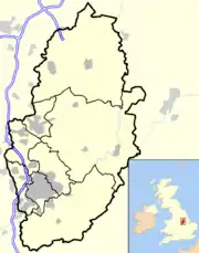
Nottinghamshire, and its location within the United Kingdom

As of March 2012 there are 66 SSSIs in Nottinghamshire. 63 are notable for their biological interest, 1 for its geology and 2 for both geological and biological interest.

For other counties, see List of SSSIs by Area of Search.

Sites

Site name Reason for designation Area Location & map ref Other designations Map/Refs
Biological interest Geological interest Hectares Acres
Annesley Woodhouse Quarry Y 34.6 85.5 53.078°N 1.276°W / 53.078; -1.276 (Annesley Woodhouse Quarries)
    SK486537
WT Map [3]
Ashton's Meadow Y 3.6 8.8 53.31°N 0.822°W / 53.31; -0.822 (Ashton's Meadow)
    SK786799
Map [4]
Attenborough Gravel Pits Y 226.6 559.9 52.899°N 1.228°W / 52.899; -1.228 (Attenborough Gravel Pits)
    SK520338
WT Map [5]
Bagthorpe Meadows Y 6.3 15.6 53.062°N 1.302°W / 53.062; -1.302 (Bagthorpe Meadows)
    SK469519
Map [6]
Barnstone Railway Cutting Y 1.5 3.8 52.912°N 0.901°W / 52.912; -0.901 (Barnstone Railway Cutting)
    SK740355
Map [7]
Barrow Hills Sandpit Y 1.9 4.6 53.418°N 0.975°W / 53.418; -0.975 (Barrow Hills Sandpit)
    SK682917
Map [8]
Besthorpe Meadows Y 9.3 23.1 53.168°N 0.778°W / 53.168; -0.778 (Besthorpe Meadows)
    SK818641
Map [9]
Besthorpe Warren Y 8.8 21.8 53.179°N 0.763°W / 53.179; -0.763 (Besthorpe Warren)
    SK828654
Map [10]
Bevercotes Park Y 8.5 21.1 53.231°N 0.953°W / 53.231; -0.953 (Bevercotes Park)
    SK700709
Map [11]
Birklands And Bilhaugh Y 505.7 1249.7 53.208°N 1.078°W / 53.208; -1.078 (Birklands And Bilhaugh)
    SK617683
CP, NNR, NCR, SAC Map [12]
Birklands West And Ollerton Corner Y 414.6 1024.6 53.199°N 1.105°W / 53.199; -1.105 (Birklands West And Ollerton Corner)
    SK599673
LNR Map [13]
Bogs Farm Quarry Y 4.9 12 53.076°N 1.283°W / 53.076; -1.283 (Bogs Farm Quarry)
    SK481534
Map [14]
Bulwell Wood Y 16.8 41.5 53.011°N 1.231°W / 53.011; -1.231 (Bulwell Wood)
    SK517462
Map [15]
Castle Hill Wood Y 30.4 75.1 53.315°N 0.895°W / 53.315; -0.895 (Castle Hill Wood)
    SK737804
Map [16]
Chesterfield Canal Y 29.8 73.7 53.368°N 0.9°W / 53.368; -0.9 (Chesterfield Canal)
    SK733863
Map [17]
Clarborough Tunnel Y 8.5 21.1 53.335°N 0.875°W / 53.335; -0.875 (Clarborough Tunnel)
    SK750826
WT Map [18]
Clipstone Heath Y 4.2 10.4 53.156°N 1.113°W / 53.156; -1.113 (Clipstone Heath)
    SK594625
Map [19]
Clumber Park Y 525.7 1298.9 53.258°N 1.062°W / 53.258; -1.062 (Clumber Park)
    SK627739
NT Map [20]
Colwick Cutting Y Y 2.1 5.1 52.952°N 1.104°W / 52.952; -1.104 (Colwick Cutting)
    SK603398
GCR, LNR Map [21]
Dovedale Wood Y 13.4 33.2 53.163°N 1.306°W / 53.163; -1.306 (Dovedale Wood)
    SK465631
NT Map [22]
Dyscarr Wood Y 21.6 53.4 53.382°N 1.131°W / 53.382; -1.131 (Dyscarr Wood)
    SK579876
WT Map [23]
Eakring And Maplebeck Meadows Y 15.8 39 53.151°N 0.952°W / 53.151; -0.952 (Eakring And Maplebeck Meadows)
    SK702621
WT Map [24]
Friezeland Grassland Y 3.7 9.1 53.051°N 1.291°W / 53.051; -1.291 (Friezeland Grassland)
    SK476506
Map [25]
Gamston & Eaton Woods & Roadside Verges Y 57.2 141.2 53.286°N 0.912°W / 53.286; -0.912 (Gamston & Eaton Woods & Roadside Verges)
    SK726771
WT Map [26]
Gotham Hill Pasture Y 8.4 20.8 52.872°N 1.214°W / 52.872; -1.214 (Gotham Hill Pasture)
    SK530308
Map [27]
Hills And Holes And Sookholme Brook, Warsop Y 30.2 74.5 53.204°N 1.171°W / 53.204; -1.171 (Hills And Holes And Sookholme Brook, Warsop)
    SK555678
WES Map [28]
Holme Pit Y 4.2 10.3 52.905°N 1.205°W / 52.905; -1.205 (Holme Pit)
    SK536345
Map [29]
Kimberley Railway Cutting Y Y 5.4 13.3 53.001°N 1.256°W / 53.001; -1.256 (Kimberley Railway Cutting)
    SK500451
GCR, WT Map [30]
Kinoulton Marsh And Canal Y 2.6 6.4 52.867°N 0.994°W / 52.867; -0.994 (Kinoulton Marsh And Canal)
    SK678304
Map [31]
Kirkby Grives Y 22 54.4 53.092°N 1.258°W / 53.092; -1.258 (Kirkby Grives)
    SK498552
LNR, WT Map [32]
Kirton Wood, Notts. Y 18.4 45.5 53.207°N 0.943°W / 53.207; -0.943 (Kirton Wood, Notts.)
    SK707683
WT Map [33]
Laxton Sykes Y 14.3 35.3 53.182°N 0.906°W / 53.182; -0.906 (Laxton Sykes)
    SK732656
Map [34]
Linby Quarries Y 38.7 95.6 53.064°N 1.205°W / 53.064; -1.205 (Linby Quarries)
    SK534522
Map [35]
Lord Stubbins Wood Y 24.8 61.4 53.215°N 1.196°W / 53.215; -1.196 (Lord Stubbins Wood)
    SK538690
Map [36]
Mather Wood Y 8 19.7 53.125°N 0.921°W / 53.125; -0.921 (Mather Wood)
    SK723592
Map [37]
Mattersey Hill Marsh Y 6 14.9 53.378°N 0.993°W / 53.378; -0.993 (Mattersey Hill Marsh)
    SK671873
Map [38]
Misson Line Bank Y 20.7 51.2 53.457°N 0.925°W / 53.457; -0.925 (Misson Line Bank)
    SK715961
Map [39]
Misson Training Area Y 85.2 210.5 53.469°N 0.926°W / 53.469; -0.926 (Misson Training Area)
    SK714974
WT Map [40]
Mother Drain, Misterton Y 3.6 9 53.447°N 0.832°W / 53.447; -0.832 (Mother Drain, Misterton)
    SK777951
Map [41]
Newhall Reservoir Meadow Y 0.7 1.8 53.085°N 1.015°W / 53.085; -1.015 (Newhall Reservoir Meadow)
    SK661546
Map [42]
Normanton Pastures Y 16.6 40.9 52.892°N 1.072°W / 52.892; -1.072 (Normanton Pastures)
    SK625331
Map [43]
Orston Plaster Pits Y 4.6 11.5 52.953°N 0.867°W / 52.953; -0.867 (Orston Plaster Pits)
    SK762401
Map [44]
Pleasley Vale Railway Y 3.5 8.7 53.178°N 1.223°W / 53.178; -1.223 (Pleasley Vale Railway)
    SK520648
LNR Map [45]
Rainworth Heath Y 13.6 33.7 53.126°N 1.118°W / 53.126; -1.118 (Rainworth Heath)
    SK591591
Map [46]
Rainworth Lakes Y 14.2 35 53.117°N 1.127°W / 53.117; -1.127 (Rainworth Lakes)
    SK585581
Map [47]
Redgate Woods And Mansey Common Y 71.3 176.1 53.132°N 0.987°W / 53.132; -0.987 (Redgate Woods And Mansey Common)
    SK679599
Map [48]
River Idle Washlands Y 88.5 218.6 53.436°N 1.003°W / 53.436; -1.003 (River Idle Washlands)
    SK663937
WT Map [49]
Robbinetts Y 6.3 15.5 52.973°N 1.269°W / 52.973; -1.269 (Robbinetts)
    SK492420
Map [50]
Roe Wood Y 46.7 115.5 53.123°N 0.958°W / 53.123; -0.958 (Roe Wood)
    SK698589
Map [51]
Rushcliffe Golf Course Y 19.5 48.1 52.848°N 1.195°W / 52.848; -1.195 (Rushcliffe Golf Course)
    SK543281
Map [52]
Scrooby Top Quarry Y 3.6 8.8 53.395°N 1.024°W / 53.395; -1.024 (Scrooby Top Quarry)
    SK650891
Map [53]
Seller's Wood Y 13.9 34.3 53.003°N 1.224°W / 53.003; -1.224 (Seller'S Wood)
    SK522454
LNR Map [54]
Sherwood Forest Golf Course Y 62.5 154.5 53.149°N 1.124°W / 53.149; -1.124 (Sherwood Forest Golf Course)
    SK587617
Map [55]
Sledder Wood Meadows Y 7.9 19.6 53.017°N 1.261°W / 53.017; -1.261 (Sledder Wood Meadows)
    SK497469
Map [56]
Spalford Warren Y 35.8 88.5 53.203°N 0.756°W / 53.203; -0.756 (Spalford Warren)
    SK832680
WT Map [57]
Strawberry Hill Heaths Y 31.5 77.9 53.137°N 1.136°W / 53.137; -1.136 (Strawberry Hill Heaths)
    SK579603
Map [58]
Styrrup Quarry Y 0.3 0.7 53.405°N 1.091°W / 53.405; -1.091 (Styrrup Quarry)
    SK605902
GCR Map [59]
Sutton And Lound Gravel Pits Y 316.8 782.8 53.369°N 0.937°W / 53.369; -0.937 (Sutton And Lound Gravel Pits)
    SK708863
WT Map [60]
Teversal Pastures Y 17.9 44.3 53.15°N 1.267°W / 53.15; -1.267 (Teversal Pastures)
    SK491617
LNR Map [61]
Teversal To Pleasley Railway Y 5 12.4 53.165°N 1.272°W / 53.165; -1.272 (Teversal To Pleasley Railway)
    SK488633
LNR, WT Map [62]
Thoresby Lake Y 58 143.3 53.227°N 1.055°W / 53.227; -1.055 (Thoresby Lake)
    SK632704
Map [63]
Treswell Wood Y 48 118.6 53.306°N 0.859°W / 53.306; -0.859 (Treswell Wood)
    SK761794
WT Map [64]
Welbeck Lake Y 101.7 251.2 53.249°N 1.144°W / 53.249; -1.144 (Welbeck Lake)
    SK572728
Wildlife refuge Map [65]
Wellow Park Y 135.5 334.8 53.197°N 0.978°W / 53.197; -0.978 (Wellow Park)
    SK684671
Map [66]
Wilford Claypits Y 2.2 5.4 52.914°N 1.154°W / 52.914; -1.154 (Wilford Claypits)
    SK570355
Map [67]
Wilwell Cutting Y 7.3 18.1 52.908°N 1.16°W / 52.908; -1.16 (Wilwell Cutting)
    SK566348
LNR, WT Map [68]

See also

  • List of SSSIs by Area of Search

Notes

A Data rounded to one decimal place.
B Grid reference is based on the British national grid reference system, also known as OSGB36, and is the system used by the Ordnance Survey.[69]
C Those SSSIs with more than one OS grid reference are composed of multiple sections, separated by non-SSSI land.[69]
E Link to maps using the Nature on the Map service provided by Natural England.

References

  1. "T 08: Selected age groups for local authorities in the United Kingdom; estimated resident population; Mid-2006 Population Estimates". Office for National Statistics. August 22, 2007. Retrieved 2008-05-26.
  2. Natural England data for Nottinghamshire SSSIs. Retrieved on 2012-03-16
  3. "Annesley Woodhouse Quarries" (PDF).
  4. "Ashton'S Meadow" (PDF).
  5. "Attenborough Gravel Pits" (PDF).
  6. "Bagthorpe Meadows" (PDF).
  7. "Barnstone Railway Cutting" (PDF).
  8. "Barrow Hills Sandpit" (PDF).
  9. "Besthorpe Meadows" (PDF).
  10. "Besthorpe Warren" (PDF).
  11. "Bevercotes Park" (PDF).
  12. "Birklands And Bilhaugh" (PDF).
  13. "Birklands West And Ollerton Corner" (PDF).
  14. "Bogs Farm Quarry" (PDF).
  15. "Bulwell Wood" (PDF).
  16. "Castle Hill Wood" (PDF).
  17. "Chesterfield Canal" (PDF).
  18. "Clarborough Tunnel" (PDF).
  19. "Clipstone Heath" (PDF).
  20. "Clumber Park" (PDF).
  21. "Colwick Cutting" (PDF).
  22. "Dovedale Wood" (PDF).
  23. "Dyscarr Wood" (PDF).
  24. "Eakring And Maplebeck Meadows" (PDF).
  25. "Friezeland Grassland" (PDF).
  26. "Gamston & Eaton Woods & Roadside Verges" (PDF).
  27. "Gotham Hill Pasture" (PDF).
  28. "Hills And Holes And Sookholme Brook, Warsop" (PDF).
  29. "Holme Pit" (PDF).
  30. "Kimberley Railway Cutting" (PDF).
  31. "Kinoulton Marsh And Canal" (PDF).
  32. "Kirkby Grives" (PDF).
  33. "Kirton Wood, Notts" (PDF).
  34. "Laxton Sykes" (PDF).
  35. "Linby Quarries" (PDF).
  36. "Lord Stubbins Wood" (PDF).
  37. "Mather Wood" (PDF).
  38. "Mattersey Hill Marsh" (PDF).
  39. "Misson Line Bank" (PDF).
  40. "Misson Training Area" (PDF).
  41. "Mother Drain, Misterton" (PDF).
  42. "Newhall Reservoir Meadow" (PDF).
  43. "Normanton Pastures" (PDF).
  44. "Orston Plaster Pits" (PDF).
  45. "Pleasley Vale Railway" (PDF).
  46. "Rainworth Heath" (PDF).
  47. "Rainworth Lakes" (PDF). Archived from the original (PDF) on 2012-10-23.
  48. "Redgate Woods And Mansey Common" (PDF).
  49. "River Idle Washlands" (PDF).
  50. "Robbinetts" (PDF).
  51. "Roe Wood" (PDF).
  52. "Rushcliffe Golf Course" (PDF).
  53. "Scrooby Top Quarry" (PDF).
  54. "Seller'S Wood" (PDF).
  55. "Sherwood Forest Golf Course" (PDF).
  56. "Sledder Wood Meadows" (PDF).
  57. "Spalford Warren" (PDF).
  58. "Strawberry Hill Heaths" (PDF).
  59. "Styrrup Quarry" (PDF).
  60. "Sutton And Lound Gravel Pits" (PDF).
  61. "Teversal Pastures" (PDF).
  62. "Teversal To Pleasley Railway" (PDF).
  63. "Thoresby Lake" (PDF).
  64. "Treswell Wood" (PDF).
  65. "Welbeck Lake" (PDF).
  66. "Wellow Park" (PDF).
  67. "Wilford Claypits" (PDF).
  68. "Wilwell Cutting" (PDF).
  69. "Guide to National Grid". Ordnance Survey. Archived from the original on 2007-10-27. Retrieved 2008-02-21.
This article is issued from Wikipedia. The text is licensed under Creative Commons - Attribution - Sharealike. Additional terms may apply for the media files.