List of airports in the Montreal area
The following active airports serve the area around Montreal, Quebec, Canada, lying underneath or immediately adjacent to Montreal's terminal control area:[1][2]

Land based airports
Scheduled commercial airline service
| Airport name | ICAO/TC LID/IATA | Location | Coordinates |
|---|---|---|---|
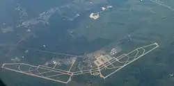
| Montréal–Mirabel International Airport | CYMX (YMX) | Mirabel | 45°40′55″N 074°00′19″W |
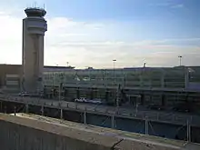
| Montréal–Trudeau International Airport | CYUL (YUL) | Dorval | 45°28′14″N 073°44′27″W |
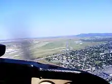
| Montreal Saint-Hubert Longueuil Airport | CYHU (YHU) | Saint-Hubert, Longueuil | 45°31′03″N 073°25′01″W |
Other
Montréal-Trudeau (formerly known as Dorval), handles the scheduled passenger service for Montreal. Mirabel formerly also handled scheduled passenger service, but it has been discontinued and the airport is little used. Saint-Hubert is the major general aviation reliever for the city, though Trudeau also sees a lot of general aviation traffic.
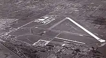
Plattsburgh International Airport in Plattsburgh, New York markets itself as "Montreal's U.S. airport". The airport is 97 km (60 mi) from Montreal, and closer than Trudeau to the South Shore. More than 80% of passengers departing the airport are Canadian.[3][4][5][6]
Water aerodromes
Heliports
Historical airports
References
- Canada Flight Supplement. Effective 0901Z 16 July 2020 to 0901Z 10 September 2020.
- Nav Canada's Water Aerodrome Supplement. Effective 0901Z 26 March 2020 to 0901Z 22 April 2021.
- Nicas, Jack. "Canadians Crowd U.S. Airports. Why? Taxes: Miffed by Rising Fees, Canadian Travelers Flock to Nearby U.S. Airports". The Wall Street Journal. July 7, 2012.
- Levere, Jane L. (2013-07-16). "Airports on the Border Make Room for Canadian Fliers". The New York Times. p. B6. ISSN 0362-4331. Retrieved 2020-02-09.
- Davis, Mark (2015-08-26). "Taking Off: Plattsburgh Airport Is Drawing More Flights, Travelers". Seven Days.
- "Plattsburgh airport vies for Montreal market". Burlington Free Press. 2016-03-18. Retrieved 2020-04-26.