List of covered bridges in Kentucky

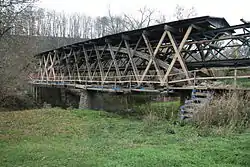
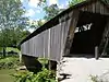
Below is a list of covered bridges in Kentucky. There are twelve authentic covered bridges in the U.S. state of Kentucky, and they are all historic.[1] A covered bridge is considered authentic not due to its age, but by its construction. An authentic bridge is constructed using trusses rather than other methods such as stringers, a popular choice for non-authentic covered bridges.
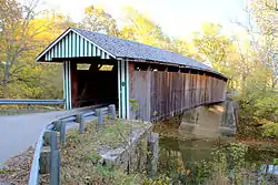
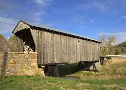
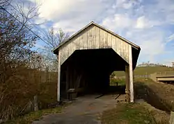
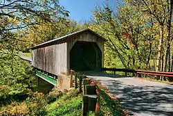
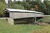
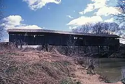
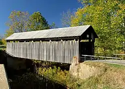
List

Name Image County Location Built Length Crosses Ownership Truss Notes
Bennett's Mill Covered Bridge[2] Greenup Greenup
38°37′50″N 82°55′37″W
ca. 1855, 2004 145 feet (44 m) Tygarts Creek County of Greenup Modified Wheeler or Warren
Cabin Creek Covered Bridge[2] Lewis Tollesboro
38°37′13″N 83°37′16″W
ca. 1867 114 feet (35 m) Cabin Creek State of Kentucky Multiple king Also called C.F. Ferguson Farm, Mackey, or Hughes Farm Covered Bridge[3]
Colville Covered Bridge[2] Bourbon Millersburg
38°19′29″N 84°12′12″W
1877, 2002 120 feet (37 m) Hinkston Creek County of Bourbon Multiple king
Goddard Bridge[2] Fleming Goddard
38°21′44″N 83°36′56″W
1864, 1933 60 feet (18 m) Sand Lick Creek County of Fleming Town Also called White Bridge[3]
Hillsboro Covered Bridge[2] Fleming Hillsboro
38°15′17″N 83°39′11″W
ca. 1865 80 feet (24 m) Fox Creek County of Fleming Multiple king Also called Grange City Covered Bridge[3]
Johnson Creek Covered Bridge[2] Robertson Mount Olivet
38°28′52″N 83°58′37″W
1874 110 feet (34 m) Blue Lick Springs County of Robertson Smith
Lee's Creek Covered Bridge[2] Mason Dover
38°44′59″N 83°52′44″W
1835 60 feet (18 m) Lee's Creek County of Mason Queen Also called Dover Covered Bridge[3]
Mount Zion Covered Bridge[2] Washington Mooresville
37°49′40″N 85°15′23″W
1871 258 feet (79 m) Beech Fork Kentucky Department of Highways Burr Also called Beech Fork Covered Bridge[3]
Oldtown Covered Bridge[2] Greenup Oldtown
38°25′53″N 82°53′42″W
1850-1874, 1999 190 feet (58 m) Frazer Branch, Little Sandy Creek County of Greenup Warren or Multiple king
Ringos Mill Covered Bridge[2] Fleming Flemingsburg
38°16′6″N 83°36′38″W
1867 86 feet (26 m) Fox Creek County of Fleming Multiple king
Switzer Covered Bridge[2] Franklin Switzer
38°15′14″N 84°45′8″W
1855, 1998 120 feet (37 m) North Fork, Elkhorn Creek County of Franklin Howe
Walcott Covered Bridge[2] Bracken Brooksville
38°44′0″N 84°6′2″W
ca. 1880, 2001 76 feet (23 m) Locust Creek Private Queen and multiple king

See also

References

  1. "12 Historic Covered Bridges in Kentucky". Only in Your State. Leaf Group Lifestyle. Retrieved 17 May 2020.
  2. "National Register Information System". National Register of Historic Places. National Park Service. July 9, 2010.
  3. Wright, David W. (2009). World Guide to Covered Bridges (2009 ed.). Concord, New Hampshire: National Society for Preservation of Covered Bridges. pp. 33–36. ISBN 978-0-692-00617-7.

Further reading

Robert W. M. Laughlin; Melissa C. Jurgensen (2007). Kentucky's Covered Bridges. Charleston, South Carolina: Arcadia Publishing. ISBN 978-0-738-54404-5.

This article is issued from Wikipedia. The text is licensed under Creative Commons - Attribution - Sharealike. Additional terms may apply for the media files.