List of crossings of the Hudson River

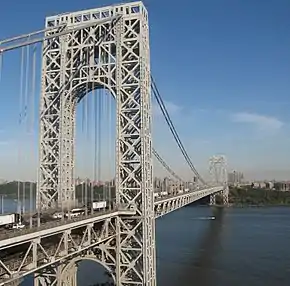
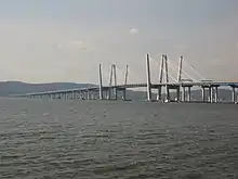
This is a list of bridges and other crossings of the Hudson River, from its mouth at the Upper New York Bay upstream to its cartographic beginning at Henderson Lake in Newcomb, New York.

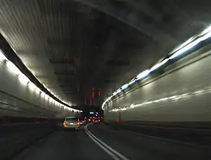
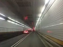
The Holland Tunnel is one of America's busiest tunnels.
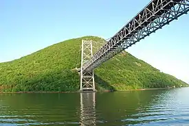
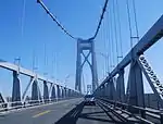
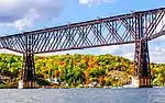
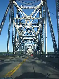
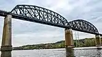
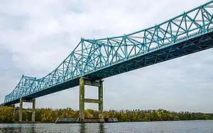
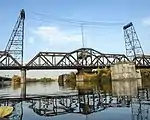
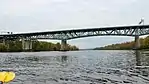
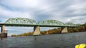
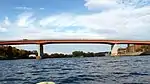
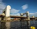
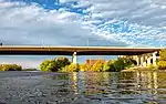
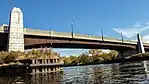
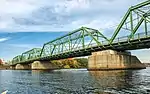
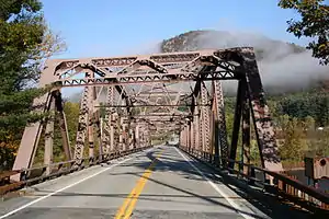
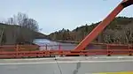
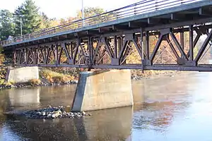
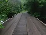
Crossings

The crossings are listed from south to north.

Crossing Carries Location Built Coordinates Image Tolls
New Jersey – New York
Downtown Hudson Tubes Port Authority Trans-Hudson PATH Jersey CityManhattan 1909
Holland Tunnel I-78 / Route 139 1927 40°43′39″N 74°01′16″W $16.00 (eastbound)
Uptown Hudson Tubes Port Authority Trans-Hudson PATH 1908
North River Tunnels Amtrak and New Jersey Transit North BergenManhattan 1910 40°45′32″N 74°00′46″W
Lincoln Tunnel Route 495 / NY 495 WeehawkenManhattan 1937 (Center Tube)
1945 (North Tube)
1957 (South Tube)
40°45′47″N 74°00′36″W $16.00 (eastbound)
George Washington Bridge I-95 / US 1-9 / US 46 / BR 9 Fort LeeManhattan 1931 (Upper Level)
1962 (Lower Level)
40°51′05″N 73°57′09″W $16.00 (eastbound)
New York
Tappan Zee Bridge I-87 / I-287 / New York Thruway South NyackTarrytown 1955-2017 (demolished) 41°04′12″N 73°53′40″W
New Tappan Zee Bridge 2017 (Westbound) 2018 (Eastbound) 41°04′17″N 73°53′40″W $5.00 (eastbound)
Bear Mountain Bridge US 6 / US 202 / Appalachian Trail / BR 9 HighlandsCortlandt 1924 41°19′11″N 73°59′00″W $1.50 (eastbound)
Newburgh–Beacon Bridge I-84 / NY 52 NewburghBeacon 1963 (westbound)
1980
41°31′11″N 73°59′50″W $1.50 (eastbound)
Mid-Hudson Bridge US 44 / NY 55 LloydPoughkeepsie 1930 41°42′10″N 73°56′45″W $1.50 (eastbound)
Poughkeepsie Railroad Bridge Former railroads, now pedestrian/bicycle HighlandPoughkeepsie 1889 (rail)
2009 (pedestrian)
41°42′37″N 73°56′22″W
Kingston-Rhinecliff Bridge NY 199 UlsterRhinebeck 1957 41°58′38″N 73°56′43″W $1.50 (eastbound)
Rip Van Winkle Bridge NY 23 CatskillGreenport 1935 42°13′24″N 73°51′01″W $1.50 (eastbound)
Alfred H. Smith Memorial Bridge CSX Castleton Subdivision SelkirkCastleton-on-Hudson 1924 42°30′31″N 73°46′30″W
Castleton Bridge Berkshire Connector CoeymansSchodack 1959 42°30′33″N 73°46′24″W $1.05 (both directions, tolled as part of Thruway cost)
Maiden Lane Bridge (demolished 1960s) Rail AlbanyRensselaer 1871
Dunn Memorial Bridge US 9 / US 20 1969 42°38′35″N 73°44′51″W
Hudson River Bridge (demolished) Rail
Livingston Avenue Bridge CSX Hudson Subdivision and Amtrak 1901 42°39′16″N 73°44′30″W
Patroon Island Bridge I-90 1968 42°39′53″N 73°43′44″W
Menands Bridge NY 378 MenandsTroy 1933 42°42′04″N 73°42′08″W
Congress Street Bridge NY 2 WatervlietTroy N/A 42°43′43″N 73°41′50″W
Green Island Bridge Green IslandTroy 1981 42°44′07″N 73°41′23″W
Collar City Bridge NY 7 1981 42°44′25″N 73°41′18″W
112th Street Bridge NY 470 CohoesTroy 1922
1996
42°46′17″N 73°40′53″W
Troy-Waterford Bridge US 4 WaterfordTroy 1909 42°47′19″N 73°40′26″W
Albany Northern Railroad Bridge (demolished)
Mechanicville Bridge NY 67 MechanicvilleSchaghticoke 1888 (original)
1950 (replaced)
42°54′19″N 73°40′57″W
Rail bridge Pan Am Southern Railroad StillwaterSchaghticoke 42°55′10″N 73°40′19″W
Stillwater Bridge CR 125 / CR 125 StillwaterSchaghticoke 1930 42°56′16″N 73°39′02″W
Schuylerville Bridge NY 29 SchuylervilleEaston 43°05′53″N 73°34′25″W
Dix Bridge CR 42 / CR 70 SchuylervilleGreenwich 1900 (original)
2013 (pedestrian)[1]
43°07′00″N 73°34′53″W
Hudson Valley Railway Bridge (demolished) NorthumberlandGreenwich 43°07′13″N 73°34′50″W
Greenwich and Johnsonville Railway Bridge (demolished) NorthumberlandGreenwich 43°07′17″N 73°35′01″W
Northumberland Bridge US 4 NorthumberlandGreenwich 1917 43°07′43″N 73°35′14″W
Rail bridge Canadian Pacific Rail and Amtrak MoreauFort Edward 43°15′50″N 73°35′21″W
Bridge NY 197 MoreauFort Edward 43°15′52″N 73°35′25″W
Sandy Hill Bridge
(abandoned)
South Glens FallsHudson Falls
Bridge CR 27 43°17′50″N 73°35′23″W
Cooper's Cave Bridge US 9 / NY 32 South Glens FallsGlens Falls 2004 43°18′20″N 73°38′28″W
Saratoga-Warren county Bridge I-87 MoreauQueensbury 43°15′48″N 73°40′35″W
Irving H. Densmore Memorial Bridge[2] CR 9 / CR 16 CorinthLake Luzerne 43°14′55″N 73°49′56″W
Bridge NY 9N HadleyLake Luzerne 43°18′17″N 73°49′58″W
County Road 44 Bridge CR 44 1931[3] 43°19′00.9″N 73°50′32.7″W
Rail bridge (not in use) Former Delaware and Hudson Railroad line ThurmanWarrensburg 1905[4] 43°28′43″N 73°49′22″W
Thurman Station Bridge NY 418 ThurmanWarrensburg 1941 43°28′47″N 73°49′06″W
The Glen Bridge NY 28 JohnsburgChester 1959 43°34′57″N 73°51′36″W
Riparius Bridge NY 8 JohnsburgChester 2003 43°39′42″N 73°53′53″W
North Creek Bridge NY 28N JohnsburgChester 1930 43°42′01″N 73°58′59″W
Adirondack Railway bridge Saratoga and North Creek Railroad 43°47′51″N 74°03′05″W
Finch Pruyn Bridge Pedestrian Newcomb 1993[5] 43°53′40″N 74°09′51″W
Newcomb Bridge NY 28N Newcomb 43°57′57″N 74°07′54″W
Bridge Campsite Road Newcomb 43°58′08″N 74°06′57″W
Bridge CR 25 Newcomb 43°57′57″N 74°03′00″W
Bridge Opolescent Road Newcomb 44°00′58″N 74°03′14″W
Bridge CR 76 Tahawus 44°02′37″N 74°03′29″W
Fill with culverts Adirondack Park Reserve Road Tahawus 44°03′04″N 74°03′45″W
Wooden foot bridge just east of Henderson Lake outlet Upper Works Trail Tahawus 44°05′31″N 74°03′28″W

See also

References

  1. Leigh Hornbeck (July 22, 2010). "1900 span will be part of walking trail". Times Union. Retrieved August 28, 2012.
  2. "New York Highway - Article 6". Law and Legal Research. Retrieved July 6, 2013.
  3. "COUNTY ROAD 44 over HUDSON RIVER, Warren County, New York". bridgereports.com.
  4. Jon Patton (2008). "Railroad Bridges at Warrensburg, NY". The Adirondack Branch of the Delaware & Hudson Railroad. Retrieved August 28, 2012.
  5. Roger A. Dziengeleski (January 11, 1994). "Criticism of Finch, Pruyn Bridge Unjustified". The Daily Gazette. Retrieved August 28, 2012.
This article is issued from Wikipedia. The text is licensed under Creative Commons - Attribution - Sharealike. Additional terms may apply for the media files.