Newburgh–Beacon Bridge
The Hamilton Fish Newburgh–Beacon Bridge is a cantilever toll bridge that spans the Hudson River in New York State. The bridge carries Interstate 84 (I-84) and New York State Route 52 (NY 52) between Newburgh and Beacon. Consisting of two separate spans, the original northern span which carries westbound traffic, was opened on November 2, 1963, as a two-lane (one in each direction) bridge.[1] A second span completed in 1980, now carries all eastbound traffic. Still often referred to by its original name, the Newburgh–Beacon Bridge, in 1997 the bridge was rededicated in honor of Hamilton Fish who was a Governor of New York, Lieutenant Governor, United States Senator from New York, U.S. Secretary of State, a Member of the U.S. House of Representatives from New York's 6th congressional district, and a patriarch of the prominent Fish family.
Newburgh–Beacon Bridge | |
|---|---|
Newburgh–Beacon Bridge from Beacon | |
| Coordinates | 41.519246°N 73.994293°W |
| Carries | 6 lanes of |
| Crosses | Hudson River |
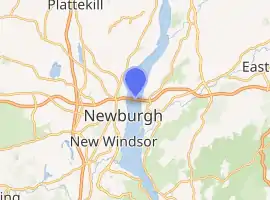
| Locale | Newburgh, New York and Beacon, New York |
| Official name | Hamilton Fish Newburgh–Beacon Bridge |
| Maintained by | New York State Bridge Authority |
| Characteristics | |
| Design | Twin span Continuous truss bridges |
| Total length | 7,789 feet (2,374 m) 7,855 feet (2,394 m) |
| Longest span | 1,000 feet (300 m) |
| Clearance below | 135 feet (41 m) |
| History | |
| Opened | November 2, 1963 (westbound) November 1, 1980 (eastbound) |
| Statistics | |
| Daily traffic | 65,000 |
| Toll | (eastbound only) passenger cars $1.75, $1.35 E-ZPass |
| Location | |

| |
Development
Although original plans called for a four-lane bridge, funding difficulties resulted in the reduction in lanes. This span was designed by Modjeski & Masters and constructed by Frederick Snare, Drave, and Bethlehem Steel.
The bridge originally carried NY 52 traffic, which was light, but the construction of Interstate 84 pushed the bridge over capacity,[2] and planning for additional capacity began in 1972. After considering double-decking (which the original bridge was not designed for) the decision was taken by NYSBA to add a second parallel span south of the original.
The original span is made of steel that requires regular painting, however, the newer span is made of "rusting" steel (believed to be COR-TEN or a similar material although sources are not clear), which surface corrodes to a brown color and does not need painting since the corrosion is only on the surface.
On November 1, 1980, this second, parallel span, also designed by Modjeski & Masters but constructed by the American Bridge Company, was opened to traffic.[3] The original span was closed for renovation, to add a lane and to paint it brown to match the color of the new span, from December 1980 to June 1984. In 1997, the bridge was officially renamed the Hamilton Fish Newburgh–Beacon Bridge, although it is commonly referred to by its original name.
Road dimensions:
- The westbound (northern) bridge opened in 1963, carrying one lane of traffic in each direction. Today it accommodates three 12-foot (3.7 m) travel lanes and has no permanent shoulders. Variable lane-use signs allow the right lane to be designated as a breakdown lane at night and off-peak travel times. When the right lane is being used as a shoulder, a red X appears on the signs above it, while a green arrow illuminates when the lane is used for travel during peak times.
- The newer eastbound span was built with three 12-foot (3.7 m) travel lanes, a 10-foot (3.0 m) right shoulder, a 6-foot (1.8 m) left shoulder and a pedestrian sidewalk separated from the roadway by a concrete barrier. Because the eastbound span was built with shoulders, there is no need to reduce the travel lanes to two during off-peak times.
The span provides connections to the New York State Thruway (I-87) and U.S. Route 9W (US 9W) in Newburgh and US 9 in Fishkill. The bridges includes a 2,204-foot-long (672 m) cantilever span, with a main span of 1,000 feet (300 m) and side spans of 602 feet (183 m). The total length of all spans and approaches is 7,855 feet (2,394 m) for the north span and 7,789 feet (2,374 m) for the south span.
The bridges, owned by the New York State Bridge Authority, carry six lanes of traffic and approximately 65,000 vehicles per day.
Eastbound passenger vehicles are charged a toll of $1.75 to cross the span. The toll plaza is located on the eastern (Beacon) shore. Originally, tolls were collected in both directions. In August 1970, the toll was abolished for westbound drivers, and at the same time, eastbound drivers saw their tolls doubled. The tolls of eleven other New York–New Jersey and Hudson River crossings along a 130-mile (210 km) stretch, from the Outerbridge Crossing in the south to the Rip Van Winkle Bridge in the north, were also changed to eastbound-only at that time.[4]
See also
 Transport portal
 Engineering portal
 New York (state) portal
- List of fixed crossings of the Hudson River
References
- Stengren, Bernard (November 3, 1963). "Ceremony Opens Newburgh Span; New Bridge is Formally Opened". New York Times. Retrieved August 7, 2009.
- "Newburgh-Beacon Bridge". New York State Bridge Authority. Archived from the original on July 5, 2008. Retrieved August 7, 2009.
- "A New Bridge Is Added to an Old One Between Two Hudson Cities". New York Times. November 1, 1980. Retrieved August 7, 2009.
- Moran, Nancy (August 13, 1970). "One‐Way Tolls Confusing Some Drivers". The New York Times. Retrieved April 9, 2018.
External links
| Wikimedia Commons has media related to Newburgh-Beacon Bridge. |