List of historic places in Eastern Ontario
This is a list of historic places in Eastern Ontario, containing heritage sites listed on the Canadian Register of Historic Places (CRHP), all of which are designated as historic places either locally, provincially, territorially, nationally, or by more than one level of government. There are separate listings for the cities of Kingston and Ottawa.
List of historic places outside Kingston and Ottawa
Frontenac County
| Name | Address | Coordinates | IDF | IDP | IDM | Image | |
|---|---|---|---|---|---|---|---|
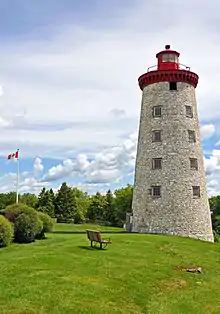
| Lighthouse | Simcoe Island, Frontenac Islands, ON | 44°09′05″N 76°33′21″W | 4749 |  | |||
| Wolfe Island Township Hall National Historic Site of Canada | Main Street, Frontenac Islands, ON | 44°11′36″N 76°26′27″W | 7553 | |
Lanark County
| Name | Address | Coordinates | IDF | IDP | IDM | Image | |
|---|---|---|---|---|---|---|---|
| Canadian Pacific Railway Station | 110 Miguel Street, Carleton Place, ON | 45°08′10″N 76°08′08″W | 6700 | | |||
| Victoria School Museum | 267 Edmund Street, Carleton Place, ON | 45°08′36″N 76°08′49″W | 7576 | .jpg.webp) | |||
| Lockmaster's House | Beveridges Lock, Rideau Canal National Historic Site of Canada, Drummond/North Elmsley, ON | 44°52′30″N 76°08′20″W | 10917 | 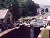 | |||
| Mary Jane Willson House | 6570 Highway 43, Drummond/North Elmsley, ON | 44°54′20″N 76°12′59″W | 8426 | | |||
| McKinley House | 2125 Scotch Line Road, Drummond/North Elmsley, ON | 44°53′07″N 76°15′05″W | 8466 | 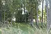 | |||
| Port Elmsley School | 4962 Highway 43, Drummond/North Elmsley, ON | 44°53′30″N 76°06′43″W | 8434 | | |||
| Auld Kirk (c. 1836) | County Road 16, Mississippi Mills (Almonte), ON | 45°12′42″N 76°13′06″W | 9943 | 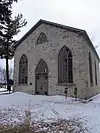 | |||
| Former Almonte Post Office National Historic Site of Canada | 73 Mill Street, Mississippi Mills, ON | 45°13′32″N 76°11′43″W | 15041 | 7428 | 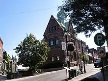 More images | ||
| James Naismith House | 4968 County Road 29, Mississippi Mills (Almonte), ON | 45°14′32″N 76°13′53″W | 8186 |  | |||
| Rosamond Woollen Mill National Historic Site of Canada | 3 Rosamond Street East, Mississippi Mills (Almonte), ON | 45°14′00″N 76°12′00″W | 7864 | 8881 | 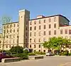 More images | ||
| Defensible Lockmaster's House | Kilmarnock Lock Station, Montague, ON | 44°53′02″N 75°55′50″W | 10875 | 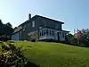 | |||
| 10 Market Square | 10 Market Square, Perth, ON | 44°53′55″N 76°14′58″W | 7296 |  More images | |||
| Barker-Wilson House | 31 Foster St, Perth, ON | 44°54′07″N 76°14′59″W | 8351 |  More images | |||
| Brooke-Matthews Building | 51 Gore Street East, Perth, ON | 44°54′00″N 76°14′58″W | 8352 |  | |||
| Daly Reid Building | 13 Gore Street West, Perth, ON | 44°54′08″N 76°15′07″W | 8349 |  More images | |||
| The Doctor's House | 22 Wilson Street West, Perth, ON | 44°54′03″N 76°15′11″W | 8472 |  More images | |||
| Haggart House (1837) | 41 Mill Street, Perth, ON | 44°53′50″N 76°15′06″W | 8506 |  More images | |||
| Hope BUilding | 69 Foster Street, Perth, ON | 44°54′03″N 76°15′08″W | 8514 | | |||
| Inge-Va (1824) | 66 Craig Street, Perth, ON | 44°53′47″N 76°14′50″W | 8178 |  More images | |||
| Jean O'Donnell House | 37 Herriott Street, Perth, ON | 44°54′05″N 76°14′59″W | 8515 |  More images | |||
| Katherine Stephen Home | 43 North Street, Perth, ON | 44°54′06″N 76°15′08″W | 17322 |  | |||
| Kellock Block | 39 Gore Street East, Perth, ON | 44°54′01″N 76°15′00″W | 8570 |  More images | |||
| Maple Drop Building | 2 Wilson Street East, Perth, ON | 44°53′58″N 76°15′05″W | 8425 |  More images | |||
| Matheson House National Historic Site of Canada | 11 Gore Street East, Perth, ON | 44°54′03″N 76°15′03″W | 11553 | 5608 | .jpg.webp) | ||
| Matthews Building | 51 Gore Street East, Perth, ON | 44°54′00″N 76°14′58″W | 8872 |  More images | |||
| Mckinley House | 2125 Scotch Line County Road 4, Perth, ON | 44°31′33″N 76°09′04″W | 10515 |  More images | |||
| McMartin House National Historic Site of Canada (1830) | 125 Gore Street, Perth, ON | 44°53′54″N 76°14′49″W | 7539 | 9322 |  More images | ||
| McMillan Building | 77 Gore Street East, Perth, ON | 44°53′58″N 76°14′55″W | 8882 | 8467 |  More images | ||
| The Old Fire Hall | 34 Herriott Street, Perth, ON | 44°54′02″N 76°14′59″W | 8473 |  More images | |||
| Perkins Building | 2 Wilson Street West, Perth, ON | 44°54′01″N 76°15′09″W | 8430 |  More images | |||
| Perth Town Hall National Historic Site of Canada | 80 Gore Street West, Perth, ON | 44°53′57″N 76°14′56″W | 7541 |  More images | |||
| Riverside Apartments | 93 Gore Street East, Perth, ON | 44°53′56″N 76°14′53″W | 8469 |  More images | |||
| St. Andrew's Presbyterian Church | 1 Drummond Street West, Perth, ON | 44°54′08″N 76°14′59″W | 8471 |  More images | |||
| St. George Hotel | 15 Harvey Street, Perth, ON | 44°53′55″N 76°14′48″W | 8433 |  More images | |||
| St. James the Apostle Anglican Church and Rectory | 12 Harvey Street, Perth, ON | 44°53′59″N 76°14′41″W | 8479 |  More images | |||
| Shaw's of Perth | 1 Gore Street East, Perth, ON | 44°54′04″N 76°15′04″W | 8435 |  More images | |||
| Sneyd House | 44 South Street, Perth, ON | 44°53′36″N 76°14′20″W | 17582 |  | |||
| Soong Building | 69 Gore Street East, Perth, ON | 44°53′59″N 76°14′56″W | 8470 | 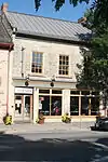 More images | |||
| Waddell House | 61 Drummond Street East, Perth, ON | 44°53′53″N 76°14′41″W | 8475 | 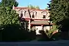 More images | |||
| Defensible Lockmaster's House (Old Slys Locks Lockstation) | Old Slys Locks, Rideau Canal National Historic Site of Canada, Smiths Falls, ON | 44°53′38″N 76°00′16″W | 10918 | 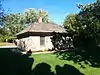 | |||
| Defensible Lockmaster's House | Combined Locks, Rideau Canal National Historic Site of Canada, Smiths Falls, ON | 44°53′42″N 76°01′37″W | 11005 | 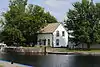 | |||
| East Mill | 34 Beckwith Street South, Smiths Falls, ON | 44°53′54″N 76°01′16″W | 10345 | 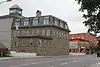 More images | |||
| Heritage House Museum | 11 Old Slys Road, Smiths Falls, ON | 44°53′21″N 76°00′27″W | 8518 | 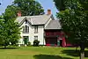 More images | |||
| The Recreation Centre | 79 Beckwith Street North, Smiths Falls, ON | 44°54′10″N 76°01′18″W | 19795 | 18594 | | ||
| Smiths Falls Bascule Bridge National Historic Site of Canada | Abbot Street, Smiths Falls, ON | 44°53′50″N 76°01′20″W | 7867 | 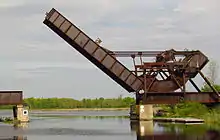 More images | |||
| Smiths Falls Railway Station (Canadian Northern) National Historic Site of Canada | 80 Abbot Street, Smiths Falls, ON | 44°53′34″N 76°01′34″W | 7786 | 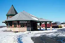 More images | |||
| Town Hall | 77 Beckwith Street, Smiths Falls, ON | 44°54′09″N 76°01′17″W | 18595 | | |||
| West Mill | 34 Beckwith Street South, Smiths Falls, ON | 44°53′54″N 76°01′16″W | 10370 | |
Leeds and Grenville United Counties
| Name | Address | Coordinates | IDF | IDP | IDM | Image | |
|---|---|---|---|---|---|---|---|
| Homewood | 1372 County Road 2, Augusta, ON | 44°39′21″N 75°35′17″W | 12013 | 8870 | 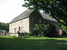 | ||
| Armoury | 1-9 East Avenue, Brockville, ON | 44°35′39″N 75°40′42″W | 4809 |  More images | |||
| Former Brockville Post Office National Historic Site of Canada | 14 Court House Avenue, Brockville, ON | 44°35′24″N 75°41′05″W | 1135 |  More images | |||
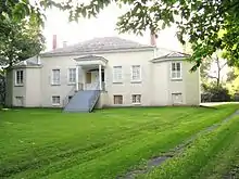
| Fulford Place National Historic Site of Canada | 287 King Street East, Brockville, ON | 44°35′53″N 75°40′16″W | 10173 | 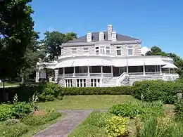 More images | |||
| Leeds and Grenville County Court House National Historic Site of Canada | 1 Court House Square, Brockville, ON | 44°35′28″N 75°41′09″W | 7635 |  More images | |||
| St. Paul's Church (Delta) | 77 King Street, Delta, ON | 44°36′25″N 76°07′16″W | 8480 | 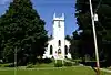 More images | |||
| Former Grand Trunk Railway (Canadian National Railways) Station | , Ernestown, ON | 44°13′02″N 76°45′17″W | 4551 | .jpg.webp) More images | |||
| Adelaide Island Picnic Shelter | St. Lawrence Islands National Park of Canada, Front of Yonge, ON | 44°26′04″N 75°50′24″W | 11128 | | |||
| Aubrey Island Picnic Shelter | St. Lawrence Islands National Park of Canada, Front of Yonge, ON | 44°17′45″N 76°11′35″W | 11093 | | |||
| Batterman's Point Complex | Batterman's Point, St. Lawrence Islands National Park of Canada, Front of Yonge, ON | 44°21′58″N 75°57′15″W | 11620 | | |||
| Bridge Island / Chimney Island National Historic Site of Canada | Chimney Island, Front of Yonge, ON | 44°28′07″N 75°50′03″W | 17987 | | |||
| Gazebo | St. Lawrence Islands National Park of Canada, Front of Yonge, ON | 44°22′00″N 75°57′13″W | 11355 | 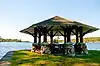 | |||
| Gordon Island Pavilion | St. Lawrence Islands National Park of Canada, Front of Yonge, ON | 44°19′51″N 76°06′08″W | 10048 | | |||
| Limberlost | Batterman's Point, St. Lawrence Islands National Park of Canada, Front of Yonge, ON | 44°21′56″N 75°57′16″W | 11130 | 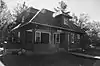 | |||
| Mallorytown Landing Pavilion | , Front of Yonge, ON | 44°27′05″N 75°51′33″W | 11125 | | |||
| Massey Farmstead | eastern end of Grenadier Island, St. Lawrence Islands National Park of Canada, Front of Yonge, ON | 44°25′30″N 75°51′01″W | 11510 | | |||
| Shelter | Beaurivage Island, St. Lawrence Islands National Park of Canada, ON | 44°18′12″N 76°11′15″W | 14861 | | |||
| Shelter | Camelot Island, St. Lawrence Islands National Park of Canada, ON | 44°18′05″N 76°06′41″W | 14827 | | |||
| Shelter | Endymion Island, St. Lawrence Islands National Park of Canada, ON | 44°18′09″N 76°05′56″W | 14828 | | |||
| Water Tower | Batterman's Point, St. Lawrence Islands National Park of Canada, Front of Yonge, ON | 44°21′59″N 75°57′12″W | 11131 | | |||
| West Grenadier Island Pavilion | St. Lawrence Islands National Park of Canada, Front of Yonge, ON | 44°23′00″N 75°54′20″W | 11060 | | |||
| Lansdowne Iron Works National Historic Site of Canada | County Rd. 33 50 m west of Lyndhurst Bridge, Lyndhurst, ON | 44°32′58″N 76°07′34″W | 18951 | | |||
| Pointe au Baril National Historic Site of Canada | 20m on north side of Highway 2, Maitland, ON | 44°38′15″N 75°36′36″W | 20107 | | |||
| Aaron Merrick House | 905 St. Lawrence Street, Merrickville–Wolford, ON | 44°54′37″N 75°50′08″W | 17601 | | |||
| Defensible Lockmaster's House | Clowes Lock, Rideau Canal National Historic Site of Canada, Merrickville–Wolford, ON | 44°56′42″N 75°49′19″W | 10924 | | |||
| Defensible Lockmaster's House | Nicholson Lock, Rideau Canal National Historic Site of Canada, Merrickville–Wolford, ON | 44°57′03″N 75°49′03″W | 10946 | | |||
| Foundry | On an island in the Rideau River, at Merrickville Lockstation, Merrickville–Wolford, ON | 44°55′04″N 75°50′13″W | 11071 | | |||
| Hutchins-Heroux Commercial Building | 212 St. Lawrence Street, Merrickville–Wolford, ON | 44°54′55″N 75°50′12″W | 17602 | | |||
| Jakes-McLean Block | 105 St. Lawrence Street, Merrickville–Wolford, ON | 44°54′58″N 75°50′12″W | 7694 | | |||
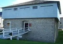
| Merrickville Blockhouse | 279 Saint Lawrence Street, Merrickville–Wolford, ON | 44°55′00″N 75°50′15″W | 4358 7445 |
 | |||
| 8 Mary Street | 8 Mary Street, North Grenville, ON | 45°00′54″N 75°38′28″W | 17301 | | |||
| Actons Corners School | 1631 Highway 43, North Grenville, ON | 45°00′20″N 75°41′04″W | 17302 | | |||
| Kemptville Public Library | 207 Prescott Street, North Grenville (Kemptville), ON | 45°00′54″N 75°38′41″W | 17321 | | |||
| Lyman Clothier House | 8 Clothier Street West, North Grenville (Kemptville), ON | 45°00′58″N 75°38′53″W | 17384 | | |||
| Maplewood Hall | 92 Maplewood Avenue, North Grenville, ON | 44°57′47″N 75°40′42″W | 17383 | | |||
| Oxford-on-Rideau Township Hall National Historic Site of Canada | 100 Maplewood Street, North Grenville, ON | 44°58′00″N 75°41′00″W | 7690 | 17382 | | ||
| Battle of the Windmill National Historic Site of Canada | County Road 2 East, Prescott, ON | 44°43′16″N 75°29′13″W | 13962 | 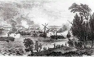 More images | |||
| Battle of the Windmill Windmill Tower | , Prescott, ON | 44°42′47″N 75°30′33″W | 4736 20373 |
 More images | |||
| Caponier | Fort Wellington National Historic Site, Prescott, ON | 44°42′46″N 75°30′30″W | 10099 | | |||
| Former Grand Trunk Railway (Canadian National Railways) Station | St. Lawrence and Railway Streets, Prescott, ON | 44°42′40″N 75°31′30″W | 4550 | 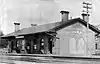 | |||
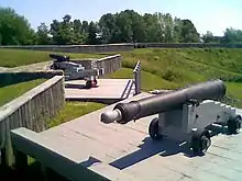
| Fort Wellington National Historic Site of Canada | King Street, Prescott, ON | 44°42′47″N 75°30′32″W | 7618 9818 |
 More images | |||
| Latrine | Fort Wellington National Historic Site, Prescott, ON | 44°42′47″N 75°30′32″W | 9797 | | |||
| Officers' Quarters | Fort Wellington National Historic Site, Prescott, ON | 44°42′47″N 75°30′32″W | 9786 | | |||
| Prescott Railway Station (Grand Trunk) National Historic Site of Canada | 820 St. Lawrence Street, Prescott, ON | 44°42′40″N 75°31′29″W | 7659 |  More images | |||
| Blacksmith's Shop | Near the Jones Falls lock station, Rideau Lakes, ON | 44°32′45″N 76°14′18″W | 9819 | 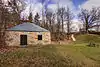 More images | |||
| Cottage | Colonel By Island, Rideau Lakes, ON | 44°44′08″N 76°13′16″W | 10326 |
44.647310, -76.321689 | |||
| Blockhouse | Blockhouse Lane, Newboro, Rideau Lakes, ON | 44°42′12″N 76°17′45″W | 10991 | | |||
| Blockhouse | Narrow Lakes Road at the Rideau Canal, Rideau Lakes, ON | 44°42′12″N 76°17′45″W | 10858 | | |||
| Defensible Lockmaster's House | Rideau Canal National Historic Site of Canada, Rideau Lakes, ON | 44°53′35″N 76°03′22″W | 10916 | | |||
| Defensible Lockmaster's House | Jones Falls Lockstation, Rideau Lakes (Jones Falls), ON | 44°32′49″N 76°14′17″W | 10992 | 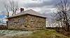 | |||
| Defensible Lockmaster's House | Chaffeys Lockstation, Rideau Lakes (Chaffeys Falls), ON | 44°34′44″N 76°19′10″W | 4765 | ||||
| Elgin United Church | 77 Main Street, Rideau Lakes (Elgin), ON | 44°36′36″N 76°13′07″W | 8344 | 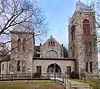 More images | |||
| Emmanuel Anglican Church | 2767 Highway 15, Rideau Lakes (Portland), ON | 44°41′16″N 76°12′15″W | 8411 | 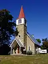 More images | |||
| The Guthrie House | 10 Perth Street, Rideau Lakes (Elgin), ON | 44°36′29″N 76°13′23″W | 8483 | 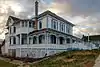 More images | |||
| The Horace Sheldon House | 3196 Sheldon Road, Rideau Lakes (Portland), ON | 44°41′38″N 76°13′09″W | 17282 | | |||
| John Green House | 2346 Harlem Road, Rideau Lakes (Harlem), ON | 44°40′24″N 76°08′59″W | 9559 | | |||
| Morton-McLeod House | 12 Queen Street, Rideau Lakes (Morton), ON | 44°32′16″N 76°11′54″W | 17281 | | |||
| Old Stone Mill National Historic Site of Canada | Highway 42, Rideau Lakes, ON | 44°36′37″N 76°07′21″W | 12127 | 8427 |  More images | ||
| Pennock-St. Pierre House | 176 Charland Road, Rideau Lakes (Elgin), ON | 44°37′28″N 76°13′12″W | 8468 | | |||
| Philo Hicock House | 8 King Street, Rideau Lakes (Delta), ON | 44°37′11″N 76°07′28″W | 8431 | 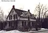 More images | |||
| Red Brick School | 48 Halladay Street, Rideau Lakes (Elgin), ON | 44°36′29″N 76°13′10″W | 8432 | 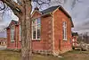 More images | |||
| St. Paul's Anglican Church | 77 King Street, Rideau Lakes (Delta), ON | 44°36′27″N 76°07′18″W | 8480 | More images | |||
| St. Peter's Anglican Church | 3600 Newboyne Road, Rideau Lakes (Newboyne), ON | 44°44′01″N 76°06′36″W | 8476 | 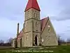 More images | |||
| Storehouse, Lock Office | Davis Lock, Rideau Canal National Historic Site of Canada, Rideau Lakes, ON | 44°33′47″N 76°17′28″W | 10884 | | |||
| Darlingside National Historic Site of Canada | Along the Thousands Island Parkway, Rockport, ON | 20125 | | ||||
| David Laidlaw House | 328 Centreville Road, Westport, ON | 44°40′36″N 76°23′50″W | 8350 | |
Lennox and Addington County
| Name | Address | Coordinates | IDF | IDP | IDM | Image | |
|---|---|---|---|---|---|---|---|
| Mazinaw Pictographs National Historic Site of Canada | Bon Echo Provincial Park, Addington Highlands (most), ON | 44°54′00″N 77°12′23″W | 10534 | 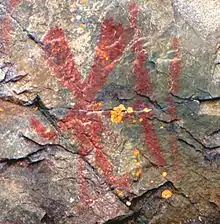 | |||
| Allison House and Grounds | 54 Adolphustown Park Road, Greater Napanee, ON | 44°03′41″N 77°00′28″W | 8842 | | |||
| Macpherson House | 180 Elizabeth Street, Greater Napanee, ON | 44°15′12″N 76°56′44″W | 10510 | | |||
| Napanee Post Office | 36 Bridge Street, Greater Napanee, ON | 44°14′57″N 76°57′01″W | 8340 | 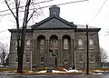 More images | |||
| Napanee Town Hall National Historic Site of Canada | , Greater Napanee, ON | 44°14′55″N 76°57′03″W | 10698 | 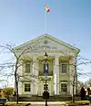 | |||
| Old Hay Bay Church National Historic Site of Canada | 2365 South Shore Road, Greater Napanee, ON | 44°06′08″N 77°01′12″W | 10617 | 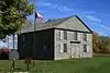 | |||
| Layer Cake Hall | 193 Davey Street, Loyalist, ON | 44°06′38″N 76°27′50″W | 10508 | | |||
| Madden Store | 397 Main Street, Stone Mills, ON | 44°19′26″N 76°52′32″W | 8332 | | |||
| Newburgh Academy | 411 Academy Street, Stone Mills, ON | 44°19′27″N 76°52′54″W | 8339 | |
United Counties of Prescott and Russell
| Name | Address | Coordinates | IDF | IDP | IDM | Image | |
|---|---|---|---|---|---|---|---|
| Canadian National Railways Station | 66 St. Joseph Street, Casselman, ON | 45°18′44″N 75°05′15″W | 4621 | 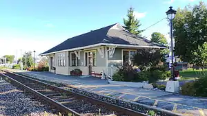 | |||
| L'Orignal Court House and Jail | 59 Court Street, Champlain (L'Orignal), ON | 45°37′06″N 74°41′23″W | 15467 | 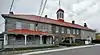 | |||
| Macdonell-Williamson House National Historic Site of Canada | 25, chemin des Outaouais, East Hawkesbury (Chute-à-Blondeau), ON | 45°33′49″N 74°23′01″W | 12070 | 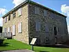 |
Renfrew County
| Name | Address | Coordinates | IDF | IDP | IDM | Image | |
|---|---|---|---|---|---|---|---|
| Gillies Grove and House National Historic Site of Canada | 412 Gillies Grove, Arnprior, ON | 45°26′42″N 76°21′30″W | 4213 | | |||
| Armoury | 177 Victoria Street, Pembroke, ON | 45°49′36″N 77°06′50″W | 4707 | | |||
| Building F-16 | CFB Petawawa, Petawawa, ON | 45°55′06″N 77°17′28″W | 9540 | | |||
| Government Building | 249 Raglan Street, Renfrew, ON | 45°28′45″N 76°41′35″W | 4672 | |
United Counties of Stormont, Dundas and Glengarry
| Name | Address | Coordinates | IDF | IDP | IDM | Image | |
|---|---|---|---|---|---|---|---|
| Cornwall Armoury | 505 4th Street East, Cornwall, ON | 45°01′31″N 74°43′09″W | 11228 |  | |||
| Glengarry House National Historic Site of Canada | ruins at Stonehouse Point, Cornwall, ON | 45°02′22″N 74°37′09″W | 13373 | | |||
| Inverarden House National Historic Site of Canada | Montreal Road, Cornwall, ON | 45°01′53″N 74°40′16″W | 9488 7444 |
 More images | |||
| VIA Rail/Canadian National Railways Station | 27 McDougall Street, North Glengarry (Alexandria), ON | 45°19′05″N 74°38′24″W | 4620 | 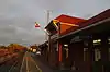 More images | |||
| Battle of Crysler's Farm National Historic Site of Canada | Crysler's Farm Battlefield Park, near Upper Canada Village, South Dundas (Morrisburg), ON | 44°56′31″N 75°04′12″W | 15771 | 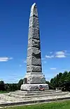 More images | |||
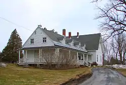
| Bethune-Thompson House / White House National Historic Site of Canada | 19730 John Street, South Glengarry (Williamstown), ON | 45°08′47″N 74°35′03″W | 4121 | 19800 |  More images | ||
| Bethune Thompson Workers' Cottage | 19730 John Street (County Road 17), South Glengarry (Williamstown), ON | 45°08′38″N 74°34′32″W | 9957 | | |||
| Ruin of St. Raphael's Roman Catholic Church National Historic Site of Canada | 20000 King's Road (County Road 18), South Glengarry, ON | 45°12′50″N 74°35′37″W | 14123 | 19806 | 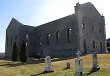 | ||
| Sir John Johnson House National Historic Site of Canada | on a hill overlooking the Raisin River, South Glengarry (Williamstown), ON | 45°08′42″N 74°34′46″W | 16922 7866 |
 |
See also
| Wikimedia Commons has media related to Cultural heritage monuments in Ontario. |
References
This article is issued from Wikipedia. The text is licensed under Creative Commons - Attribution - Sharealike. Additional terms may apply for the media files.