List of historic places in Southwestern Ontario
This is a list of historic places in Southwestern Ontario, containing heritage sites listed on the Canadian Register of Historic Places (CRHP), all of which are designated as historic places either locally, provincially, territorially, nationally, or by more than one level of government.
The following subregions have separate listings:
- County of Brant
- Essex County
- Middlesex County
- Perth County
- Regional Municipality of Waterloo
- Wellington County
List of historic places in other subregions
Bruce County


Chatham-Kent
| Name | Address | Coordinates | IDF | IDP | IDM | Image | |
|---|---|---|---|---|---|---|---|
| Buxton Settlement National Historic Site of Canada | 7th Concession, Dillon and Drake Roads, Chatham-Kent, ON | 42°16′00″N 82°11′00″W | 1206 |  More images | |||
| Canadian National Railways/VIA Rail Station | Queen & William Streets, Chatham-Kent, ON | 42°23′54″N 82°10′44″W | 4584 |  | |||
| Fairfield on the Thames National Historic Site of Canada | , Chatham-Kent, ON | 42°37′55″N 81°52′11″W | 15726 |  More images | |||
| Government of Canada Building | 120 Wellington Street, Chatham-Kent, ON | 42°24′16″N 82°11′07″W | 13467 | | |||
| Uncle Tom's Cabin - Harris House | 29251 Uncle Tom's Road, Chatham-Kent, ON | 42°35′06″N 82°11′45″W | 8199 | _Grave_Site.jpg.webp) | |||
| Uncle Tom's Cabin - Henson House | 29251 Uncle Tom's Road, Chatham-Kent, ON | 42°35′08″N 82°11′45″W | 8200 | | |||
| Uncle Tom's Cabin - Pioneer Church | 29251 Uncle Tom's Road, Chatham-Kent, ON | 42°35′07″N 82°11′46″W | 8198 | |
Elgin County
| Name | Address | Coordinates | IDF | IDP | IDM | Image | |
|---|---|---|---|---|---|---|---|
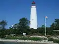
| Port Burwell Lighthouse | 17 Robinson, Bayham, ON | 42°38′43″N 80°48′24″W | 7787 | 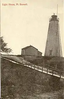 More images | |||
| Port Stanley Breakwater Lighthouse | Port Stanley breakwater, Port Stanley, ON | 42°39′18″N 81°12′48″W | 20953 | | |||
| Port Stanley National Historic Site of Canada | junction of Bridge, Main and Colbourne Streets, Central Elgin (Port Stanley), ON | 42°39′58″N 81°12′43″W | 15722 |  | |||
| Southwold Earthworks National Historic Site of Canada | , Southwold, ON | 42°40′27″N 81°21′37″W | 11706 |  More images | |||
| Armoury | Chester and Wilson Streets, St. Thomas, ON | 42°46′07″N 81°11′46″W | 11057 | | |||
| Canada Southern Railway Station | 810 Talbot Street, St. Thomas, ON | 42°46′41″N 81°11′10″W | 6495 | More images | |||
| St. Thomas City Hall National Historic Site of Canada | 545 Talbot Street, St. Thomas, ON | 42°46′45″N 81°11′34″W | 9166 | 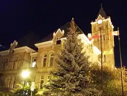 More images | |||
| St. Thomas Pioneer Church | 55 Walnut Street, St. Thomas, ON | 42°46′38″N 81°12′22″W | 10581 |  |
Grey County
| Name | Address | Coordinates | IDF | IDP | IDM | Image | |
|---|---|---|---|---|---|---|---|
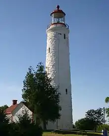
| Tower | Griffith Island, Georgian Bluffs, ON | 44°51′04″N 80°53′24″W | 3292 | 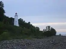 | |||
| Billy Bishop Boyhood Home National Historic Site of Canada | 948 Third Avenue West, Owen Sound, ON | 44°33′59″N 80°56′54″W | 4028 | 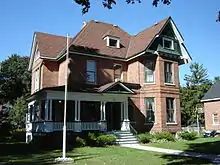 More images | |||
| Canadian Pacific Railway Station | First Avenue East (at 12th St. E.), Owen Sound, ON | 44°34′20″N 80°56′32″W | 4586 | | |||
| Former Owen Sound Bus Terminal | 1023 2nd Avenue East, Owen Sound, ON | 44°34′06″N 80°56′34″W | 15128 | | |||
| Former Reitman's Store | 992 2nd Avenue East, Owen Sound, ON | 44°34′03″N 80°56′36″W | 15129 | |
Haldimand County
| Name | Address | Coordinates | IDF | IDP | IDM | Image | |
|---|---|---|---|---|---|---|---|
| Caledonia Town Hall | 80 Caithness Street East, Haldimand, ON | 43°04′23″N 79°56′56″W | 18022 | 10808 |  | ||
| Campbell-Pine House | 396 Highway 3, Haldimand, ON | 42°55′51″N 79°56′11″W | 10807 |  | |||
| Charles Reicheld House | 601 Regional Road 12, Haldimand, ON | 42°50′28″N 79°53′17″W | 10900 | | |||
| Cook-Peart House | 3355 River Road, Haldimand, ON | 43°00′12″N 79°52′44″W | 10264 | | |||
| Cottonwood Mansion | 740 Regional Road 53, Haldimand, ON | 42°49′07″N 79°55′30″W | 10896 | | |||
| Cranston Post Office | 915 Regional Road 29, Haldimand, ON | 43°00′27″N 79°57′04″W | 10909 | | |||
| Dochstader Hotel | 3220 River Road, Haldimand, ON | 43°00′17″N 79°52′44″W | 10954 | | |||
| Duff House | 5 Mohawk Street East, Cayuga, ON | 42°57′08″N 79°51′19″W | 10957 |  | |||
| Edmondson-Weaver House | 1613 Concession 13, Haldimand, ON | 42°53′33″N 80°10′04″W | 10976 | | |||
| Empire School | 3038 Regional Road 9 (York Road), Haldimand, ON | 43°02′12″N 79°56′38″W | 15226 | | |||
| Enniskillen Lodge | 39 Front Street, Haldimand, ON | 43°02′12″N 79°56′38″W | 11108 | | |||
| Furry Tavern | 2511 North Shore Road, Haldimand, ON | 42°51′40″N 79°28′08″W | 10089 | | |||
| Gibson-Alderson House | 4830 Highway 6, Haldimand, ON | 43°03′32″N 79°58′06″W | 10834 | | |||
| Gibson-Bunn Building | 19 Cayuga Street North, Cayuga, ON | 42°57′01″N 79°51′31″W | 10098 |  | |||
| The Gore School | 699 Haldimand Road 9, Haldimand, ON | 42°57′42″N 79°58′18″W | 11177 | | |||
| Gypsum Mines School | 1256 Regional Road 17, Haldimand, ON | 42°55′22″N 79°47′25″W | 11000 | | |||
| Hoover Log House | 95 Concession 4, Haldimand, ON | 42°49′44″N 79°55′48″W | 11109 | | |||
| Jeffrey Residence | 1615 Concession 13, Haldimand, ON | 42°53′33″N 80°10′03″W | 11141 | | |||
| John Fry House | 1915 Regional Road 3, Haldimand, ON | 42°51′30″N 79°41′34″W | 11142 | | |||
| Jones-Doughty Residence | 53 Talbot Street East, Jarvis, ON | 42°53′06″N 80°06′34″W | 11143 |  | |||
| Kirkland House | 3062 River Road, Haldimand, ON | 42°54′48″N 79°47′13″W | 11144 | | |||
| Lalor Estate | 241 Broad Street West, Dunnville, ON | 42°54′19″N 79°37′19″W | 11149 |  | |||
| Mohawk Island Lighthouse | Mohawk Island National Wildlife Area, Haldimand, ON | 42°50′04″N 79°31′21″W | 9770 20801 |
 More images | |||
| McKinnon-Smith Residence | 156 Caithness Street East, Haldimand, ON | 43°04′21″N 79°56′47″W | 10931 |  | |||
| Mooney Residence | 210 Broad Street West, Dunnville, ON | 42°54′16″N 79°37′16″W | 11164 |  | |||
| Murray-Walton House and Farm | 266 Irish Line, Haldimand, ON | 42°55′43″N 79°51′56″W | 11167 | | |||
| Nanticoke National Historic Site of Canada | 38 Rainham Road, Haldimand (Nanticoke), ON | 42°47′50″N 80°03′11″W | 17701 |  | |||
| Old Caledonia Mill | 149 Forfar Street West, Haldimand, ON | 43°04′18″N 79°57′29″W | 11169 |  | |||
| Ruthven Gatehouse | 243 Highway 54, Haldimand (Cayuga), ON | 42°58′53″N 79°52′18″W | 10547 | | |||
| Ruthven Park | 243 Highway 54, Haldimand (Cayuga), ON | 42°58′53″N 79°52′24″W | 12099 | 10564 | 11134 | 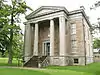 | |
| St. John's Parish Hall | Front Street, Haldimand, ON | 43°02′12″N 79°56′38″W | 11176 | | |||
| Seneca Bridge | 651 Caithness Street East, Haldimand, ON | 43°03′54″N 79°56′01″W | 11173 | 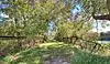 | |||
| Thompson-Colwell House | 86 Sutherland Street East, Haldimand, ON | 43°04′27″N 79°56′52″W | 11178 | 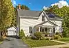 | |||
| Toll House | 4 Argyle Street North, Haldimand, ON | 43°04′24″N 79°57′06″W | 10932 | 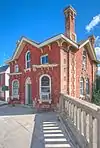 | |||
| Upper Farm Cemetery | 863 Keith Richardson Parkway, Haldimand, ON | 42°53′37″N 80°08′29″W | 10606 | | |||
| Union School | 34 Main Street W, Haldimand (Selkirk), ON | 42°49′59″N 79°56′12″W | 11179 | | |||
| Vanderburgh House | 4163 Highway 3, Haldimand, ON | 42°52′16″N 79°46′53″W | 10869 | | |||
| Wilson Pugsley MacDonald Museum | 3513 Rainham Road, Haldimand, ON | 42°49′37″N 79°58′31″W | 10591 | |
Huron County
| Name | Address | Coordinates | IDF | IDP | IDM | Image | |
|---|---|---|---|---|---|---|---|
| Carolinian Oak Tree | 81340 Mill Place, Ashfield–Colborne–Wawanosh, ON | 43°45′08″N 81°42′59″W | 15674 | | |||
| Acheson House | 55 Nelson, Goderich, ON | 43°44′44″N 81°42′30″W | 14797 | | |||
| Captain Dancy House | 108 East Street, Goderich, ON | 43°44′35″N 81°42′22″W | 14145 | | |||
| The Cottage | 135 Essex Street, Goderich, ON | 43°44′15″N 81°43′26″W | 15293 | | |||
| Ford House | 34 Wellington Street South, Goderich, ON | 43°44′31″N 81°43′04″W | 15252 | | |||
| Former Bank of Upper Canada Building | 46 West Street, Goderich, ON | 43°44′34″N 81°42′47″W | 14181 | | |||
| Garrow House | 65 Montreal Street, Goderich, ON | 43°44′29″N 81°42′48″W | 14146 | | |||
| Garvey House | 97 St. Patrick, Goderich, ON | 43°44′38″N 81°42′57″W | 14590 | | |||
| Geary House | 133 St. Georges Crescent, Goderich, ON | 43°44′42″N 81°42′59″W | 14147 | | |||
| Gibbons Townhouse | 33 Montreal Street, Goderich, ON | 43°44′32″N 81°42′45″W | 14148 | | |||
| Goderich Canadian Pacific Railway Station | 1 Ship, Goderich, ON | 43°44′41″N 81°43′33″W | 14594 |  More images | |||
| Goderich Public Library | 52 Montreal Street, Goderich, ON | 43°44′29″N 81°42′49″W | 14182 | 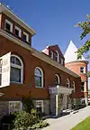 | |||
| Goderich Town Hall | 57 West Street, Goderich, ON | 43°44′35″N 81°42′51″W | 14162 |  | |||
| Hands Bakery | 169 West Street, Goderich, ON | 43°44′35″N 81°43′07″W | 14163 | | |||
| Henry Horton Cottage | 156 East Street, Goderich, ON | 43°44′35″N 81°42′14″W | 14721 | | |||
| Hunter House | 66 Victoria Street North, Goderich, ON | 43°44′43″N 81°42′28″W | 14164 | | |||
| Huron County Gaol National Historic Site of Canada | 181 Victoria Street North, Goderich, ON | 43°44′59″N 81°42′28″W | 12027 | 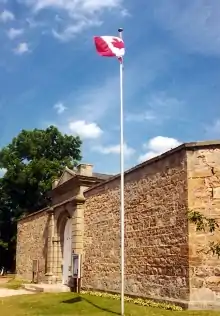 | |||
| Huron County Museum | 110 North Street, Goderich, ON | 43°44′49″N 81°42′40″W | 14165 | 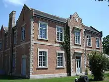 | |||
| Hutchinson House | 191 Britannia, Goderich, ON | 43°44′21″N 81°43′16″W | 14902 | | |||
| Judges' House | 85 Essex, Goderich, ON | 43°44′24″N 81°43′27″W | 14589 | | |||
| Lawson House | 37 Essex Street, Goderich, ON | 43°44′31″N 81°43′20″W | 14806 | | |||
| Menesetung Bridge | , Goderich, ON | 43°45′05″N 81°42′50″W | 14596 | 15690 | 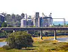 More images | ||
| Polley's Livery Stable | 35 South Street, Goderich, ON | 43°44′29″N 81°42′40″W | 14202 | | |||
| Samuel Platt House | 148 Victoria Street North, Goderich, ON | 43°44′53″N 81°42′28″W | 14937 | | |||
| Seegmiller House | 87 St. Patrick Street, Goderich, ON | 43°44′38″N 81°42′53″W | 14144 | | |||
| Sloane-Cooper House | 80 Hamilton Street, Goderich, ON | 43°44′42″N 81°42′31″W | 14166 | | |||
| The Square | , Goderich, ON | 43°44′35″N 81°42′40″W | 7450 |  More images | |||
| Strachan House | 20 Wellington Street South, Goderich, ON | 43°44′33″N 81°43′04″W | 15251 | | |||
| Thomas Mercer Jones House | 168 West Street, Goderich, ON | 43°44′35″N 81°43′07″W | 14167 | | |||
| Tom House | 82 Wellesley Street, Goderich, ON | 43°44′25″N 81°43′16″W | 14168 | | |||
| Wellesley House | 203 Lighthouse Street, Goderich, ON | 43°44′32″N 81°43′15″W | 14169 | | |||
| West Street Heritage Conservation District | West Street, Goderich, ON | 43°44′34″N 81°42′47″W | 14681 | 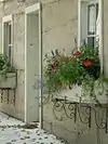 | |||
| Whitely House | 58 Elgin Avenue East, Goderich, ON | 43°44′26″N 81°42′32″W | 14947 | | |||
| Box Residence | 57 High Street, Huron East, ON | 43°33′08″N 81°23′45″W | 14563 | | |||
| Britton House | 12 Church Street, Huron East, ON | 43°33′18″N 81°23′43″W | 15688 | | |||
| Brussels Library | 402 Turnberry Street, Huron East, ON | 43°44′39″N 81°14′59″W | 15405 | 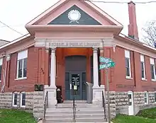 More images | |||
| Cameron House | 84354 McNabb Line, Huron East, ON | 43°42′15″N 81°11′38″W | 15406 | | |||
| Cardno Block | 39 Main Street South, Huron East, ON | 43°33′16″N 81°23′33″W | 14565 | | |||
| Carnohan House | 123 James Street, Huron East, ON | 43°33′25″N 81°23′55″W | 14568 | | |||
| Carroll Residence | 131 Goderich Street, Huron East, ON | 43°33′23″N 81°24′00″W | 14569 | | |||
| Commercial Hotel | 84 Main Street South, Huron East, ON | 43°33′05″N 81°23′43″W | 15407 | | |||
| Cornish Residence | 17 Helen Street, Huron East, ON | 43°33′24″N 81°23′54″W | 14850 | | |||
| Doig Residence | 98 Goderich Street West, Huron East, ON | 43°33′20″N 81°23′53″W | 14851 | | |||
| The Former Seaforth Public School | 13 Church Street, Huron East, ON | 43°33′18″N 81°23′43″W | 15421 | | |||
| Hansen Residence | 23 Sparling Street, Huron East, ON | 43°33′20″N 81°24′00″W | 14566 | | |||
| Harpurhey Cemetery | Harpurhey Road, Huron East, ON | 43°33′37″N 81°24′59″W | 15408 | | |||
| Horthy House | 87 Main Street North, Huron East, ON | 43°33′24″N 81°23′27″W | 15409 | | |||
| McIver Residence | 41 John Street, Huron East, ON | 43°33′12″N 81°23′42″W | 14582 | | |||
| Moncrieff Church | 83506 Livingston Line, Huron East, ON | 43°38′36″N 81°09′14″W | 15423 | | |||
| Mullen House | 92 Goderich Street, Huron East, ON | 43°33′18″N 81°23′50″W | 14570 | | |||
| Pinkney House | 31 Goderich Street West, Huron East, ON | 43°33′23″N 81°24′00″W | 15415 | | |||
| Pletsch Residence | 19 Sparling Street, Huron East, ON | 43°33′21″N 81°23′59″W | 14530 | | |||
| Round House | 140 Duke Street, Huron East, ON | 43°33′24″N 81°23′17″W | 14592 | | |||
| Seaforth Heritage Conservation District | Main Street, Huron East, ON | 43°33′06″N 81°23′42″W | 15418 | | |||
| Seaforth Town Hall | 72 Main Street, Huron East, ON | 43°33′06″N 81°23′42″W | 14567 | 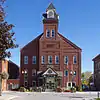 | |||
| The Shepherd Residence | 148 Goderich Street West, Huron East, ON | 43°33′24″N 81°24′04″W | 15956 | | |||
| Van Egmond Residence | 80 Kippen Road, Huron East (Tuckersmith), ON | 43°32′21″N 81°24′19″W | 15422 | | |||
| Vanastra Park Gate and Posts | London Road, Huron East, ON | 43°34′56″N 81°31′43″W | 15424 | | |||
| Victoria Park | Victoria Street at Gouinlock Street, Huron East, ON | 43°33′05″N 81°23′35″W | 15425 | | |||
| W.J. Carling House | 73 Huron Street West, South Huron, ON | 43°13′N 81°17′W | 7790 | |
Lambton County
| Name | Address | Coordinates | IDF | IDP | IDM | Image | |
|---|---|---|---|---|---|---|---|
| First Commercial Oil Field National Historic Site of Canada | , Oil Springs, ON | 42°47′00″N 82°07′00″W | 1148 | 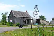 More images | |||
| Government of Canada Building | 105 Christina Street, Sarnia, ON | 42°58′14″N 82°24′29″W | 2887 |  | |||
| Independent Order Odd Fellows Ridgely Lodge #250 | 2594 Kelly Road, Oil Springs, ON | 42°47′03″N 82°07′12″W | 17941 |  | |||
| Langbank Post Office | 2423 Kelly Road, Oil Springs, ON | 42°46′27″N 82°07′12″W | 17962 | | |||
| Oil Springs Community Hall | 4596 Oil Springs Line, Oil Springs, ON | 42°46′27″N 82°07′12″W | 17961 | 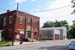 | |||
| Oil Springs Railway Station | 2423 Kelly Road, Oil Springs, ON | 42°46′22″N 82°07′18″W | 18021 |  | |||
| Old Post Office | 4189 Petrolia Line, Petrolia, ON | 42°52′54″N 82°08′51″W | 17984 |  | |||
| Petrolia Orange Hall (destroyed by fire in 2004) |
4224 Petrolia Line, Petrolia, ON | 42°52′55″N 82°08′42″W | 1505 | | |||
| Petrolia Public Library | 4200 Petrolia Line, Petrolia, ON | 42°52′55″N 82°08′47″W | 17983 |  | |||
| VIA Rail Station | 125 Green Street, Sarnia, ON | 42°57′28″N 82°23′20″W | 4628 | 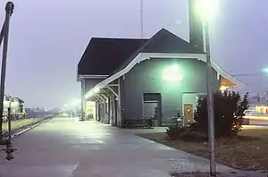 | |||
| Victoria Hall / Petrolia Town Hall National Historic Site of Canada | 411 Greenfield Street, Petrolia, ON | 42°52′50″N 82°08′47″W | 7551 |  More images |
Norfolk County
| Name | Address | Coordinates | IDF | IDP | IDM | Image | |
|---|---|---|---|---|---|---|---|
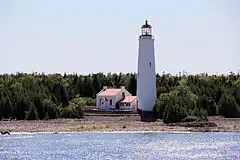
| Lighttower | Tip of Long Point, south of Port Dover, Long POint, ON | 42°32′56″N 80°02′57″W | 11199 | | |||
| Backhouse Grist Mill National Historic Site of Canada | RR 3, Norfolk, ON | 42°37′00″N 80°28′00″W | 7554 |  More images | |||
| Cliff Site National Historic Site of Canada | Brant Hill in Port Dover, Norfolk, ON | 42°47′08″N 80°11′46″W | 13398 |  | |||
| Fort Norfolk National Historic Site of Canada | , Norfolk, ON | 42°41′56″N 80°19′31″W | 16785 |  | |||
| Lynnwood/Campbell-Reid House National Historic Site of Canada | 21 Lynnwood Avenue, Norfolk, ON | 42°50′16″N 80°18′12″W | 12402 |  | |||
| Van Norman-Guiler House | 2318 Front Road, Norfolk (Normandale), ON | 42°42′39″N 80°18′45″W | 15347 | | |||
| Lighttower | End of west pier, Port Dover, ON | 42°46′52″N 80°12′06″W | 4739 20710 |
| |||
| Walpole Island Lower A32 Lighthouse | Off Walpole Island in the St. Clair River, Walpole Island, ON | 42°36′42″N 82°31′03″W | 21033 | | |||
| Walpole Island Upper A34 Lighthouse | Off Walpole Island in the St. Clair River opposite Algonac Michigan, Walpole Island, ON | 42°37′20″N 82°30′41″W | 21034 | |
Oxford County
| Name | Address | Coordinates | IDF | IDP | IDM | Image | |
|---|---|---|---|---|---|---|---|
| African Methodist Episcopal Cemetery | Church St (Pick Line), Otterville, Norwich, ON | 42°55′53″N 80°36′30″W | 10775 | 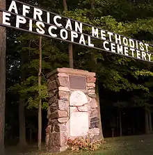 | |||
| Annandale House | 30 Tillson Avenue, Tillsonburg, Tillsonburg, ON | 42°51′44″N 80°43′18″W | 4178 | 18001 | 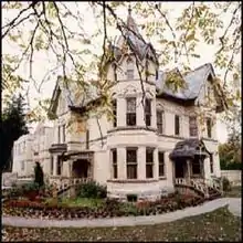 More images | ||
| Curries United Church | 465003 Curries Road, Curries, Norwich, ON | 43°04′17″N 80°43′14″W | 10925 |  | |||
| Knox Presbyterian Church (Norwich) | 67 Main Street West, Norwich, Norwich, ON | 42°59′13″N 80°36′04″W | 11678 | 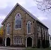 | |||
| Museum School | 656 Main Street North, Burgessville, Norwich, ON | 43°01′39″N 80°39′18″W | 11828 | 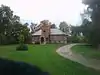 | |||
| Norwich Gore United Church | 89 Stover Street North, Norwich, Norwich, ON | 42°59′44″N 80°36′01″W | 11848 | 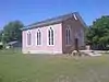 | |||
| Norwich United Church and Manse | 80 Main Street West, Norwich, Norwich, ON | 42°59′14″N 80°36′05″W | 11849 | 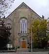 | |||
| Otter Creek Bridge | Middletown Line (just west of Otterville), Norwich, ON | 42°53′50″N 80°37′10″W | 11865 | 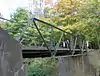 More images | |||
| Otterville Mill | Main St W, Otterville, Norwich, ON | 42°55′30″N 80°36′22″W | 11864 | 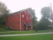 | |||
| Otterville Park | William St, Otterville, Norwich, ON | 42°55′43″N 80°36′11″W | 11866 | 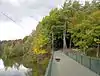 | |||
| Otterville Railway Museum | Main Street W, Otterville, Norwich, ON | 42°55′25″N 80°37′11″W | 11867 | 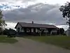 | |||
| Quaker Meeting House (Norwich Museum) | 89 Stover Street North, Norwich, Norwich, ON | 42°59′42″N 80°36′00″W | 11893 | 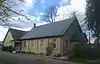 | |||
| Quaker Street Burying Ground | 8 Quaker Street (just north of Norwich village), Norwich, ON | 43°00′06″N 80°36′24″W | 11894 | 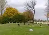 | |||
| Woodlawn Place | Main Street West, Otterville, Norwich, ON | 42°55′25″N 80°37′09″W | 9941 |  | |||
| Old St. Paul's Church (Anglican) | 723 Dundas Street, Woodstock, Woodstock, ON | 43°07′56″N 80°44′47″W | 10544 |  | |||
| Woodstock Railway Station | 94 Victoria Street South, Woodstock, Woodstock, ON | 43°07′35″N 80°45′07″W | 4610 | 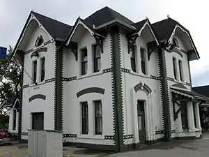 More images | |||
| Old Woodstock Town Hall | 500 Dundas Street, Woodstock, Woodstock, ON | 43°07′46″N 80°45′27″W | 4257 | 8207 | 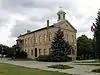 More images |
See also
| Wikimedia Commons has media related to Cultural heritage monuments in Ontario. |
References
This article is issued from Wikipedia. The text is licensed under Creative Commons - Attribution - Sharealike. Additional terms may apply for the media files.