Southwold, Ontario
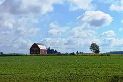
Southwold is a township in Elgin County, in Ontario, Canada, located on the north shore of Lake Erie. It is a rich agricultural zone producing predominantly corn and soybeans. It is part of the London census metropolitan area.
Southwold, Ontario | |
|---|---|
| Township of Southwold | |
 | |
 Southwold, Ontario | |
| Coordinates: 42°45′N 81°19′W | |
| Country | Canada |
| Province | Ontario |
| County | Elgin |
| Incorporated | 1852 |
| Government | |
| • Mayor | Grant Jones |
| • Federal riding | Elgin—Middlesex—London |
| • Prov. riding | Elgin—Middlesex—London |
| Area | |
| • Land | 301.74 km2 (116.50 sq mi) |
| Population (2016)[1] | |
| • Total | 4,421 |
| • Density | 14.7/km2 (38/sq mi) |
| Time zone | UTC-5 (EST) |
| • Summer (DST) | UTC-4 (EDT) |
| Postal Code | N0L |
| Area code(s) | 519 and 226 |
| Website | www.southwold.ca |
History
Southwold was named in 1792 after Southwold in Suffolk, England. The municipality was incorporated in 1852.
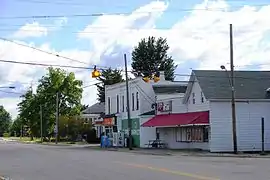
Shedden's growth occurred when the Canada Southern Railway was built, bypassing Fingal. Later it was joined by the Pere Marquette railway, still further boosting Shedden's importance. Both railways are now defunct. Talbotville is situated at the intersection of highways 3 & 4, two of the oldest roads in the region.
Southwold was the site of the 2006 Shedden massacre.
Economy
The township is home to the Green Lane Landfill, a large garbage dump site purchased by the City of Toronto in 2007.[2] Toronto began shipping waste to the site in 2010. Southwold was also home of the Ford St. Thomas Assembly plant until its closure in 2011.
Demographics
| Canada census – Southwold, Ontario community profile | |||
|---|---|---|---|
| 2016 | 2011 | 2006 | |
| Population: | 4,421 (-1.6% from 2011) | 4,494 (-4.9% from 2006) | 4,724 (5.3% from 2001) |
| Land area: | 301.74 km2 (116.50 sq mi) | 301.71 km2 (116.49 sq mi) | 301.71 km2 (116.49 sq mi) |
| Population density: | 14.7/km2 (38/sq mi) | 14.9/km2 (39/sq mi) | 15.7/km2 (41/sq mi) |
| Median age: | 44.7 (M: 44.6, F: 44.8) | 43.7 (M: 43.2, F: 44.2) | 39.9 (M: 39.4, F: 40.5) |
| Total private dwellings: | 1,655 | 1,643 | 1,635 |
| Median household income: | $83,942 | $71,189 | |
| References: 2016[3] 2011[4] 2006[5] earlier[6] | |||
| Year | Pop. | ±% |
|---|---|---|
| 1991 | 4,351 | — |
| 1996 | 4,282 | −1.6% |
| 2001 | 4,487 | +4.8% |
| 2006 | 4,724 | +5.3% |
| 2011 | 4,494 | −4.9% |
| 2016 | 4,421 | −1.6% |
| [7][8][1] 1996 population would have been 4,273 when adjusted to 2001 boundaries | ||
See also
References
- "Census Profile, 2016 Census: Southwold, Township". Statistics Canada. Retrieved June 11, 2019.
- "Green Lane Landfill". City of Toronto. Archived from the original on March 1, 2017.
- "2016 Community Profiles". 2016 Canadian Census. Statistics Canada. February 21, 2017. Retrieved 2019-06-11.
- "2011 Community Profiles". 2011 Canadian Census. Statistics Canada. July 5, 2013. Retrieved 2012-07-16.
- "2006 Community Profiles". 2006 Canadian Census. Statistics Canada. March 30, 2011. Retrieved 2011-02-11.
- "2001 Community Profiles". 2001 Canadian Census. Statistics Canada. February 17, 2012.
- Statistics Canada: 1996, 2001, 2006 census
- "Southwold census profile". 2011 Census of Population. Statistics Canada. Retrieved 2012-07-16.
| Wikimedia Commons has media related to Southwold, Ontario. |
Places adjacent to Southwold, Ontario | |
|---|---|