List of lakes of Australia
Natural freshwater lakes in Australia are rare due to the general absence of glacial and tectonic activity in Australia.
Types
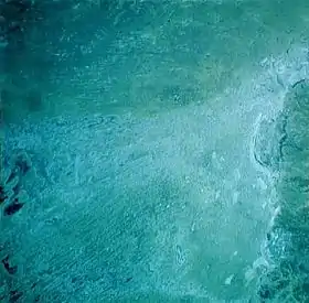
Most lakes in Australia fall within one of five categories. Excluding lakes created by man-made dams for water storage and other purposes, one can identify the following:
- coastal lakes and lagoons including perched lakes;
- natural freshwater inland lakes, often ephemeral and some part of wetland or swamp areas;
- the Main Range containing mainland Australia's five glacial lakes.[1] In Tasmania, due to glaciation, there are a large number of natural freshwater lakes on the central plateau, many of which have been enlarged or modified by hydro-electric developments;
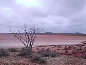
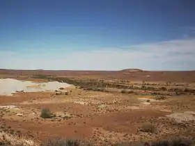
- predominantly dry, salt lakes in the flat desert regions of the country lacking organised drainage; and
- lakes created in volcanic remnants.
List of lakes by state and territory
Australian Antarctic Territory
The following is a list of prominent natural lakes and lagoons in the sector of Antarctica claimed by Australia as the Australian Antarctic Territory:
| Order | Name | Type | Region | Designation | Area | Image | Notes | |
|---|---|---|---|---|---|---|---|---|
| ha | acre | |||||||
| 1 | Braunsteffer Lake | Glacial | Princess Elizabeth Land | [2] | ||||
| 2 | Club Lake | Glacial | [3] | |||||
| 3 | Collerson Lake | Glacial | [4] | |||||
| 4 | Dingle Lake | Glacial | [5] | |||||
| 5 | Krok Lake | Glacial | [6] | |||||
| 6 | Station Tarn | Glacial | ||||||
| 7 | Stinear Lake | Glacial | ||||||
| 8 | Lake Vereteno | Glacial | ||||||
| 9 | Lake Zvezda | Glacial | ||||||
Australian Capital Territory
In the Australian Capital Territory there are no prominent naturally-formed lakes and lagoons. Artificial lakes include Bendora Dam, Cotter Dam, Corin Dam, Lake Burley Griffin, Lake Ginninderra, Lake Tuggeranong, and Stranger Pond.
New South Wales
The following is a list of prominent natural lakes and lagoons in New South Wales:
| Order | Name | Type | Region | Designation | Area | Image | Notes | |
|---|---|---|---|---|---|---|---|---|
| ha | acre | |||||||
| 1 | Lake Albina | Glacial | Snowy Mountains | 0.66 | 2 | 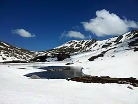 | [7] | |
| 2 | Avoca Lake | Coastal | Central Coast | 70 | 173 | 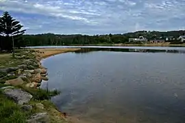 | [8] | |
| 3 | Lake Bathurst | Freshwater ephemeral | Southern Tablelands | 10 | 25 | |||
| 4 | Blue Lake | Freshwater ephemeral; Glacial | Snowy Mountains |
| 16 | 40 | 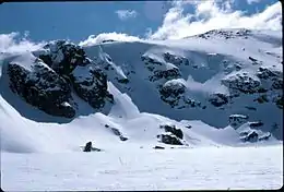 | [9] |
| 5 | Budgewoi Lake | Coastal | Central Coast | 1,400 | 3,459 | |||
| 6 | Lake Cathie | Coastal | ||||||
| 7 | Chipping Norton Lake | Freshwater ephemeral | Greater Sydney | 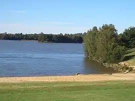 | ||||
| 8 | Lake Cootapatamba | Glacial | Snowy Mountains | World Heritage Area | 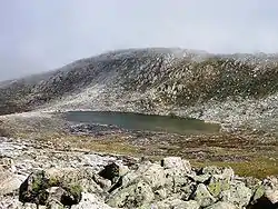 | |||
| 9 | Lake Cowal | Freshwater ephemeral | Central West | |||||
| 10 | Dee Why Lagoon | Coastal lagoon | Northern Beaches | .jpg.webp) | ||||
| 11 | Lake George | Freshwater ephemeral | Southern Tablelands |  | ||||
| 12 | Glenbrook Lagoon | Freshwater ephemeral | Blue Mountains | Glenbrook_Lagoon_033.jpg.webp) | ||||
| 13 | Glenrock Lagoon | Coastal lagoon | ||||||
| 14 | Headley Tarn | Glacial | ||||||
| 15 | Lake Illawarra | Coastal | Illawarra | |||||
| 16 | Lake Macquarie | Coastal | Hunter | .jpg.webp) | ||||
| 17 | Menindee Lakes | Freshwater ephemeral | Far West |  | ||||
| 18 | Lake Moore | Freshwater ephemeral | ||||||
| 19 | Lake Mungo | Saline | Far West | 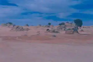 | ||||
| 20 | Lake Munmorah | Coastal | Central Coast | |||||
| 21 | Myall Lakes | Coastal | Mid North Coast | 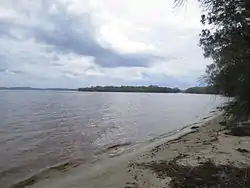 | ||||
| 22 | Narrabeen Lagoon | Coastal | Northern Beaches | 220 | 544 |  | [10] | |
| 23 | Narran Lakes | Freshwater ephemeral | ||||||
| 24 | Smiths Lake | Coastal | Mid North Coast | |||||
| 25 | St Georges Basin | Coastal | South Coast / Jervis Bay Territory | |||||
| 26 | Tabourie Lake | Coastal | Mid North Coast | |||||
| 27 | Terrigal Lagoon | Coastal lagoon | Central Coast | |||||
| 28 | Tuggerah Lake | Coastal | Central Coast | 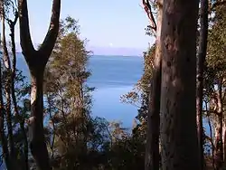 | ||||
| 29 | Lake Urana | Saline | Far West | |||||
| 30 | Wallaga Lake | Freshwater ephemeral | ||||||
| 31 | Wallis Lake | Coastal | Mid North Coast | |||||
| 32 | Wamberal Lagoon | Coastal lagoon | Central Coast | |||||
| 33 | Wattle Grove Lake | Freshwater ephemeral | ||||||
| 34 | Willandra Lakes | Saline | Far West | |||||
| 35 | Lake Wollumboola | Coastal | Mid North Coast | |||||
| 36 | Wonboyn Lake | Coastal | Mid North Coast | |||||
| 37 | Lake Woytchugga | Freshwater ephemeral | ||||||
| 38 | Peery Lake | Freshwater ephemeral | Far West | Ramsar | 5,026 | 12,420 | 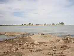 | |
Northern Territory
The following is a list of prominent natural lakes and lagoons in the Northern Territory:
| Order | Name | Type | Region | Designation | Area | Image | Notes | |
|---|---|---|---|---|---|---|---|---|
| ha | acre | |||||||
| 1 | Lake Amadeus | Saline | South-west | 103,200 | 255,013 |  | [11] | |
| 2 | Corella Lake | Freshwater ephemeral | ||||||
| 3 | Lake Mackay | Saline | Great Sandy Desert; Gibson Desert; Tanami Desert | 349,400 | 863,386 |  | ||
| 4 | Lake Neale | Saline | South-west | 30,000 | 74,132 | [12] | ||
| 5 | Numby Numby | Sinkhole | Gulf of Carpentaria | 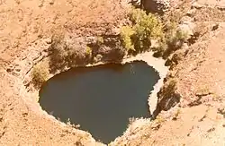 | ||||
| 6 | Lake Sylvester | Freshwater ephemeral | Barkly Tableland | 200,000 | 494,211 | |||
| 7 | Tarrabool Lake | Freshwater ephemeral | Barkly Tableland | Tarrabool Lake – Eva Downs Swamp System Important Bird Area; Register of the National Estate; DIWA | 118,600 | 293,067 | 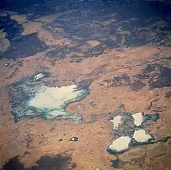 | |
| 8 | Lake Woods | Freshwater ephemeral | Barkly Tableland | Important Bird Area; Longreach Waterhole Protected Area (part) | 118,600 | 293,067 |  | |
| 9 | Lake Lewis | Saline ephemeral | ||||||
Queensland
The following is a list of prominent natural lakes and lagoons in Queensland:
| Order | Name | Type | Region | Designation | Area | Image | Notes | |
|---|---|---|---|---|---|---|---|---|
| ha | acre | |||||||
| 1 | Lake Awoonga | Freshwater ephemeral | ||||||
| 2 | Lake Barrine | Volcanic | ||||||
| 3 | Blue Lake | Coastal | ||||||
| 4 | Boobera Lagoon | Freshwater ephemeral | ||||||
| 5 | Brown Lake | Coastal | ||||||
| 6 | Lake Broadwater | Coastal | South East | |||||
| 7 | Lake Buchanan | Saline | _satellite_image.png.webp) | |||||
| 8 | Lake Como | Coastal | ||||||
| 9 | Lake Cooloola | Coastal | ||||||
| 10 | Lake Cooroibah | Coastal | ||||||
| 11 | Lake Cootharaba | Coastal | ||||||
| 12 | Lake Dunn | Freshwater ephemeral | ||||||
| 13 | Lake Eacham | Volcanic | ||||||
| 14 | Lake Elphinstone | Freshwater ephemeral | ||||||
| 15 | Lake Euramoo | Volcanic | ||||||
| 16 | Lake Galilee | Saline | ||||||
| 17 | Lake McKenzie | Perched | Fraser Island | Great Sandy National Park | 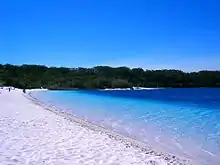 | |||
| 18 | Lake Nuga Nuga | Freshwater ephemeral | ||||||
| 19 | Lake Weyba | Coastal | ||||||
| 20 | Lake Wabby | Perched | Fraser Island | Great Sandy National Park | ||||
| 21 | Lake Yamma Yamma | Saline | ||||||
South Australia
The following is a list of prominent natural lakes and lagoons in South Australia:
Tasmania
The following is a list of prominent natural lakes and lagoons in Tasmania:
| Order | Name | Type | Region | Designation | Area | Image | Notes | |
|---|---|---|---|---|---|---|---|---|
| ha | acre | |||||||
| 1 | Lake Beatrice | Freshwater | Western | 55 | 136 | [22] | ||
| 2 | Lake Dora | Freshwater | Western | 48 | 119 | [23] | ||
| 3 | Dove Lake | Cirque freshwater | Central Highlands | Cradle Mountain-Lake St Clair National Park | 86 | 213 | 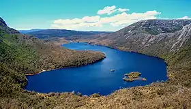 | [24][25][26] |
| 4 | Lake Dulverton | Freshwater ephemeral | Southern Midlands | 230 | 568 | [27][28] | ||
| 5 | Lake Edgar | Fault scarp pond | South West | Tasmanian Wilderness World Heritage Area | 147 | 363 | [29] | |
| 6 | Lake Fidler | Meromictic | South West | Tasmanian Wilderness World Heritage Area | ||||
| 7 | Lake Flannigan | Freshwater | King Island | Game reserve (pending as at 2005) | 150 | 371 | 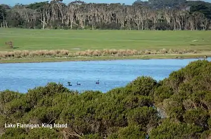 | |
| 8 | Great Lake | Freshwater | Central Highlands | 17,600 | 43,491 | [30] | ||
| 9 | Jocks Lagoon | Dystrophic lake | Central Northern | Ramsar site | 18 | 44 | [31] | |
| 10 | Little Waterhouse Lake | Freshwater coastal | North East | Ramsar Site | 10 | 25 | 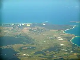 | [32] |
| 11 | Lake Meston | Freshwater | Central Northern | Walls of Jerusalem National Park | ||||
| 12 | Orielton Lagoon | Dystrophic coastal lagoon | South East Coast | Ramsar Site | 3,334 | 8,240 | [33] | |
| 13 | Lake Selina | Glacial | West Coast | |||||
| 14 | Lake St Clair | Freshwater | Central Highlands | Cradle Mountain-Lake St Clair National Park | 4,500 | 11,120 | 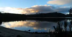 | |
| 15 | Lake Westwood | Glacial | West Coast | 35 | 86 | [34] | ||
Victoria
The following is a list of prominent natural lakes and lagoons in Victoria.
| Order | Name | Type | Region | Designation | Area | Image | Notes | |
|---|---|---|---|---|---|---|---|---|
| ha | acre | |||||||
| 1 | Lake Batyo Catyo | Freshwater ephemeral | 230 | |||||
| 2 | Lake Corangamite | Saline | 23000 | |||||
| 3 | Gippsland Lakes | Coastal | 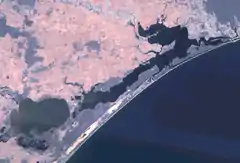 | |||||
| 4 | Lake Hindmarsh | Freshwater ephemeral | Wimmera | 13500 | 33000 | |||
| 5 | Mallacoota Inlet | Coastal | ||||||
| 6 | Murtnaghurt Lagoon | Saline | 81 | 200 | ||||
| 7 | Lake Victoria | Coastal lake | 139 | 340 | 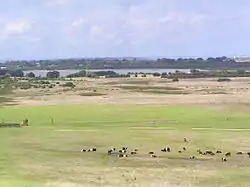 | |||
| 8 | Lake Tali Karng | Freshwater | Alpine | 14 | 35 | |||
| 9 | Pink Lake (Victoria) | Saline | Wimmera | 45 | 111 | |||
Western Australia
The following is a list of prominent natural lakes and lagoons in Western Australia:
| Order | Name | Type | Region | Designation | Area | Image | Notes | |
|---|---|---|---|---|---|---|---|---|
| ha | acre | |||||||
| 1 | Angove Lake | Freshwater | Great Southern | Two Peoples Bay Nature Reserve | 33 | 82 | ||
| 2 | Lake Anneen | Saline | Mid West | 12,000 | 29,653 | |||
| 3 | Lake Baghdad | Saline | Rottnest Island | |||||
| 4 | Lake Ballard | Saline ephemeral | Goldfields-Esperance | 4,900 | 12,108 | 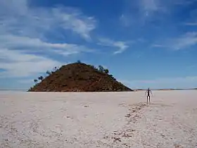 | [35] | |
| 5 | Lake Barlee | Saline | Mid West | 198,000 | 489,269 | 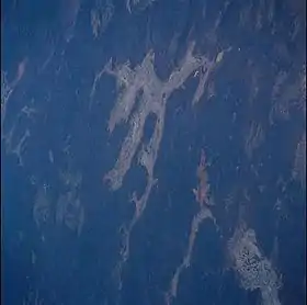 | [36] | |
| 6 | Bibra Lake | Freshwater | Perth | Beeliar Regional Park | ||||
| 7 | Lake Boonderoo | Freshwater | Goldfields-Esperance | 2,500 | 6,178 | |||
| 8 | Booragoon Lake | Freshwater | Perth | Beeliar Regional Park | [37] | |||
| 9 | Boyd Lagoon | Saline lagoon | Gibson Desert | 870 | 2,150 | [38] | ||
| 10 | Lake Breaden | Saline | Gibson Desert | 2,600 | 6,425 | [39][40] | ||
| 11 | Lake Bryde-East Lake Bryde | Freshwater wetland | Great Southern | Lake Bryde Nature Reserve | 1,900 | 4,695 | [41] | |
| 12 | Lake Burnside | Saline | Gibson Desert | 42,000 | 103,784 | [42] | ||
| 13 | Lake Carey | Saline | Goldfields-Esperance | |||||
| 14 | Lake Carnegie | Ephemeral | Goldfields-Esperance | 571,400 | 1,411,960 |  | [43][44] | |
| 15 | Lake Disappointment | Saline endorheic | Pilbara | 33,000 | 81,545 |  | [45] | |
| 16 | Lake Dora | Saline | Pilbara | 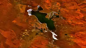 | ||||
| 17 | Dumbleyung Lake | Saline | Great Southern | Dumbleyung Lake Nature Reserve | 5,200 | 12,849 | 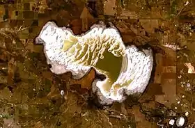 | |
| 18 | Lake Dundas | Saline | Goldfields-Esperance | |||||
| 19 | Forrestdale Lake | Brackish seasonal groundwater | Perth | Forrestdale Lake Nature Reserve; Forrestdale and Thomsons Lakes Ramsar Site | 245 | 605 | [46] | |
| 20 | Lake Gore | Seasonal freshwater | Goldfields-Esperance | Lake Gore Nature Reserve; Lake Gore Ramsar Site | 740 | 1,829 | [47] | |
| 21 | Lake Gregory | Seasonal freshwater | Kimberley | Paraku Indigenous Protected Area | ||||
| 22 | Herdsman Lake | Freshwater | Perth | Herdsman Lake Regional Park | 300 | 741 | 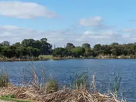 | [48] |
| 23 | Lake Hillier | Saline | Goldfields-Esperance | Recherche Archipelago Nature Reserve | 1.5 | 4 | 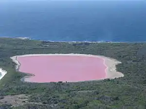 | [49] |
| 24 | Hutt Lagoon | Saline | Mid West | 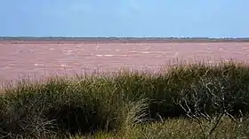 | ||||
| 25 | Lake Jasper | Freshwater | South West | 4,500 | 11,120 | [50] | ||
| 26 | Lake Joondalup | Freshwater | Perth | Yellagonga Regional Park | 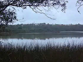 | |||
| 27 | Jualbup Lake | Freshwater | Perth | Shenton Park | 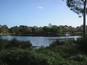 | |||
| 28 | Lake Lefroy | Saline ephemeral | Goldfields-Esperance | |||||
| 29 | Lake Mackay | Saline | Great Sandy Desert | 349,400 | 863,386 |  | [51] | |
| 30 | Lake McLarty | Freshwater | South West | Lake McLarty Nature Reserve; Peel-Yalgorup System Ramsar site | ||||
| 31 | Lake Macleod | Freshwater | Gascoyne | 150,000 | 370,658 | 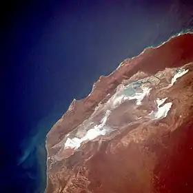 | ||
| 32 | Loch McNess | Freshwater | Perth | Yanchep National Park | 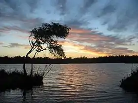 | [52] | ||
| 33 | Lake Magenta | Saline ephemeral | Wheatbelt | Lake Magenta Nature Reserve | 11,000 | 27,182 | [53] | |
| 34 | Lake Maitland | Dry saline | Mid West | |||||
| 35 | Lake Monger | Freshwater | Perth | Lake Monger Reserve | 70 | 173 | ||
| 36 | Lake Monginup | Freshwater | Goldfields-Esperance | Lake Monginup Nature Reserve | 32 | 79 | 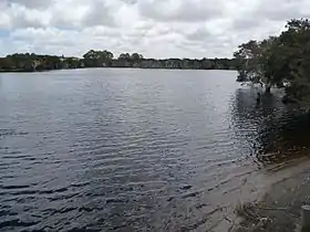 | [54] |
| 37 | Lake Muir | Freshwater | South West | Muir-Byenup System Ramsar Site | 4 | 10 | 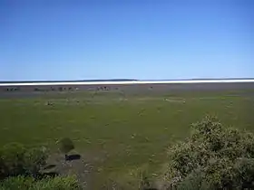 | [55][56] |
| 38 | Lake Nabberu | Saline | Mid West | 18,000 | 44,479 | [57] | ||
| 39 | Lake Newell | Goldfields-Esperance | 2,600 | 6,425 | [58] | |||
| 40 | North Lake | Freshwater | Perth | Beeliar Regional Park | ||||
| 41 | Perry Lakes | Freshwater | Perth | Perry Lakes Reserve | 12.6 | 31 | [59] | |
| 42 | Perth Wetlands | Wetlands | Perth | Herdsman Lake Regional Park | ||||
| 43 | Pink Lake | Saline | Goldfields-Esperance | 99 | 245 | 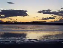 | [60] | |
| 44 | Lake Seppings | Freshwater | South West | Lake Seppings Nature Reserve | 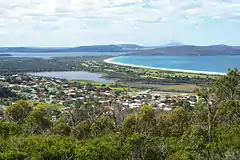 | [61] | ||
| 45 | Serpentine Lakes | Saline | Great Victoria Desert | Mamungari Conservation Park | 9,700 | 23,969 | 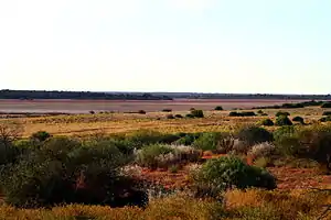 | [20] |
| 46 | Lake Shaster | Hypersaline | Goldfields-Esperance | Lake Shaster Nature Reserve | 479 | 1,184 | [62] | |
| 47 | Lake Thetis | Saline | Mid West | |||||
| 48 | Thomsons Lake | Brackish seasonal groundwater | Perth | Thomsons Lake Nature Reserve; Forrestdale and Thomsons Lakes Ramsar Site | 538 | 1,329 | ||
| 49 | Toolibin Lake | Perched freshwater | Wheatbelt | Toolibin Lake Nature Reserve; Toolibin Lake Ramsar Site | 300 | 741 | [63] | |
| 50 | Lake Warden | Saline | Goldfields-Esperance | Lake Warden Nature Reserve | 59 | 146 | [64] | |
| 51 | Lake Way | Dry saline | Mid-West | 46,000 | 113,668 | [65] | ||
| 52 | Lake Wooleen | Intermittent freshwater | Mid-West | 5,500 | 13,591 | |||
See also
- List of reservoirs and dams in Australia
References
- Powell, Greg (1990). The Snowy Mountains: A bushwalker's diary. Hampton, Victoria: Macstyle. p. 10. ISBN 978-1-875293-08-7.
- "Braunsteffer Lake". Geographic Names Information System. United States Geological Survey. Retrieved 29 August 2011.
- "Club Lake". Geographic Names Information System. United States Geological Survey. Retrieved 16 November 2011.
- "Collerson Lake". Geographic Names Information System. United States Geological Survey. Retrieved 16 November 2011.
- "Dingle Lake". Geographic Names Information System. United States Geological Survey. Retrieved 16 November 2011.
- "Krok Lake". Geographic Names Information System. United States Geological Survey. Retrieved 16 November 2011.
- "Map of Lake Albina, TAS". Bonzle Digital Atlas of Australia. n.d. Retrieved 1 June 2018.
- "Estuaries of NSW: Avoca Lake". Office of Environment and Heritage. Government of New South Wales. Retrieved 6 April 2013.
- "Blue Lake". Australian Ramsar Wetlands. Australian Government, Department of the Environment, Water, Heritage and the Arts. 5 March 2010. Retrieved 4 April 2010.
- "Narrabeen Lakes". Manly Northern Beaches. 2015. Retrieved 12 August 2015.
- "Largest Waterbodies". Geoscience Australia. Commonwealth of Australia. 23 December 2009. Retrieved 13 May 2010.
- "Lake Amadeus and Lake Neale" (PDF). Sites of conservation significance. Government of the Northern Territory, Department of Natural Resources, Environment, the Arts and Sport. p. 175. Archived from the original (PDF) on 18 May 2013. Retrieved 30 March 2013.
- "Archived copy" (PDF). Archived from the original (PDF) on 2011-02-18. Retrieved 2010-10-28.CS1 maint: archived copy as title (link)
- Walker, Keith. "Alexandrina always was a freshwater lake" (PDF). Media Watch. Australia: ABC TV. Archived from the original (transcript) on 2016-01-07. Retrieved 16 August 2015.
- Harris, Richard (July–September 2008). "The big blue". Australian Geographic. 91: 34.
- "Map of Lake Cadibarrawirracanna, SA". Bonzle Digital Atlas of Australia. Retrieved 17 August 2015.
- "Map of Lake Callabonna, SA". Bonzle Digital Atlas of Australia. Retrieved 17 August 2015.
- "Information Sheet on Ramsar Wetlands: Coongie Lakes" (PDF). Department of Environment, Water and Natural Resources (DEWNR). April 2013. pp. 2–3. Retrieved 27 March 2015.
- Rafferty, John P. (2007). Lakes and Wetland. The Rosen Publishing Group. p. 186. ISBN 978-1-61530-320-5. Retrieved 20 December 2012.
- Mamungari Conservation Park Board of Management (2011). "Mamungari Conservation Park Management Plan 2011" (PDF). Adelaide: Department of Environment and Natural Resources. Retrieved 1 April 2013.
- John K. Warren (12 June 2006). Evaporites:Sediments, Resources and Hydrocarbons: Sediments, Resources, and Hydrocarbons. Springer Science & Business Media. p. 201. ISBN 978-3-540-32344-0.
- McNeill, A. W. (11 September 2001). "Lake Beatrice EL 20/98: Annual and final report for the period ending 23 September 2001" (PDF). Pasminco Exploration. Mineral Resources Tasmania, Tasmania Government. p. 1. Retrieved 23 May 2018.
- "Map of Lake Dora, TAS". Bonzle Digital Atlas of Australia. n.d. Retrieved 24 May 2018.
- "Map of Dove Lake, TAS". Bonzle Digital Atlas of Australia. n.d. Retrieved 22 May 2018.
- "Dove Lake". Topographicmap.com. n.d. Retrieved 22 May 2018.
- Elder, Bruce (2008). Australia. New Holland Publishers. p. 7. ISBN 978-1-84773-100-5.
- Michael Shield & Associates (October 2002). "Lake Dulverton Management Strategy" (PDF). Southern Midlands Council. Retrieved 29 May 2018.
- "Map of Lake Dulverton, TAS". Bonzle Digital Atlas of Australia. n.d. Retrieved 29 May 2018.
- McCue, Kevin; et al. (October 2003). "The Lake Edgar Fault: an active fault in Southwestern Tasmania, Australia, with repeated displacement in the Quaternary" (PDF). Annals of Geophysics. 46 (5).
- "Register of Large Dams in Australia" (Workbook (requires download)). Dams information. Australian National Committee on Large Dams. 2010. Retrieved 23 June 2015.
- "Jocks Lagoon". Ramsar Convention. 16 November 1982. Retrieved 12 August 2015.
- "Little Waterhouse Lake Ramsar Site Ecological Character Description" (PDF). Lloyd Environmental Project No: LE0907b. NRM North. 2012-03-02. Retrieved 2013-08-02.
- "Australia's Ramsar Sites" (PDF). Department of the Environment. Australian Government. Retrieved 12 August 2015.
- "Map of Lake Westwood, TAS". Bonzle Digital Atlas of Australia. n.d. Retrieved 27 May 2018.
- "Map of Lake Ballard, WA". Bonzle Digital Atlas of Australia. 2009. Retrieved 3 March 2009.
- "Interesting facts about Western Australia". Landgate. Western Australian Land Information Authority. Archived from the original on 25 June 2012. Retrieved 6 May 2012.
- "Booragoon Lake Reserve Management Plan" (PDF). 2004. Archived from the original (PDF) on 2009-09-28. Retrieved 2009-05-23.
- "Map of Boyd Lagoon, WA". Bonzle Digital Atlas of Australia. Retrieved 14 January 2013.
- "Map of Lake Breaden, WA". Bonzle Digital Atlas of Australia. Retrieved 14 January 2013.
- "Lake Breaden". GeoNames. Retrieved 14 January 2013.
- Beecham, Brett and Alan Danks. "Mallee 2 (MAL2 – Western Mallee subregion)" (PDF). A Biodiversity Audit of Western Australia's 54 Biogeographical Subregions in 2002. Department of Conservation and Land Management. Retrieved 2007-02-24.
- "Lake Burnside, WA". Bonzle Digital Atlas of Australia. Retrieved 14 January 2013.
- "Largest Lake in Australia". Travel Australia. 2011. Archived from the original on 15 January 2018. Retrieved 21 June 2014.
- "Lake Carnegie". Bonzle Digital Atlas of Australia. Retrieved 21 June 2014.
- Monroe, M. H. "Lake Disappointment". Australia: The Land Where Time Began. Retrieved 23 August 2015.
- Forrestdale Lake Nature Reserve: Management Plan 2005. Perth: Conservation Commission of Western Australia. 2005.
- "LakeNet Lake Profile – Lake Gore". 2004. Retrieved 31 March 2009.
- www.wagouldleague.com.au Archived 2006-04-09 at the Wayback Machine About Herdsman Lake Regional Park. Accessed 21 February 2005.
- "Guide to Asia – Lake Hillier – Australia". 2004. Archived from the original on 23 August 2006. Retrieved 31 August 2008.
- "Map of Lake Jasper, WA". Bonzle Digital Atlas of Australia. 2009. Retrieved 3 March 2009.
- "Australian Geoscience – Largest Waterbodies". 2009. Archived from the original on 26 February 2009. Retrieved 7 March 2009.
- Predicting wetland water storage
- "Map of Lake Magenta, WA". Bonzle Digital Atlas of Australia. 2009. Retrieved 4 March 2009.
- "Map of Lake Mortijinup, WA". Bonzle Digital Atlas of Australia. 2009. Retrieved 31 March 2009.
- "Map of Lake Muir, WA". Bonzle Digital Atlas. 2009. Retrieved 2 March 2009.
- "Information Sheet on Ramsar Wetlands – Muir – Byenup System, Western Australia". 2003. Archived from the original on 31 July 2008. Retrieved 2 March 2009.
- "Map of Lake Nabberu, WA". Bonzle Digital Atlas of Australia. Retrieved 28 August 2015.
- "Map of Lake Newell, WA". Bonzle Digital Atlas of Australia. Retrieved 28 August 2015.
- PPK Environment & Infrastructure Pty Ltd (June 2012). "Perry Lakes Reserve Environmental Management Plan" (PDF). Town of Cambridge. Archived from the original (PDF) on 23 September 2015. Retrieved 29 August 2015.
- "Map of Pink Lake, WA". Bonzle Digital Atlas. 2009. Retrieved 28 March 2009.
- "South Coast Regional Management Plan 1992–2002" (PDF). 2002. Retrieved 10 June 2007.
- "Esperance and Recherche parks and reserves management plan 84" (PDF). Department of Biodiversity, Conservation and Attractions. 2016.
- "Approved Conservation Advice for Perched Wetlands of the Wheatbelt Region with extensive stands of living sheoak and paperbark across the lake floor (Toolibin Lake)" (PDF). Department of the Environment, Heritage and the Arts, Australia. 1 October 2008. Retrieved 21 April 2010.
- "Map of Lake Warden, WA". Bonzle Digital Atlas of Australia. 2009. Retrieved 2009-03-28.
- "Map of Lake Way, WA". Bonzle Digital Atlas of Australia. Retrieved 13 February 2011.
External links
![]() Media related to Lakes of Australia at Wikimedia Commons
Media related to Lakes of Australia at Wikimedia Commons
