List of lighthouses in New Jersey
This is a list of all lighthouses in the U.S. state of New Jersey as identified by the United States Coast Guard.[1]
| Name | Image | Location | Coordinates | Year first lit | Automated | Year deactivated | Current Lens | Focal Height |
|---|---|---|---|---|---|---|---|---|
| Absecon Light | 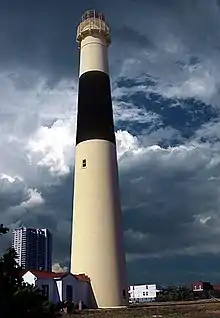 |
Atlantic City | 39°21′58″N 74°24′51″W | 1857 | Never | 1933 | Decorative | Unknown |
| Barnegat Lighthouse |  |
Barnegat Light | 39°45′52″N 74°06′22″W | 1835 (Former) 1857 (Current) |
1927 | Active (Inactive: 1944-2009) |
VRB-25 | 163 ft (50 m) |
| Brandywine Shoal Light | 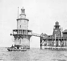 |
Delaware Bay (Lower) |
38.9864°N 75.1135°W | 1828 (Former) 1914 (Current) |
1974 | Active | Unknown | 60 ft (18 m) |
| Cape May Light | 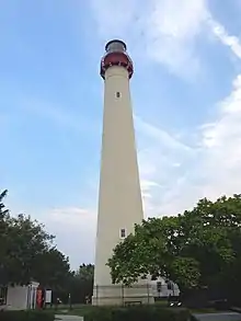 |
Cape May Point | 38°55′58.8″N 74°57′37.5″W | 1823 (Former) 1859 (Current) |
1933 | Active (Inactive: 1940-1945) |
VRB-25 | Unknown |
| Chapel Hill Rear Range Light | Leonardo | 40.3983°N 74.0587°W | 1856 | Never | 1957 (Now a private house) |
None | Unknown | |
| Conover Beacon | Leonardo | 40.4213°N 74.0556°W | 1856 | 1941 | 1957 | None | Unknown | |
| Cross Ledge Light | Downe Township | 39.2040°N 75.2307°W | 1875 | Never | 1910 (Now ruins) |
None | 58 ft (18 m) | |
| East Point (Maurice River) Light | 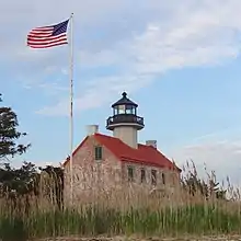 |
Heislerville | 39°11′45″N 75°1′38″W | 1849 | 1911 | Active (Inactive: 1941-1980) |
Fourth-order Fresnel | Unknown |
| Elbow of Cross Ledge Light | 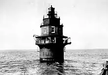 |
Delaware Bay (Middle) |
39.1816°N 75.2683°W | 1910 | 1951 | 1953 (Destroyed) |
None | 61 ft (19 m) |
| Finns Point Range Light | 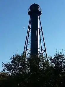 |
Pennsville Township | 39°37′2″N 75°32′3″W | 1877 | 1934 | 1950 | None | Unknown |
| Great Beds Light | 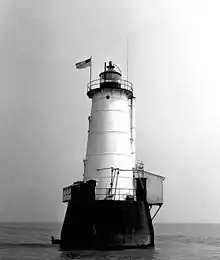 |
South Amboy | 40°29′12″N 74°15′12″W | 1880 | 1945 | Active | Unknown | 57 ft (17 m) |
| Hereford Inlet Light | 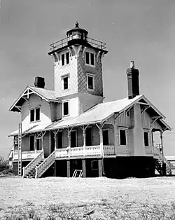 |
North Wildwood | 39°0′24″N 74°47′32″W | 1874 | 1986 (Relit) |
Active (Inactive: 1964-1986) |
VRB-25 | Unknown |
| Ludlam's Beach Light | 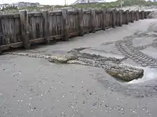 |
Sea Isle City | 39.15978°N 74.68807°W | 1885 | Never | 1924 (Destroyed) |
None | Unknown |
| Miah Maull Shoal Light | 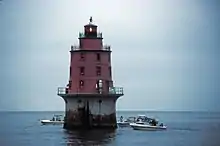 |
Downe Township | 39°7′36″N 75°12′35″W | 1913 | 1973 | Active | 500mm | 59 ft (18 m) |
| Navesink Twin Lights | 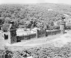 |
Highlands | 40°23′46.4″N 73°59′8.8″W | 1828 (Former) 1862 (Current) |
1949 | Active (North tower) |
Unknown | Unknown |
| Robbins Reef Light | 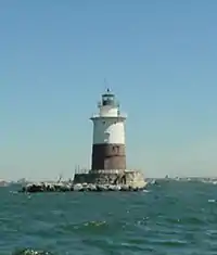 |
Bayonne | 40°39′26.512″N 74°3′55.277″W | 1839 (Former) 1883 (Current) |
Unknown | Active | 300mm | 56 ft (17 m) |
| Romer Shoal Light | 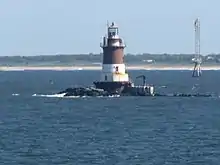 |
Lower New York Bay | 40°30′46.823″N 74°0′48.672″W | 1838 (Former) 1898 (Current) |
1966 | Active | 190mm | 54 ft (16 m) |
| Sandy Hook Light |  |
Middletown Township (Sandy Hook) |
40°27′42″N 74°00′07″W | 1764 | 1941 | Active | Unknown | Unknown |
| Sea Girt Light | 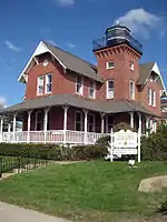 |
Sea Girt | 40.1367°N 74.0275°W | 1896 | Never | 1955 | None | 60 ft (18 m) |
| Ship John Shoal Light | 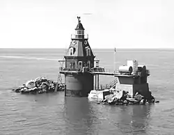 |
Delaware Bay (Upper) |
39°18′19″N 75°22′36″W | 1877 | 1973 | Active | VRB-25 | 50 ft (15 m) |
| Tinicum Island Rear Range Light | 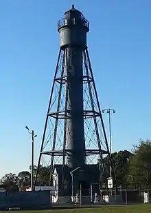 |
Paulsboro | 39°50′51″N 75°14′24″W | 1880 | 1933 | Active | DCB-24 | Unknown |
| Tucker's Beach Light | 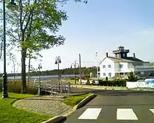 |
Tuckerton | N/A | 1848 (Original) 1980s (Replica) |
Never | 1927 (Destroyed) |
LED (Non-navigational replica) |
Unknown |
| Waackaack Rear Range Light | Keansburg | 40°26′39″N 74°8′10″W | 1856 (The last L.H. was built in 1894) |
Never | 1959 (Scrapped) |
None | Unknown |
References
- "Historic Light Station Information & Photography". United States Coast Guard. Retrieved September 15, 2017.
| Types |
| _-_cropped.jpg.webp) | ||||
|---|---|---|---|---|---|---|
| Fixtures | ||||||
| Maintenance | ||||||
| Locations | ||||||
| Categories |
| |||||
| Global organizations | ||||||
| ||||||
This article is issued from Wikipedia. The text is licensed under Creative Commons - Attribution - Sharealike. Additional terms may apply for the media files.