List of mountains in Greenland
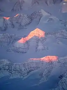
Mountain peaks lit by the sun in East Greenland

This is a list of mountains in Greenland.

List

For each mountain, the municipality in which it is located is given, along with coordinates indicating the approximate centre of the mountain (follow the link to see satellite images of the location).

Above 3000 m

Mountain Coordinates Region Height (m) Height (feet) Notes
Gunnbjørn Fjeld 68°55′N 29°47′W Sermersooq 3,694 12,119 Watkins Range
Watkins Range (unnamed) 68°48′40″N 29°33′26″W Sermersooq 3,606 11,831 Part of a group of high peaks NE of Gunnbjørn Fjeld[1]
Forel, Mont 66°56′N 36°49′W Sermersooq 3,360 11,024 Schweizerland
Watkins Range (unnamed) 68°48′21″N 29°16′57″W Sermersooq 3,344 10,973 Part of a group of high peaks NE of Gunnbjørn Fjeld[1]
Ejnar Mikkelsen Fjeld 68°53′N 28°37′W Sermersooq 3,282[1] 10,769 [2] Ejnar Mikkelsen Range
Borgetinde 68°51′N 28°14′W Sermersooq 3,267[1] 10,719 Borgtinderne
Crown Prince Frederick Range HP 67°3′N 35°34′W Sermersooq 3,256 10,683 Crown Prince Frederick Range[1]
Summit —not a mountain in the strict sense 72°32′N 37°29′W NE Greenland National Park 3,207 10,522 [3] Geographic high point on the Greenland ice sheet
Snebordet 68°57′N 30°50′W Sermersooq 3,171[1] 10,404 Lindbergh Range
Crown Prince Frederick Range (unnamed) 67°7′5″N 36°14′8″W Sermersooq 3,153 10,344 Crown Prince Frederick Range[1]
Crown Prince Frederick Range (unnamed) 67°0′15″N 35°52′13″W Sermersooq 3,127 10,259 Crown Prince Frederick Range, highest rocky peak of a massive nunatak with many peaks[1]
Crown Prince Frederick Range (unnamed) 67°3′3″N 35°44′47″W Sermersooq 3,108 10,196 Crown Prince Frederick Range, the spectacular central summit of a nunatak with three peaks[1]
Crown Prince Frederick Range (unnamed) 67°9′23″N 35°36′9″W Sermersooq 3,092 10,144 Crown Prince Frederick Range[1]
Crown Prince Frederick Range (unnamed) 67°8′39″N 35°44′33″W Sermersooq 3,088 10,131 Crown Prince Frederick Range[1]
Crown Prince Frederick Range (unnamed) 67°4′22″N 36°2′31″W Sermersooq 3,075 10,089 Crown Prince Frederick Range[1]
Crown Prince Frederick Range (unnamed) 67°0′10″N 35°52′50″W Sermersooq 3,069 10,068 Crown Prince Frederick Range[1]
Crown Prince Frederick Range (unnamed) 67°4′17″N 36°12′59″W Sermersooq 3,056 10,026 Crown Prince Frederick Range[1]
Crown Prince Frederick Range (unnamed) 66°59′20″N 35°34′8″W Sermersooq 3,021 9,911 Crown Prince Frederick Range[1]
Trillingerne High Point 68°57′N 30°50′W Sermersooq 3,020[1] 9,909 Lindbergh Range

Above 2000 m

Mountain Coordinates Region Height (m) Height (feet) Notes
Petermann Peak 73°05′N 28°36′W NE Greenland National Park 2,940 9,646 Fraenkel Land
Jaetteborg 68°55′N 30°54′W Sermersooq 2,919[1] 9,579 Lindbergh Range
Dansketinden 72°7′N 24°57′W NE Greenland National Park 2,842 9,324 [4] Stauning Alps highest point
Snekuplen 68°53′N 31°11′W Sermersooq 2,825[1] 9,270 Lindbergh Range
Gronau Nunataks High Point 69°27′N 30°8′W Sermersooq 2,812 9,227 Gronau Nunataks
Norsketinden 72°8′N 25°3′W NE Greenland National Park 2,756 9,042 [4] Stauning Alps
Sortebrae Range High Point 69°2′N 26°49′W Sermersooq 2,734 8,970 [5] Sortebrae Range
Stockenbjoerg 68°36′N 37°10′W Schweizerland 2,520 8,268
Actress 68°35′N 31°50′W Sermersooq 2,514 8,248 [1] Lemon Range highest point
Mount Paatusoq 60°52′N 43°44′W Kujalleq 2,488[1] 8,163 [6]Paatusoq Fjord
Skærmen High Point 60°50′N 30°13′W Sermersooq 2,449 8,035 Skaermen
Lilloise Range High Point 68°34′N 28°48′W Sermersooq 2,429 7,971 Lilloise Range
Lilloise Range Northern Peak 68°47′N 29°5′W Sermersooq 2,383 7,819 Lilloise Range
Gefiontinde 76°28′N 25°38′W NE Greenland National Park 2,364 7,756 [4] Queen Louise Land highest point
Margaretatop 73°23.1′N 26°13.3′W NE Greenland National Park 2,360 7,740 [4] Andrée Land highest point
Revaltoppe 76°39′N 25°42′W NE Greenland National Park 2,317 7,602 Queen Louise Land
Tiningnertok (Apostelen Tommelfinger) 60°35′N 43°49′W Kujalleq 2,291 7,518 Lindenow Fjord
Rigny Bjerg 69°10′N 26°24′W Sermersooq 2,224[1] 7,299 Blosseville Coast
Mount Lugano 72°48′N 27°27′W NE Greenland National Park 2,194[7] 7,200 Gletscherland
Taateraat (Mount Atter) 66°02′N 52°16′W Qeqqata 2,190 7,185 Evighedsfjord
Gaule Bjerg 66°55′N 38°11′W Sermersooq 2,133 6,998 off Schweizerland
Alpebjerg 73°28′N 25°32′W NE Greenland National Park 2,052 6,732 [4] Andrée Land
Nalumasortoq 60°23′N 44°28′W Kujalleq 2,045 6,709 Tasermiut Fjord
Kangerluluk Range High Point 61°9′N 43°44′W Kujalleq 2,020 6,630 Kangerluluk Fjord
Ketil 60°25′N 44°31′W Kujalleq 2,003 6,572 Tasermiut Fjord

Above 1000 m

Mountain Coordinates Region Height (m) Height (feet) Notes
Payer Peak 73°8′N 26°23′W NE Greenland National Park 1,979[1] 6,493 Suess Land
Helvetia Tinde 83°20′N 34°40′W NE Greenland National Park 1,929 6,329 Roosevelt Range highest point; Peary Land
Ansbjerg 63°34′N 41°40′W Sermersooq 1,917[1] 6,289 Thorland
Favre Bjerg 73°56′N 23°17′W NE Greenland National Park 1,900[8] 6,233 Hudson Land High Point
(height approximate)
Snehatten 62°44′N 42°51′W Sermersooq 1,892 6,208 Timmiarmiut Fjord
Ulamertorsuaq 60°22′N 44°32′W Kujalleq 1,858 6,096 Tasermiut Fjord
Tuvilissuaq 60°11′N 44°30′W Kujalleq 1,838 6,030 Torsukattak Fjord
Angiartarfik 60°11′N 44°29′W Kujalleq 1,824 5,984 Torsukattak Fjord
Angelin Bjerg 73°9′N 24°19′W NE Greenland National Park 1,821[1] 5,975 Ymer Island
Hjelmen 76°34′N 25°18′W NE Greenland National Park 1,758 5,767 Queen Louise Land
Alleruusakasiit 60°8′N 44°31′W Kujalleq 1,743 5,721 Known for the Thumbnail cliff.[9] Torsukattak Fjord
Azimuthbjerg 63°27′N 41°50′W Sermersooq 1,738 5,702 Skjoldungen Island
Mount Wistar 82°53′N 32°30′W NE Greenland National Park 1,737 5,699

Peary Land

Qingassat Qaqqaat 60°34′N 44°42′W Kujalleq 1,730 5,676
Tininnertuup Qaqqaat 60°28′N 44°25′W Kujalleq 1,720 5,643
Wiedemann Range High Point 68°39′N 28°29′W Sermersooq 1,715 5,627 Wiedemann Range
Valhaltinde 61°26′N 45°19′W Kujalleq 1,690 5,545
Qalutaassuaq 60°12′N 44°31′W Kujalleq 1,665 5,463
Illerfissalik (Burjfjeld) 61°03′N 45°17′W Kujalleq 1,662 5,453 Near Igaliku
Sulussugutaasaa 60°59′N 45°12′W Kujalleq 1,660 5,446
Holm Land HP 80°28′N 19°36′W NE Greenland National Park 1,627 5,340 [1] Princess Caroline-Mathilde Alps
Harder Bjerg 73°25′N 22°50′W NE Greenland National Park 1,627 5,338 Hjelm Range
Ensom Majestaet 63°48′N 41°2′W Sermersooq 1,591 5,220 [1] Odinland
Allerulik 61°04′N 45°10′W Kujalleq 1,587 5,207
Akuliarusersuaq 60°34′N 43°44′W Kujalleq 1,534 5,034 Lindenow Fjord
Suikkassuaq 60°21′N 44°36′W Kujalleq 1,524 5,000
Putooruttoq 60°14′N 44°40′W Kujalleq 1,519 4,984
Ingolf Fjeld 66°25′N 35°38′W Sermersooq 1,503 4,931 Kangertittivatsiaq
Iffit Qaqqaat 60°30′N 44°35′W Kujalleq 1,488 4,882
Haffner Bjerg 76°26′N 62°18′W Qaasuitsup 1,483 4,865
Princess Elizabeth Alps HP 80°44′N 18°47′W NE Greenland National Park 1,466 4,811 [1] Princess Elizabeth Alps
Utsussuatsiaat 60°16′N 44°29′W Kujalleq 1,460 4,790
Issuttussoq 60°11′N 44°22′W Kujalleq 1,457 4,780
Qasigeerneq 60°17′N 44°41′W Kujalleq 1,450 4,757
Aqqutikitsoq 67°06′N 53°13′W Qeqqata 1,448 4,751 (old spelling:Avqutikitsoq)
Stjernebannertinde 83°19′N 28°12′W NE Greenland National Park 1,433 4,701 H. H. Benedict Range HP, Peary Land
Uumannanngua 60°08′N 44°36′W Kujalleq 1,425 4,675
Kuunnaat 61°13′N 48°25′W Sermersooq 1,418 4,652 (old spelling: Kûngnât)
Sermitsiap Qaqqaat 60°33′N 44°25′W Kujalleq 1,417 4,649
Daly Range HP 83°20′N 27°26′W NE Greenland National Park 1,399 4,593 Peary Land
Faraway How 74°25′N 23°33′W NE Greenland National Park 1,398 4,587 Wordie Glacier
Ilimmaasaq 61°00′N 45°56′W Kujalleq 1,390 4,560 (old spelling: Ilímaussaq)
Qassi 64°09′N 51°17′W Sermersooq 1,382 4,534
Nasannguaq 61°01′N 45°53′W Kujalleq 1,380 4,528
Ippissuasiip Qaqqaa 60°25′N 44°49′W Kujalleq 1,376 4,514
Akuliaruseq 60°29′N 44°46′W Kujalleq 1,352 4,436
Devil's Castle (Teufelsschloss) 73°22′N 25°29′W NE Greenland National Park 1,303 4,275 Andrée Land
Nuussuup Qaqqaa 60°23′N 44°44′W Kujalleq 1,302 4,272
Niviarsiat 61°25′N 45°13′W Kujalleq 1,300 4,265
Napasorsuaq (Kirkespiret) 60°22′N 44°46′W Kujalleq 1,287 4,222 Southern Sermilik fjord
Nordkrone 82°45′N 31°0′W NE Greenland National Park 1,280 4,200

Peary Land

Natinnguaq 61°17′N 45°39′W Kujalleq 1,279 4,196
Killavaat (Savtakkerne) 60°17′N 45°18′W Kujalleq 1,276 4,186 (old spelling: Kitdlavât)
Qajuuttaa 64°14′N 50°54′W Sermersooq 1,254 4,114
Usumeersip Qaqqaa 60°30′N 44°52′W Kujalleq 1,248 4,094
Qajarsuup Qaqqaa 60°29′N 44°53′W Kujalleq 1,229 4,032
Marrat Qaqqaat 60°32′N 44°45′W Kujalleq 1,214 3,983
Naajarsuit 61°02′N 45°48′W Kujalleq 1,212 3,976
Sermitsiaq 64°18′N 51°30′W Sermersooq 1,210 3,970 Sermitsiaq Island
Nakkaalaaq 60°58′N 45°54′W Kujalleq 1,207 3,960
Naajatsiaat Qaqqaat 60°32′N 44°47′W Kujalleq 1,196 3,924
Kingittorsuaq (Hjortetakken) 64°07′N 51°35′W Sermersooq 1,184 3,885 (old spelling: Kingigtorssuaq) near Nuuk
Ulunnguarsuaq 61°14′N 45°47′W Kujalleq 1,160 3,806
Mara Mountain 83°34′N 30°28′W NE Greenland National Park 1,155 3,790 Roosevelt Range
Qaqqarsuaq 64°14′N 51°03′W Sermersooq 1,154 3,786
Arpatsivik 60°19′N 44°48′W Kujalleq 1,152 3,780
Ujarasussuttaliit Qaqqaa 60°23′N 44°52′W Kujalleq 1,143 3,750
Uilorsuaq 60°27′N 44°49′W Kujalleq 1,109 3,638
Arpatsiviip Qaqqaat 60°18′N 44°53′W Kujalleq 1,107 3,632
Balkonen 61°22′N 45°14′W Kujalleq 1,105 3,625
Paarnaliarsuup Qaqqaa 60°18′N 44°52′W Kujalleq 1,101 3,612
Vegas Fjeld 65°41′N 37°44′W Sermersooq 1,096 3,596
Ymer Nunatak 77°27′N 24°37′W NE Greenland National Park 1,096 3,596
Kayser Mountain 81°33′15″N 58°58′28″W Qaasuitsup 1,094 3,589 Haug Range, Hall Land
Qilakitsoq (Laksefjeld) 61°16′N 47°56′W Sermersooq 1,091 3,579
Teqqiingalik 64°08′N 51°27′W Sermersooq 1,075 3,527
Puilasorsuit Qaqqaat 60°24′N 44°51′W Kujalleq 1,071 3,514
Uummannaq 70°42′47″N 52°07′52″W Qaasuitsup 1,070 3,839
Qupik 64°13′N 51°06′W Sermersooq 1,069 3,507
Qaqortukuluup Qaqqaa 60°51′N 45°47′W Kujalleq 1,059 3,474
Pisissarfik 67°07′N 52°59′W Qeqqata 1,050 3,445 (old spelling: Pisigsarfik) near Kapisillit
Qoornip Qaqqartivaa (Rødhorn) 65°50′N 37°21′W Sermersooq 1,038 3,406
Matorsuaq 60°45′N 45°16′W Kujalleq 1,023 3,356
Oriartorfik 64°11′N 51°22′W Sermersooq 1,012 3,320
Imertivap Qaqqartivaa (Sofias Fjeld) 65°42′N 37°35′W Sermersooq 1,010 3,314
Qimmeertaajaliip Qaqqartivaa (Polhems Fjeld) 65°40′N 37°31′W Sermersooq 1,003 3,291
Inussussuaq 64°04′N 51°12′W Sermersooq 1,001 3,284

Other relevant mountains

Mountain Coordinates Region Height (m) Height (feet) Notes
Uunnguttoq 65°37′N 37°48′W Sermersooq 973 3,192
Aqqitsoq 64°11′N 51°26′W Sermersooq 943 3,094
Mittivakkat 65°43′N 37°47′W Sermersooq 931 3,054
Pic de Gerlache 78°36′N 21°40′W NE Greenland National Park 899 2,949 Duc d'Orleans Land
Qassinnguit 64°10′N 51°20′W Sermersooq 895 2,936
Aqajarua 67°06′N 53°34′W Qeqqata 894 2,933
Kangerluluup Qaqqaa 60°36′N 45°31′W Kujalleq 890 2,920
Tasiusap Qaqqaa 61°12′N 45°43′W Kujalleq 890 2,920
Meqqutoqqat Qaqqaa 60°53′N 45°38′W Kujalleq 884 2,900
Kuannersuit (Kvanefjeld) 60°59′N 45°59′W Kujalleq 879 2,884
Niaqornaarsuk 60°18′N 44°41′W Kujalleq 876 2,874
Aajuitsoq 64°07′N 51°28′W Sermersooq 855 2,805
Innajuattoq 67°05′N 52°44′W Qeqqata 853 2,799
Mittivakkat 65°46′N 37°29′W Sermersooq 852 2,795
Ittikasaat Qaqqaat (Blokken) 65°48′N 36°56′W Sermersooq 851 2,792
Asingaleq 65°52′N 37°40′W Sermersooq 847 2,779
Timilequssuanngua 60°54′N 45°36′W Kujalleq 840 2,756
Niviarsiat 73°4′N 25°13′W NE Greenland National Park 837 2,746 Suess Land
Ymers Bjerg 65°36′N 37°46′W Sermersooq 830 2,723
Avalaatseq 65°51′N 36°57′W Sermersooq 829 2,720
Nuuluk 60°58′N 45°26′W Kujalleq 823 2,700
Nina Bang Mountain 81°38′22″N 57°38′58″W Qaasuitsup 815 2.674 Nyeboe Land
Sulussugutaasaasaq 64°09′N 50°58′W Sermersooq 814 2,671
Taatsukajik 65°36′N 37°03′W Sermersooq 807 2,648
Iviangiusaq Kangilleq 60°51′N 45°54′W Kujalleq 805 2,641
Sisoorajooq 64°08′N 51°31′W Sermersooq 792 2,598
Talut 60°56′N 45°59′W Kujalleq 791 2,595
Ukkusissat Kangilequtaat 64°11′N 51°33′W Sermersooq 787 2,582
Nasaasaaq (Kællingehætten) 66°56′N 53°34′W Qeqqata 784 2,572
Ukkusissat (Store Malene) 64°10′N 51°37′W Sermersooq 772 2,533
Nunasarnaasaq 60°54′N 45°53′W Kujalleq 770 2,526
Mallemuk Mountain 80°11′8″N 16°37′9″W NE Greenland National Park 762 2,500 Holm Land
Erngata Qaqqaa 61°17′N 45°34′W Kujalleq 749 2,457
Kiinaaliitaa 60°35′N 45°40′W Kujalleq 730 2,395
Sivingasoq 64°09′N 51°33′W Sermersooq 720 2,362

See also

References

  1. Google Earth
  2. "North America, Greenland, Ejnar Mikkelsen Fjeld, Watkins Mountains, East Greenland". AAJ. Retrieved 5 July 2016.
  3. Summit Station
  4. Higgins, Anthony K. (2010-12-21). "Exploration history and place names of northern East Greenland" (PDF). Geological Survey of Denmark and Greenland Bulletin. Copenhagen, Denmark: Geological Survey of Denmark and Greenland (GEUS). 21: 1–368. ISSN 1604-8156. Retrieved 2019-12-01.
  5. "North America, Greenland, East Coast, Sortebrae Mountains, Seven Ascents". AAJ. Retrieved 24 June 2016.
  6. "North America, Greenland, South Greenland". AAJ. Retrieved 5 July 2016.
  7. Sailing Directions for East Greenland and Iceland, p. 117
  8. "Catalogue of place names in northern East Greenland". Geological Survey of Denmark. Retrieved 30 September 2019.
  9. Ian Parnell: Learning Process. American Alpine Journal (AAJ) 2001, pp. 57–70, Greenland: The Thumbnail. Fragile moments, pp. 61–65

Bibliography

This article is issued from Wikipedia. The text is licensed under Creative Commons - Attribution - Sharealike. Additional terms may apply for the media files.