Livingston, Tennessee
Livingston is a town in Overton County, Tennessee, United States, and serves as the county seat. The population was 3,498 at the 2000 census and 4,058 at the 2010 census. The current mayor, Curtis Hayes, began serving his mayoral position in September 2006.
Livingston, Tennessee | |
|---|---|
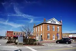 Courthouse Square in Livingston | |
 Location of Livingston in Overton County, Tennessee. | |
| Coordinates: 36°23′13″N 85°19′32″W | |
| Country | United States |
| State | Tennessee |
| County | Overton |
| Founded | 1833[1] |
| Incorporated | 1907[2] |
| Named for | Edward Livingston |
| Area | |
| • Total | 6.53 sq mi (16.91 km2) |
| • Land | 6.51 sq mi (16.86 km2) |
| • Water | 0.02 sq mi (0.06 km2) |
| Elevation | 1,027 ft (313 m) |
| Population (2010) | |
| • Total | 4,058 |
| • Estimate (2019)[4] | 4,049 |
| • Density | 622.16/sq mi (240.20/km2) |
| Time zone | UTC-6 (Central (CST)) |
| • Summer (DST) | UTC-5 (CDT) |
| ZIP code | 38570 |
| Area code(s) | 931 |
| FIPS code | 47-43140[5] |
| GNIS feature ID | 1291738[6] |
| Website | www |
Livingston is part of the Cookeville, Tennessee Micropolitan Statistical Area.
History
Livingston was named after Edward Livingston (1764–1836), who served as Secretary of State under President Andrew Jackson. In 1833, in a close and controversial election, the residents of Overton County voted to move the county seat from the town of Monroe to Livingston.[7]
Geography
Livingston is located at 36°23′13″N 85°19′32″W (36.386942, -85.325568),[8] approximately 15 miles north by northeast of Cookeville.
According to the United States Census Bureau, the town has a total area of 5.2 square miles (13 km2), of which 5.1 square miles (13 km2) is land and 0.04 square miles (0.10 km2) (0.77%) is water. Elevation in the town ranges from 1,027 ft (313 m) to 1700 ft (518.16 m)
Demographics
| Historical population | |||
|---|---|---|---|
| Census | Pop. | %± | |
| 1850 | 881 | — | |
| 1860 | 268 | −69.6% | |
| 1870 | 240 | −10.4% | |
| 1880 | 312 | 30.0% | |
| 1890 | 320 | 2.6% | |
| 1910 | 1,421 | — | |
| 1920 | 1,215 | −14.5% | |
| 1930 | 1,526 | 25.6% | |
| 1940 | 1,527 | 0.1% | |
| 1950 | 2,082 | 36.3% | |
| 1960 | 2,817 | 35.3% | |
| 1970 | 3,050 | 8.3% | |
| 1980 | 3,372 | 10.6% | |
| 1990 | 3,809 | 13.0% | |
| 2000 | 3,498 | −8.2% | |
| 2010 | 4,058 | 16.0% | |
| 2019 (est.) | 4,049 | [4] | −0.2% |
| Sources:[9][10] | |||
As of the census[5] of 2000, there were 3,498 people, 1,543 households, and 924 families residing in the town. The population density was 680.1 people per square mile (262.8/km2). There were 1,746 housing units at an average density of 339.5 per square mile (131.2/km2). The racial makeup of the town was 88.08% White, 0.60% African American, 5.29% Native American, 0.17% Asian, 0.14% Pacific Islander, 0.14% from other races, and 0.57% from two or more races. Hispanic or Latino of any race were 5.31% of the population.
Of the 1,543 households, 22.9% had children under the age of 18 living with them, 42.3% were married couples living together, 14.2% had a female householder with no husband present, and 40.1% were non-families. 37.1% of all households were made up of individuals, and 18.1% had someone living alone who was 65 years of age or older. The average household size was 2.15 and the average family size was 2.80.
The population was 20.0% under the age of 18, 8.6% from 18 to 24, 24.3% from 25 to 44, 23.8% from 45 to 64, and 23.2% who were 65 years of age or older. The median age was 43 years. For every 100 females, there were 83.1 males. For every 100 females age 18 and over, there were 77.5 males.
The median income for a household in the town was $23,309, and the median income for a family was $34,141. Males had a median income of $25,183 versus $20,991 for females. The per capita income for the town was $15,558. About 14.4% of families and 19.3% of the population were below the poverty line, including 32.7% of those under age 18 and 20.0% of those age 65 or over.
Education
Livingston is currently home to five schools: Livingston Academy (9-12), Livingston Middle School (5-8), and A.H. Roberts Elementary School (K-4). Livingston is home to a branch campus of the Tennessee College of Applied Technology and a satellite campus of Volunteer State Community College.
Notable people
- Michael J. McCulley, U.S. Astronaut
- Albert H. Roberts, former Governor of Tennessee
- Roy Roberts, Blues artist
References
- Livingston website Archived 2007-07-15 at the Wayback Machine. Retrieved: 16 January 2013.
- Tennessee Blue Book, 2005-2006, pp. 618-625.
- "2019 U.S. Gazetteer Files". United States Census Bureau. Retrieved July 30, 2020.
- "Population and Housing Unit Estimates". United States Census Bureau. May 24, 2020. Retrieved May 27, 2020.
- "U.S. Census website". United States Census Bureau. Retrieved 2008-01-31.
- "US Board on Geographic Names". United States Geological Survey. 2007-10-25. Retrieved 2008-01-31.
- The Federal Writers' Project, The WPA Guide to Tennessee (Knoxville, Tenn.: University of Tennessee Press, 1986), 508.
- "US Gazetteer files: 2010, 2000, and 1990". United States Census Bureau. 2011-02-12. Retrieved 2011-04-23.
- "Census of Population and Housing: Decennial Censuses". United States Census Bureau. Retrieved 2012-03-04.
- "Incorporated Places and Minor Civil Divisions Datasets: Subcounty Resident Population Estimates: April 1, 2010 to July 1, 2012". Population Estimates. U.S. Census Bureau. Archived from the original on 17 June 2013. Retrieved 11 December 2013.
External links
| Wikimedia Commons has media related to Livingston, Tennessee. |
- Livingston, Tennessee — official site
- Livingston Academy
- Overton County Schools
- Livingston Enterprise
- Overton County News
Municipalities and communities of Overton County, Tennessee, United States | ||
|---|---|---|
| Town | ||
| Unincorporated communities | ||
| ||
| Authority control |
|---|