Lough Marrave
Lough Marrave (Irish: Loch Marbh, meaning "Dead lake")[3] is a small freshwater lake in county Leitrim in the northwest of Ireland.
| Lough Marrave | |
|---|---|
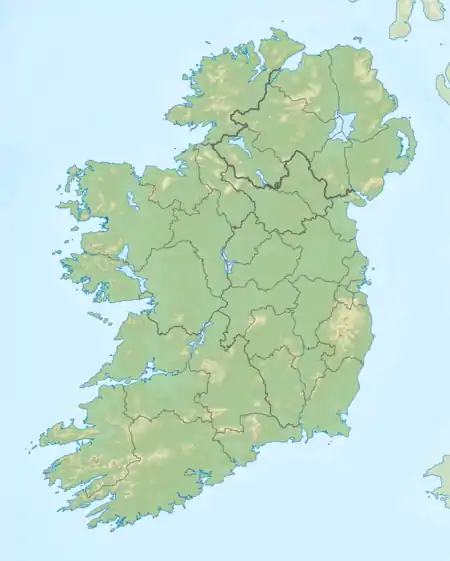 Location in Ireland | |
| Location | County Leitrim |
| Coordinates | 54°02′N 7°56′W |
| Lake type | Freshwater |
| Native name | Loch Marbh (Irish) |
| Primary inflows | Shannon–Erne Waterway |
| Primary outflows | Shannon–Erne Waterway |
| Basin countries | Ireland |
| Surface area | 0.1 km2 (0.039 sq mi) est. |
| Max. depth | 4 m (13 ft) est. |
| Surface elevation | 62 m (203 ft) est. |
| References | [1][2] |
Etymology
(Irish: Loch Marbh) translates to "the dead lake, or lake of death".[3] It is plausible Lough Marrave served a pagan sacrificial purpose, and the Keshcarrigan Bowl was deposited there as a ritual offering. There is a reference in the "Book of Fenagh" to an unidentified and "Irish: Inbher, meaning "cursed estuary, pool, or lake"" on the "road to Fenagh", with a marginal note attributed to Tadgh O'Roddy (flourit 1700) adding: "no fish was afterwards caught in it; for they (the fishes) cannot even live in that lake".[4] Nevertheless, the origin of the "Dead lake" etymology remains speculative and unknown.
Geography
Lough Marrave lies 1 kilometre (0.6 mi) north east of Keshcarrigan village, and 500 metres (1,640.4 ft) east of Lough Scur. The lake is very small and shallow, covering a surface-area of about 0.1 square kilometres (0.0 sq mi), and might be considered a continuation of Lough Scur, as they share the same level and connected by a half-mile channel.[1] Lough Marrave is connected to St. John's Lough and Lough Scur by the Shannon–Erne Waterway.
Ecology
The presence, and type, of fish found in Lough Marrave is not recorded. The ecology of Leitrim waterways, such as Lough Marrave, is threatened by zebra mussel and other invasive species.[5]
Human settlement
The primary human settlements at Lough Marrave are Keshcarrigan and Fenagh villages. Lough Marrave is bounded by the townlands of Gubroe to the south and east, Killmacsherwell to the north, and Rossy to the west.[6]
Heritage
The Keshcarrigan Bowl was discovered in the canal between Lough Scur and Lough Marrave in the 19th century, c. 1843 – c. 1852, and is today preserved at the National Museum of Ireland.[7]
See also
- List of loughs in Ireland
- Keshcarrigan
- Castlefore Lough
- Keshcarrigan Lough
References and notes
Notes
Citations
- MacMahon 1845, pp. 22.
- Haug 2013, pp. 53.
- logainm.ie, pp. Loch Marbh.
- Ó Donnabháin 1828, pp. 181.
- Pedreschi, Kelly-Quinn, Caffrey, O’Grady, Mariani, Phillimore 2014.
- townlands.ie.
- Mulvany, Fraser, Roberts, Mulvany, O'Flaherty 1852, pp. lix.
Primary references
- MacMahon, John (1845). Correspondance relative to the navigation between Lough Erne and the River Shannon (Report). Parliamentary Papers, House of Commons and Command, Volume 45 (Digitized 2006 from original in Harvard University ed.). H.M. Stationery Office.CS1 maint: ref=harv (link)
- logainm.ie. "Loch Marbh/Lough Marrave".CS1 maint: ref=harv (link)
- Haug, Per Ivar (2013). "Gazetteer of Ireland". Til Opplysning, A series of papers from the University Library in Trondheim, Nummer 16 (Third ed.). Hommelvik: UBiT, Universitetsbiblioteket i Trondheim. Cite journal requires
|journal=(help)CS1 maint: ref=harv (link)
Secondary references
- Ó Donnabháin, Sean (1828). Book of Fenagh, Translation and Copious Notes (PDF). Fenagh, Leitrim, Ireland: Maolmhordha Mac Dubhghoill Uí Raghailligh. Retrieved 20 August 2016.CS1 maint: ref=harv (link)
- Pedreschi, D.; Kelly-Quinn, M.; Caffrey, J; O'Grady, M.; Mariani, S.; Phillimore, A. (2014), "Genetic structure of pike (Esox lucius) reveals a complex and previously unrecognized colonization history of Ireland", Journal of Biogeography, Journal of Biogeography, 41(3), 548–560., 41 (3): 548–560, doi:10.1111/jbi.12220, PMID 25435649, S2CID 13486116CS1 maint: ref=harv (link)
- Mulvany, W. T.; Fraser, William; Roberts, Samuel; Mulvany, Thomas J.; O'Flaherty, John (1852). Appendix No. V: Notices of Antiquities Presented to the Royal Irish Academy by W. T. Mulvany, Esq., M. R. I. A., on the Part of the Commissioners of Public Works. Proceedings of the Royal Irish Academy (Report). 5 (1850 - 1853). Royal Irish Academy. pp. xxxi–lxvi. JSTOR 20489812.CS1 maint: ref=harv (link)
External links
- townlands.ie. "Rossy Townland, Co. Leitrim".CS1 maint: ref=harv (link)
Places in County Leitrim | ||
|---|---|---|
| Towns | 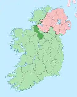 | |
| Villages | ||
| Townlands | ||
| Loughs | ||
| Mountains | ||
| Baronies | ||
| Parishes | ||
| ||
