Mae Lan District
Mae Lan (Thai: แม่ลาน, pronounced [mɛ̂ː lāːn]) is a district (amphoe) of Pattani Province, southern Thailand.
Mae Lan
แม่ลาน | |
|---|---|
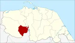 District location in Pattani Province | |
| Coordinates: 6°39′39″N 101°14′23″E | |
| Country | Thailand |
| Province | Pattani |
| Seat | Mae Lan |
| Area | |
| • Total | 89.2 km2 (34.4 sq mi) |
| Population (2005) | |
| • Total | 14,863 |
| • Density | 166.6/km2 (431/sq mi) |
| Time zone | UTC+7 (ICT) |
| Postal code | 94180 |
| Geocode | 9412 |
History
The minor district (king amphoe) Mae Lan was formed on 1 April 1989 by splitting off three tambons from Khok Pho District.[1] On 7 September 1995, it was upgraded to a full district.[2]
As of 2018, the provisions of Thailand's Internal Security Act remain imposed on Mae Lan District. Internal security restrictions, maintained by Thailand's Internal Security Operations Command (ISOC) can result in curfews, prohibited entry, or prohibited transport of goods. It is considered one step below the imposition of full martial law.[3]
Geography
Neighboring districts are (from the west clockwise): Khok Pho, Nong Chik, and Yarang of Pattani Province; and Mueang Yala of Yala Province.
Administration
The district is divided into three sub-districts (tambons), which are further subdivided into 22 villages (mubans). There are no municipal (thesaban) areas. There are three tambon administrative organizations (TAO).
| No. | Name | Thai name | Villages | Pop. | |
|---|---|---|---|---|---|
| 1. | Mae Lan | แม่ลาน | 8 | 3,682 | |
| 2. | Muang Tia | ม่วงเตี้ย | 9 | 5,436 | |
| 3. | Pa Rai | ป่าไร่ | 10 | 5,745 |
References
- ประกาศกระทรวงมหาดไทย เรื่อง แบ่งท้องที่อำเภอโคกโพธิ์ จังหวัดปัตตานี ตั้งเป็นกิ่งอำเภอแม่ลาน (PDF). Royal Gazette (in Thai). 106 (40 ง): 1888. March 14, 1989.
- พระราชกฤษฎีกาตั้งอำเภอด่านมะขามเตี้ย อำเภอแก่งหางแมว อำเภอภักดีชุมพล อำเภอเวียงแก่น อำเภอแม่วาง อำเภอถ้ำพรรณรา อำเภอบ่อเกลือ อำเภอโนนสุวรรณ อำเภอห้วยราช อำเภอแม่ลาน อำเภอบางแก้ว อำเภอป่าพะยอม อำเภอหนองม่วงไข่ อำเภอยางสีสุราช อำเภอจังหาร อำเภอบ้านธิ อำเภอภูสิงห์ อำเภอบางกล่ำ อำเภอวังม่วง และอำเภอนายูง พ.ศ. ๒๕๓๘ (PDF). Royal Gazette (in Thai). 112 (32 ก): 1–3. August 8, 1995.
- Raksaseri, Kornchanok (8 January 2018). "Isoc power boost 'not political'". Bangkok Post. Retrieved 8 January 2018.