Yaring District
Yaring (Thai: ยะหริ่ง, pronounced [já(ʔ).rìŋ]) is a district (amphoe) of Pattani Province, southern Thailand. The Thai name is a corruption of the Malay Jaring (Jawi: جاريڠ).
Yaring
ยะหริ่ง | |
|---|---|
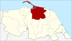 District location in Pattani Province | |
| Coordinates: 6°51′59″N 101°22′9″E | |
| Country | Thailand |
| Province | Pattani |
| Area | |
| • Total | 196.8 km2 (76.0 sq mi) |
| Population (2005) | |
| • Total | 77,941 |
| • Density | 396.0/km2 (1,026/sq mi) |
| Time zone | UTC+7 (ICT) |
| Postal code | 94150 |
| Geocode | 9409 |
Geography
Neighboring districts are (from the east clockwise): Panare, Mayo, Yarang, and Mueang Pattani. To the north is the Gulf of Thailand.
Administration
The district is divided into 18 sub-districts (tambons), which are further subdivided into 81 villages (mubans). There are three townships (thesaban tambons) in the district. Bang Pu covers tambon Bang Pu, Yaring parts of tambon Ya Mu, and Than Yong part of tambon Manang Yong. There are a further 13 tambon administrative organizations (TAO).
| No. | Name | Thai name | Villages | Pop. | |
|---|---|---|---|---|---|
| 1. | Talo | ตะโละ | 5 | 2,928 | |
| 2. | Talo Kapo | ตะโละกาโปร์ | 5 | 7,470 | |
| 3. | Tanyong Dalo | ตันหยงดาลอ | 5 | 3,144 | |
| 4. | Tanyong Chueng-nga | ตันหยงจึงงา | 2 | 1,685 | |
| 5. | Tolang | ตอหลัง | 3 | 2,656 | |
| 6. | Ta Kae | ตาแกะ | 4 | 3,874 | |
| 7. | Tali-ai | ตาลีอายร์ | 4 | 3,735 | |
| 8. | Yamu | ยามู | 5 | 8,434 | |
| 9. | Bang Pu | บางปู | 3 | 9,269 | |
| 10. | Nong Raet | หนองแรต | 6 | 3,158 | |
| 11. | Piya Mumang | ปิยามุมัง | 5 | 3,290 | |
| 12. | Pula Kong | ปุลากง | 4 | 1,834 | |
| 13. | Baloi | บาโลย | 4 | 2,420 | |
| 14. | Saban | สาบัน | 5 | 2,532 | |
| 15. | Manang Yong | มะนังยง | 5 | 5,187 | |
| 16. | Rata Panyang | ราตาปันยัง | 5 | 3,965 | |
| 17. | Charang | จะรัง | 7 | 4,366 | |
| 18. | Laem Pho | แหลมโพธิ์ | 4 | 7,994 |
External links
- amphoe.com (in Thai)
This article is issued from Wikipedia. The text is licensed under Creative Commons - Attribution - Sharealike. Additional terms may apply for the media files.