Mandi Bahauddin District
Mandi Bahauddin, also spelled Mandi Baha ud Din, (Punjabi and Urdu: ضلع منڈی بہاءالدین) is a district in the Punjab province of Pakistan. It is bordered on the northwest by the Jhelum River, on the southeast by the Chenab River (which separates it from Gujranwala District and Gujrat District), and on the southwest by the Sargodha District. The district has an area of 2,673 square kilometres (1,032 sq mi). Mandi district currently has 1.5 million population.
Mandi-Bahauddin District
ضلع منڈی بہاءالدین | |
|---|---|
 Map of Punjab with Mandi-Bahauddin District highlighted | |
| Coordinates: 32°35′N 73°30′E | |
| Country | Pakistan |
| Province | Punjab |
| Division | Gujranwala Division |
| Headquarters | Mandi Bahauddin |
| Government | |
| • Deputy Commissioner | Hafiz Shoukat |
| Area [1]:1 | |
| • Total | 2,673 km2 (1,032 sq mi) |
| Population (2017)[2] | |
| • Total | 1,593,292 |
| • Density | 600/km2 (1,500/sq mi) |
| Time zone | UTC+5 (PST) |
| Number of tehsils | 3 |
Administration
Mandi Bahauddin is subdivided into Three tehsils and 80 Union Councils:[3]
| Name of Tehsil | Number of Union Councils |
|---|---|
| Malakwal | 20 |
| Mandi Bahauddin | 30 |
| Phalia | 30 |
| Total | 80 |
Geography
The district forms a central portion of the Chaj Doab lying between the Jhelum and Chenab rivers. It lies from 30° 8' to 32° 40' N and 73° 36' to 73° 37' E. The tehsil headquarters towns of Phalia and Malikwal are 22.5 and 28.5 kilometres (14.0 and 17.7 mi) from Mandi Bahauddin, respectively. It is bounded on the north by the Jhelum river, which separates it from Jehlam district; on the west by Sargodha district; on the south by the river Chenab (which separates it from the Gujranwala and Hafizabad districts); and on the east by Gujrat district. The total area of the district is 2,673 square kilometres (1,032 sq mi). The district comprises the Mandi Bahauddin, Phalia, and Malikwal tehsils.
Demography and language
According to the 1998 Pakistan census, the population of the district was 1,160,552, 14.93% of which lived in urban environments.[4]
Punjabi is the first language[5] of 97% of the population, and Urdu – of 2.5%.[1]:27 still everyone can speak Urdu easily.
Climate
This district has a moderate climate, hot in summer and cold in winter. During the peak of summer the temperature may rise to 48 °C (118 °F) during the day, but in the winter months the minimum temperature may fall below 3 °C (37 °F). The average rainfall in the district is 388 millimetres (15.3 in).[6] mainly resonates with weather from Islamabad
Notable residents
- Hasan Askari Rizvi, Chief Minister Punjab (Caretaker)
- Mustansar Hussain Tarar, Pakistani novelist, columnist, travel writer and TV host
- Naved Arif Gondal, Pakistani cricketer
- Pervaiz Mehdi Qureshi Ex Chief Of Pakistan Air Force
- Shaukat Ali folk singer
- Hasan Ali cricketer
- Mumtaz Ahmed Tarar, M.N.A Federal Minister of Human Rights (PML-N, Ex PPP)
- Hameeda Waheeduddin M.P.A Minister of Women Development Punjab (PML-N, Ex PLM-Q)
- Nasir Iqbal Bosal, M.N.A. Cousin of District Chairman Mandi Bahauddin (PML-N, Ex PLM-Q)
- Muhammad Tariq Tarar Ex M.N.A (PTI, Ex PPP)
- Pir Syed Muhammad Binyamin Rizvi Ex Minister of Punjab (PML-N)
- Basma Riaz Choudhry Ex M.P.A (PML-Q)
- Asif Bashir Bhagat Ex M.P.A (PPP)
References
- 1998 District Census report of Mandi Bahauddin. Census publication. 117. Islamabad: Population Census Organization, Statistics Division, Government of Pakistan. 2000.
- "DISTRICT WISE CENSUS RESULTS CENSUS 2017" (PDF). www.pbscensus.gov.pk. Archived from the original (PDF) on 29 August 2017. Retrieved 3 September 2017.
- "Tehsils & Unions in the District of Mandi Bahauddin". Archived from the original on 11 September 2016. Retrieved 2 September 2016.
- Population – Urban Resource Centre Archived 2006-05-13 at the Wayback Machine (1998 census details)
- "Mother tongue": defined as the language of communication between parents and children.
- "Average rainfall & Temperature in mandi bahauddin". World Weather. Retrieved 25 October 2013.
Provincial capital: Lahore | ||
| Divisions | Districts | 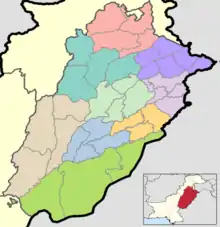 |
| Bahawalpur | ||
| Dera Ghazi Khan | ||
| Faisalabad | ||
| Gujranwala | ||
| Lahore | ||
| Multan | ||
| Rawalpindi | ||
| Sahiwal | ||
| Sargodha | ||