Manghai
Manghai (simplified Chinese: 芒海镇; traditional Chinese: 芒海鎮; pinyin: Mánghǎi Zhèn) is a town in Mangshi, Yunnan, China. As of the 2017 census it had a population of 6,777 and an area of 105-square-kilometre (41 sq mi). It is surrounded by Zhefang Town on the northwest, Mengga Town and Dongshan Township on the east, and Myanmar on the south.[1][2]
Manghai Town
芒海镇 | |
|---|---|
 The Government building of Manghai. | |
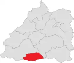 Location of the town region in Mangshi | |
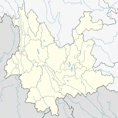 Manghai Town Location in Yunnan | |
| Coordinates: 24.117449°N 98.317746°E | |
| Country | People's Republic of China |
| Province | Yunnan |
| Prefecture-level city | Dehong Dai and Jingpo Autonomous Prefecture |
| County-level city | Mangshi |
| Area | |
| • Total | 105 km2 (41 sq mi) |
| Population (2017) | |
| • Total | 6,777 |
| • Density | 65/km2 (170/sq mi) |
| Time zone | UTC+08:00 (China Standard) |
| Postal code | 678401 |
| Area code(s) | 0692 |
Administrative division
As of December 2015, the town is divided into 3 villages:
- Manghai (芒海村)
- Lüyin (吕尹村)
- Lainan (赖南村)
Geography
Climate
The town has a subtropical climate with an annual rainfall of 1,650-millimetre (65 in), a long sunshine time and an annual average temperature of 19.5 °C (67.1 °F). The highest elevation is 2,147-metre (7,044 ft) and the lowest is 870-metre (2,850 ft).
Economy
The economy is supported primarily by farming, ranching and frontier trade. The traditional industries are rice, tea, sugarcane, animal husbandry and tsao-ko. The emerging industries are walnut, coffee, macadamia nut and bamboo industry.[1]
Education
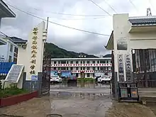
- Manghai Nine-year School
Transportation
The National Highway G320 passes across the town.
References
- 芒海镇基本情况. dhms.gov.cn (in Chinese). 2018-03-26.
- Lai Xinlin (2016-11-22). 芒海镇对面,缅甸一侧山区时有炮火硝烟. thepaper.cn (in Chinese).