Manokin Historic District
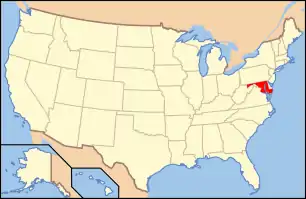
Manokin Historic District is a national historic district at Princess Anne, Somerset County, Maryland, United States, located at the mouth of the Manokin River. It consists of the Manokin settlement, which forms a unique and visually interesting area of great historical significance on the Lower Eastern Shore. These structures, Clifton, More and Case It, Almodington, Elmwood, and Homewood are most strongly linked together visually, culturally, and historically, although architecturally they span the period between the early 18th and the mid 20th centuries. Historically the structures are united by a tangled web of family interconnections. The continuous use of the properties for agriculture adds to the continuity of the intertwined historic associations. The vista from the district to the Chesapeake Bay or from the mouth of the Manokin River upstream remains unchanged from the 17th century.[2]
Manokin Historic District | |
  | |
| Location | Southwest of Princess Anne at the Manokin River, Princess Anne, Maryland |
|---|---|
| Coordinates | 38°9′16″N 75°47′22″W |
| Area | 2,700 acres (1,100 ha) |
| Architectural style | Georgian Revival |
| NRHP reference No. | 76001010[1] |
| Added to NRHP | June 29, 1976 |
It was added to the National Register of Historic Places in 1976.[1]
References
- "National Register Information System". National Register of Historic Places. National Park Service. July 9, 2010.
- Mrs. Norman Taylor (1974). "National Register of Historic Places Registration: Manokin Historic District" (PDF). Maryland Historical Trust. Retrieved 2016-03-01.
External links
- Manokin Historic District, Somerset County., including photo from 2002, at Maryland Historical Trust.
- Boundary Map of the Manokin Historic District, Somerset County, at Maryland Historical Trust.

