National Register of Historic Places listings in Kent County, Maryland
This is a list of the National Register of Historic Places listings in Kent County, Maryland.
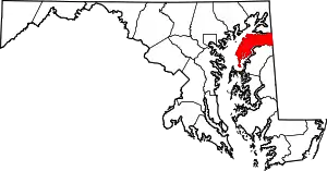
Location of Kent County in Maryland
This is intended to be a complete list of the properties and districts on the National Register of Historic Places in Kent County, Maryland, United States. Latitude and longitude coordinates are provided for many National Register properties and districts; these locations may be seen together in a map.[1]
There are 42 properties and districts listed on the National Register in the county, including 2 National Historic Landmarks.
| Allegany - Anne Arundel - Baltimore (city) - Baltimore County - Calvert - Caroline - Carroll - Cecil - Charles - Dorchester - Frederick - Garrett - Harford - Howard - Kent - Montgomery - Prince George's - Queen Anne's - Somerset - St. Mary's - Talbot - Washington - Wicomico - Worcester |
- This National Park Service list is complete through NPS recent listings posted February 5, 2021.[2]
Current listings
| [3] | Name on the Register[4] | Image | Date listed[5] | Location | City or town | Description |
|---|---|---|---|---|---|---|
| 1 | Airy Hill | 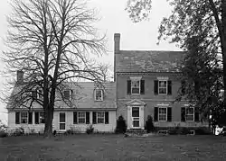 Airy Hill |
December 30, 1996 (#96001478) |
7909 Airy Hill Rd. 39°11′34″N 76°05′36″W |
Chestertown | |
| 2 | BERNICE J. (skipjack) | September 5, 1985 (#85001946) |
Town Dock 39°12′24″N 76°03′48″W |
Chestertown | ||
| 3 | Betterton Historic District | 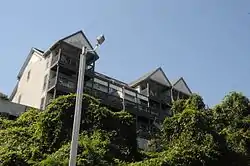 Betterton Historic District |
June 7, 1984 (#84001805) |
Roughly bounded by the Sassafras River, Gut Marsh, 6th, and Ericsson Aves. 39°22′02″N 76°03′47″W |
Betterton | |
| 4 | Brampton | 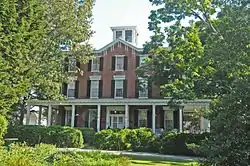 Brampton |
August 4, 1983 (#83002954) |
Maryland Route 20 39°12′43″N 76°05′44″W |
Chestertown | |
| 5 | Carvill Hall | 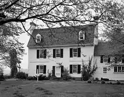 Carvill Hall |
March 14, 1973 (#73000930) |
Great Oak Estates, 10 miles west of Chestertown 39°15′34″N 76°12′06″W |
Chestertown | |
| 6 | Chestertown Armory |  Chestertown Armory |
September 25, 1985 (#85002668) |
Quaker Neck Rd. 39°12′10″N 76°04′06″W |
Chestertown | |
| 7 | Chestertown Historic District | 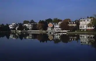 Chestertown Historic District |
April 15, 1970 ((original) 84001808 (increase) #70000263 (original) 84001808 (increase)) |
Roughly bounded by Maple Avenue, the Chester River, and Cannon and Cross Streets 39°12′29″N 76°03′52″W |
Chestertown | |
| 8 | Chestertown Railroad Station |  Chestertown Railroad Station |
December 8, 1982 (#82001597) |
Cross St. 39°12′28″N 76°04′08″W |
Chestertown | |
| 9 | Chesterville Brick House | 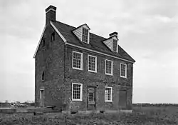 Chesterville Brick House |
July 17, 1979 (#79001139) |
Junction of Maryland Routes 290 and 444 39°16′36″N 75°54′57″W |
Chesterville | |
| 10 | Christ Church, Graveyard and Sexton's House | 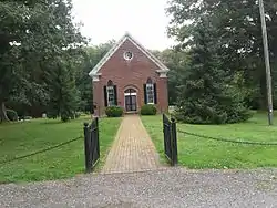 Christ Church, Graveyard and Sexton's House |
April 2, 1980 (#80001822) |
North of Worton on Maryland Route 298 39°17′26″N 76°05′32″W |
Worton | |
| 11 | Clark's Conveniency | 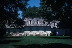 Clark's Conveniency |
September 9, 1975 (#75000906) |
2 miles south of Pomona on Quaker Neck Rd. 39°08′27″N 76°07′18″W |
Pomona | |
| 12 | Denton House | 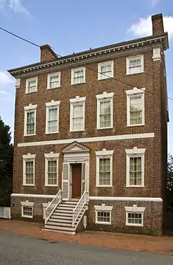 Denton House |
March 11, 1971 (#71000377) |
107 Water St. 39°12′29″N 76°03′47″W |
Chestertown | |
| 13 | ELSWORTH |  ELSWORTH |
May 16, 1985 (#85001088) |
Gibsontown Rd. 38°42′46″N 76°19′53″W |
Tilghman | |
| 14 | Fairlee Manor Camp House | 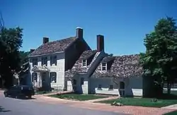 Fairlee Manor Camp House |
April 11, 1973 (#73000931) |
1.5 miles west of Fairlee off Maryland Route 445 39°14′33″N 76°12′12″W |
Fairlee | |
| 15 | Gobbler Hill |  Gobbler Hill |
December 23, 2009 (#09001149) |
10121 Fairlee Rd. 39°14′33″N 76°12′12″W |
Chestertown | |
| 16 | Godlington Manor | 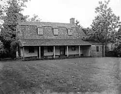 Godlington Manor |
February 11, 1972 (#72000583) |
Wilkins Lane 39°10′42″N 76°03′27″W |
Chestertown | |
| 17 | George Harper Store | 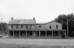 George Harper Store |
July 9, 1982 (#82002816) |
Maryland Route 292 and Main St. 39°19′38″N 76°02′41″W |
Still Pond | |
| 18 | Hebron | 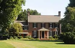 Hebron |
September 18, 1978 (#78001471) |
Southeast of Still Pond off Maryland Route 292 39°19′23″N 76°02′24″W |
Still Pond | |
| 19 | Hinchingham | 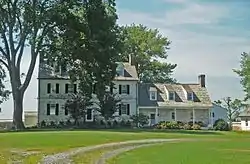 Hinchingham |
September 5, 1975 (#75000907) |
North of Rock Hall off Maryland Route 445 39°11′40″N 76°14′56″W |
Rock Hall | |
| 20 | Hopeful Unity | 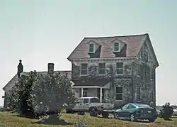 Hopeful Unity |
August 18, 2015 (#15000526) |
25789 Lambs Meadow Rd. 39°17′38″N 76°04′29″W |
Worton | |
| 21 | ISLAND IMAGE (log canoe) | September 18, 1985 (#85002248) |
Walnut Point Rd. 39°10′11″N 76°03′46″W |
Chestertown | ||
| 22 | Knocks Folly | 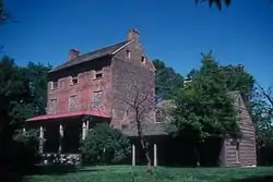 Knocks Folly |
June 17, 1976 (#76001006) |
North of Kennedyville on Maryland Route 298 39°21′06″N 75°59′04″W |
Kennedyville | |
| 23 | Lauretum |  Lauretum |
September 4, 1997 (#97000926) |
954 High St. 39°13′10″N 76°05′08″W |
Chestertown | |
| 24 | NELLIE CROCKETT | April 19, 1994 (#94001185) |
Sassafras River 39°21′47″N 75°52′55″W |
Georgetown | ||
| 25 | Piney Grove | December 8, 2020 (#100005962) |
7281 Wilkins Ln. 39°10′39″N 76°04′26″W |
Chestertown | ||
| 26 | Radcliffe Mill | 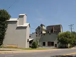 Radcliffe Mill |
December 27, 2006 (#06001165) |
860 High St. 39°13′09″N 76°04′49″W |
Chestertown | |
| 27 | Reward-Tilden's Farm | 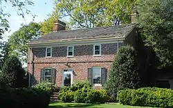 Reward-Tilden's Farm |
May 6, 1976 (#76001004) |
South of Chestertown, off Maryland Route 289 on Walnut Point Rd. 39°09′08″N 76°08′39″W |
Chestertown | |
| 28 | Rich Hill | 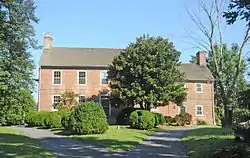 Rich Hill |
December 15, 1972 (#72000585) |
Maryland Route 299 39°22′07″N 75°48′27″W |
Sassafras | |
| 29 | Rose Hill | 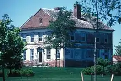 Rose Hill |
December 12, 1976 (#76001005) |
2 miles north of Chestertown on Maryland Route 213 39°14′54″N 76°03′48″W |
Chestertown | |
| 30 | St. Paul's Church | 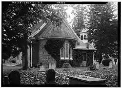 St. Paul's Church |
June 6, 1980 (#80001820) |
Sandy Bottom Rd. and Ricaud's Branch-Lankford Rd. 39°11′11″N 76°10′47″W |
Fairlee | |
| 31 | Shepherd's Delight | 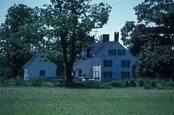 Shepherd's Delight |
June 17, 1976 (#76001007) |
South of Still Pond on Maryland Route 292 39°17′58″N 76°02′22″W |
Still Pond | |
| 32 | Shrewsbury Church | 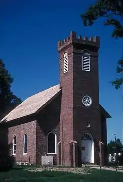 Shrewsbury Church |
June 4, 1986 (#86001245) |
Shrewsbury Ln. 39°19′44″N 75°58′03″W |
Kennedyville | |
| 33 | SILVER HEEL (log canoe) |  SILVER HEEL (log canoe) |
September 18, 1985 (#85002249) |
Quaker Neck Landing 39°07′45″N 76°05′50″W |
Chestertown | |
| 34 | Still Pond Historic District | 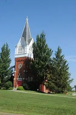 Still Pond Historic District |
August 26, 2009 (#09000645) |
Still Pond Road, Old Still Pond Road, Main Street, Medders Road, Maple Avenue, Trustee Street 39°19′42″N 76°03′55″W |
Still Pond | |
| 35 | Charles Sumner Post No. 25, Grand Army of the Republic |  Charles Sumner Post No. 25, Grand Army of the Republic |
July 6, 2005 (#05000655) |
206 S. Queen St. 39°12′24″N 76°04′00″W |
Chestertown | |
| 36 | Thornton |  Thornton |
December 23, 2005 (#05001428) |
10618 Perkins Hill Rd. 39°16′20″N 76°01′11″W |
Chestertown | |
| 37 | Trumpington | 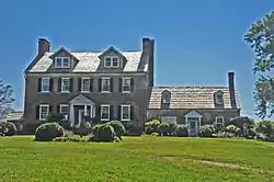 Trumpington |
November 10, 1980 (#80001821) |
South of Rock Hall on Maryland Route 445 39°03′47″N 76°13′39″W |
Rock Hall | |
| 38 | Valley Cottage | 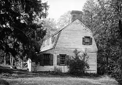 Valley Cottage |
January 11, 1983 (#83002955) |
Princess Stop St. 39°21′37″N 75°52′51″W |
Georgetown | |
| 39 | Washington College: Middle, East and West Halls |  Washington College: Middle, East and West Halls |
September 6, 1979 (#79001138) |
Washington Ave., Washington College campus 39°13′02″N 76°04′05″W |
Chestertown | |
| 40 | White House Farm | 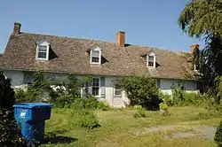 White House Farm |
March 12, 1992 (#92000080) |
Maryland Route 213 southwest of its junction with Maryland Route 292 39°17′00″N 76°01′11″W |
Chestertown | |
| 41 | Widehall | 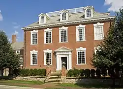 Widehall |
October 31, 1972 (#72000584) |
101 Water St. 39°12′27″N 76°03′50″W |
Chestertown | |
| 42 | Woodland Hall | 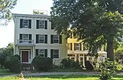 Woodland Hall |
December 10, 2008 (#07001287) |
13111 Shallcross Wharf Road 39°20′02″N 75°56′19″W |
Kennedyville |
See also
| Wikimedia Commons has media related to National Register of Historic Places in Kent County, Maryland. |
References
- The latitude and longitude information provided in this table was derived originally from the National Register Information System, which has been found to be fairly accurate for about 99% of listings. Some locations in this table may have been corrected to current GPS standards.
- "National Register of Historic Places: Weekly List Actions". National Park Service, United States Department of the Interior. Retrieved on February 5, 2021.
- Numbers represent an alphabetical ordering by significant words. Various colorings, defined here, differentiate National Historic Landmarks and historic districts from other NRHP buildings, structures, sites or objects.
- "National Register Information System". National Register of Historic Places. National Park Service. April 24, 2008.
- The eight-digit number below each date is the number assigned to each location in the National Register Information System database, which can be viewed by clicking the number.
| Topics | 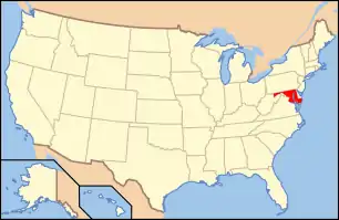 | |
|---|---|---|
| Lists by county | ||
| Lists by city | ||
| Other lists | ||
| ||
Municipalities and communities of Kent County, Maryland, United States | ||
|---|---|---|
| Towns | | |
| CDPs | ||
| Unincorporated communities | ||
| Footnotes | ‡This populated place also has portions in an adjacent county or counties | |
| ||
This article is issued from Wikipedia. The text is licensed under Creative Commons - Attribution - Sharealike. Additional terms may apply for the media files.