Manteigas
Manteigas (Portuguese pronunciation: [mɐ̃ˈtɐjɣɐʃ] (![]() listen)) is a town and a municipality in Portugal. The population in 2011 was 3,430,[1] in an area of 121.98 km².[2]
listen)) is a town and a municipality in Portugal. The population in 2011 was 3,430,[1] in an area of 121.98 km².[2]
Manteigas | |
|---|---|
 | |
 Flag  Coat of arms | |
 | |
| Coordinates: 40°24′N 7°32′W | |
| Country | |
| Region | Centro |
| Intermunic. comm. | Beiras e Serra da Estrela |
| District | Guarda |
| Parishes | 4 |
| Government | |
| • President | Esmeraldo Carvalhinho (PS) |
| Area | |
| • Total | 121.98 km2 (47.10 sq mi) |
| Population (2011) | |
| • Total | 3,430 |
| • Density | 28/km2 (73/sq mi) |
| Time zone | UTC±00:00 (WET) |
| • Summer (DST) | UTC+01:00 (WEST) |
| Local holiday | March 4 |
| Website | http://www.cm-manteigas.pt |
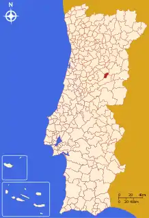
The municipality is located in Guarda District; in Centro Region and Beira Interior Norte Subregion. It is located in the Serra da Estrela Mountains, the highest elevation in mainland Portugal. Cities nearby: Guarda, Seia, Gouveia and Covilhã.
The municipal holiday is March 4.
Climate
| Climate data for Manteigas, elevation: 799 m or 2,621 ft | |||||||||||||
|---|---|---|---|---|---|---|---|---|---|---|---|---|---|
| Month | Jan | Feb | Mar | Apr | May | Jun | Jul | Aug | Sep | Oct | Nov | Dec | Year |
| Average high °C (°F) | 8.2 (46.8) |
9.8 (49.6) |
12.0 (53.6) |
14.8 (58.6) |
17.5 (63.5) |
22.9 (73.2) |
26.2 (79.2) |
26.5 (79.7) |
22.6 (72.7) |
17.3 (63.1) |
11.7 (53.1) |
8.6 (47.5) |
16.5 (61.7) |
| Daily mean °C (°F) | 5.2 (41.4) |
6.2 (43.2) |
8.3 (46.9) |
10.5 (50.9) |
13.0 (55.4) |
17.7 (63.9) |
20.4 (68.7) |
20.7 (69.3) |
17.7 (63.9) |
13.4 (56.1) |
8.4 (47.1) |
5.6 (42.1) |
12.3 (54.1) |
| Average low °C (°F) | 2.3 (36.1) |
2.6 (36.7) |
4.6 (40.3) |
6.2 (43.2) |
8.5 (47.3) |
12.5 (54.5) |
14.7 (58.5) |
15.0 (59.0) |
12.9 (55.2) |
9.5 (49.1) |
5.2 (41.4) |
2.7 (36.9) |
8.1 (46.5) |
| Average rainfall mm (inches) | 188 (7.4) |
173 (6.8) |
127 (5.0) |
100 (3.9) |
85 (3.3) |
57 (2.2) |
12 (0.5) |
12 (0.5) |
52 (2.0) |
117 (4.6) |
168 (6.6) |
143 (5.6) |
1,234 (48.4) |
| Source: climate-data.org[3] | |||||||||||||
| Climate data for Penhas Douradas, Manteigas, elevation: 1,380 m or 4,530 ft, 1981-2010 normals and 1971-2000 extremes | |||||||||||||
|---|---|---|---|---|---|---|---|---|---|---|---|---|---|
| Month | Jan | Feb | Mar | Apr | May | Jun | Jul | Aug | Sep | Oct | Nov | Dec | Year |
| Record high °C (°F) | 16.4 (61.5) |
17.8 (64.0) |
20.3 (68.5) |
22.9 (73.2) |
24.9 (76.8) |
31.0 (87.8) |
32.6 (90.7) |
33.2 (91.8) |
32.1 (89.8) |
32.1 (89.8) |
24.4 (75.9) |
16.8 (62.2) |
33.2 (91.8) |
| Average high °C (°F) | 6.1 (43.0) |
7.0 (44.6) |
9.5 (49.1) |
10.4 (50.7) |
13.5 (56.3) |
19.1 (66.4) |
22.6 (72.7) |
23.0 (73.4) |
19.4 (66.9) |
13.4 (56.1) |
9.1 (48.4) |
7.0 (44.6) |
13.3 (56.0) |
| Daily mean °C (°F) | 3.2 (37.8) |
3.8 (38.8) |
5.9 (42.6) |
6.7 (44.1) |
9.7 (49.5) |
14.9 (58.8) |
17.9 (64.2) |
18.2 (64.8) |
15.2 (59.4) |
10.1 (50.2) |
6.3 (43.3) |
4.1 (39.4) |
9.7 (49.4) |
| Average low °C (°F) | 0.3 (32.5) |
0.7 (33.3) |
2.3 (36.1) |
3.0 (37.4) |
5.9 (42.6) |
10.6 (51.1) |
13.3 (55.9) |
13.3 (55.9) |
11.0 (51.8) |
6.8 (44.2) |
3.5 (38.3) |
1.3 (34.3) |
6.0 (42.8) |
| Record low °C (°F) | −11.2 (11.8) |
−10 (14) |
−10.2 (13.6) |
−6.1 (21.0) |
−3.9 (25.0) |
−0.5 (31.1) |
3.3 (37.9) |
3.0 (37.4) |
−0.3 (31.5) |
−3.3 (26.1) |
−6.4 (20.5) |
−7.3 (18.9) |
−11.2 (11.8) |
| Average precipitation mm (inches) | 187.8 (7.39) |
143.1 (5.63) |
103.3 (4.07) |
139.8 (5.50) |
108.3 (4.26) |
48.8 (1.92) |
18.6 (0.73) |
21.8 (0.86) |
71.4 (2.81) |
194.8 (7.67) |
224.2 (8.83) |
248.5 (9.78) |
1,510.4 (59.45) |
| Average precipitation days (≥ 0.1 mm) | 14.1 | 13.8 | 11.9 | 14.8 | 14.0 | 9.0 | 4.7 | 3.6 | 8.2 | 13.4 | 13.8 | 15.2 | 136.5 |
| Average relative humidity (%) | 80 | 81 | 77 | 76 | 73 | 68 | 57 | 55 | 63 | 75 | 79 | 78 | 72 |
| Mean monthly sunshine hours | 126.1 | 129.1 | 185.0 | 172.8 | 226.2 | 275.9 | 344.0 | 327.8 | 229.3 | 163.7 | 128.6 | 102.5 | 2,411 |
| Source 1: Instituto de Meteorologia (normals and precipitation)[4] | |||||||||||||
| Source 2: Instituto de Meteorologia (extremes, precipitation days and sunshine hours)[5] | |||||||||||||
Parishes
Administratively, the municipality is divided into 4 civil parishes (freguesias):[6]
- Sameiro
- Santa Maria (Town of Manteigas)
- São Pedro (Town of Manteigas)
- Vale de Amoreira
See also
References
- Instituto Nacional de Estatística
- "Áreas das freguesias, concelhos, distritos e país". Archived from the original on 2018-11-05. Retrieved 2018-11-05.
- "Manteigas Climate". climate-data.org.
- "Monthly Averages for Penhas Douradas (1981–2010)". Instituto de Meteorologia.
- "Monthly Averages for Penhas Douradas (1971–2000)" (PDF). Instituto de Meteorologia.
- Diário da República. "Law nr. 11-A/2013, page 552 67" (pdf) (in Portuguese). Retrieved 28 July 2014.
This article is issued from Wikipedia. The text is licensed under Creative Commons - Attribution - Sharealike. Additional terms may apply for the media files.