Mapleview, Minnesota
Mapleview is a city in Lansing Township, Mower County, Minnesota, United States. It is situated directly to the north of Austin's Oakwood Cemetery and can more or less be considered a suburb of Austin, although it is politically independent of it. The population was 176 at the 2010 census.[6] It was named for row of maple trees that once stood on the west side of town.

Mapleview | |
|---|---|
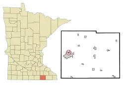 Location of Mapleview, Minnesota | |
| Coordinates: 43°41′19″N 92°58′35″W | |
| Country | United States |
| State | Minnesota |
| County | Mower |
| Area | |
| • Total | 0.19 sq mi (0.48 km2) |
| • Land | 0.19 sq mi (0.48 km2) |
| • Water | 0.00 sq mi (0.00 km2) |
| Elevation | 1,220 ft (372 m) |
| Population | |
| • Total | 176 |
| • Estimate (2019)[3] | 175 |
| • Density | 940.86/sq mi (362.34/km2) |
| Time zone | UTC-6 (Central (CST)) |
| • Summer (DST) | UTC-5 (CDT) |
| Area code(s) | 507 |
| FIPS code | 27-40346[4] |
| GNIS feature ID | 0647501[5] |
History
The village of Mapleview was incorporated in 1945 to provide facilities for about 100 families. In 1948 a plot of land north of town was purchased and this is where the liquor store, fire station, water tower, pump house and equipment garages were eventually built. In 1954 the city bought four acres along Murphy Creek and this became Hillside Park. The fire house was built in 1958 and is currently running 2 fire trucks and 17 volunteer fire fighters. Natural gas was made available to residents in 1962. Mapleview and city of Lyle, MN share Police protection though a police commission of 2 city council members from each city and Michael P. Langstaff as Police Commissioner.
Geography
According to the United States Census Bureau, the city has a total area of 0.18 square miles (0.47 km2), all of it land.[7]
County 45 serves as a main route in the community. Interstate Highway 90 and U.S. Highway 218 are nearby.
Demographics
| Historical population | |||
|---|---|---|---|
| Census | Pop. | %± | |
| 1950 | 435 | — | |
| 1960 | 381 | −12.4% | |
| 1970 | 328 | −13.9% | |
| 1980 | 253 | −22.9% | |
| 1990 | 206 | −18.6% | |
| 2000 | 189 | −8.3% | |
| 2010 | 176 | −6.9% | |
| 2019 (est.) | 175 | [3] | −0.6% |
| U.S. Decennial Census[8] | |||
2010 census
As of the census[2] of 2010, there were 176 people, 83 households, and 44 families residing in the city. The population density was 977.8 inhabitants per square mile (377.5/km2). There were 93 housing units at an average density of 516.7 per square mile (199.5/km2). The racial makeup of the city was 90.3% White, 1.7% Asian, 5.7% from other races, and 2.3% from two or more races. Hispanic or Latino of any race were 14.2% of the population.
There were 83 households, of which 22.9% had children under the age of 18 living with them, 33.7% were married couples living together, 9.6% had a female householder with no husband present, 9.6% had a male householder with no wife present, and 47.0% were non-families. 34.9% of all households were made up of individuals, and 7.2% had someone living alone who was 65 years of age or older. The average household size was 2.12 and the average family size was 2.64.
The median age in the city was 46.5 years. 15.9% of residents were under the age of 18; 12.5% were between the ages of 18 and 24; 19.8% were from 25 to 44; 36.5% were from 45 to 64; and 15.3% were 65 years of age or older. The gender makeup of the city was 54.5% male and 45.5% female.
2000 census
As of the census[4] of 2000, there were 189 people, 88 households, and 51 families residing in the city. The population density was 1,010.9 people per square mile (384.1/km2). There were 96 housing units at an average density of 513.5 per square mile (195.1/km2). The racial makeup of the city was 92.59% White, 3.17% Asian, 2.12% from other races, and 2.12% from two or more races. Hispanic or Latino of any race were 6.35% of the population.
There were 88 households, out of which 22.7% had children under the age of 18 living with them, 40.9% were married couples living together, 8.0% had a female householder with no husband present, and 42.0% were non-families. 35.2% of all households were made up of individuals, and 11.4% had someone living alone who was 65 years of age or older. The average household size was 2.15 and the average family size was 2.63.
In the city, the population was spread out, with 20.6% under the age of 18, 7.4% from 18 to 24, 30.2% from 25 to 44, 25.4% from 45 to 64, and 16.4% who were 65 years of age or older. The median age was 40 years. For every 100 females, there were 110.0 males. For every 100 females age 18 and over, there were 114.3 males.
The median income for a household in the city was $30,909, and the median income for a family was $30,625. Males had a median income of $29,000 versus $20,833 for females. The per capita income for the city was $16,884. About 4.5% of families and 12.8% of the population were below the poverty line, including none of those under the age of eighteen and 20.7% of those 65 or over.
References
- "2019 U.S. Gazetteer Files". United States Census Bureau. Retrieved July 26, 2020.
- "U.S. Census website". United States Census Bureau. Retrieved 2012-11-13.
- "Population and Housing Unit Estimates". United States Census Bureau. May 24, 2020. Retrieved May 27, 2020.
- "U.S. Census website". United States Census Bureau. Retrieved 2008-01-31.
- "US Board on Geographic Names". United States Geological Survey. 2007-10-25. Retrieved 2008-01-31.
- "2010 Census Redistricting Data (Public Law 94-171) Summary File". American FactFinder. United States Census Bureau. Retrieved 27 April 2011.
- "US Gazetteer files 2010". United States Census Bureau. Archived from the original on 2012-01-25. Retrieved 2012-11-13.
- "Census of Population and Housing". Census.gov. Retrieved June 4, 2015.
Further reading
- Mower County History Committee (1984). Mill on the Willow: A History of Mower County, Minnesota. Lake Mills, Iowa: Graphic Pub. Co. LCCN 84-062356. OCLC 13009348.
Municipalities and communities of Mower County, Minnesota, United States | ||
|---|---|---|
| Cities | 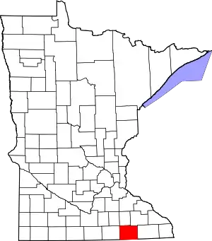 Map of Minnesota highlighting Mower County | |
| Townships | ||
| CDP | ||
| Unincorporated communities | ||
| Footnotes | ‡This populated place also has portions in adjacent county or counties | |
| ||
