Lyle, Minnesota
Lyle is a city in Mower County, Minnesota, United States. The city lies within a mile of the Iowa border, which also is its southern city limit. Lyle Township adjoins the city on its east, north, and west sides. The population was 551 at the 2010 census.[6]
City of Lyle | |
|---|---|
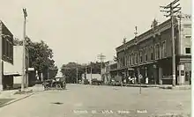
 Approaching Lyle from the north on U.S. Route 218 | |
| Nickname(s): Biggest little town on the border | |
| Motto(s): Our pride is showing! | |
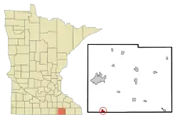 Location of Lyle within Mower County, Minnesota | |
| Coordinates: 43°30′19″N 92°56′38″W | |
| Country | United States |
| State | Minnesota |
| County | Mower |
| Established | 1854 |
| Incorporated | June 18, 1870 |
| Government | |
| • Type | Mayor - Council |
| • Mayor | Gary Harrison |
| Area | |
| • Total | 0.76 sq mi (1.97 km2) |
| • Land | 0.76 sq mi (1.97 km2) |
| • Water | 0.00 sq mi (0.00 km2) 0.0% |
| Elevation | 1,207 ft (367 m) |
| Population | |
| • Total | 551 |
| • Estimate (2019)[3] | 554 |
| • Density | 727.99/sq mi (281.07/km2) |
| Time zone | UTC-6 (CST) |
| • Summer (DST) | UTC-5 (CDT) |
| ZIP code | 55953 |
| Area code(s) | 507 |
| FIPS code | 27-38654[4] |
| GNIS feature ID | 0647318[5] |
| Website | www.lylemn.org |
Geography
According to the United States Census Bureau, the Lyle has a total area of 0.76 square miles (1.97 km2), all of it land.[7]
Demographics
| Historical population | |||
|---|---|---|---|
| Census | Pop. | %± | |
| 1880 | 182 | — | |
| 1890 | 306 | 68.1% | |
| 1900 | 488 | 59.5% | |
| 1910 | 552 | 13.1% | |
| 1920 | 505 | −8.5% | |
| 1930 | 453 | −10.3% | |
| 1940 | 513 | 13.2% | |
| 1950 | 609 | 18.7% | |
| 1960 | 607 | −0.3% | |
| 1970 | 522 | −14.0% | |
| 1980 | 576 | 10.3% | |
| 1990 | 504 | −12.5% | |
| 2000 | 566 | 12.3% | |
| 2010 | 551 | −2.7% | |
| 2019 (est.) | 554 | [3] | 0.5% |
| U.S. Decennial Census | |||
2010 census
As of the census[2] of 2010, there were 551 people, 220 households, and 147 families residing in the city. The population density was 725.0 inhabitants per square mile (279.9/km2). There were 235 housing units at an average density of 309.2 per square mile (119.4/km2). The racial makeup of the city was 98.2% White, 0.2% Native American, 0.2% from other races, and 1.5% from two or more races. Hispanic or Latino of any race were 0.7% of the population.
There were 220 households, of which 33.6% had children under the age of 18 living with them, 51.8% were married couples living together, 11.8% had a female householder with no husband present, 3.2% had a male householder with no wife present, and 33.2% were non-families. 30.5% of all households were made up of individuals, and 16% had someone living alone who was 65 years of age or older. The average household size was 2.50 and the average family size was 3.06.
The median age in the city was 36.3 years. 27.2% of residents were under the age of 18; 8.4% were between the ages of 18 and 24; 23.6% were from 25 to 44; 26.1% were from 45 to 64; and 14.7% were 65 years of age or older. The gender makeup of the city was 48.3% male and 51.7% female.
2000 census
As of the census[4] of 2000, there were 566 people, 211 households, and 148 families residing in the city. The population density was 733.2 people per square mile (283.8/km2). There were 225 housing units at an average density of 291.5 per square mile (112.8/km2). The racial makeup of the city was 99.82% White and 0.18% Native American. Hispanic or Latino of any race were 0.35% of the population.
There were 211 households, out of which 37.9% had children under the age of 18 living with them, 59.7% were married couples living together, 8.1% had a female householder with no husband present, and 29.4% were non-families. 25.6% of all households were made up of individuals, and 13.3% had someone living alone who was 65 years of age or older. The average household size was 2.68 and the average family size was 3.26.
In the city, the population was spread out, with 30.0% under the age of 18, 6.7% from 18 to 24, 30.6% from 25 to 44, 17.0% from 45 to 64, and 15.7% who were 65 years of age or older. The median age was 37 years. For every 100 females, there were 96.5 males. For every 100 females age 18 and over, there were 96.0 males.
The median income for a household in the city was $34,464, and the median income for a family was $42,500. Males had a median income of $30,938 versus $24,107 for females. The per capita income for the city was $14,624. About 4.2% of families and 9.4% of the population were below the poverty line, including 9.4% of those under age 18 and 11.0% of those age 65 or over.
School
Lyle Independent School District #497 serves both the city of Lyle and the surrounding farm community.
This district is merged for purposes of athletics with Austin Pacelli, a Catholic high school in Austin, Minnesota. Lyle sports teams used to be called the Lyle Lions. Now they are the Lyle-Pacelli Athletics. Since the district is so small, Lyle-Pacelli frequently plays against schools with much larger enrollments and plays nine-man football.
The Lyle area was engaged in a bitter fight over a school bond referendum from 2002 to 2005. Two groups emerged in the community: "Save our Schools and Community", a group supporting construction of a new school, and "Concerned Citizens for Lyle's Future", a group opposing the construction of a new school in favor of other less expensive solutions. In 2005, the Concerned Citizens for Lyle's Future group hired an anti-school bond consultant from Ocheyedan, Iowa.[8] The bond did eventually pass on May 24, 2005 by a vote of 449 to 343. In this election, 98% of eligible voters participated.[9] The new school has been built on the site of the former facility.

| Bond issue size | Votes for | Votes against | Margin | Result | |
|---|---|---|---|---|---|
| 2002-11-05 | $11.1 million | 276 | 356 | 80 | Rejected |
| 2002-12-03 | $8.05 million | 325 | 365 | 29 | Rejected |
| 2004-09-14 | $6.3 million | 310 | 319 | 9 | Rejected |
| 2005-05-24 | $8.34 million | 449 | 343 | 106 | Passed |
History
Lyle was platted in 1870.[11] The city was named after Robert Lyle, a farmer, territorial, and state legislator.[12] Lyle was incorporated in 1875.[11]
Media
Lyle area news is covered by the following local media organizations:
Newspaper
- Austin Daily Herald
- Rochester Post-Bulletin - Austin Edition
References
- "2019 U.S. Gazetteer Files". United States Census Bureau. Retrieved July 26, 2020.
- "U.S. Census website". United States Census Bureau. Retrieved 2012-11-13.
- "Population and Housing Unit Estimates". United States Census Bureau. May 24, 2020. Retrieved May 27, 2020.
- "U.S. Census website". United States Census Bureau. Retrieved 2008-01-31.
- "US Board on Geographic Names". United States Geological Survey. 2007-10-25. Retrieved 2008-01-31.
- "2010 Census Redistricting Data (Public Law 94-171) Summary File". American FactFinder. United States Census Bureau. Retrieved 27 April 2011.
- "US Gazetteer files 2010". United States Census Bureau. Archived from the original on 2012-01-25. Retrieved 2012-11-13.
- Bonorden, Lee (2005-04-27). "Mood Tense Over Lyle School Levy". Austin Daily Herald. Retrieved 2006-10-21.
- Bonorden, Lee (2005-05-25). "Lyle Votes to Rebuild School". Austin Daily Herald. Retrieved 2006-10-21.
- Bonorden, Lee (2005-05-21). "Countdown to Lyle Bond Vote Begins". Austin Daily Herald. Retrieved 2006-10-21.
- Upham, Warren (1920). Minnesota Geographic Names: Their Origin and Historic Significance. Minnesota Historical Society. p. 361.
- History of Lyle, Minnesota Archived 2007-07-02 at the Wayback Machine
Further reading
- Inter-State Historical Co. (1884). History of Mower County, Minnesota 1884. Mankato, Minnesota: The Free Press Publishing House.
- Lyle Centennial Committee (1970). Centennial History of Lyle, 1870-1970.
- Mower County Historical Society (2001). Images of America: Mower County, Minnesota. Arcadia Publishing. ISBN 0-7385-1992-8.
- Various Authors (1941). History and Golden Memories of Lyle, Minnesota, 1853-1941. St. Ansgar, Iowa: St. Ansgar Enterprise and Lyle Leader News.
- Mower County History Committee (1984). Mill on the Willow: A History of Mower County, Minnesota. Lake Mills, Iowa: Graphic Pub. Co. LCCN 84-062356. OCLC 13009348.
External links
| Wikimedia Commons has media related to Lyle, Minnesota. |
Municipalities and communities of Mower County, Minnesota, United States | ||
|---|---|---|
| Cities |  Map of Minnesota highlighting Mower County | |
| Townships | ||
| CDP | ||
| Unincorporated communities | ||
| Footnotes | ‡This populated place also has portions in adjacent county or counties | |
| ||
