Marion Airport
Marion Airport (FAA LID: C17) is a privately owned public use airport located three nautical miles (6 km) east of the central business district of Marion, a city in Linn County, Iowa, United States.[1]
Marion Airport | |||||||||||
|---|---|---|---|---|---|---|---|---|---|---|---|
| Summary | |||||||||||
| Airport type | Public use | ||||||||||
| Owner | City of Marion - managed by Perry & Jan Walton | ||||||||||
| Serves | Marion, Iowa | ||||||||||
| Elevation AMSL | 862 ft / 263 m | ||||||||||
| Coordinates | 42°01′47″N 091°31′54″W | ||||||||||
| Map | |||||||||||
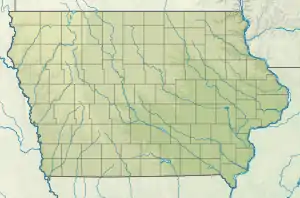 C17 Location of airport in Iowa/United States  C17 C17 (the United States) | |||||||||||
| Runways | |||||||||||
| |||||||||||
| Statistics (2010) | |||||||||||
| |||||||||||
Facilities and aircraft
Marion Airport covers an area of 40 acres (16 ha) at an elevation of 862 feet (263 m) above mean sea level. It has one runway designated 17/35 with an asphalt and turf surface measuring 6,600 by 100 feet (2,011.68 x 30 m).[1]
For the 12-month period ending August 26, 2010, the airport had 11,372 aircraft operations, an average of 31 per day: 99% general aviation, 1% air taxi, and <1% military. At that time there were 51 aircraft based at this airport: 76% single-engine, 8% helicopter, 8% ultralight, 6% multi-engine, and 2% glider.[1]
In October 2019 expansion started to extend the runway to 6,600'. It was completed July 28, 2020. There are also plans to expand with a 5,400' E/W runway. [2]
References
- FAA Airport Form 5010 for C17 PDF. Federal Aviation Administration. Effective November 15, 2012.
- King, Grace. "Marion Airport runway expansion underway". The Gazette.
External links
- Marion Airport (C17) at Iowa DOT Airport Directory
- Aerial image as of March 1990 from USGS The National Map
- Resources for this airport:
- FAA airport information for C17
- AirNav airport information for C17
- FlightAware airport information and live flight tracker
- SkyVector aeronautical chart for C17
- King, Grace. "Marion Airport runway expansion underway". The Gazette. Retrieved 2020-07-29.
