Maupin, Oregon
Maupin is a city in Wasco County, Oregon, United States. Located on the Deschutes River, much of the city's economy is related to the river through outdoor activities, such as fishing and rafting. The population was 418 at the 2010 census.
Maupin, Oregon | |
|---|---|
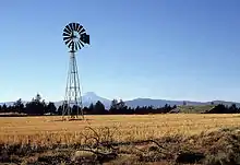
 Maupin and the Deschutes River | |
 Location in Oregon | |
| Coordinates: 45°10′26″N 121°4′59″W[1] | |
| Country | United States |
| State | Oregon |
| County | Wasco |
| Incorporated | 1922 |
| Government | |
| • Mayor | Lynn Ewing |
| Area | |
| • Total | 1.43 sq mi (3.69 km2) |
| • Land | 1.37 sq mi (3.56 km2) |
| • Water | 0.05 sq mi (0.13 km2) |
| Elevation | 1,345 ft (410 m) |
| Population | |
| • Total | 418 |
| • Estimate (2019)[4] | 441 |
| • Density | 320.96/sq mi (123.90/km2) |
| Time zone | UTC-8 (Pacific) |
| • Summer (DST) | UTC-7 (Pacific) |
| ZIP code | 97037 |
| Area code(s) | 541 |
| FIPS code | 41-46500[5] |
| GNIS feature ID | 1123848[6] |
History
Maupin is named for Howard Maupin, a pioneer who had a farm and ferry at the town's location in the late 19th century. Originally named Hunts Ferry after the owner of a ferry on the Deschutes River, the name was changed to Maupin Ferry by town founder William H. Staats. The city's name was shortened to Maupin in about 1909.[7][8]
Geography
According to the United States Census Bureau, the city has a total area of 1.45 square miles (3.76 km2), of which, 1.4 square miles (3.63 km2) is land and 0.05 square miles (0.13 km2) is water.[9] Road access is provided by U.S. Route 197, which crosses the Deschutes River in town at one of the few places the Deschutes can be crossed north of Madras.
Climate
This region experiences warm (but not hot) and dry summers, with no average monthly temperatures above 71.6 °F (22.0 °C). Being in the high desert, the nights cool down from the daytime heat. According to the Köppen Climate Classification system, Maupin has a warm-summer Mediterranean climate, abbreviated "Csb" on climate maps.[10]
Demographics
| Historical population | |||
|---|---|---|---|
| Census | Pop. | %± | |
| 1920 | 198 | — | |
| 1930 | 240 | 21.2% | |
| 1940 | 267 | 11.3% | |
| 1950 | 312 | 16.9% | |
| 1960 | 381 | 22.1% | |
| 1970 | 428 | 12.3% | |
| 1980 | 495 | 15.7% | |
| 1990 | 456 | −7.9% | |
| 2000 | 411 | −9.9% | |
| 2010 | 418 | 1.7% | |
| 2019 (est.) | 441 | [4] | 5.5% |
| U.S. Decennial Census[11] | |||
As of the census[3] of 2010, there were 418 people, 199 households, and 113 families residing in the city. The population density was about 299 inhabitants per square mile (115.4/km2). There were 274 housing units at an average density of about 196 per square mile (75.7/km2). The racial makeup of the city was 95.7% White, 0.7% Native American, 0.2% Asian, 0.2% Pacific Islander, 0.2% from other races, and 2.9% from two or more races. Hispanic or Latino of any race were 1.2% of the population.
There were 199 households, of which about 20% had children under the age of 18 living with them, about 50% were married couples living together, 3.5% had a female householder with no husband present, 3% had a male householder with no wife present, and about 43% were non-families. About 41% of all households were made up of individuals, and about 21% had someone living alone who was 65 years of age or older. The average household size was 1.98 and the average family size was 2.65.
The median age in the city was about 56 years. About 15% of residents were under the age of 18; about 5% were between the ages of 18 and 24; 15.5% were from 25 to 44; 32.8% were from 45 to 64; and about 32% were 65 years of age or older. The gender makeup of the city was about 51% male and 49% female.
Education
Maupin is served by the South Wasco County School District, a two-school district that comprises Maupin Grade School and South Wasco County Junior/Senior High School, both of which are in Maupin.[12]
See also
References
- "US Gazetteer files: 2010, 2000, and 1990". United States Census Bureau. 2011-02-12. Retrieved 2011-04-23.
- "2019 U.S. Gazetteer Files". United States Census Bureau. Retrieved July 28, 2020.
- "U.S. Census website". United States Census Bureau. Retrieved 2012-12-21.
- "Population and Housing Unit Estimates". United States Census Bureau. May 24, 2020. Retrieved May 27, 2020.
- "U.S. Census website". United States Census Bureau. Retrieved 2008-01-31.
- "US Board on Geographic Names". United States Geological Survey. 2007-10-25. Retrieved 2008-01-31.
- "City of Maupin, Oregon". Maupin, Oregon. Retrieved 2010-05-05.
- McArthur, Lewis A.; McArthur, Lewis L. (2003) [1928]. Oregon Geographic Names (7th ed.). Portland, Oregon: Oregon Historical Society Press. p. 618. ISBN 978-0875952772.
- "US Gazetteer files 2010". United States Census Bureau. Archived from the original on 2012-01-25. Retrieved 2012-12-21.
- Climate Summary for Maupin, Oregon
- "Census of Population and Housing". Census.gov. Retrieved June 4, 2015.
- "District Information". South Wasco County School District. Archived from the original on 2011-04-02. Retrieved 2010-12-23.
External links
Municipalities and communities of Wasco County, Oregon, United States | ||
|---|---|---|
| Cities | 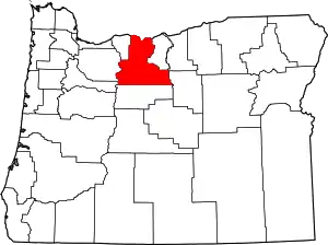 Wasco County map | |
| CDPs | ||
| Unincorporated communities | ||
| Ghost towns | ||
| Indian reservation | ||
| Footnotes | ‡This populated place also has portions in an adjacent county or counties | |
| ||
| Authority control |
|---|