Meadowthorpe, Lexington
Meadowthorpe is a neighborhood in western Lexington, Kentucky, United States. Its boundaries are Leestown Road to the south, New Circle Road to the west, and Norfolk Southern railroad tracks to the north and east.[1] Since 2000, areas south of Leestown Road have seen residential and commercial development in Townley Center. This area is not a part of the Meadowthorpe neighborhood.[2] Schools in the area are Meadowthorpe Elementary and Leestown Middle School.
Meadowthorpe | |
|---|---|
Neighborhood of Lexington, Kentucky | |
| Coordinates: 38.071°N 84.525°W | |
| Country | United States |
| State | Kentucky |
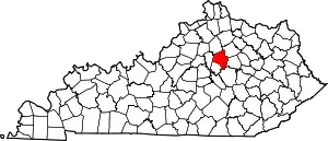
| County | Fayette |
| City | Lexington |
| Area | |
| • Total | 0.489 sq mi (1.27 km2) |
| Elevation | 950 ft (289.56 m) |
| Population (2000) | |
| • Total | 1,460 |
| • Density | 2,983/sq mi (1,149.6/km2) |
| Time zone | UTC-5 (Eastern (EST)) |
| • Summer (DST) | UTC-4 (EDT) |
| ZIP code | 40511 |
| Area code(s) | 859 |
| Website | www.mnalex.org |
Neighborhood statistics
- Area: 0.489 square miles (1.27 km2)
- Population: 1,460
- Population density: 2,983 people per square mile (1,149.6/km²)
- Median household income: $47,217[1]
References
- Meadowthorpe Neighborhood Profile city-data.com. Retrieved on 2011-01-02
- Meadowthorpe Neighborhood Website Retrieved on 2017-02-20
| Subject areas |  Downtown Lexington  Lexington History Center  Keeneland  William T. Young Library | |
|---|---|---|
| Culture and landmarks |
| |
| Colleges and universities | ||
| Transportation | ||
| Sports | ||
| Metro Lexington | ||
This article is issued from Wikipedia. The text is licensed under Creative Commons - Attribution - Sharealike. Additional terms may apply for the media files.