Mount Horeb Earthworks Complex
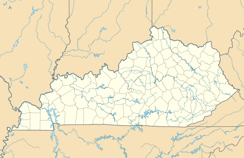
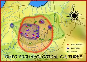
The Mount Horeb Earthworks Complex is an Adena culture group of earthworks in Fayette County, Kentucky. It consists of two major components, the Mount Horeb Site 1 and the Peter Village enclosure, and several smaller features including the Grimes Village site, Tarleton Mound, and Fisher Mound.[1] The Peter Village and Grimes Village enclosures were mapped by Rafinesque and featured in Squier and Davis's landmark publication Ancient Monuments of the Mississippi Valley in 1848 as Plate XIV Figures 3 and 4.[2]
 Location within Kentucky today | |
| Location | Lexington, Kentucky, Fayette County, Kentucky, |
|---|---|
| Region | Fayette County, Kentucky |
| Coordinates | 38°9′32″N 84°27′56″W |
| History | |
| Cultures | Adena culture |
| Architecture | |
| Architectural styles | Earthworks |
Mount Horeb Site 1
This site is the center piece of the University of Kentucky's Adena Park and is located on a bank 75 feet (23 m) above Elkhorn Creek. It is a perfectly circlular 105 feet (32 m) diameter platform, surrounded by a 45 feet (14 m) wide ditch and a 13 feet (4.0 m) wide enclosure with a 33 feet (10 m) wide entryway facing to the west. In 1939 the site was excavated by William S. Webb and the Works Projects Administration. They discovered the remains of a 97 feet (30 m) diameter circular wooden structure on the platform, which Webb speculated was a ceremonial center for a nearby clan. In 1936 the site and 6 acres (24,000 m2) were paid for through private dontations and transferred to the Kentucky Archaeological Society. It is currently owned and operated by the University of Kentucky as part of the Campus Recreation Department.[1]
Peter Village enclosure
The earliest occupation at this site is 300 to 200 BCE and is considered to be a pre-Adena site for harvesting and processing galena, which occurs naturally nearby. At this time the site had an earthen enclosure and a palisade and later a 2 meter deep ditch.[3] Rafinesque described the site as a twenty sided icosogonal polygon 3,767 feet (1,148 m) long with a 15 feet (4.6 m) wide 4 feet (1.2 m) to 8 feet (2.4 m) deep ditch surrounding it. An entryway to the enclosure was located to the south.[1]
Images in Squier and Davis
Mount Horeb, described as "ancient work near Lexington, Kentucky," was featured in the 1848 book Ancient Monuments of the Mississippi Valley by Ephraim George Squier and Edwin Hamilton Davis.[4]
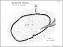 Peter Village enclosure
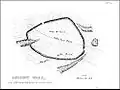 Grimes Village enclosure
See also
References
- Susan L. Woodward and Jerry N. McDonald (2002). Indian Mounds of the Middle Ohio Valley. McDonald and Woodward Publishing. pp. 109–113. ISBN 0-939923-72-6.CS1 maint: uses authors parameter (link)
- E. G. Squier and E. H. Davis (1848). Ancient Monuments of the Mississippi Valley. Smithsonian Institution.
- Lewis, R. Barry (1996). Kentucky Archaeology. University Press of Kentucky. pp. 99–100. ISBN 0-8131-1907-3.
- Ephraim George Squier; Edwin Hamilton Davis (1848). Ancient Monuments of the Mississippi Valley. Smithsonian Institution. p. 93.
External links
| Ohio sites |
|  |
|---|---|---|
| Kentucky sites |
| |
| West Virginia sites | ||
| Indiana sites | ||
| ||
| Subject areas |  Downtown Lexington  Lexington History Center  Keeneland  William T. Young Library | |
|---|---|---|
| Culture and landmarks |
| |
| Colleges and universities | ||
| Transportation | ||
| Sports | ||
| Metro Lexington | ||