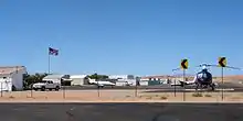
Mesquite Airport
Mesquite Airport (IATA: MFH[2][3], FAA LID: 67L) is a public use airport located two nautical miles (4 km) north of the central business district of Mesquite, in Clark County, Nevada, United States.[1] It is owned by the City of Mesquite.[1]
Mesquite Airport | |||||||||||
|---|---|---|---|---|---|---|---|---|---|---|---|
 | |||||||||||
| Summary | |||||||||||
| Airport type | Public | ||||||||||
| Owner | City of Mesquite | ||||||||||
| Serves | Mesquite, Nevada | ||||||||||
| Elevation AMSL | 1,978 ft / 603 m | ||||||||||
| Coordinates | 36°49′59″N 114°03′21″W | ||||||||||
| Map | |||||||||||
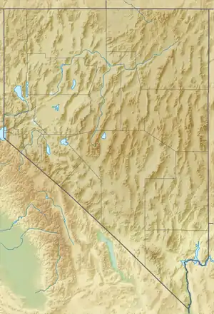 67L Location of airport in Nevada | |||||||||||
| Runways | |||||||||||
| |||||||||||
| Helipads | |||||||||||
| |||||||||||
| Statistics (2011) | |||||||||||
| |||||||||||
The National Plan of Integrated Airport Systems for 2011–2015 categorized it as a general aviation facility.[4]
Facilities and aircraft
Mesquite Airport covers an area of 155 acres (63 ha) at an elevation of 1,978 feet (603 m) above mean sea level. It has one runway designated 1/19 with an asphalt surface measuring 5,121 by 75 feet (1,561 x 23 m). It also has one helipad designated H1 with a concrete surface measuring 20 by 20 feet (6 x 6 m).[1]
For the 12-month period ending January 31, 2011, the airport had 15,050 aircraft operations, an average of 41 per day: 99.7% general aviation and 0.3% military. At that time there were 22 aircraft based at this airport: 86% single-engine, 9% ultralight, and 5% jet.[1]
See also
References
- FAA Airport Form 5010 for 67L PDF. Federal Aviation Administration. Effective November 15, 2012.
- "IATA Airport Code Search (MFH: Mesquite)". International Air Transport Association. Retrieved June 13, 2014.
- "Mesquite, Nevada (IATA: MFH, FAA: 67L)". Great Circle Mapper.
-
"2011–2015 NPIAS Report, Appendix A" (PDF). National Plan of Integrated Airport Systems. Federal Aviation Administration. October 4, 2010. Archived from the original (PDF, 2.03 MB) on September 27, 2012. External link in
|work=(help)
External links
- "Diagram of Mesquite Airport (67L)" (PDF). Archived from the original (PDF) on 2016-03-04. from Nevada DOT
- Aerial image as of June 1994 from USGS The National Map
- Resources for this airport:
- FAA airport information for 67L
- AirNav airport information for 67L
- FlightAware airport information and live flight tracker
- SkyVector aeronautical chart for 67L