Millcreek Township, Erie County, Pennsylvania
Millcreek Township is a township in Erie County, Pennsylvania, United States. The population was 53,515 at the 2010 census.[4] It is the largest suburb of Erie, Pennsylvania, and the 14th-largest municipality in the state, larger than the cities of Altoona and Harrisburg.[5]
Millcreek Township | |
|---|---|
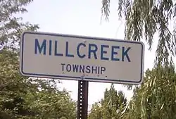 Millcreek Township sign | |
| Etymology: Mill Creek | |
| Motto(s): "Gateway to Presque Isle" | |
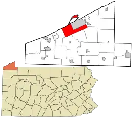 Location in Erie County and the state of Pennsylvania | |
| Country | |
| State | |
| County | Erie |
| Area | |
| • Total | 32.79 sq mi (84.93 km2) |
| • Land | 32.02 sq mi (82.93 km2) |
| • Water | 0.78 sq mi (2.01 km2) |
| Highest elevation [2] (near Belleview Heights) | 1,170 ft (360 m) |
| Lowest elevation [2] (Lake Erie) | 572 ft (174 m) |
| Population (2010) | |
| • Total | 53,515 |
| • Estimate (2018)[3] | 53,037 |
| • Density | 1,629.79/sq mi (1,629.79/km2) |
| Time zone | UTC-5 (EST) |
| • Summer (DST) | UTC-4 (EDT) |
| Area code(s) | 814 |
| Website | www |
Millcreek Township is home to the entrance to Presque Isle State Park, Waldameer Park, the Millcreek Mall, and many other attractions. Also located in the township is Erie International Airport, the major airport serving the Erie metropolitan area.
History
Evidence exists of Native American presence in Millcreek Township as early as 3700 BC. The township's Sommerheim Park is the location of the Sommerheim Park Archaeological District, which has yielded archaeological artifacts from the Archaic and Woodland periods.[6]
One of the earliest townships in the Erie Triangle to be settled, Millcreek was one of the original 16 townships of Erie County. As families came they moved from the bayfront settlement of Erie and began to form small hamlets such as Federal Hill, Kearsarge, Marvintown, and Weigelville, all to become part of Mill Creek Township. As the Erie settlement grew, first into a borough, then a city, it annexed more and more sections of the township.
After the east–west roads were laid out, taverns began to sprout about every mile or so. Along the Ridge Road (U.S. Route 20), which was laid west through Millcreek in 1805, one of the few that remain is the Nicholson Tavern. Built in 1836, mostly by Isabella Nicholson and her sons, it is still owned by the family and is listed on the National Register of Historic Places. The Presque Isle Light and Sommerheim Park Archaeological District are also listed.[7]
A recurving sandspit peninsula, Presque Isle, connects to the mainland in western Millcreek. During the War of 1812, Oliver Hazard Perry commanded his fleet in battle and strategically used the peninsula's bay as a harbor to construct six out of nine of the ships in his fleet. In 1921 the peninsula was made a state park and was designated a National Natural Landmark by the National Park Service. Today the park is a bird sanctuary with over 150 different species identified here.
Just west of the entry into Presque Isle was a well-forested area known as Hopkins Grove. The Erie Electric Motor Company purchased the grove in 1896 for development into an amusement park. Today Waldameer Park is one of the oldest amusement parks in the nation.
Geography
According to the United States Census Bureau, the township has a total area of 32.8 square miles (84.9 km2), of which 32.1 square miles (83.1 km2) is land and 0.73 square miles (1.9 km2), or 2.20%, is water.[4]
Today land use in Millcreek is dedicated to retail, commercial and service-oriented businesses, to light industry, public and private schools, and residential areas. About 1% of the land is still zoned for agriculture. Located within its borders is Edinboro University's Porreco College, Zuck Park, the Erie Golf Course, and the Asbury Woods Nature Center and Recreation Center.
Demographics
| Historical population | |||
|---|---|---|---|
| Census | Pop. | %± | |
| 1950 | 16,776 | — | |
| 1960 | 28,239 | 68.3% | |
| 1970 | 36,946 | 30.8% | |
| 1980 | 44,303 | 19.9% | |
| 1990 | 46,820 | 5.7% | |
| 2000 | 52,129 | 11.3% | |
| 2010 | 53,515 | 2.7% | |
| 2018 (est.) | 53,037 | [3] | −0.9% |
| U.S. Decennial Census[8][9][10] | |||
At the 2000 census there were 52,129 people, 21,217 households, and 14,088 families living in the township. The population density was 1,768.5 people per square mile (682.7/km2). There were 22,369 housing units at an average density of 758.9/sq mi (293.0/km2). The racial makeup of the township was 96.55% White, 1.09% African American, 0.09% Native American, 1.34% Asian, 0.01% Pacific Islander, 0.30% from other races, and 0.62% from two or more races. Hispanic or Latino of any race were 0.99%.[11]
There were 21,217 households, 30.2% had children under the age of 18 living with them, 55.0% were married couples living together, 8.4% had a female householder with no husband present, and 33.6% were non-families. 29.0% of households were made up of individuals, and 11.7% were one person aged 65 or older. The average household size was 2.42 and the average family size was 3.01.
The age distribution was 24.1% under the age of 18, 7.2% from 18 to 24, 27.4% from 25 to 44, 25.2% from 45 to 64, and 16.1% 65 or older. The median age was 40 years. For every 100 females, there were 93.2 males. For every 100 females age 18 and over, there were 89.6 males.
The median household income was $45,019 and the median family income was $56,341. Males had a median income of $41,868 versus $26,610 for females. The per capita income for the township was $24,279. About 3.9% of families and 5.8% of the population were below the poverty line, including 7.0% of those under age 18 and 4.8% of those age 65 or over.
Education
Millcreek Township is served by the Millcreek Township School District.
Elementary Schools
Asbury Elementary School
Belle Valley Elementary School
Chestnut Hill Elementary
Grandview Elementary
Tracy Elementary School
Middle Schools
James S. Wilson Middle School
Walnut Creek Middle School
Westlake Middle School
High Schools
References
- "2016 U.S. Gazetteer Files". United States Census Bureau. Retrieved Aug 13, 2017.
- "West Branch Cascade Creek Topo Map, Erie County PA (Erie North Area)". TopoZone. Locality, LLC. Retrieved 5 September 2019.
- Bureau, U. S. Census. "U.S. Census website". United States Census Bureau. US Census Bureau. Retrieved 2 September 2019.
- "Geographic Identifiers: 2010 Demographic Profile Data (G001): Millcreek township, Erie County, Pennsylvania". American Factfinder. U.S. Census Bureau. Archived from the original on February 13, 2020. Retrieved March 21, 2016.
- "Geographic Identifiers: 2010 Census Summary File 1 (G001): All County Subdivisions within Pennsylvania". American Factfinder. U.S. Census Bureau. Archived from the original on February 13, 2020. Retrieved March 21, 2016.
- Johnson, William C. "National Register of Historic Places Inventory/Nomination: Sommerheim Park Archaeological District". National Park Service, 1981-06-29, p. 2.
- "National Register Information System". National Register of Historic Places. National Park Service. July 9, 2010.
- United States Census Bureau. "Census of Population and Housing". Retrieved December 2, 2014.
- https://www.eriecountypa.gov/media/19672/erieco_demo_study_jan_03.pdf
- http://www.millcreekpd.com/index.php?content=deptHistory
- "U.S. Census website". United States Census Bureau. Retrieved 2008-01-31.
External links
Municipalities and communities of Erie County, Pennsylvania, United States | ||
|---|---|---|
| Cities |  | |
| Boroughs | ||
| Townships | ||
| CDPs | ||
| Unincorporated communities | ||
| ||