Wattsburg, Pennsylvania
Wattsburg is a borough in Erie County, Pennsylvania, United States. The population was 403 at the 2010 census.[4] It is part of the Erie Metropolitan Statistical Area.
Wattsburg, Pennsylvania | |
|---|---|
 Location in Erie County and the U.S. state of Pennsylvania. | |
| Coordinates: 42°0′10″N 79°48′34″W | |
| Country | United States |
| State | Pennsylvania |
| County | Erie |
| Government | |
| • Mayor | Donna M. Horn |
| Area | |
| • Total | 0.31 sq mi (0.80 km2) |
| • Land | 0.30 sq mi (0.77 km2) |
| • Water | 0.01 sq mi (0.03 km2) |
| Elevation [2] (Borough benchmark) | 1,286 ft (392 m) |
| Highest elevation [2] (northeast end of borough) | 1,300 ft (400 m) |
| Lowest elevation | 1,278 ft (390 m) |
| Population (2010) | |
| • Total | 403 |
| • Estimate (2019)[3] | 381 |
| • Density | 1,278.52/sq mi (494.22/km2) |
| Time zone | UTC-4 (EST) |
| • Summer (DST) | UTC-5 (EDT) |
| ZIP code | 16442 |
| Area code(s) | 814 |
History
Incorporated in 1833, Wattsburg was once a thriving stagecoach center.
Geography
Wattsburg is located in eastern Erie County at 42°0′10″N 79°48′34″W (42.002903, -79.809321).[5] It is bordered to the west, north, and east by Venango Township, and to the south by Amity Township. The New York state border is 2.5 miles (4.0 km) to the east.
According to the United States Census Bureau, the borough has a total area of 0.31 square miles (0.8 km2), of which 0.01 square miles (0.03 km2), or 3.72%, is water.[4] Wattsburg is at the junction of French Creek with its West Branch. The borough is in the Allegheny River watershed.
Demographics
| Historical population | |||
|---|---|---|---|
| Census | Pop. | %± | |
| 1840 | 131 | — | |
| 1850 | 227 | 73.3% | |
| 1860 | 329 | 44.9% | |
| 1870 | 286 | −13.1% | |
| 1880 | 389 | 36.0% | |
| 1890 | 382 | −1.8% | |
| 1900 | 351 | −8.1% | |
| 1910 | 283 | −19.4% | |
| 1920 | 232 | −18.0% | |
| 1930 | 256 | 10.3% | |
| 1940 | 290 | 13.3% | |
| 1950 | 343 | 18.3% | |
| 1960 | 401 | 16.9% | |
| 1970 | 453 | 13.0% | |
| 1980 | 513 | 13.2% | |
| 1990 | 486 | −5.3% | |
| 2000 | 378 | −22.2% | |
| 2010 | 403 | 6.6% | |
| 2019 (est.) | 381 | [3] | −5.5% |
| Sources:[6][7][8] | |||
As of the census[7] of 2000, there were 378 people, 148 households, and 97 families residing in the borough. The population density was 1,160.8 people per square mile (442.3/km²). There were 166 housing units at an average density of 509.8 per square mile (194.2/km²). The racial makeup of the borough was 99.47% White, 0.26% from other races, and 0.26% from two or more races. Hispanic or Latino of any race were 0.53% of the population.
There were 148 households, out of which 30.4% had children under the age of 18 living with them, 45.9% were married couples living together, 14.2% had a female householder with no husband present, and 33.8% were non-families. 26.4% of all households were made up of individuals, and 8.8% had someone living alone who was 65 years of age or older. The average household size was 2.55 and the average family size was 3.13.
In the borough the population was spread out, with 24.6% under the age of 18, 10.6% from 18 to 24, 29.6% from 25 to 44, 23.8% from 45 to 64, and 11.4% who were 65 years of age or older. The median age was 35 years. For every 100 females there were 92.9 males. For every 100 females age 18 and over, there were 96.6 males.
The median income for a household in the borough was $32,500, and the median income for a family was $37,813. Males had a median income of $29,250 versus $25,156 for females. The per capita income for the borough was $14,830. About 17.6% of families and 17.9% of the population were below the poverty line, including 16.2% of those under age 18 and 51.4% of those age 65 or over.
References
- "2019 U.S. Gazetteer Files". United States Census Bureau. Retrieved July 28, 2020.
- "Little Hope Topo Map, Erie County PA (Wattsburg Area)". TopoZone. Locality, LLC. Retrieved 2 September 2019.
- "Population and Housing Unit Estimates". United States Census Bureau. May 24, 2020. Retrieved May 27, 2020.
- "Geographic Identifiers: 2010 Demographic Profile Data (G001): Wattsburg borough, Pennsylvania". American Factfinder. U.S. Census Bureau. Archived from the original on February 13, 2020. Retrieved March 17, 2016.
- "US Gazetteer files: 2010, 2000, and 1990". United States Census Bureau. 2011-02-12. Retrieved 2011-04-23.
- "Census of Population and Housing". U.S. Census Bureau. Retrieved 11 December 2013.
- "U.S. Census website". United States Census Bureau. Retrieved 2008-01-31.
- "Incorporated Places and Minor Civil Divisions Datasets: Subcounty Resident Population Estimates: April 1, 2010 to July 1, 2012". Population Estimates. U.S. Census Bureau. Retrieved 11 December 2013.
External links
Municipalities and communities of Erie County, Pennsylvania, United States | ||
|---|---|---|
| Cities | 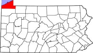 | |
| Boroughs | ||
| Townships | ||
| CDPs | ||
| Unincorporated communities | ||
| ||