Milton Township, DuPage County, Illinois
Milton Township is one of nine townships in DuPage County, Illinois, USA. As of the 2010 census, its population was 117,067 and it contained 45,153 housing units.[2]
Milton Township | |
|---|---|
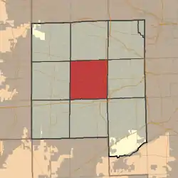 Location in DuPage County | |
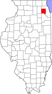 DuPage County's location in Illinois | |
| Coordinates: 41°51′31″N 88°05′22″W | |
| Country | |
| State | |
| County | DuPage |
| Settled | November 6, 1849 |
| Government | |
| • Type | Illinois Township |
| • Supervisor | O. Chris Heidorn |
| • Assessor | Chris E. LeVan |
| Area | |
| • Total | 35.27 sq mi (91.3 km2) |
| • Land | 34.36 sq mi (89.0 km2) |
| • Water | 0.92 sq mi (2.4 km2) 2.61% |
| Elevation | 771 ft (235 m) |
| Population (2010) | |
| • Total | 117,067 |
| • Estimate (2018)[1] | 117,475 |
| • Density | 3,407.4/sq mi (1,315.6/km2) |
| Time zone | UTC-6 (CST) |
| • Summer (DST) | UTC-5 (CDT) |
| ZIP Codes | 60137, 60139, 60148, 60187, 60188, 60189, 60190, 60515, 60563 |
| Area codes | 630, 331 |
| FIPS code | 17-043-49451 |
| Website | miltontownship |
Geography
According to the 2010 census, the township has a total area of 35.27 square miles (91.3 km2), of which 34.36 square miles (89.0 km2) (or 97.42%) is land and 0.92 square miles (2.4 km2) (or 2.61%) is water.[2]
Cities, towns, villages
- Carol Stream (southeast quarter)
- Downers Grove (northwest quarter)
- Glen Ellyn
- Glendale Heights (partial)
- Lisle (north quarter)
- Lombard (west quarter)
- Naperville (northeast quarter)
- Wheaton, the county seat
- Winfield (east quarter)
Unincorporated towns
- Arboretum Estates at 41.834474°N 88.066177°W
- Butterfield at 41.8364187°N 88.0420097°W
- Flowerfield at 41.867252°N 88.033955°W
- Foxcroft at 41.836141°N 88.075344°W
- Glen Oak at 41.881696°N 88.039233°W
- Gretna at 41.898085°N 88.101458°W
- Jewell Road at 41.876696°N 88.135903°W
- North Glen Ellyn at 41.891974°N 88.063123°W
- Saddlewood at 41.892251°N 88.075901°W
- Shorewood at 41.899196°N 88.079791°W
- Valley View at 41.830308°N 88.067844°W
(This list is based on USGS data and may include former settlements.)
Adjoining Townships
- Bloomingdale Township, DuPage County (north)
- Addison Township, DuPage County (northeast)
- York Township, DuPage County (east)
- Downers Grove Township, DuPage County (southeast)
- Lisle Township, DuPage County (south)
- Naperville Township, DuPage County (southwest)
- Winfield Township, DuPage County (west)
- Wayne Township, DuPage County (northwest)
Cemeteries
The township contains the following cemeteries, of which Jewell Grove, Pleasant Hill, and Saint Stephen's are under the township's care:[3]
- Forest Hill
- Jewell Grove
- Pleasant Hill
- Saint Michaels Catholic
- Saint Stephen's German Catholic
- Wheaton
Major highways
Lakes
- Herrick Lake
- Marmo Lake
- North Side Park Lake
- Rice Lake
Landmarks
- College of DuPage
- Dupage County Forest Preserve-Danada Forest Preserve
- Dupage County Forest Preserve-Willowbrook Preserve
- Dupage County-Hidden Lake Forest Preserve
- Morton Arboretum (partial)
- Wheaton College
Demographics
| Historical population | |||
|---|---|---|---|
| Census | Pop. | %± | |
| 2010 | 117,067 | — | |
| 2018 (est.) | 117,475 | [1] | 0.3% |
| U.S. Decennial Census[4] | |||
School districts
- Community Consolidated School District 89
- Community Unit School District 200
- Glen Ellyn School District 41
- Glenbard Township High School District 87
Political districts
- Illinois's 6th congressional district
- State House District 42
- State House District 45
- State House District 48
- State House District 95
- State Senate District 21
- State Senate District 23
- State Senate District 24
- State Senate District 48
Notes
- "2018 ACS 1-Year Estimates Data Profiles: Table DP05". American Community Survey. Retrieved 18 August 2020.
- "Population, Housing Units, Area, and Density: 2010 - County -- County Subdivision and Place -- 2010 Census Summary File 1". United States Census. Archived from the original on 2020-02-12. Retrieved 2013-05-28.
- "Cemeteries Authority". Milton Township. Retrieved 18 August 2020.
- "Census of Population and Housing". Census.gov. Retrieved June 4, 2016.
References
External links
- Official website
- Milton Township Assessor's Office
- City-Data.com
- Illinois State Archives
- Township Officials of Illinois
Places adjacent to Milton Township, DuPage County, Illinois | |
|---|---|
Municipalities and communities of DuPage County, Illinois, United States | ||
|---|---|---|
| Cities | Map of Illinois highlighting DuPage County | |
| Villages |
| |
| Townships | ||
| Unincorporated communities | ||
| Ghost towns/Neighborhoods | ||
| Footnotes | ‡This populated place also has portions in an adjacent county or counties | |
| ||
This article is issued from Wikipedia. The text is licensed under Creative Commons - Attribution - Sharealike. Additional terms may apply for the media files.