Minnesota State Highway 107
Minnesota State Highway 107 (MN 107) is a 17.571-mile-long (28.278 km) highway in east-central Minnesota, which runs from its intersection with State Highway 65 in Stanchfield Township near Braham and continues north to its northern terminus at its intersection with State Highway 23 in Pine County near Brook Park.
| ||||
|---|---|---|---|---|
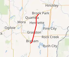
MN 107 highlighted in red | ||||
| Route information | ||||
| Maintained by MnDOT | ||||
| Length | 17.571 mi[1] (28.278 km) | |||
| Existed | April 22, 1933[2]–present | |||
| Major junctions | ||||
| South end | ||||
| North end | ||||
| Location | ||||
| Counties | Isanti, Kanabec, Pine | |||
| Highway system | ||||
| ||||

Highway 107 passes through the communities of Braham, Grasston, and Henriette.
Route description
Highway 107 serves as a north–south route between Braham, Grasston, Henriette, and Brook Park. It is geographically located between the cities of Cambridge and Hinckley in east-central Minnesota and parallels Interstate 35 and State Highway 65 throughout its route.
The route intersects State Highway 70 twice. Highway 107 and Highway 70 are concurrent for two miles between Braham and Grasston.
Highway 107 is also known as Main Avenue in Braham.
The original part of the route is legally defined as Route 134 in the Minnesota Statutes.[3] The southern portion is part of Minnesota Constitutional Route 5. It is not marked with either of these numbers.
History
Highway 107 was authorized in 1933 between Grasston and Brook Park.[2]
Present day Highway 107 was originally numbered Highway 65 between Braham and Grasston from 1934 to 1942. Nearby Highway 65 was built on a new alignment circa 1942 and this old section of 65 between Braham and Grasston was renumbered 107 as a southerly extension of the existing Highway 107.[4]
All of Highway 107 was paved by 1960.[4]
Major intersections
| County | Location | mi[1] | km | Destinations | Notes |
|---|---|---|---|---|---|
| Isanti | Stanchfield Township | 0.000 | 0.000 | Southern terminus | |
| Braham | 1.238 | 1.992 | |||
| 2.226 | 3.582 | ||||
| Kanabec | Grass Lake Township | 4.286 | 6.898 | Southern end of MN 70 concurrency | |
| 5.565 | 8.956 | ||||
| 6.055 | 9.745 | Northern end of MN 70 concurrency | |||
| Grasston | 6.779 | 10.910 | |||
| Pine | Pokegama Township | 11.986 | 19.290 | ||
| 12.234 | 19.689 | ||||
| Brook Park Township | 17.537 | 28.223 | Northern terminus | ||
1.000 mi = 1.609 km; 1.000 km = 0.621 mi
| |||||
References
- "Trunk Highway Log Point Listing - Construction District 3" (PDF). Minnesota Department of Transportation. August 23, 2010. Archived from the original (PDF) on December 4, 2008. Retrieved November 18, 2010.
- "Chapter 440-H.F. No. 2000", Session Laws of Minnesota for 1933, Mike Holm, Secretary of State, pp. 881–897
- "161.115, Additional Trunk Highways". Minnesota Statutes. Office of the Revisor of Statutes, State of Minnesota. 2010. Retrieved November 18, 2010.
- Riner, Steve. "Details of routes 101–149". The Unofficial Minnesota Highways Page. Self-published. Retrieved November 18, 2010.
