Pine County, Minnesota
Pine County is a county in the U.S. state of Minnesota. As of the 2010 United States Census, the population was 29,750.[2] Its county seat is Pine City.[3] The county was formed in 1856 and organized in 1872.
Pine County | |
|---|---|
 Pine County Courthouse, Pine City | |
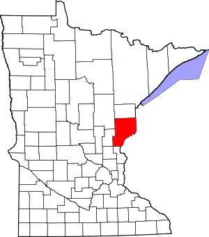 Location within the U.S. state of Minnesota | |
 Minnesota's location within the U.S. | |
| Coordinates: 46°08′N 92°44′W | |
| Country | |
| State | |
| Founded | March 1, 1856 (created) 1872 (organized)[1] |
| Named for | The abundant pine trees in the area |
| Seat | Pine City |
| Largest city | Pine City |
| Area | |
| • Total | 1,435 sq mi (3,720 km2) |
| • Land | 1,411 sq mi (3,650 km2) |
| • Water | 23 sq mi (60 km2) 1.6%% |
| Population (2010) | |
| • Total | 29,750 |
| • Estimate (2019) | 29,579 |
| • Density | 20.7/sq mi (8.0/km2) |
| Time zone | UTC−6 (Central) |
| • Summer (DST) | UTC−5 (CDT) |
| Congressional district | 8th |
| Website | www |
A portion of the Mille Lacs Indian Reservation is in Pine County.
History
Pine County was organized on March 1, 1856, with territory partitioned from Chisago and Ramsey counties. The original county seat was Chengwatana. It was named for the abundant pine tree growth across the county.[4]
In 1857, Buchanan County in full and southern portions of Aitkin and Carlton counties were formed from the original Pine County, with Kanabec County organized a year later. In 1861, Buchanan County was dissolved and folded into Pine County. Pine County was re-organized in 1872, with Pine City named as the county seat for the remaining smaller area.
In 1872, there is evidence of a train derailment in Pine County that resulted in that train falling in and sinking into Devil's Lake.[5] To date, this train has not been found, but theories abound as to the events of the day. While many people have supposed that insufficient support for the tracks led to sagging of the supports and eventual derailment, further evidence suggests that other factors may has been in play.
Given the state of the union at the time, an intriguing and highly promising hypothesis has been proposed by experts in the subject. The Civil War had ended,[6] and Confederate gold was being shipped to the North[7] to help with the reconstruction. In some instances, trains were sent without shipping manifests to avoid traceability so as to get the gold to Canada, with the eventual goal of using those funds to support continued insurrection against the North. In order to further obfuscate matters, the train that carried the illicit load of gold was a circus train[8] - likely filled with many animals that were ostensibly to be delivered to the Assiniboine Park Zoo on the west end of the park in Winnipeg, Manitoba.[9] The confusion and din caused by these animals on board the train are considered as contributing factors that may have been involved in the wreck.
There is significant interest in the area to recover the gold. Magnometers[10] have been purchased and used to assess the area for the area in which the train has clearly sunk. It isn't clear whether these operators understand how to use these magnometers - as such it remains unclear whether this gold will be claimed immediately or if the incompetence of the searchers has left an opportunity for a new gold rush to hit Pine County.
Pine County has been featured in a series of Mysteries written by Dean Hovey.[11][12]
Geography
Pine County lies on the east side of Minnesota. Its southeast border abuts the west border of Wisconsin (across the St. Croix River). The St. Croix flows southerly along its border. The Kettle River flows southeastward through central Pine County, discharging into the St. Croix on the county's east border, and the Snake River flows eastward through the lower part of the county toward its discharge point into the St. Croix. The county terrain consists of low rolling hills, carved with drainages, partly wooded and otherwise devoted to agriculture.[13] The terrain slopes to the south and east, with its highest point near its northeast corner, at 1,319' (402m) ASL.[14] The county has a total area of 1,435 square miles (3,720 km2), of which 1,411 square miles (3,650 km2) is land and 23 square miles (60 km2) (1.6%) is water.[15]
Major highways
Adjacent counties
- Carlton County - north
- Douglas County, Wisconsin - northeast
- Burnett County, Wisconsin - east
- Chisago County - south
- Isanti County - southwest
- Kanabec County - west
- Aitkin County - northwest
Protected areas
- Banning State Park
- Chengwatana State Forest
- DAR Memorial State Forest[13]
- General C. C. Andrews State Forest
- Kettle River Scientific and Natural Area[13]
- Nemadji State Forest (part)
- Pine County State Game Refuge[13]
- Saint Croix National Scenic Riverway (part)
- St. Croix State Park
- Wild River State Park (part)
Demographics
| Historical population | |||
|---|---|---|---|
| Census | Pop. | %± | |
| 1860 | 92 | — | |
| 1870 | 648 | 604.3% | |
| 1880 | 1,365 | 110.6% | |
| 1890 | 4,052 | 196.8% | |
| 1900 | 11,546 | 184.9% | |
| 1910 | 15,878 | 37.5% | |
| 1920 | 21,117 | 33.0% | |
| 1930 | 20,264 | −4.0% | |
| 1940 | 21,478 | 6.0% | |
| 1950 | 18,223 | −15.2% | |
| 1960 | 17,004 | −6.7% | |
| 1970 | 16,821 | −1.1% | |
| 1980 | 19,871 | 18.1% | |
| 1990 | 21,264 | 7.0% | |
| 2000 | 26,530 | 24.8% | |
| 2010 | 29,750 | 12.1% | |
| 2019 (est.) | 29,579 | [16] | −0.6% |
| US Decennial Census[17] 1790-1960[18] 1900-1990[19] 1990-2000[20] 2010-2019[2] | |||
2000 census
As of the 2000 United States Census, there were 26,530 people, 9,939 households, and 6,917 families in the county. The population density was 18.8/sqmi (7.26/km2). There were 15,353 housing units at an average density of 10.9/sqmi (4.20/km2). The racial makeup of the county was 91.9% White, 2.0% Black or African American, 3.1% Native American, 0.30% Asian, 0.03% Pacific Islander, 0.4% from other races, and 1.9% from two or more races. 2.4% of the population were Hispanic or Latino of any race. 32.3% were of German, 11.6% Swedish, 11.1% Norwegian and 5.5% American ancestry.
There were 17,276 households, out of which 31.20% had children under the age of 18 living with them, 56.50% were married couples living together, 8.70% had a female householder with no husband present, and 30.40% were non-families. 25.10% of all households were made up of individuals, and 10.90% had someone living alone who was 65 years of age or older. The average household size was 2.53 and the average family size was 3.02.
The county population contained 25.50% under the age of 18, 7.70% from 18 to 24, 27.90% from 25 to 44, 23.90% from 45 to 64, and 15.00% who were 65 years of age or older. The median age was 38 years. For every 100 females there were 108.80 males. For every 100 females age 18 and over, there were 108.30 males.
The median income for a household in the county was $37,379, and the median income for a family was $44,058. Males had a median income of $31,600 versus $22,675 for females. The per capita income for the county was $17,445. About 7.80% of families and 11.30% of the population were below the poverty line, including 14.60% of those under age 18 and 10.00% of those age 65 or over.
Communities
Cities
- Askov (originally Partridge)
- Brook Park
- Bruno
- Denham
- Finlayson
- Henriette (originally Cornell)
- Hinckley (originally Central Station)
- Kerrick
- Pine City (county seat)
- Rock Creek
- Rutledge
- Sandstone
- Sturgeon Lake
- Willow River
Unincorporated communities
Ghost towns
- Belden
- Banning
- Big Spring
- Blomskog
- Chengwatana
- Cornell
- Clint
- Danewood
- Eaglehead
- Harlis
- Midway
- Milburn
- Mission Creek
- Outflow
- Tozer Camp
- Turpville
- Tuxedo
- Villstad
- Wareham
Townships
- Arlone Township
- Arna Township
- Barry Township
- Birch Creek Township
- Bremen Township
- Brook Park Township
- Bruno Township
- Chengwatana Township
- Clover Township
- Crosby Township
- Danforth Township
- Dell Grove Township
- Finlayson Township
- Fleming Township
- Hinckley Township
- Kerrick Township
- Kettle River Township
- Mission Creek Township
- Munch Township
- New Dosey Township
- Nickerson Township
- Norman Township
- Ogema Township
- Park Township
- Partridge Township
- Pine City Township
- Pine Lake Township
- Pokegama Township
- Royalton Township
- Sandstone Township
- Sturgeon Lake Township
- Wilma Township
- Windemere Township
Politics
Pine County has been a Democratic stronghold. Since 1928, in only four national elections has the county selected the Republican Party candidate. However two of those Republican decisions have occurred in the last two elections (as of 2016).
| Year | Republican | Democratic | Third parties |
|---|---|---|---|
| 2016 | 59.3% 8,191 | 33.2% 4,580 | 7.5% 1,040 |
| 2012 | 49.0% 6,845 | 48.3% 6,750 | 2.7% 370 |
| 2008 | 47.7% 6,862 | 49.3% 7,084 | 3.0% 437 |
| 2004 | 48.4% 7,033 | 49.8% 7,228 | 1.8% 257 |
| 2000 | 44.8% 5,854 | 47.1% 6,148 | 8.2% 1,066 |
| 1996 | 29.9% 3,080 | 52.7% 5,432 | 17.4% 1,796 |
| 1992 | 26.3% 2,841 | 45.6% 4,929 | 28.1% 3,043 |
| 1988 | 40.5% 3,857 | 58.2% 5,540 | 1.2% 116 |
| 1984 | 46.0% 4,493 | 53.4% 5,223 | 0.6% 63 |
| 1980 | 40.3% 3,899 | 52.9% 5,121 | 6.9% 667 |
| 1976 | 34.4% 3,057 | 61.2% 5,442 | 4.4% 388 |
| 1972 | 48.4% 3,881 | 47.3% 3,794 | 4.3% 342 |
| 1968 | 36.4% 2,591 | 56.8% 4,044 | 6.8% 482 |
| 1964 | 30.7% 2,279 | 69.0% 5,123 | 0.2% 18 |
| 1960 | 44.9% 3,450 | 54.8% 4,211 | 0.3% 26 |
| 1956 | 45.5% 3,204 | 54.4% 3,829 | 0.1% 8 |
| 1952 | 52.9% 4,255 | 45.9% 3,692 | 1.1% 91 |
| 1948 | 36.5% 3,069 | 59.2% 4,978 | 4.3% 360 |
| 1944 | 43.9% 3,433 | 55.3% 4,332 | 0.8% 64 |
| 1940 | 43.1% 4,106 | 55.3% 5,263 | 1.7% 157 |
| 1936 | 28.4% 2,452 | 67.1% 5,797 | 4.5% 389 |
| 1932 | 29.5% 2,304 | 62.3% 4,862 | 8.1% 635 |
| 1928 | 56.5% 4,278 | 42.1% 3,185 | 1.4% 105 |
| 1924 | 42.0% 2,706 | 7.3% 469 | 50.7% 3,263 |
| 1920 | 66.8% 3,879 | 19.4% 1,127 | 13.8% 798 |
| 1916 | 44.4% 1,531 | 43.7% 1,507 | 11.9% 412 |
| 1912 | 17.0% 513 | 25.8% 777 | 57.1% 1,720 |
| 1908 | 56.4% 1,548 | 29.2% 802 | 14.3% 393 |
| 1904 | 74.2% 1,743 | 19.7% 463 | 6.1% 142 |
| 1900 | 59.1% 1,121 | 38.3% 726 | 2.7% 51 |
| 1896 | 55.5% 1,152 | 42.1% 875 | 2.4% 50 |
| 1892 | 48.4% 538 | 41.2% 458 | 10.4% 115 |
References
- "Minnesota Place Names". Minnesota Historical Society. Archived from the original on October 28, 2014. Retrieved March 19, 2014.
- "State & County QuickFacts". United States Census Bureau. Archived from the original on June 7, 2011. Retrieved September 1, 2013.
- "Find a County". National Association of Counties. Archived from the original on May 3, 2015. Retrieved 7 June 2011.
- Upham, Warren (1920). Minnesota Geographic Names: Their Origin and Historic Significance. Minnesota Historical Society. p. 410.
- https://www.presspubs.com/pine_city/opinion/columns/the-legend-of-the-lost-train-in-devils-lake/article_9f42cbb8-d7b9-11e3-9d07-0019bb2963f4.html
- American Civil War
- Confederate gold
- Circus train
- Assiniboine Park Zoo
- Magnetometer
- Dean L. Hovey (amazon.com): "Dean Hovey is the award-winning author of Family Trees: A Pine County Mystery. His books are set in rural Northeastern Minnesota communities and tap into local history, politics, and current events."
- Hovey, Dean (2012). Create Space Independent Publishing Platform. ISBN 1475052545
- Pine County MN Google Maps (accessed 16 April 2019)
- ""Find an Altitude/Pine County MN" Google Maps (accessed 16 April 2019)". Archived from the original on 21 May 2019. Retrieved 17 April 2019.
- "2010 Census Gazetteer Files". US Census Bureau. August 22, 2012. Archived from the original on September 21, 2013. Retrieved October 24, 2014.
- "Population and Housing Unit Estimates". Retrieved March 26, 2020.
- "US Decennial Census". US Census Bureau. Archived from the original on April 26, 2015. Retrieved October 24, 2014.
- "Historical Census Browser". University of Virginia Library. Retrieved October 24, 2014.
- "Population of Counties by Decennial Census: 1900 to 1990". US Census Bureau. Retrieved October 24, 2014.
- "Census 2000 PHC-T-4. Ranking Tables for Counties: 1990 and 2000" (PDF). US Census Bureau. Retrieved October 24, 2014.
- Leip, David. "Atlas of US Presidential Elections". uselectionatlas.org. Retrieved October 10, 2018.
External links
- Pine County Government's Website
- Mn/DOT Official Map of Southern Pine County
- Mn/DOT Official Map of Northern Pine County
Places adjacent to Pine County, Minnesota | |
|---|---|
Municipalities and communities of Pine County, Minnesota, United States | ||
|---|---|---|
| Cities | Map of Minnesota highlighting Pine County | |
| Townships | ||
| Unincorporated communities | ||
| Ghost towns | ||
| Indian reservation | ||
| ||

| Authority control |
|---|