Mogriguy
Mogriguy is a small village located approximately 30 km north of Dubbo in central west New South Wales, Australia. Situated on the Mogriguy Road, and the Dubbo Coonamble branch railway line, it has a population of about 25.
| Mogriguy New South Wales | |
|---|---|
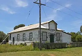 Soldiers Memorial Hall, 2017 | |
Mogriguy | |
| Coordinates | 32°03′44″S 148°39′51″E |
| Postcode(s) | 2830 |
| Location | |
| LGA(s) | Dubbo Regional Council |
| State electorate(s) | Dubbo |
| Federal Division(s) | Parkes |
The area surrounding the village is predominantly sheep grazing and wheat growing country. Once the centre of a vibrant local community, with a wheat silo, town hall, school, tennis courts, cricket ground and post office and general store, Mogriguy experienced a severe decline with the construction of the sealed Mogriguy/Dubbo road, which allowed easy access to the much larger centre of Dubbo. Recent years have seen a further decline in the area, as the severe drought affecting most of New South Wales has limited agricultural productivity.
