Mokoliʻi
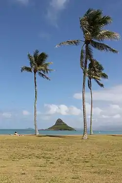
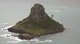
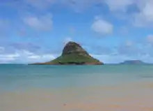
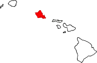
Mokoliʻi, commonly known as Chinaman's Hat, is a basalt islet in Kāneʻohe Bay, Hawaii. Mokoliʻi is part of Kualoa Regional Park and located 1⁄3 mile (0.54 km) offshore of Kualoa Point, Oahu. The 12.5-acre (5.1 ha) islet was at one time part of a basaltic ridge on Oahu before marine erosion separated it.[1]

 | |
| Geography | |
|---|---|
| Location | Oahu, Hawaii |
| Coordinates | 21.5092°N 157.8297°W |
| Area | 12.5 acres (5.1 ha) |
| Highest elevation | 206 ft (62.8 m) |
| Administration | |
United States | |

Etymology
Mokoliʻi translates from Hawaiian as "little lizard." According to Hawaiian mythology, the island is the remains of a giant lizard's or dragon's tail that was chopped off and tossed into the ocean by the goddess Hiʻiaka.[2] The common name of Chinaman's Hat derives from its likeness to the Asian conical hat.[2]
Flora and fauna
Both wildlife and plants of Mokolii have been affected by the presence of non-native species, in particular the black rat and yellow crazy ant. Although other species of birds previously nested there, the Wedge-tailed shearwater is the only species of bird that nests on Mokolii. 72 species of plants have been identified, the majority of which are invasive non-native species. Native plants thrive in the coastal margins and include ahu awa (Cyperus javanicus), naupaka (Scaevola taccada), and ilima (Sida fallax).[3] Invasive plants which dominate the slopes are Lantana camara, Spanish needles (Bidens alba var. radiata), and christmasberry.[3] The island was designated as a critical habitat for Carter’s panicgrass (Panicum fauriei var. carteri) by the U.S. Fish and Wildlife Service (USFWS) in 1983.[1] In 2002, the USFWS initiated a program to eradicate rats from Mokolii.[3]
History
Mokoliʻi was under private ownership until the 1970s, when the City and County of Honolulu had it assessed (World War II D-Day veteran Joseph Coggins was the assessor) and purchased it.[4]
Access
Mokoliʻi is owned by the City and County of Honolulu and is protected by state and federal park regulations. It is open to the public from dawn to dusk. It can be accessed by kayak, boat, surfboard, or by swimming, or wading at low tide.[5] There is also a 20-minute hike to the top of the island.[6]
References
- "Mokolii". Offshore Islet Restoration Committee. U.S. Fish and Wildlife Service Pacific Islands Office. Archived from the original on 5 September 2014. Retrieved 23 September 2013.
- Clark, John A. (November 1, 2004). Beaches of Oahu. A Latitude 20 Book (Revised ed.). University of Hawaii Press. pp. 79–80. ISBN 978-0824828929.
- Starr, Forest; Kim Starr (2006). "Oahu Offshore Islets Botanical Survey" (PDF). Hawaii State Department of Land and Natural Resources. pp. 49–50. Retrieved 25 September 2013.
- http://www.city-data.com/articles/Chinamans-Hat-Kaaawa-Hawaii-Secluded.html
- "Chinaman's Hat - Kaaawa, Hawaii - Secluded Beach and Great Views on Mokolii Island". citydata.com.
- Borders & Bucket Lists (2018-07-25). "The Adventures of Chinaman's Hat, Oahu, Hawaii". Borders & Bucket Lists. Retrieved 2019-02-02.
External links
| Wikimedia Commons has media related to Mokolii. |
- Mokolii Island on Google Maps As of 15 July 2011
- Mokolii Island on Yahoo! Maps As of 27 May 2007
