Monacia-d'Aullène
Monacia-d'Aullène is a commune in the Corse-du-Sud department of France on the island of Corsica.
Monacia-d'Aullène
Munacia d'Auddé | |
|---|---|
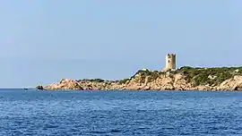 The Tower of Olmeto, a Genoese tower which is located in the commune | |
Location of Monacia-d'Aullène 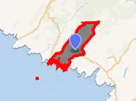
| |
 Monacia-d'Aullène 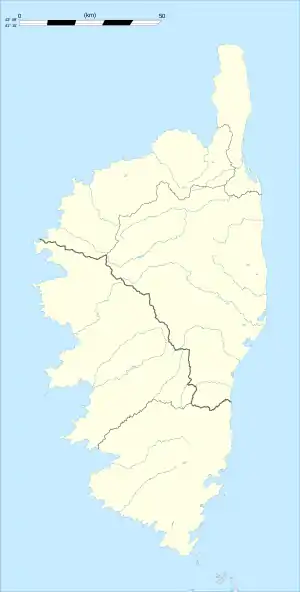 Monacia-d'Aullène | |
| Coordinates: 41°30′49″N 9°00′45″E | |
| Country | France |
| Region | Corsica |
| Department | Corse-du-Sud |
| Arrondissement | Sartène |
| Canton | Grand Sud |
| Government | |
| • Mayor (2008–2014) | Marc Eugène Luciani |
| Area 1 | 40 km2 (20 sq mi) |
| Population (2017-01-01)[1] | 528 |
| • Density | 13/km2 (34/sq mi) |
| Time zone | UTC+01:00 (CET) |
| • Summer (DST) | UTC+02:00 (CEST) |
| INSEE/Postal code | 2A163 /20171 |
| Elevation | 0–1,188 m (0–3,898 ft) (avg. 120 m or 390 ft) |
| 1 French Land Register data, which excludes lakes, ponds, glaciers > 1 km2 (0.386 sq mi or 247 acres) and river estuaries. | |
It is part of the canton of Grand Sud.
Geography
Monacia-d'Aullène is 14 kilometres (9 mi) west northwest of Figari. It was created in 1864 by dividing Aullène. To the north is the 1,292-metre (4,239 ft) high Mount Cagna, known for its balanced granite boulders named the "Man of Cagna", where the isolated hamlet of Giannucio is located. To the southwest, the commune has an opening to the coast between Point Roccapino to the northwest and the Cala di Furnellu. The latter is preceded by Caniscione Point, on which is the Genoese Tower of Olmeto.[2]
Population
| Year | Pop. | ±% |
|---|---|---|
| 1962 | 308 | — |
| 1968 | 325 | +5.5% |
| 1975 | 353 | +8.6% |
| 1982 | 421 | +19.3% |
| 1990 | 412 | −2.1% |
| 1999 | 396 | −3.9% |
| 2005 | 476 | +20.2% |
| 2008 | 478 | +0.4% |
References
- "Populations légales 2017". INSEE. Retrieved 6 January 2020.
- "France, le trésor des régions: Département: Corse-du-Sud" (in French). Retrieved 2008-05-06..
| Wikimedia Commons has media related to Monacia-d'Aullène. |
| Authority control |
|---|
This article is issued from Wikipedia. The text is licensed under Creative Commons - Attribution - Sharealike. Additional terms may apply for the media files.