Bastelicaccia
Bastelicaccia (Corsican: A Bastirgaccia) is a commune in the Corse-du-Sud department of France on the island of Corsica.[2]
Bastelicaccia | |
|---|---|
Location of Bastelicaccia 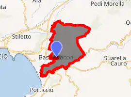
| |
 Bastelicaccia 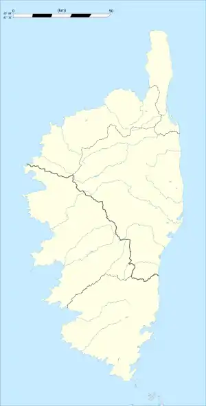 Bastelicaccia | |
| Coordinates: 41°55′23″N 8°49′45″E | |
| Country | France |
| Region | Corsica |
| Department | Corse-du-Sud |
| Arrondissement | Ajaccio |
| Canton | Ajaccio-5 |
| Intercommunality | Celavu-Prunelli |
| Government | |
| • Mayor (2020–2026) | Antoine Ottavi |
| Area 1 | 18.21 km2 (7.03 sq mi) |
| Population (2017-01-01)[1] | 3,983 |
| • Density | 220/km2 (570/sq mi) |
| Time zone | UTC+01:00 (CET) |
| • Summer (DST) | UTC+02:00 (CEST) |
| INSEE/Postal code | 2A032 /20129 |
| Elevation | 7–888 m (23–2,913 ft) (avg. 30 m or 98 ft) |
| 1 French Land Register data, which excludes lakes, ponds, glaciers > 1 km2 (0.386 sq mi or 247 acres) and river estuaries. | |
The inhabitants of the commune are known as Bastilcacci or Bastelicacciais and Bastelicacciaises.[3]
Geography
Bastelicaccia is 11 kilometres (7 mi) to the east of the centre of Ajaccio and immediately to the east of Ajaccio Napoleon Bonaparte Airport. It was created in 1865 between the Gravona and Prunelli Rivers. The highest point in the commune is Monte Aragnasco. Access to the commune is by Route nationale N196 which passes through the south of the commune from the airport in the west to Cauro in the east. The D3 branches off the N196 at the south-western edge of the commune and goes north-east through the commune to Ocana. Access to the village is by the D303 which branches from the D3 in the commune and goes north to the village then continues north to join the D1 west of Cuttoli-Corticchiato. Apart from the main village there are the villages of Colombina, Macina, Bottacina, Cagile, Casaccia, Mascarone, Cuara, Funtanacciu, Mascardaccia, Suaralta, Forcala, and Pisciatello. The commune is hilly with many villages, farms, and some forests.[4][5]
One of the traditional cheeses of Corsica is called bastelicacciu after the commune. It is produced in the lower valleys of the Gravona and Prunelli.[6]
Neighbouring communes and villages[4] | |
|---|---|
History
On the 18th century land survey Bastelicaccia was better known as Bastélica-Communes. It became populated from the beginning of the 19th century.
With a land area of 1820 hectares, the population of about 800 in Bastelica village considered that it was easier to settle in the plains for most farmers as the lowland climate was better in winter. So, in summer, there would be an annual migration back to Bastelica village. As a result, the Chief Surveyor advised the creation of the commune of Bastelicaccia.
Bastelicaccia is part of the Canton of Ajaccio-5. The Canton also includes Alata, Villanova and part of Ajaccio.[7]
Bastelicaccia has evolved at a rapid pace due to the proximity of the regional capital and its urban sprawl.
Administration
| From | To | Name | Party | Position |
|---|---|---|---|---|
| 1866 | M. Seta | |||
| 1866 | 1870 | Joseph Benielli | ||
| 1871 | 1871 | François Porri | ||
| 1871 | 1876 | Jean-Pierre Frassati | ||
| 1876 | 1878 | Innocent Valle | ||
| 1878 | 1900 | Dominique Valle | ||
| 1900 | 1908 | Jean-Toussaint Ottavi | ||
| 1908 | 1919 | Baptiste Paoletti | ||
| 1925 | 1930 | Vincent Vincenti | ||
| 1930 | 1935 | Joseph Vincenti | ||
| 1935 | 1959 | Henri Antonetti | ||
| 1959 | 1977 | Pierre Benielli | ||
| 1977 | 1995 | Augustin Gambarelli | ||
| 2001 | 2020 | Antoine Ottavi | DVG |
(Not all data is known)
Demography
In 2017 the commune had 3,983 inhabitants.
|
| |||||||||||||||||||||||||||||||||||||||||||||||||||||||||||||||||||||||||||||||||
| Source: EHESS[9] and INSEE[10] | ||||||||||||||||||||||||||||||||||||||||||||||||||||||||||||||||||||||||||||||||||
Culture and heritage
Civil heritage
The commune has a very large number of houses that are registered as historical monuments.[11] As well as the houses the commune also has a number of other sites that are registered as historical monuments:
References
- "Populations légales 2017". INSEE. Retrieved 6 January 2020.
- Bastelicaccia on Lion1906
- Inhabitants of Corse-du-Sud (in French)
- Bastelicaccia on Google Maps
- Bastelicaccia on the Géoportail from National Geographic Institute (IGN) website (in French)
- "France, le trésor des régions: Département: Haut-Corse" (in French). Retrieved 27 November 2015..
- Décret n° 2014-229 du 24 février 2014 portant délimitation des cantons dans le département de la Corse-du-Sud
- List of Mayors of France (in French)
- Données Cassini, EHESS
- Population en historique depuis 1968, INSEE
- Base Mérimée: Search for heritage in the commune, Ministère français de la Culture. (in French)
- Ministry of Culture, Mérimée IA2A001372 Bread Oven (in French)
- Ministry of Culture, Mérimée IA2A001350 Prunelli Inn (in French)
- Ministry of Culture, Mérimée IA2A001319 Fontanaccio Primary School (in French)
- Ministry of Culture, Mérimée IA2A001318 Pedocchio Primary School (in French)
- Ministry of Culture, Mérimée IA2A001317 Church of Saint Michel (in French)
- Ministry of Culture, Palissy PM2A000172 Statue: Christ on the Cross (in French)
| Wikimedia Commons has media related to Bastelicaccia. |
| Authority control |
|---|