Mont Ngafula
Mont Ngafula is a municipality (commune) in the Lukunga district of Kinshasa, the capital city of the Democratic Republic of the Congo.[2]
Mont Ngafula | |
|---|---|
| Commune de Mont Ngafula | |
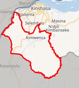
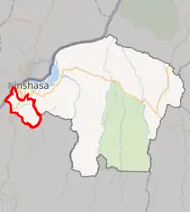
Mont Ngafula on map of Kinshasa city-province | |
_-_Kinshasa.svg.png.webp) Kinshasa city-province on map of DR Congo | |
| Coordinates: 04°25′29″S 15°17′44″E[1] | |
| Country | |
| City-Province | Kinshasa |
| Area | |
| • Total | 358.92 km2 (138.58 sq mi) |
| Population (2004 est.) | |
| • Total | 261,004 |
| • Density | 730/km2 (1,900/sq mi) |
It is in the hilly southern area of Kinshasa and is intersected by the Lukaya River valley in its southern portion. The boundary with the Ngaliema commune is defined by the Lukunga River.[3]
Residence in the area is relatively new; in the 1970s, it became home to a small number of upper and middle-class business executives, politicians and other relatively affluent people. However, many of the would-be extravagant compounds commissioned remain incomplete, mainly due to the drastic economic decline that characterized the latter portion of the Mobutu era.
Demographics
| Year | 1967 | 1970 | 1984 | 2003 | 2004 |
|---|---|---|---|---|---|
| Population | 2,040 | 29,811 | 52,820 | 252,412 | 261,004 |
References
- "Mont Ngafula, Kinshasa, Democratic Republic of the Congo". Google Maps. Retrieved 20 August 2011.
- "Géographie de Kinshasa (Geography of Kinshasa)" (in French). Ville de Kinshasa (City of Kinshasa). Archived from the original on 23 July 2012. Retrieved 20 August 2011.
- Nzuzi, Francis Lelo (2008). Kinshasa: ville et environnement. Editions L'Harmattan. p. 132. ISBN 2-296-06080-3.CS1 maint: ref=harv (link)
This article is issued from Wikipedia. The text is licensed under Creative Commons - Attribution - Sharealike. Additional terms may apply for the media files.