Montana Highway 3
Montana Highway 3 (MT 3) is a highway in central Montana extending north from Billings to Great Falls.[2][3]
| ||||
|---|---|---|---|---|
MT 3 highlighted in red | ||||
| Route information | ||||
| Maintained by MDT | ||||
| Length | 221.770 mi[1] (356.904 km) | |||
| Major junctions | ||||
| South end | ||||
| North end | ||||
| Highway system | ||||
| ||||

Route description
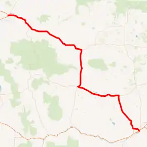
At its southern end, MT 3 begins at I-90 in Billings and travels northwest 47 miles (76 km) to US 12 near Lavina – this is the only section of MT 3 that is not concurrent with a US highway. MT 3 joins US 12 and travels 45 miles (72 km) west to Harlowton, where it leaves US 12 and joins US 191, and travels north for 39 miles (63 km) to Eddie's Corner (near Moore). At Eddie's Corner, MT 3 turns west, leaving US 191 and joining the US 87 / MT 200 concurrency, and travels west 65 miles (105 km) to Armington where US 89 joins the highway. The four highways continue 23 miles (37 km) to Great Falls, where it follows a 0.8-mile (1.3 km) concurrency with I-315 and ends at I-15.[1][3]
MT 3 is part of the Camino Real Corridor (Corridor 27), a High Priority Corridor that connects El Paso, Texas to the Canada–US border at Sweet Grass, Montana. The corridor is anchored by Interstate 25 and is part of the larger Ports-to-Plains Alliance. MT 3 is connected to the Canadian border via I-15, and is connected to I-25 in Buffalo, Wyoming via I-90.[4]
Major intersections
| County | Location | mi[1] | km | Destinations | Notes |
|---|---|---|---|---|---|
| Yellowstone | Billings | 0.000 | 0.000 | I-90 exit 450; US 212 is unsigned | |
| 1.298– 1.369 | 2.089– 2.203 | One-way couplet | |||
| 3.499 | 5.631 | Roundabout | |||
| Golden Valley | | 47.010 | 75.655 | Southern end of US 12 overlap | |
| Ryegate | 63.285 | 101.847 | |||
| Wheatland | Shawmut | 76.929 | 123.805 | ||
| Harlowton | 92.188 | 148.362 | Northern end of US 12 overlap; southern end of US 191 overlap | ||
| Judith Gap | 109.990 | 177.012 | |||
| Fergus | Eddies Corner | 131.421 | 211.502 | Northern end of US 191 overlap; southern end of US 87 / MT 200 overlap | |
| Judith Basin | | 137.574 | 221.404 | ||
| Moccasin | 141.350 | 227.481 | |||
| | 146.367 | 235.555 | |||
| | 153.314 | 246.735 | |||
| | 159.419 | 256.560 | |||
| Geyser | 174.711 | 281.170 | |||
| | 185.591 | 298.680 | |||
| Cascade | Armington Junction | 196.118 | 315.621 | Southern end of US 89 overlap | |
| | 199.721 | 321.420 | |||
| | 212.577 | 342.110 | |||
| Great Falls | 215.596 | 346.968 | |||
| 218.696– 218.776 | 351.957– 352.086 | One-way couplet; northern end of US 87 overlap | |||
| 219.429– 219.514 | 353.137– 353.274 | One-way couplet; southern end of I-15 Bus. overlap | |||
| 220.942 | 355.572 | Fox Farm Road / 6th Street SW | Southern end of I-315 overlap; southern end of freeway | ||
| 221.435 | 356.365 | 14th Street SW | I-315 exit 0 | ||
| 221.770 | 356.904 | Northern end of I-315 / I-15 Bus. / US 89 / MT 200 overlap; I-15 exit 278 | |||
1.000 mi = 1.609 km; 1.000 km = 0.621 mi
| |||||
References
| Wikimedia Commons has media related to Montana Highway 3. |
- "Montana Road Log" (PDF). Montana Department of Transportation. 2011. Retrieved September 14, 2011.
- "Montana Highway 3". Montana Code Annotated 2009. State of Montana. Retrieved 2011-09-13.
- Official 2009-2010 Montana Highway Travel Map (PDF) (Map). Montana Department of Transportation. Retrieved 2011-09-13.
- "Statutory Listing of Corridor Descriptions". High Priority Corridors - National Highway System. FHWA. January 15, 2020. Retrieved January 10, 2021.
