List of secondary highways in Montana
The secondary highway system is a lower-level classification of state highway maintained by the Montana Department of Transportation (MDT) in the US state of Montana. Secondary highways first appeared on the state highway map in 1960,[1] even though the secondary system was established in 1942.[2] With very few exceptions, notably MT 287 and the former MT 789, secondary highways are numbered 201 and higher.
| Montana Secondary Highways | |
|---|---|
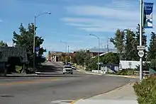
  Highway marker for S-236 and S-323 | |
| System information | |
| Maintained by MDT | |
| Formed | 1942 |
| Highway names | |
| Interstates | Interstate n (I-n) |
| US Highways | U.S. Highway n (US n) |
| State | Montana Highway n (MT n) |
| Secondary | Secondary Highway n (S-n) |
| System links | |
The highway markers for Montana's secondary highways are distinctive in that the route number appears in black on a white downward-pointing arrowhead. Early markers were white numbers on black arrowheads with the word Montana in the flat top of the inverted arrowhead and Secondary appearing below the route number on the shields.
List of highways
| Number | Length (mi) | Length (km) | Southern or western terminus | Northern or eastern terminus | Formed | Removed | Notes | |
|---|---|---|---|---|---|---|---|---|
| 69.511 | 111.867 | MT 13 near Vida | MT 200 in Fairview | 1952 | current | |||
| 34.646 | 55.757 | MT 200 west of Noxon | US 2 east of Troy | 1945 | 1977 | Replaced by MT 56 | ||
| 2.662 | 4.284 | MT 23 near Sidney | McKenzie County Route 38 near Sidney | 1977 | current | |||
| 11.983 | 19.285 | S-269 north of Stevensville | US 93 in Florence | 1952 | current | |||
| 1.596 | 2.569 | Milk River near Dodson | US 2 in Dodson | 1952 | current | |||
| — | — | — | — | 1945 | — | |||
| 24.361 | 39.205 | I-90 at Three Forks | S-411 near Bozeman | 1976 | current | |||
| 9.741 | 15.677 | MT 35 east of Evergreen | US 2 near Columbia Falls | 1945 | current | |||
| — | — | S-208 | US 93 in Kalispell | 1945 | 1977 | Now Lower Valley Road | ||
| 21.862 | 35.183 | US 87/MT 3/MT 200 near Moccasin | MT 81 in Denton | 1978 | current | |||
| — | — | US 93 north of Somers | MT 35 north of Bigfork | 1945 | 1977 | Replaced by MT 82 | ||
| 9.412 | 15.147 | US 191 in Phillips County | Whitewater | 1978 | current | |||
| 4.861 | 7.823 | MT 35 at Bigfork | MT 83 near Ferndale | 1945 | current | Partially replaced by MT 83 in 1977 | ||
| 9.855 | 15.860 | MT 200 at Missoula | I-90/US 12 at Clinton | 1976 | current | Former U.S. 10 | ||
| 9.757 | 15.702 | Flathead River near Ronan | US 93 in Ronan | 1945 | current | Round Butte Road | ||
| 17.285 | 27.818 | MT 200 near Dixon | US 93 near Charlo | 1945 | current | |||
| 39.513 | 63.590 | US 2 in Cut Bank | Hwy 62 at the Port of Del Bonita | 1945 | current | |||
| 32.828 | 52.832 | S-213 near Cut Bank | I-15 at Sweet Grass | 1945 | current | |||
| 21.299 | 34.277 | S-213 near Cut Bank | I- near Oilmont | 1945 | current | |||
| — | — | I-15 near Valier | US 89 | 1945 | 1977 | Replaced by MT 44 | ||
| — | — | Marysville | S-279 in Silver City | 1981 | 1993 | Now Marysville Road | ||
| — | — | — | — | 1945 | — | |||
| 14.087 | 22.671 | S-343 near Whitlash | S-409 at Whitlash | 1976 | current | |||
| 29.253 | 47.078 | I-15 Bus in Conrad | S-225 near Tiber Dam | 1945 | current | |||
| 19.818 | 31.894 | US 89 near Pendroy | I-15 Bus near Conrad | 1945 | current | |||
| 17.940 | 28.872 | S-221 near Choteau | S-219 east of Pendroy | 1945 | current | |||
| 24.444 | 39.339 | US 89 at Choteau | I-15/S-379 near Dutton | 1945 | current | |||
| — | — | — | — | 1945 | — | |||
| 3.589 | 5.776 | I-15/S-278 south of Dillon | I-15 Bus. at Dillon | 1976 | current | |||
| 52.901 | 85.136 | US 87/MT 80 near Fort Benton | US 2 in Chester | 1945 | current | |||
| 18.950 | 30.497 | US 2 near Joplin | 1200 Road S near Whitlash | 1945 | current | |||
| 56.220 | 90.477 | US 87 in Great Falls | S-366 near Tiber Dam | 1945 | current | |||
| 14.560 | 23.432 | Eden | US 87/US 89/MT 3 in Great Falls | 1945 | current | |||
| 16.756 | 26.966 | S-226 near Eden | US 87/US 89/MT 3/MT 200 near Great Falls | 1945 | current | |||
| 42.633 | 68.611 | US 87/US 89/MT 3/MT 200 near Great Falls | MT 80 near Fort Benton | 1945 | current | |||
| — | — | — | — | 1945 | 1954 | |||
| 2.592 | 4.171 | Helena city limits | S-279 near Helena | 1976 | current | |||
| — | — | US 87 at Stanford | US 87 at Fort Benton | 1945 | 1977 | Not built until 1945; replaced by MT 80 | ||
| — | — | East of Laurel | S-429 (Shiloh Road) in Billings | 1982 | 1993 | I-90 south frontage road | ||
| — | — | US 2 in Rudyard | Goldstone | 1945 | 1977 | Restored as S-255 in 1984 | ||
| 5.674 | 9.131 | US 12 in Helena | S-279 near Helena | 1983 | current | |||
| 42.784 | 68.854 | US 2 in Havre | Hwy 41 at the Port of Wild Horse, Alberta | 1945 | current | |||
| 30.482 | 49.056 | S-232 near Havre | Hwy 21 at the Port of Willow Creek | 1945 | current | |||
| 21.662 | 34.862 | Rocky Boys Indian Reservation | US 2 in Havre | 1945 | current | |||
| — | — | S-230 near Coffee Creek | US 191 at Brooks | 1945 | 1977 | Replaced by MT 81 | ||
| 5.610 | 9.028 | MT 85 near Bozeman | S-412 in Bozeman | 1983 | current | |||
| 88.235 | 142.000 | US 191 at Hilger | US 87 at Big Sandy | 1945 | current | |||
| 2.478 | 3.988 | S-426 near Hanover | US 87 Business/US 191 Business at Lewistown | 1945 | current | |||
| 68.888 | 110.864 | US 2 in Ryegate | US 89/MT 200 in Lewistown | 1945 | current | |||
| 11.666 | 18.775 | Utica | US 87/MT 3/MT 200 in Hobson | 1945 | current | |||
| 25.333 | 40.770 | Cleveland | US 2 in Chinook | 1945 | current | |||
| 43.220 | 69.556 | US 2 at Harlem | Hwy 37 at the Port of Turner | 1945 | current | |||
| — | — | Port of Morgan at the Saskatchewan border | Malta | 1945 | 1993 | Replaced by US 191 | ||
| 21.185 | 34.094 | US 2 near Bowdoin National Wildlife Refuge | US 2 in Saco | 1945 | current | |||
| 24.702 | 39.754 | US-87 north of Roundup | MT 200 in Winnett | 1945 | current | |||
| 37.826 | 60.875 | Brusett | MT 200 in Jordan | 1945 | current | |||
| 11.548 | 18.585 | Tampico | MT 42 in Glasgow | 1945 | current | |||
| — | — | Port of Opheim | US-2 in Glasgow | 1945 | 1977 | Replaced by MT 24 | ||
| 6.260 | 10.074 | S-322 near Mill Iron | Webster | 1983 | current | |||
| 46.134 | 74.245 | MT 24 in Opheim | MT 13 in Scobey | 1945 | current | Old route of MT 5 | ||
| — | — | MT 24 at Fort Peck | US 2 at Nashua | 1945 | 1977 | Replaced by MT 117 | ||
| 11.775 | 18.950 | MT 287 near Ennis | US 287 near Cameron | 1984 | current | |||
| 49.416 | 79.527 | US 2 near Wolf Point | MT 13 near Volt | 1945 | current | |||
| 52.109 | 83.861 | US 2 near Poplar | MT 5/S-511 near Flaxville | 1945 | current | |||
| 23.438 | 37.720 | MT 200 near Circle | Horse Creek | 1945 | current | |||
| 46.913 | 75.499 | I-94 in Terry | MT 200 in Brockway | 1945 | current | |||
| 67.705 | 108.961 | MT 16 in Glendive | MT 13 near Vida | 1945 | current | |||
| — | — | — | — | 1945 | — | |||
| 24.936 | 40.131 | US 2 in Rudyard | Goldstone | 1984 | current | |||
| — | — | MT 15 in Plentywood | Hwy 6 near Port of Raymond | 1945 | 1977 | Replaced by MT 16 | ||
| 5.772 | 9.289 | I-90 in Superior | Trout Creek | 1952 | current | |||
| 19.800 | 31.865 | MT 16 in Reserve | ND 50 at North Dakota border | 1945 | current | |||
| — | — | — | — | 1945 | 1954 | |||
| 10.073 | 16.211 | S-360 near White Sulphur Springs | US 89 at Newlan Creek | 1984 | current | |||
| — | — | Lambert | MT 14/MT 16 in Sidney | 1945 | 1950 | Replaced by MT 23 (later MT 20; now MT 200) | ||
| 3.577 | 5.757 | Bobtail Road near Libby | S-567 near Libby | 1986 | current | |||
| 51.446 | 82.794 | I-94 in Wibaux | MT 23 in Sidney | 1945 | current | Former MT 7 | ||
| — | — | County Road southeast of St. Regis | S-257 in Superior | 1945 | 1977 | Now Diamond Road and Southside Road | ||
| 14.786 | 23.796 | I-90 in Frenchtown | US 93 in Missoula | 1945 | current | |||
| — | — | S-266 in Missoula | S-265 in Missoula | 1945 | 1974 | Now 3rd Street and Clements Road | ||
| — | — | S-266 in Missoula | S-264 in Missoula | 1945 | 1974 | Now South Avenue | ||
| — | — | US 12 in Missoula | S-390 in Missoula | 1945 | 1974 | Now Higgins Avenue | ||
| — | — | Sawmill Gulch Road | MT 200 in Missoula | 1945 | 1993 | Now Van Buren Street and Rattlesnake Drive | ||
| — | — | — | — | 1945 | 1977 | |||
| 21.284 | 34.253 | US 93/S-531 in Hamilton | US 93 in Stevensville | 1945 | current | |||
| — | — | Capitol | S-323 in Albion | 1953 | 1993 | |||
| 22.319 | 35.919 | I-90 in Drummond | MT 141 near Helmville | 1945 | current | Partially replaced by MT 141 in 1978 | ||
| 2.024 | 3.257 | S-271 near Helmville | US 12 in Avon | 1945 | 1977 | Replaced by MT 141 | ||
| 2.024 | 3.257 | Montana State Prison | S-275 in Deer Lodge | 1987 | current | |||
| 12.181 | 19.603 | MT 48 near Opportunity | I-90 in Galen | 1945 | current | |||
| — | — | MT 43 near Wise River | MT 1 near Opportunity | 1945 | 1985 | Restored in 2001 as S-569 | ||
| — | — | — | — | 1945 | 1977 | |||
| 3.045 | 4.900 | I-90 in Deer Lodge | I-90 near Deer Lodge | 1987 | current | |||
| 7.863 | 12.654 | I-90 near Rocker | Rocker | 1945 | current | |||
| 33.556 | 54.003 | US 212 in Hammond | S-323 near Ridgeway | 1952 | current | |||
| 61.092 | 98.318 | MT 43 in Wisdom | I-15/S-222 in Dillon | 1945 | current | |||
| 38.965 | 62.708 | I-15/US 287/S-453 in Helena | MT 200 near Flecher Pass | 1945 | current | |||
| 16.050 | 25.830 | I-15 in Helena | Trout Creek Canyon | 1945 | current | |||
| — | — | MT 2 at Cardwell | I-15 at Boulder | 1945 | 1977 | Replaced by MT 69 | ||
| — | — | — | — | 1945 | — | |||
| 3.575 | 5.753 | Jack Mountain | I-15/S-518 near Montana City | 1987 | current | |||
| 6.434 | 10.355 | Pony | US 287 in Harrison | 1945 | current | |||
| 42.073 | 67.710 | US 12/US 287 near Canyon Ferry | US 12 near Townsend | 1945 | current | |||
| 9.371 | 15.081 | Radersburg | US 287 in Toston | 1945 | current | |||
| 3.930 | 6.325 | S-205 near Three Forks | Trident | 1945 | current | |||
| 7.931 | 12.764 | MT 2 in Three Forks | Williams Bridge Road south of Willow Creek | 1945 | current | |||
| 16.176 | 26.033 | S-347 in Amsterdam | I-90/S-346 in Manhattan | 1945 | current | |||
| — | — | US 287 in Norris | US 191/S-291 near Four Corners | 1945 | 1977 | Replaced by MT 84 | ||
| 16.247 | 26.147 | S-205 in Belgrade | 16 Mile Creek near Maudlow | 1945 | current | |||
| 0.826 | 1.329 | S-205 in Belgrade | I-90/MT 85 in Belgrade | 1993 | 2001 | Now Jackrabbit Lane; partially replaced by MT 85 in 1977 | ||
| — | — | — | — | 1945 | 1977 | |||
| 8.789 | 14.145 | S-548 in Evergreen | MT 40 near Whitefish | 1996 | current | |||
| — | — | US 191/I-90 Bus. in Bozeman | US 89 near Wilsall | 1945 | 1977 | Replaced by MT 86 | ||
| 29.169 | 46.943 | US 89 near Horse Butte | US 12 near Martinsdale | 1945 | current | |||
| 16.379 | 26.359 | I-90 near Livingston | I-90 near Mission | 1945 | current | |||
| — | — | US 12 in Two Dot | Lebo Lake | 1945 | 1977 | Now Two Dot Highway | ||
| 37.818 | 60.862 | US 12/MT 3 in Shawmut | MT 3 in Judith Gap | 1945 | current | |||
| 25.655 | 41.288 | Boulder Ranger Station | US 191 in Big Timber | 1945 | current | |||
| — | — | — | — | 1945 | 1977 | |||
| 13.341 | 21.470 | Big Coolie Creek | US 12/MT 3/S-238 in Ryegate | 1945 | current | |||
| — | — | MT 6 in Lavina | I-90 in Billings | 1945 | 1956 | Replaced by MT 3 | ||
| 14.322 | 23.049 | Molt | MT 3 in Billings | 1945 | current | |||
| — | — | — | — | 1945 | 1977 | |||
| — | — | Shepherd | US 312 | 1945 | 1977 | Now Shepherd Road | ||
| — | — | Laurel | S-302 in Billings | 1945 | 1977 | Now 72nd Street and S-532 (King Avenue) | ||
| 25.273 | 40.673 | MT 78 in Columbus | Rapelje | 1945 | current | |||
| — | — | US 212 at Red Lodge | I-90 at Columbus | 1945 | 1977 | Replaced by MT 78 | ||
| 14.383 | 23.147 | US 212 in Red Lodge | MT 72 in Belfry | 1945 | current | Partially replaced by MT 72 | ||
| — | — | — | — | 1945 | 1972 | |||
| 41.348 | 66.543 | I-94 in Custer | US 12 near Musselshell | 1945 | current | |||
| 25.915 | 41.706 | S-310 in Myers | I-94 in Hysham | 1945 | current | |||
| — | — | — | — | 1945 | 1962 | |||
| 38.588 | 62.101 | Fort Smith | MT 47 in Hardin | 1945 | current | |||
| 44.342 | 71.362 | WYO 338 near Decker | US 212 near Busby | 1946 | current | |||
| — | — | US 212 in Lame Deer | North of I-94 near Forsyth | 1945 | 1977 | Replaced by MT 45 | ||
| — | — | — | — | 1945 | — | |||
| 3.503 | 5.638 | US 93 in Kalispell | MT 35 in Kalispell | 1953 | c. 2012 | |||
| — | — | Swords Park | Billings Municipal Airport | 1945 | 1974 | Now East Airport Road | ||
| — | — | US 212 near Broadus | Wyoming border south of Biddle | 1945 | 1967 | Replaced by MT 59 | ||
| 6.070 | 9.769 | US 12 near Plevna | Ismay | 1945 | current | |||
| — | — | — | — | 1945 | 1977 | |||
| 26.908 | 43.304 | Medicine Rocks | MT 7 near Baker | 1945 | current | |||
| 71.126 | 114.466 | US 212/S-326 in Alzada | MT 7 in Ekalaka | 1945 | current | |||
| 34.429 | 55.408 | SH 29 at Bannock Pass | I-15 near Clark Canyon Dam | 1945 | current | |||
| 13.353 | 21.490 | US 2 in Chinook | North Chinook Reservoir | 1946 | current | |||
| — | — | MT 35 in Bigfork | S-209 near Bigfork | 1954 | 1977 | Replaced by MT 83 | ||
| 1.683 | 2.709 | WYO 112 near Alzada | US 212/S-323 in Alzada | 1990 | current | |||
| 15.043 | 24.209 | ND 1804 at Fort Union | US 2 Bainville | 1953 | current | |||
| — | — | MT 3 in Broadview | MT 3 in Acton | 1953 | 1977 | Now 21 Mile Road and Oswald Road | ||
| 18.843 | 30.325 | S-323 near Ekalaka | SD 20 near Capitol | 1994 | current | |||
| — | — | — | — | 1945 | 1977 | |||
| 36.924 | 59.423 | MT 68 in Cascade | I-15 in Ulm | 1945 | current | |||
| 10.072 | 16.209 | US 87/US 89 in Belt | S-228 near Highwood | 1945 | current | |||
| 50.391 | 81.096 | S-447 near Brandenburg | MT 59 near Twelve Mile Dam | 1945 | current | |||
| — | — | US 12 east of Miles City | Mizpah | 1945 | 1983 | Now Mizpah Road and Trail Creek Road | ||
| — | — | Port of Scobey | MT 5 in Scobey | 1945 | 1962 | Replaced by MT 13 | ||
| 3.760 | 6.051 | Beaver Creek Reservoir | US 87 in Laredo | 1994 | current | |||
| 14.598 | 23.493 | Balier Reservoir | I-94 in Glendive | 1945 | current | |||
| 14.595 | 23.488 | MT 7 near Rush Hall | ND 16 near Carlyle | 1945 | current | |||
| — | — | — | — | 1956 | 1957 | |||
| 21.558 | 34.694 | S-241 near Harlem | Hogeland | 1954 | current | |||
| — | — | US 89 near Wilsall | Smith Creek Road northeast of Wilsall | 1954 | 1977 | Now Shields River Road | ||
| 18.501 | 29.774 | Mildred | I-94 in Fallon | 1954 | current | |||
| 21.930 | 35.293 | MT 200 near Jordan | Fort Peck Lake | 1954 | current | |||
| 0.859 | 1.382 | US 212 near Crow Agency | Little Big Horn Battlefield | 1954 | current | |||
| 43.227 | 69.567 | I-15/S-215 in Oilmont | US 2 near Galata | 1954 | current | |||
| 35.648 | 57.370 | US 2 in Brockton | MT 16 in Froid | 1954 | current | |||
| 12.036 | 19.370 | US 191 in Gallatin Gateway | Kagy Boulevard in Bozeman | 1951 | current | |||
| 7.975 | 12.835 | I-90/S-288 in Manhattan | S-290 at Manhattan city limits | 1946 | current | |||
| 6.226 | 10.020 | S-288 in Amsterdam | MT 85 in Belgrade | 1945 | current | |||
| 13.974 | 22.489 | Gilles | MT 1 in Philipsburg | 2945 | current | |||
| 5.487 | 8.830 | Homestead | MT 16 near Medicine Lake | 1954 | current | |||
| 5.093 | 8.196 | US 93 in Dayton | Lake Mary Ronan | 1945 | current | |||
| — | — | Round Butte | Moiese | — | — | |||
| — | — | Helena | — | — | — | |||
| — | — | US 12 in Helena | Central Avenue in Helena | — | — | Formerly ended at S-279 near Birdseye | ||
| 26.800 | 43.130 | Ruby River Reservoir | MT 287 in Alder | 1945 | current | |||
| 27.838 | 44.801 | MT 44 in Valier | US 2 in Cut Bank | 1954 | current | |||
| 15.964 | 25.692 | MT 2/MT 69 in Harrison | MT 2 in Cardwell | 1945 | current | |||
| 18.217 | 29.317 | Fort Logan | US 12/US 89 in White Sulphur Springs | 1945 | current | |||
| 11.203 | 18.029 | US 2 in Dodson | US 191 in Malta | 1945 | current | |||
| — | — | US 191 in Malta | South Black Coulee Road near Malta | — | — | |||
| 24.231 | 38.996 | Brady | S-225 near Carter | 1945 | current | |||
| 49.245 | 79.252 | I-15 near Ledger | S-223 near Chester | 1945 | current | |||
| 1.954 | 3.145 | US 93 near Victor | S-203 near Stevensville | 1945 | current | |||
| — | — | Melville | Twodot | — | — | |||
| 4.529 | 7.289 | US 93 in Woodside | Corvallis | 1945 | current | |||
| 6.503 | 10.466 | MT 5 in Archer | Outlook | 1945 | current | |||
| — | — | Continental Drive—downtown Butte | US 10 southeast of Butte | — | — | |||
| — | — | Fort Belknap Agency | US 191 near Landusky | — | — | Replaced by MT 66 | ||
| — | — | Stevensville | Bitterroot National Forest | — | — | |||
| 18.008 | 28.981 | I-15/S-221 near Dutton | S-225 near Carter | 1945 | current | |||
| 16.370 | 26.345 | Colding Creek | US 12 near Roundup | 1945 | current | |||
| 15.703 | 25.272 | MT 28 near Hot Springs | MT 200 in Perma | 1945 | current | |||
| 57.052 | 91.816 | MT 47 in Hardin | I-94 near Sanders | 1945 | current | |||
| 1.534 | 2.469 | US 87 in Kershaw | MT 80 in Fort Benton | 1945 | current | |||
| 2.646 | 4.258 | MT 80 in Fort Benton | US 87 in Loma | 1945 | current | |||
| — | — | US 12 in Missoula | US 12 in Missoula | 1945 | 1974 | Now 39th Street and Russell Street | ||
| 16.563 | 26.656 | Yarger | US 212/MT 59 in Broadus | 1945 | current | |||
| 6.594 | 10.612 | Newcomb | MT 2 in Butte | 1945 | current | |||
| 16.908 | 27.211 | S-211 in Harlem | Coburg | 1946 | current | Former routing of US 2 | ||
| — | — | Belfry | Wyoming border | — | — | Replaced by MT 72 | ||
| — | — | county road 4.7 miles north of MT 48 | MT 48 3 miles east of Anaconda | 1946 | 1956 | Replaced by S-273 | ||
| 7.009 | 11.280 | US 212/MT 59 in Broadus | Powderville | 2000 | current | |||
| 25.228 | 40.601 | I-90/MT 55 in Whitetail | MT 69 in Boulder | 1946 | current | |||
| 12.335 | 19.851 | Buffalo | S-239 near Hobson | 1946 | current | |||
| — | — | — | — | — | — | Replaced by MT 55 | ||
| 7.903 | 12.719 | S-532 near Laurel | S-302 near Molt | 1987 | current | |||
| 7.009 | 11.280 | US 212/MT 59 in Broadus | Powderville | 1946 | 1987 | Now S-398 | ||
| — | — | Brockton | — | — | — | |||
| 28.371 | 45.659 | US 2 near Bainville | MT 16 in Froid | 1946 | current | |||
| 19.568 | 31.492 | US 287 near Gilman | US 89 in Fairfield | 1946 | current | |||
| 40.499 | 65.177 | US 2 in Chester | MWYO 880 near Whitlash | 1946 | current | |||
| 10.744 | 17.291 | S-205/S-570 in Bozeman | Springhill Cemetery | 1946 | current | |||
| 0.349 | 0.562 | S-411 near Bozeman | S-205 bridge in Bozeman | 1995 | c. 2012 | |||
| 24.709 | 39.765 | MT 7 near Carlyle | MT 7 near Saint Phillip | 1948 | current | |||
| 14.113 | 22.713 | S-418 near Pryor | I-90/US 212 in Billings | 1950 | current | |||
| 16.530 | 26.602 | S-366 near Ledger | US 2 near Shelby | 1950 | current | |||
| 16.124 | 25.949 | S-416 near Pryor | Pryor | 2000 | current | |||
| 21.254 | 34.205 | Limestone | MT 78 near Absarokee | 1951 | current | |||
| 6.929 | 11.151 | S-419 in Nye | MT 78 near Absarokee | 1951 | current | |||
| 18.167 | 29.237 | MT 78 near Columbus | US 212 near Joliet | 1951 | current | |||
| 8.521 | 13.713 | MT 41 in Silver Star | MT 55 near Waterloo | 1951 | current | |||
| 17.108 | 27.533 | US 93 in Kalispell | US 93 west of Whitefish | 1976 | current | |||
| — | — | Roscoe | Fishtail | — | — | |||
| 26.573 | 42.765 | US 87/MT 3/MT 200 near Kolin | US 191 in Lewistown | 1951 | current | |||
| 12.319 | 19.826 | US 89 at Currie Spring | US 87/MT 3/MT 200 in Raynesford | 1951 | current | |||
| — | — | US 191 in Judith Gap | Living Springs Road | 1952 | 1977 | Replaced by an extended S-297 | ||
| — | — | Zoo Drive in Billings | S-429 (Shiloh Road) in Billings | 1999 | 2001 | I-90 south Frontage Road | ||
| 6.392 | 10.287 | Zoo Drive in Billings | S-428 (I-90 Frontage Road) in Billings | 1952 | 2001 | Now Shiloh Road | ||
| 3.802 | 6.119 | S-280 in Helena | S-284 near Canyon Creek | 1987 | current | |||
| 19.999 | 32.185 | US 89/S-565 near Fairfield | I-15 in Power | 1955 | current | |||
| 46.932 | 75.530 | US 2 in Rudyard | US 287/S-223 in Big Sandy | 1955 | current | |||
| 18.032 | 29.020 | I-15 near Wolf Creek | MT 200 near Johnson Mountain | 1955 | current | |||
| 15.361 | 24.721 | US 287 in Augusta | Johnson Mountain | 1987 | current | |||
| — | — | US 2 near Chinook | Saskatchewan border | — | — | Now local Blaine County roads | ||
| 8.895 | 14.315 | S-285 near Radersburg | US 287 Toston | 1956 | current | |||
| 52.465 | 84.434 | US 2 in Nashua | S-248 nearGlentana | 1955 | current | |||
| 7.829 | 12.600 | I-90 near Gregson | MT 1 near Opportunity | 1956 | current | |||
| 19.773 | 31.822 | US 2 near Blackfoot | S-213 near Bonita | 1956 | current | |||
| 2.778 | 4.471 | I-94/S-447 in Rosebud | Cartersville | 1956 | current | |||
| 52.478 | 84.455 | US 212 in Ashland | I-94/S-446 in Rosebud | 1956 | current | |||
| 30.108 | 48.454 | US 87 in Box Elder | US 2/S-449 Gildford | 1955 | current | |||
| 16.590 | 26.699 | US 2/S-448 in Gildford | Milk River | 1955 | current | |||
| 38.047 | 61.231 | WYO 345 south of Wyola | I-90/US 87 north of Wyola | 1988 | current | Formerly US 87 | ||
| 5.121 | 8.241 | I-15/US 287/S-279 in Helena | Lake Helena | 1955 | current | |||
| 3.330 | 5.359 | Unionville | US 12 in Helena | 1955 | current | |||
| 1.506 | 2.424 | S-451 in Wyola | I-90/US 87 near Wyola | 1988 | current | |||
| — | — | Great Falls | S-226 | — | — | |||
| — | — | MT 200 near Paradise | St. Regis | — | — | Replaced by MT 135 | ||
| 38.464 | 61.902 | MT 59 in Rock Springs | MT 200 near Brockway | 1956 | current | |||
| 14.202 | 22.856 | Willow Creek Dam | I-90 in Lodge Grass | 1957 | current | |||
| 33.671 | 54.188 | US 2/US 89 in Browning | US 89 in Babb | 1957 | current | |||
| 2.160 | 3.476 | Hansons Creek Road near Lewistown | S-238 near Lewistown | 1956 | current | |||
| 31.745 | 51.089 | MT 200S in Lindsay | MT 200 in Circle | 1957 | current | |||
| 24.032 | 38.676 | MT 200S in Lindsay | S-254 in Bloomfield | 1957 | current | |||
| 22.069 | 35.517 | NFS Route 9 at Idaho border near Murray, Idaho | MT 200 near Thompson Falls, Montana | 1957 | current | |||
| 16.5 | 26.6 | US 93 in Sula | Reynolds Creek Road near Martin Creek Campground | 1993 | current | |||
| 14.394 | 23.165 | Painted Rocks State Park | US 93 near Conner | 1957 | current | |||
| 3.859 | 6.210 | S-263 near Frenchtown | I-90/US 93/MT 200 in Wye | 1957 | current | |||
| — | — | S-540 near Pray | Montanapolis Springs | — | — | |||
| 21.995 | 35.398 | US 191 near Big Timber | Stephens Hill Road near Rapelje | 1957 | current | |||
| 19.696 | 31.698 | S-201 near Richey | US 2 in Sprole | 1957 | current | |||
| 7.176 | 11.549 | US 2 near Libby Creek | US 2 near Libby | 1958 | current | |||
| — | — | Port of Del Bonita | Santa Rita | — | — | Replaced by an extension of S-213 | ||
| 27.863 | 44.841 | Fort Howe | US 212 near Ashland | 1958 | current | |||
| — | — | Trailcreek | Columbia Falls | — | — | |||
| 22.646 | 36.445 | US 2 in Columbia Falls | Camas Creek entrance of Glacier National Park | 1958 | current | |||
| 7.223 | 11.624 | US 93 in Whitefish | Whitefish Mountain Resort at Big Mountain | 1958 | current | |||
| 18.006 | 28.978 | MT 59 near Miles City | Kinsey | 1985 | current | |||
| 4.877 | 7.849 | MT 7 near Baker | Anticline Road near Plevna | 1959 | current | |||
| 22.743 | 36.601 | MT 7 in Willard | US 12 in Plevna | 1959 | current | |||
| — | — | Great Falls | — | — | — | |||
| — | — | Bainville | MT 16 | — | — | |||
| — | — | In Great Falls | — | — | — | Replaced by bypass US 87 | ||
| — | — | Follows the north end of Hebgen Lake from MT 287 | US 191 | — | — | Replaced by US 287 in 1964 | ||
| 30.407 | 48.935 | US 12 near Melstone | MT 200 in Mosby | 1960 | current | |||
| — | — | MT 38 at Grantsdale | Sleeping Child Hot Springs | — | — | |||
| 12.166 | 19.579 | US 93A near Kalispell | US 2 in Kalispell | 1960 | current | |||
| 12.847 | 20.675 | S-340 in Marsh | Cabin Creek | 1960 | current | |||
| — | — | Lewistown | Glengarry | — | — | |||
| — | — | Yaak | Libby | — | — | Replaced by S-567 | ||
| 2.533 | 4.076 | I-90 in Alberton | I-90 near Huson | 1961 | current | |||
| 29.272 | 47.109 | US 2 near Troy | S-567 in Yaak | 1961 | current | |||
| 37.499 | 60.349 | I-15 in Monida | Red Rock Lakes National Wildlife Refuge | 1961 | current | |||
| — | — | Brockway | Dry Ash Creek | — | — | |||
| 13.790 | 22.193 | MT 5/S-251 in Flaxville | Whitetail | 1962 | current | Formerly MT 13; formerly ended at Port of Whitetail | ||
| 13.790 | 22.193 | MT 1/S-513 in Hall | New Chicago Road near Hall | 1962 | current | |||
| 9.663 | 15.551 | Lower Willow Creek Road near Hall | MT 1/S-512 in Hall | 1962 | current | |||
| — | — | Poplar | Plentywood | — | — | |||
| — | — | US 2 | Katy Lake | — | — | |||
| 6.008 | 9.669 | S-258 near Dagmar | S-517 in Coalridge | 1961 | current | |||
| 12.291 | 19.780 | MT 16 near Antelope | S-516 in Coalridge | 1961 | current | |||
| 4.468 | 7.191 | I-15/S-282 in Montana City | US 12/US 287 in East Helena | 1961 | current | |||
| 2.368 | 3.811 | I-94 in Huntley | Worden | 1962 | current | |||
| 18.703 | 30.100 | Prairie Elk Road near Oswego | MT 13 near Macon | 1998 | current | |||
| 9.959 | 16.027 | Clear Creek Road near Chinook | S-240 in Chinook | 1963 | current | |||
| 6.308 | 10.152 | US 93 in Grantsdale | US 93/S-269 in Hamilton | 1963 | current | |||
| 17.628 | 28.370 | I-90/US 212/US 310 in Laurel | I-90/US 212 in Billings | 1964 | current | |||
| 27.894 | 44.891 | US 89 in Dupuyer | S-218 in Conrad | 1964 | current | |||
| 23.126 | 37.218 | US 2 in Hinsdale | Snake Creek Road near Hinsdale | 1965 | current | |||
| 31.859 | 51.272 | US 89 near Miner | US 89 near Pine Creek | 1966 | current | |||
| 10.691 | 17.205 | S-239 Utica | US 87/MT 3/MT 200 in Windham | 1966 | current | |||
| 24.160 | 38.882 | MT 200 in Jordan | Hell Creek State Park | 1967 | current | |||
| 32.937 | 53.007 | MT 59 in Biddle | US 212 in Boyes | 1968 | current | |||
| 6.477 | 10.424 | MT 81 in Denton | Bear Springs Road near Denton | 1969 | current | |||
| 6.521 | 10.495 | US 93 near Whitefish | US 2 in Kalispell | 1969 | current | |||
| 6.515 | 10.485 | US 87/MT 3/MT 200 in Geyser | Braun Creek Road near Geyser | 1971 | current | |||
| 33.090 | 53.253 | I-15 at Sunburst | S-343 near Whitlash | 1973 | current | |||
| 44.200 | 71.133 | MT 200 near Snider | US 2 near Happy's Inn | 1971 | current | |||
| 3.118 | 5.018 | US 93/MT 200 near Arlee | Jocko Canyon Road near Arlee | 1973 | current | |||
| — | — | I-90 near Springdale | Springdale | — | — | |||
| 24.992 | 40.221 | US 87 in Carter | S-223 near Loma | 1975 | current | |||
| 7.134 | 11.481 | MT 200 in Simms | US 89/S-441 near Fairfield | 1975 | current | |||
| 51.835 | 83.420 | S-314 near Tongue River Reservoir State Park | US 212 in Ashland | 1975 | current | |||
| 35.943 | 57.845 | MT 37 in Libby | S-508 in Yaak | 1994 | current | |||
| 2.673 | 4.302 | I-94 near Pompeys Pillar | Pompeys Pillar | 1976 | current | |||
| 22.020 | 35.438 | MT 43 near Wise River | MT 1 near Opportunity | 2001 | current | |||
| — | — | S-205/S-411 in Bozeman | I-90 in Bozeman | — | — | |||
| 1.168 | 1.880 | US 89 in Emigrant | S-540 near Emigrant | 2001 | current | |||
| 1.750 | 2.816 | S-540 near Emigrant | Chico Hot Springs | 2001 | current | |||
| 14.870 | 23.931 | MT 16 in Medicine Lake | Katy Lake | 2001 | current | |||
| 10.970 | 17.655 | I-90 in Huson | US 93/MT 200 near Wye | 2006 | current | |||
| ||||||||
Secondary Highway 206
| |
|---|---|
| Location | Flathead County |
| Length | 9.741 mi[3] (15.677 km) |
| Existed | 1960–present |
Secondary Highway 206 (S-206) is a 9.741-mile-long (15.677 km) secondary state highway in Flathead County, Montana connecting Montana Highway 35 (MT 35) east of Evergreen to U.S. Highway 2 (US 2) east of Columbia Falls.
S-206 begins at the junction with MT 35 and runs almost due north to its terminus with US 2 east of Columbia Falls, providing a rural bypass for traffic headed to Glacier National Park, Kalispell, Bigfork and Polson.
S-206 passes through mostly rural landscape, and wildlife crossings should be expected at all times as animals search for food and water.
Today's S-206 was part of the original 1926 US 2 corridor from Kalispell to Columbia Falls (along with MT 35 from the S-206 southern terminus to Evergreen). This two-lane paved road was initially built in 1934 and last improved in 2011 as listed in the state road log.[3]
The S-206 designation has existed since at least 1960[1] when S-206 was LaSalle Road, an 11.104-mile-long (17.870 km) four-lane highway that connected US 2 in Evergreen to MT 40 west of Columbia Falls and provides access to Glacier Park International Airport. It was route swapped from LaSalle Road in 1983 (as seen in the 1985 state map),[4] and the former routing is now part of US 2 from junction P-52 (MT 35) to junction N-38 (MT 40).[3]
Secondary Highway 232
| |
|---|---|
| Location | Hill County |
| Length | 42.784 mi[5] (68.854 km) |
| Existed | c. 1945–present |
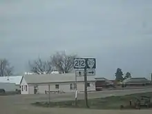
Secondary Highway 232 (S-232) is a 42.784 miles (68.854 km) long[5] secondary state highway in eastern Hill County connecting Havre and the Canada–United States border.
Secondary Highway 232 begins in the census-designated place (CDP) of Havre North, at Havre city limits, and travels north to Secondary Highway 233 at 3.316 miles. S-232 turns northwest where it terminates the Wild Horse Border Crossing at the Canada-U.S. border, continuing north as Alberta Highway 41 towards Medicine Hat.[6]
S-232 is a combined urban and secondary route, with Corridor C000232 comprises 7th Avenue and 5th Street North within Havre, connecting S-232 with U.S. Highway 2 (US 2).[7]
Secondary Highway 317
| |
|---|---|
| Location | Flathead County |
| Length | 4.499 mi[3] (7.240 km) |
| Existed | 1953[3]–present |
Secondary Highway 317 (S-317) is a 4.499-mile-long (7.240 km) secondary state highway in Flathead County, Montana, connecting Kalispell and Evergreen.
S-317 begins at the "Four Corners" junction with Cemetery Road to the west and U.S. Highway 93 (US 93) and Lower Valley Road south of the city limits of Kalispell. It proceeds north on Willow Glen Drive, then north and east on Conrad Drive along the Stillwater River, and north on Shady Lane to its terminus at State Highway 35 (MT 35). It is a de facto southeast bypass of downtown Kalispell for traffic headed to Evergreen and places such as Glacier National Park and Bigfork.
S-317 passes through mostly rural landscape outside the Kalispell city limits, and wildlife crossings should be expected at all times as animals go to the river for water and search for food.
S-317 is a paved two-lane highway entirely within the Kalispell urban area. As such, it is signed as a secondary route (corridor C000317) but listed as an urban route (U-6734) in the road log.[3]
Secondary Highway 323
| |
|---|---|
| Location | Carter County |
| Length | 71.130 mi[3] (114.473 km) |
Secondary Highway 323 (S‑323) is a 71.130-mile (114.473 km)[3] secondary state highway in eastern Carter County, Montana, that connects Alzada and Ekalaka.
S‑323 begins at the U.S. Route 212 (US 212) in the unincorporated community of Alzada near the Montana-Wyoming state line. S‑323 travels north from Alzada through eastern Carter County. Secondary Highway 277 (Hammond Road) is intersected at 38.717 miles (62.309 km) and Secondary Highway 328 (Tie Creek Road) at 48.018 miles (77.277 km). S‑323 enters and leaves the Custer National Forest between 63.576 miles (102.316 km) and 66.304 miles (106.706 km), respectively. At 71.130 miles (114.473 km) S‑323 reaches its northern terminus at the southern terminus of Montana Highway 7 in Ekalaka.
S‑323 is a paved two-lane highway its entire length.
Secondary Highway 326
| |
|---|---|
| Location | Carter County |
| Length | 1.683 mi[3] (2.709 km) |
Secondary Highway 326 (S-326) is a secondary state highway in the extreme south part of Carter County, Montana.
S-326 begins at Wyoming Highway 112 (WYO 112) at the Montana–Wyoming state line. Located here is a historical marker for Camp Devin. The highway then travels north 1.7 miles (2.7 km) to end at US Route 212 (US 212) in Alzada.[8]
Secondary Highway 391
| |
|---|---|
| Location | Powder River County |
Secondary Highway 391 (S-391) is a secondary state highway in the southern half of Powder River County, Montana, although it is a non-paved gravel road.
S-391 begins at the Montana–Wyoming state line in Powder River County. The gravel highway then travels north 36 miles (58 km) to an end at US Route 212 (US 212) in Broadus.
Secondary Highway 419
| |
|---|---|
| Location | Stillwater County |
Secondary Highway 419 (S-419) is a secondary state highway between Montana Highway 78 to the Stillwater Mining Company near Nye.
The David Thatcher Memorial Highway is an 18 mile highway that begins at the intersection of Montana Highways 78 and 419 south of Absarokee and runs through Fishtail and Nye. It was named in honor of World War II veteran and Montana native Sergeant David Thatcher, who enlisted in the United States Army Air Corps in December 1940.[9] Thatcher was one of the Doolittle Raiders and a recipient of the Silver Star.[9] On March 20, 2019, Governor Steve Bullock signed into law Montana Senate Bill 175, which named the section of highway.
Secondary Highway 424
| |
|---|---|
| Location | Flathead County |
| Length | 17.108 mi[3] (27.533 km) |
| Existed | 1930s–present |
Secondary Highway 424 (S-424), also known as Three Mile Drive and Farm to Market Road, is a 17.108-mile-long (27.533 km) secondary state highway in Flathead County, Montana, connecting northwestern Kalispell to U.S. Route 93 (US 93) west of Whitefish.
S-424 begins at the junction of North Meridian Road and Three Mile Drive in Kalispell, just south of US 93 and just north of US 2. It follows Three Mile Drive west past the Kalispell Middle School to an interchange with the new US 93 Alternate before curving north and west as Farm to Market Road (subsuming sections of Springcreek Road and Four Mile Drive). S-424 proceeds mostly north from here, passing the West Valley Elementary School at the intersection with S-548, entering a forested area, going north on Lodgepole Road and then going east and north on Twin Bridges Road to its northern terminus at US 93 west of Whitefish, near Spencer Lake.
S-424 passes through mostly rural and forest landscape between Kalispell and Whitefish and wildlife crossings should be expected at all times as animals search for food and water.
S-424 is a paved two-lane road throughout. In the state road log, S-424 is a combined urban and secondary route, but is only currently signed outside the Kalispell city limits. Corridor C000424 comprises U-6706 (Three Mile Drive/Farm to Market Road) and S-424.[3]
Farm to Market Road can be seen on the 1935 map as an all-weather gravel road.[10]
The 1960 map was the first to use the S-424 route designation, where state highways were shown with square shields and the new numbered state roads (the secondary highways) were shown with oval shields.[1]
Some map products still show the original S-424 routing, which continued on Farm to Market Road to the west terminus of, and including the entirety of, Twin Bridges Road. This routing provided access to Tally Lake Road and various U.S. Forest Service sites therein. The section of Farm to Market between Tally Lake and Twin Bridges Roads, even though paved, is much narrower and has more sudden curves than is preferred for modern driving. This prompted the route shift to Lodgepole Road between Farm to Market and Twin Bridges Roads. Lodgepole Road is a much wider county road built in 1956, and improved to paved state highway standards in 2003 expressly for this purpose.[3]
Farm to Market Road continues north, providing access to the Twin Lakes area before intersecting with US 93 north of milepost 139.[3]
Secondary Highway 486
| |
|---|---|
| Location | Flathead County |
| Length | 22.646 mi[3] (36.445 km) |
| Existed | 1945–present |
Secondary Highway 486 (S-486), also known as the North Fork Flathead Road (NFFR), is a 22.646-mile-long (36.445 km) secondary state highway in Flathead County, Montana, that connects the city of Columbia Falls with the Glacier National Park at Camas Road.
S-486 begins at the junction with U.S. Highway 2 (US 2) in Columbia Falls. It follows Nucleus Avenue north through downtown, turning northeast at Railroad Street (the truck route used by logging trucks coming from the north). It spends the next 21 miles (34 km) winding its way through the Flathead National Forest until it reaches its officially signed terminus at Camas Road, which leads to the western entrance of Glacier National Park.
The highway passes through mostly forest landscape north of Columbia Falls, and wildlife crossings should be expected at all times as animals search for food and water.
S-486 is a two-lane road paved for the first 12.367 miles (19.903 km) and mostly gravel the rest of the way. It is listed in the state road log as a combined urban and secondary route. Corridor C000486 comprises U-2501 (Nucleus Avenue/Railroad Street/North Fork Road) and S-486. The oldest section remaining in the current road was constructed by Flathead County in 1945, and the road has been signed as a state secondary highway since at least 1971.[3]
Even though NFFR runs north from Columbia Falls to Canada, the S-486 designation (and the state funding that goes with it) currently stops at Camas Road. Flathead County is responsible for maintaining the gravel portion of S-486 and all construction and maintenance on the rest of the road that parallels the North Fork Flathead River to Polebridge (the northwestern entrance to Glacier National Park) and on to the Canadian border.[11]
In August 2010, Flathead County and Montana Department of Transportation completed a study of the NFFR to evaluate corridor issues for the road such as dust pollution that carries into Glacier National Park. Because the NFFR is also Forest Highway 61, additional federal funding could be tapped for any reconstruction projects.[11] With pending bridge replacement on US 2 near Hungry Horse scheduled for 2017, Columbia Falls city officials and residents are once again calling for paving the NFFR to Camas Road, at minimum, to give Glacier National Park visitors an alternate route to detour around the construction.
The entire route is in Flathead County.
| Location | mi[3] | km | Destinations | Notes | |
|---|---|---|---|---|---|
| Columbia Falls | 0.000 | 0.000 | Southern terminus; S-486 heads north as Nucleus Avenue | ||
| | 22.646 | 36.445 | Camas Creek Road | Northern terminus; roadway continues north as North Fork Flathead Road | |
| 1.000 mi = 1.609 km; 1.000 km = 0.621 mi | |||||
Secondary Highway 487
| |
|---|---|
| Location | Flathead County |
| Length | 7.223 mi[3] (11.624 km) |
| Existed | 1947–present |
Secondary Highway 487 (S-487), also known as Big Mountain Road, is a 7.223-mile-long (11.624 km) secondary state highway in Flathead County, Montana connecting the city of Whitefish to the Whitefish Mountain Resort at Big Mountain.
S-487 begins at the junction with U.S. Highway 93 (US 93, 2nd Street) in Whitefish. It follows Baker Avenue, turning into Wisconsin Avenue when it crosses the BNSF railroad tracks west of the historic Amtrak station. S-487 turns west on Lakeshore Drive, before turning north onto Big Mountain Road and winding its way up to the Whitefish Mountain Resort at Big Mountain.
S-487 passes through mostly rural and forest landscape north of Whitefish, and wildlife crossings should be expected at all times as animals search for food and water.
S-487 is a paved two-lane road throughout, and is listed in the state road log as a combined urban and secondary route. Corridor C000487 comprises U-12001 (Baker Avenue/Wisconsin Avenue/Lakeshore Drive/Big Mountain Road) and S-487. Big Mountain Road was created in 1947 when the ski resort was established, and has been signed as a state secondary route since at least 1963.[3]
Secondary Highway 503
| |
|---|---|
| Location | Flathead County |
| Length | 12.166 mi[3] (19.579 km) |
| Existed | 1967[3]–present |
Secondary Highway 503 (S-503) is a 12.166-mile-long (19.579 km) secondary state highway in Flathead County serving Foys Lake and Foys Canyon residents southwest of Kalispell.
S-503 begins at the junction with U.S. Highway 2 (US 2) and Meridian Road. It follows Meridian Road south to the southwest corner of the city limits of Kalispell. It meets the new US 93 Alternate at a roundabout, and proceeds west and southward on Foys Lake Road along Foys Lake and providing access to the Lone Pine State Park before heading southeast into Foys Canyon. S-503 turns north and emerges from the canyon at Rocky Cliff Drive and continues northward as Airport Road to its second roundabout with US 93 Alternate and passes the Kalispell city airport before reaching its terminus at US 93 and 13th Street East.
S-503 passes through mostly rural landscape outside the Kalispell city limits, and wildlife crossings should be expected at all times as animals search for food and water.
S-503 is now a paved two-lane road throughout, with the former gravel segment through Foys Canyon finally being reconstructed to paved state highway standards in 2002 to reduce dust pollution in the valley. In the state road log, S-503 is a combined urban and secondary route, but is only currently signed outside the Kalispell city limits. Corridor C000503 comprises U-6713 (Meridian Road), S-503, and U-6730 (Airport Road).[3]
Secondary Highway 508
| |
|---|---|
| Location | Lincoln County |
| Length | 29.272 mi[12] (47.109 km) |
Secondary Highway 508 (S-508) is a secondary highway in far northwestern Montana. It begins at a junction with State Highway 37 (MT 37) and heads north-northeast to the town of Yaak where it ends at S-567. It is also known as Yaak River Road, and is located completely within Lincoln County.[13]
Secondary Highway 537
| |
|---|---|
| Location | Valley County |
| Length | 23.126 mi[14] (37.218 km) |
Secondary Highway 537 (S-537) is a secondary highway in northeast Montana. It begins at a junction with U.S. Highway 2 (US 2) and heads north out of the town of Hinsdale where it turns into Hinsdale North Road as it heads towards the Canadian Border. It is located completely within Valley County.
Secondary Highway 548
| |
|---|---|
| Location | Flathead County |
| Length | 6.521 mi[3] (10.495 km) |
| Existed | 1969[3]–present |
Secondary Highway 548 (S-548), also known as West Reserve Drive and Old Reserve Drive, is a 6.521-mile-long (10.495 km) secondary state highway in Flathead County, Montana connecting S-424 across the northern rural areas of Kalispell to U.S. Highway 2 (US 2) in Evergreen.
S-548 begins at the junction with S-424 and McMannamy Draw. It proceeds east as Old Reserve Drive across rolling and flat terrain. It reaches Stillwater Road and passes Glacier High School before meeting the new US 93 Alternate and joining it for its last half mile (0.8 km) to US 93. Now under its original name, West Reserve Drive, S-548 proceeds east across the Stillwater River, intersects with Whitefish Stage Road, descends a hill, and crosses the Whitefish River before reaching its terminus at US 2 in Evergreen.
S-548 passes through mostly rural landscape outside the Kalispell city limits, and wildlife crossings should be expected at all times as animals search for food and water.
Prior to the realignment caused by the US 93 Alt. construction, S-548 was known throughout as West Reserve Drive, based on Evergreen's east/west divider at LaSalle Road (today's US 2).
S-548 is a paved two-lane road throughout, except for the four-lane segment where it is overlaid on US 93 Alt. and across US 93 east to Hutton Ranch Road. In the state road log, S-548 is a combined urban and secondary route. Corridor C000548 comprises S-548 and U-6737 (West Reserve Drive/Old Reserve Drive/Reserve Place).[3]
Past US 2, East Reserve Drive (urban route U-6708) extends another 1.001 miles (1.611 km) to Helena Flats Road (U-6712) before coming totally under county construction, funding, and maintenance. East Reserve and Helena Flats provide a de facto rural bypass from north Evergreen, connecting the terminus of S-548 east and south to Montana Highway 35 (MT 35).[3]
See also
 U.S. Roads portal
References
- Montana State Highway Commission (1960). State Highway Map (PDF) (Map). Montana State Highway Commission. Retrieved February 14, 2015.
- "Federal-Aid Road Log" (PDF). archive.org. Helena, Montana: Montana Highway Department. January 1, 1943. Retrieved 5 May 2017.
- Montana Department of Transportation (2013). "Montana Road Log" (PDF). Montana Department of Transportation. Retrieved February 8, 2015.
- Montana Department of Transportation Montana Promotion Division (1985). State Highway Map (PDF) (Map). Montana Department of Transportation. Retrieved February 14, 2015.
- Montana Department of Transportation (2013). "Montana Road Log" (PDF). Helena: Montana Department of Transportation. p. 258. Retrieved February 13, 2017.
- Montana Department of Transportation (2016). Montana Official Highway Map (Map). 1:633,600. Helena: Montana Department of Transportation. §§ A-3,B-3,B-4,C-4,D-4,D-5,D-6,E-6,F-6,G-6,H-6,I-6.
- Montana Department of Transportation (2013). "Montana Road Log" (PDF). Helena: Montana Department of Transportation. p. 382. Retrieved February 13, 2017.
- Google (September 13, 2011). "Overview Map of S-326" (Map). Google Maps. Google. Retrieved September 13, 2011.
- Rodriquez Jr., Ismael. "Doolittle Raider Memorialized in Montana", VFW Magazine, Veterans of Foreign Wars, volume 108, number 5, February 2021, page 46.
- Montana State Highway Commission (1935). State Highway Map (PDF) (Map). Montana State Highway Commission. Retrieved February 14, 2015.
- "North Fork Flathead Road Corridor Study". Montana Department of Transportation. 2010. Retrieved February 11, 2015.
- Montana Department of Transportation (2013). "Montana Road Log" (PDF). Helena: Montana Department of Transportation. p. 349. Retrieved August 20, 2015.
- Google (August 18, 2015). "Yaak, Mt 59935" (Map). Google Maps. Google. Retrieved August 18, 2015.
- Montana Department of Transportation (2013). "Montana Road Log" (PDF). Helena: Montana Department of Transportation. p. 235. Retrieved May 14, 2016.