Montsià
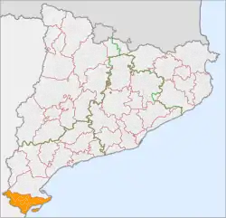
Montsià (Catalan pronunciation: [munsiˈa]) is the southernmost comarca (county) of Catalonia in Spain. Its capital and largest city is Amposta.
Montsià | |
|---|---|
 | |
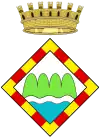
 Coat of arms | |
 | |
| Country | |
| Autonomous community | |
| Province | Tarragona |
| Capital | Amposta |
| Municipalities | |
| Area | |
| • Total | 735.5 km2 (284.0 sq mi) |
| Population (2014) | |
| • Total | 69,613 |
| • Density | 95/km2 (250/sq mi) |
| Demonym(s) | |
| Time zone | UTC+1 (CET) |
| • Summer (DST) | UTC+2 (CEST) |
| Largest municipality | Amposta |
History
The Montsià was first established as a separate administrative comarca in 1936 and was named after the Serra del Montsià mountain range (highest point 764 m). It is located at the southern end of Catalonia and the Sénia River marks the ancient boundary with the former Kingdom of Valencia. Many areas in this comarca have ancient passages and resting places of transhumant cattle herders, known locally as lligallos, that were very important in the past.
Almost all Montsià municipalities are part of the Taula del Sénia free association or mancomunitat (commonwealth).
Municipalities
| Municipality | Population(2014)[1] | Areakm2[1] |
|---|---|---|
| Alcanar | 9,637 | 47.1 |
| Amposta | 21,197 | 138.3 |
| Freginals | 405 | 17.6 |
| La Galera | 800 | 27.5 |
| Godall | 673 | 33.6 |
| Mas de Barberans | 619 | 78.8 |
| Masdenverge | 1,106 | 14.6 |
| Sant Carles de la Ràpita | 15,003 | 53.7 |
| Sant Jaume d'Enveja | 3,555 | 60.8 |
| Santa Bàrbara | 3,821 | 28.2 |
| La Sénia | 5,893 | 108.4 |
| Ulldecona | 6,904 | 126.9 |
| • Total: 12 | 69,613 | 735.5 |
See also
References
- "El municipi en xifres". Institut d'Estadística de Catalunya. Retrieved 2015-05-25.
External links
 Montsià travel guide from Wikivoyage
- Official comarcal web site (in Catalan)
This article is issued from Wikipedia. The text is licensed under Creative Commons - Attribution - Sharealike. Additional terms may apply for the media files.